Nagpur–Gondia Expressway – MSRDC 162.5 km Vidarbha Corridor: Status and Buyer Guide

Nagpur Gondia Expressway Preview
Try the Nagpur–Gondia Expressway – MSRDC 162.5 km Vidarbha Corridor on the map
Sign in once and explore the layer for a full day.
- No card details needed
- Find nearby verified lands for sale
Overview
The Nagpur Gondia Expressway cuts 162.57 km through eastern Vidarbha, linking Nagpur to Gondia via Bhandara district. Maharashtra Cabinet approved the project on 26 August 2025; Government Resolution and administrative sanction were issued on 3 October 2025, putting ₹3,162 crore toward land acquisition across 115 villages. MSRDC is handling execution, and when finished, the route drops your drive from three hours to 75 minutes. What you need to know: where land acquisition stands, which interchanges matter, how fraud works in corridor deals, and which sections carry verifiable acquisition risk and which have documented planning approvals.
How Land Fraud Works Along the Expressway Route
MSRDC started buying land in 2023. They need 1,600 hectares, mostly agricultural parcels spread across Nagpur, Bhandara, and Gondia. That scale attracts operators who know buyers get excited about interchange proximity and stop asking basic questions.
Nagpur's Anti-Land Mafia Squad caught five separate fraud rings between September and November 2025, total haul ₹50.51 lakh. One crew in Gorewada sold 159 plots off a single 7.72-acre property using a ₹20 stamp paper power of attorney that was never registered. Another group in Shantinagar drew a fake layout on land they didn't own and collected ₹6.40 lakh before anyone checked the revenue records.
Here's what actually happens on the ground:
Fraud Patterns and Buyer Protections Along the Nagpur-Gondia Expressway
Fraud Type
How It Runs
What Stops It
Fake layout near interchanges
Seller claims NMRDA (Nagpur Metropolitan Region Development Authority) or NIT (Nagpur Improvement Trust) approved the subdivision, shows you a photocopy
Demand the original sanctioned layout with file number and approval date, call the authority to confirm
Cheap POA (Power of Attorney) with no registration
You get shown a ₹20 or ₹100 stamp paper saying someone can sell the land, but the registry has no record
Insist on a registered sale deed showing the full ownership chain back to the original title holder
Same plot, different buyers
Common in Bhandara villages where record-keeping is slower
Get a 7/12 extract dated within the last 15 days and an encumbrance certificate covering the past 13 years
Doctored 7/12 records
The survey number matches but the area or owner name has been altered
Collect the certified copy directly from the Tehsildar office, verify the survey number on site with GPS
If the broker says "NA order is coming" or "we have political contacts to clear it," that's your exit. The transaction should already have documentary proof, not future promises.
Corridor Sections: Status and Buyer Risks
The expressway runs 72.5 km from Nagpur to Bhandara, another 72.6 km from Bhandara to Gondia, plus a 3.8 km spur into Tiroda and a 13.7 km bypass skirting Gondia city. Eight interchanges sit at Gavasi, Pachgaon, Thana, Rotary, Panjra, Paldongri, Lohri, and Savari.
What happened along the Samruddhi corridor gives you the structure for what to verify: confirm RERA (Real Estate Regulatory Authority) approval, sanctioned layout, and NA conversion before transacting — interchange proximity alone is not a buyer-safety signal. But that's aggregate data. Individual micro-markets vary wildly depending on existing infrastructure, zoning clearances, and how far speculation has already run.
Corridor Stretch
What's There Now
Buyer-Relevant Activity
What Can Go Wrong
Gavasi to Jamtha
Gavasi interchange, 5 km from where Samruddhi begins at Shivmadka
RERA layouts, NMRDA oversight, plotted developments already moving
Prices have run ahead of delivery, confirm the NA order is final and the development plan permits residential use
Tiroda spur (3.8 km)
Direct link to MIDC (Maharashtra Industrial Development Corporation) Growth Centre, mining and mineral logistics hub
Industrial buyers, warehouse demand, last-mile connectivity for freight
Land adjacent to forest zones needs an NOC (No Objection Certificate) from the forest department, don't assume it's coming
Bhandara to Paldongri
Agricultural belt, Rotary and Panjra interchanges, 115 villages under acquisition
Acquisition notifications issued; no change-of-use or residential zoning approved yet. Verify your survey number's notification status before transacting.
NA conversion is incomplete in most villages, tribal land sale restrictions apply in several pockets
Savari to Gondia bypass
Tribal region, mining access, 13.7 km bypass improving city entry
Logistics, industrial, some residential near Gondia interchange
Tribal land requires specific clearances, and many parcels are still classified agricultural with no approved change of use
The stretch nobody talks about honestly: Navegaon-Nagzira. The expressway passes within 5 km of the notified tiger reserve, which triggers Category A environmental clearance under the 2006 EIA (Environmental Impact Assessment) rules. Brokers sell "eco-tourism plots" here, but forest department approval is required for any commercial activity. Most of these plots don't have it and won't get it.
Was this layer helpful?
Anything wrong, outdated, or missing we want to hear it.
For Land Owners & Agents
Looking to sell your land in Maharashtra?
I want to sell my land in Maharashtra
10:32
Plz share your Land's location - We will list it on 1acre map, for Free.
10:32

For Land Buyers
Browse all verified lands & plots in Maharashtra
Every listing goes through our Preliminary Verification Process.
More Layers in Maharashtra
See all 32 layers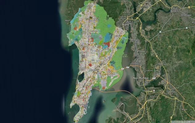
Mumbai Development Plan 2034: Zone Check and Land Use Guide
View Mumbai Masterplan as a live map overlay – check any plot's land use zone for free on 1acre.in. Mumbai masterplan 20...
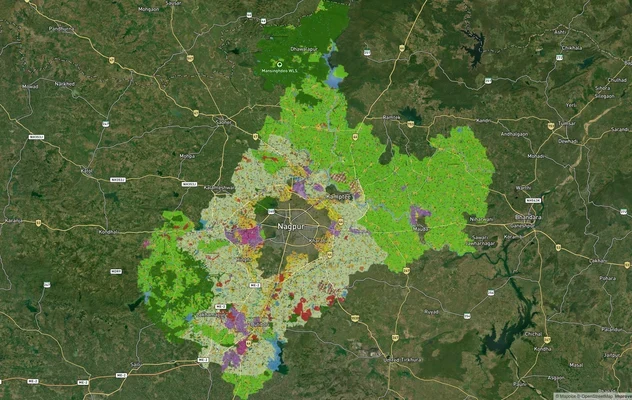
Nagpur Masterplan 2032: Zone Check and Land Use Guide
View Nagpur Masterplan as a live map overlay – check any plot's land use zone for free on 1acre.in. Nagpur Metropolitan ...
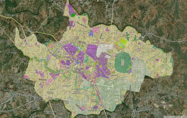
Pimpri Chinchwad PCMC Masterplan: Zone Check and Land Use Guide
View Pimpri Chinchwad Masterplan as a live map overlay – check any plot's land use zone for free on 1acre.in. Pimpri Chi...
More Layers in Maharashtra
Mumbai Development Plan 2034: Zone Check and Land Use Guide
View Mumbai Masterplan as a live map overlay – check any plot's land use zone for free on 1acre.in. Mumbai masterplan 20...
Nagpur Masterplan 2032: Zone Check and Land Use Guide
View Nagpur Masterplan as a live map overlay – check any plot's land use zone for free on 1acre.in. Nagpur Metropolitan ...
Pimpri Chinchwad PCMC Masterplan: Zone Check and Land Use Guide
View Pimpri Chinchwad Masterplan as a live map overlay – check any plot's land use zone for free on 1acre.in. Pimpri Chi...