
Kharghar Coastal Road: Route Map, Status and Kharghar Sector Map


Kharghar Coastal Road Preview
Try the Kharghar Coastal Road on the map
Sign in once and explore the layer for a full day.
- No card details needed
- Find nearby verified lands for sale
Overview
The Kharghar Coastal Road Navi Mumbai project is a 9.679 km CIDCO-built corridor connecting Jalmarg Sector 16 in Kharghar to the Passenger Water Terminal near Nerul, running parallel to Panvel Creek. Contracted to J Kumar Infraprojects for Rs 1,020.70 crore (excluding GST) in March 2025, the road will slash travel time from Kharghar to Navi Mumbai International Airport (NMIA) from 40 minutes to roughly 10 minutes. Of the total length, 2.986 km uses existing roads while the remainder is stilt-built or land-reclaimed. This page covers the project's approvals, active risks, and which Kharghar corridors stand to gain most.
CIDCO had not announced an opening date when this page was revised in October 2026. The section on current status sets out the latest verifiable milestones, including the June 2025 review of the Belapur stretch, and a separate section explains where to find the Kharghar sector map and CIDCO's nodal plan.
Kharghar Coastal Road route map: start point, end point and sectors
The road starts at Jalmarg in Sector 16, Kharghar, and ends near the Passenger Water Terminal at Nerul, running along Panvel Creek. The Ministry of Environment, Forest and Climate Change's forest diversion file describes the same project as a coastal road from Jalmarg Sector 16, Kharghar, to Sector 11 in CBD Belapur, continuing to the transport terminal at Nerul.
Point on the route
Location
What happens there
Start
Jalmarg, Sector 16, Kharghar
Origin node beside the creek
Interchange
Sion-Panvel Expressway
Link to Kharghar's main highway
Belapur stretch
Between Sectors 10 and 11, CBD Belapur
Uses existing 30 metre roads
Highway crossing
Amra Marg (NH 348A)
Vehicular underpass
End
Near Delhi Public School, Nerul
Joins Palm Beach Marg near the Passenger Water Terminal
Point on the route
Location
What happens there
Start
Jalmarg, Sector 16, Kharghar
Origin node beside the creek
Interchange
Sion-Panvel Expressway
Link to Kharghar's main highway
Belapur stretch
Between Sectors 10 and 11, CBD Belapur
Uses existing 30 metre roads
Highway crossing
Amra Marg (NH 348A)
Vehicular underpass
End
Near Delhi Public School, Nerul
Joins Palm Beach Marg near the Passenger Water Terminal
Of the 9.679 km length, 2.986 km uses existing roads and the rest is on stilts or reclaimed land. The Belapur stretch is the part most likely to change. In June 2025 the Navi Mumbai Municipal Corporation objected that a 1.57 km extension in Sector 11 runs through a residential area with 13 housing societies, 9 schools, a hospital and a library, and a former corporator also flagged Sector 15, Killa Gaothan and the NRI Complex. View the alignment on the 1acre map layer, and treat the Belapur portion as provisional until CIDCO confirms it.
Kharghar Coastal Road status: latest update (October 2026)
J Kumar Infraprojects holds CIDCO's Letter of Acceptance, issued in March 2025, for the Rs 1,020.70 crore contract. Two issues now decide when the road opens: mangrove land and the Belapur alignment.
Item
Date
Position
Forest land diversion, 8.2222 ha
February 2024
The Ministry's Regional Empowered Committee deferred the proposal and asked for CRZ status, alternatives to avoid mangroves and land for compensatory mangrove planting
CRZ clearance
August 2024
Granted
Construction contract
March 2025
Letter of Acceptance to J Kumar Infraprojects
Belapur alignment
June 2025
After residents' protests, the Chief Minister reportedly asked officials to study a sea route from Kharghar Sector 16 to Nerul jetty linking to Sector 11 Belapur, or a double-decker road at Sector 15 Belapur
Completion
Not announced
CIDCO has not announced an opening date; a 30-month construction period from the March 2025 award would point to late 2027
Item
Date
Position
Forest land diversion, 8.2222 ha
February 2024
The Ministry's Regional Empowered Committee deferred the proposal and asked for CRZ status, alternatives to avoid mangroves and land for compensatory mangrove planting
CRZ clearance
August 2024
Granted
Construction contract
March 2025
Letter of Acceptance to J Kumar Infraprojects
Belapur alignment
June 2025
After residents' protests, the Chief Minister reportedly asked officials to study a sea route from Kharghar Sector 16 to Nerul jetty linking to Sector 11 Belapur, or a double-decker road at Sector 15 Belapur
Completion
Not announced
CIDCO has not announced an opening date; a 30-month construction period from the March 2025 award would point to late 2027
The June 2025 report said the alignment had not been formally changed, and it is the latest published update on the alignment available when this page was revised. CIDCO's news page carried no update on the road in October 2026. Any change to the Belapur stretch, or a delay in mangrove permission, would push completion beyond 2027. Track the forest clearance stage on the Ministry's forest clearance portal and ask CIDCO for its current target date before paying a premium for coastal road access.
Kharghar Coastal Road: CRZ Approvals, Mangrove Risk, and What Buyers Near Panvel Creek Must Know
This project has more regulatory layers than a standard Navi Mumbai road, and buyers or investors in Sector 16 of Kharghar and Sectors 10 and 11 of CBD Belapur need to understand exactly where those layers bite.
The MoEF&CC's Expert Appraisal Committee granted CRZ clearance in August 2024, which allowed CIDCO to call tenders. However, CRZ clearance is not the final word. Under Bombay High Court PIL No. 87/2006 (BEAG vs State of Maharashtra), any project that involves cutting mangroves classified as forest land requires separate court permission before felling can proceed. The Kharghar Coastal Road affects 8.222 hectares of mangrove-tagged forest land. Environmental activists from NatConnect Foundation and Kharghar Wetlands Forum have already documented landfilling and debris dumping near the alignment, alleging violations of the conditional MoEF&CC clearance.
The table below tracks the key approvals and outstanding hurdles as of October 2026.
Approval Stage
Status
Issuing Authority
CRZ Clearance
Granted, August 2024
MoEF&CC Expert Appraisal Committee
Bombay High Court mangrove permission
Required before felling
Bombay HC (PIL No. 87/2006)
Construction contract (LoA)
Awarded March 2025
CIDCO to J Kumar Infraprojects
MCZMA clearance
Granted
Maharashtra Coastal Zone Management Authority
Forest land diversion (8.2222 ha)
Deferred by the Regional Empowered Committee in February 2024 for CRZ status, mangrove alternatives and compensatory mangrove land; later stage to be confirmed
MoEF&CC Regional Office, Nagpur
Alignment through CBD Belapur Sector 11
Under review after residents' objections, June 2025
Government of Maharashtra and CIDCO
Ulwe Coastal Road (linked project)
Construction begun
CIDCO
Approval Stage
Status
Issuing Authority
CRZ Clearance
Granted, August 2024
MoEF&CC Expert Appraisal Committee
Bombay High Court mangrove permission
Required before felling
Bombay HC (PIL No. 87/2006)
Construction contract (LoA)
Awarded March 2025
CIDCO to J Kumar Infraprojects
MCZMA clearance
Granted
Maharashtra Coastal Zone Management Authority
Forest land diversion (8.2222 ha)
Deferred by the Regional Empowered Committee in February 2024 for CRZ status, mangrove alternatives and compensatory mangrove land; later stage to be confirmed
MoEF&CC Regional Office, Nagpur
Alignment through CBD Belapur Sector 11
Under review after residents' objections, June 2025
Government of Maharashtra and CIDCO
Ulwe Coastal Road (linked project)
Construction begun
CIDCO
If you are buying a plot or apartment within 100 metres of the Panvel Creek alignment in Sectors 10 or 16, ask your broker for the exact CRZ zone classification of that survey number before signing anything. A property priced with "coastal road upside" built in is a different risk profile from one priced purely on current fundamentals.
Sector 16, CBD Belapur, and Nerul: Where the Kharghar Coastal Road Moves Property Values
Not every part of Kharghar benefits equally from the Navi Mumbai International Airport connectivity this road is designed to deliver. The corridor runs from Jalmarg Sector 16 through an interchange on the Sion-Panvel Expressway, passes between Sectors 10 and 11 in CBD Belapur using existing 30-metre-wide roads, crosses Amra Marg (National Highway 348A) via a vehicular underpass, and ends near Delhi Public School in Nerul, joining Palm Beach Marg. The alignment makes some locations genuinely investable and others speculative.
The table below maps each key corridor to its likely role once the road is operational.
Corridor
Road's Direct Benefit
Indicative Avg. Price (Flats)
Risk Level
Sector 16, Kharghar (origin node)
Immediate access to NMIA via interchange
Rs 10,000-12,000/sq ft
Moderate (mangrove adjacency)
Sectors 10-11, CBD Belapur
Utilises existing 30m roads; traffic reduction on Sion-Panvel Hwy
Central business location
Low (existing road base)
Nerul Water Terminal area
Connects to Palm Beach Marg; International Corporate Park access
Established residential
Low-Moderate
Upper Kharghar (Sectors 35-36)
Indirect; benefits from metro + airport combined
Rs 16,500-17,500/sq ft avg
Lower (further from alignment)
Corridor
Road's Direct Benefit
Indicative Avg. Price (Flats)
Risk Level
Sector 16, Kharghar (origin node)
Immediate access to NMIA via interchange
Rs 10,000-12,000/sq ft
Moderate (mangrove adjacency)
Sectors 10-11, CBD Belapur
Utilises existing 30m roads; traffic reduction on Sion-Panvel Hwy
Central business location
Low (existing road base)
Nerul Water Terminal area
Connects to Palm Beach Marg; International Corporate Park access
Established residential
Low-Moderate
Upper Kharghar (Sectors 35-36)
Indirect; benefits from metro + airport combined
Rs 16,500-17,500/sq ft avg
Lower (further from alignment)
Properties near metro stations on Navi Mumbai Metro Line 1 (Belapur-Pendhar) already command a 10-12% premium over comparable stock. The coastal road adds a second connectivity premium specifically for airport-facing corridors. The most misunderstood opportunity here is CBD Belapur Sector 11: it sits on the alignment, uses existing roads, and connects directly to the International Corporate Park being developed on the lines of Bandra Kurla Complex. That corridor is underpriced relative to its future commercial catchment.
Kharghar map: sector map, nodal plan and development plan
Most people searching for a Kharghar map want the sector layout, not only the coastal road. Kharghar is one of the nodes CIDCO planned for Navi Mumbai, and CIDCO publishes a nodal plan for each node on its website under Navi Mumbai, Nodal Scheme. Searches for a Kharghar DP plan, development plan or nodal plan lead to the same document. The Kharghar nodal plan PDF shows:
Feature on the nodal plan
What to look for
Sector numbers and boundaries
Which sector a building or plot sits in
Land use labels
Residential, commercial, commercial plus residential, public utility, schools, playgrounds and gardens
Transport
Kharghar railway station, the proposed metro alignment and road widths from 6 m to 40 m
Open space
Central Park, the proposed golf course and Kharghar Hill
Constraints
Holding ponds, channels, tree belts and a 100 m MSEB high-tension power corridor
Feature on the nodal plan
What to look for
Sector numbers and boundaries
Which sector a building or plot sits in
Land use labels
Residential, commercial, commercial plus residential, public utility, schools, playgrounds and gardens
Transport
Kharghar railway station, the proposed metro alignment and road widths from 6 m to 40 m
Open space
Central Park, the proposed golf course and Kharghar Hill
Constraints
Holding ponds, channels, tree belts and a 100 m MSEB high-tension power corridor
Upper Kharghar usually refers to the higher-numbered sectors such as 35 and 36, which sit further from the coastal road than Sector 16. The Sion-Panvel Expressway, often searched as the Kharghar highway, meets the coastal road at the Jalmarg interchange.
Since 1 October 2016, Kharghar has been part of the Panvel Municipal Corporation, together with the CIDCO areas of Taloja, Kalamboli, Kamothe and New Panvel. For any plot, read its sector and land use on CIDCO's nodal plan, then check how close it sits to the coastal road alignment on this layer.
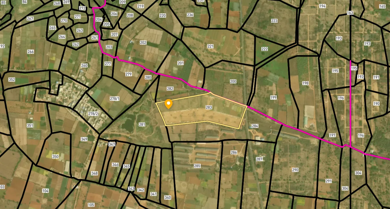
Access Survey NumbersAccess Maharashtra
Survey Numbers
Boundaries and numbers come from published state cadastral records. See all map layers.
Looking to sell your land in Maharashtra?

Browse all verified lands & plots in Maharashtra
More Layers in Maharashtra
See all 60 layers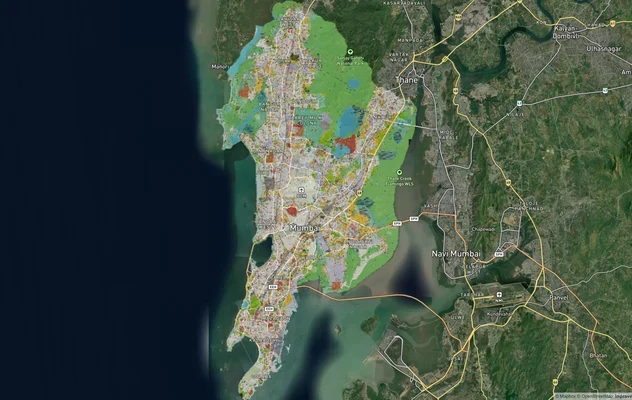
Mumbai Development Plan 2034: Zone Check and Land Use Guide
View Mumbai Masterplan as a live map overlay – check any plot's land use zone for free on 1acre.in. Mumbai masterplan 20...
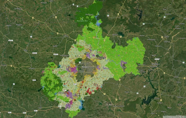
Nagpur Masterplan 2032: Zone Check and Land Use Guide
View Nagpur Masterplan as a live map overlay – check any plot's land use zone for free on 1acre.in. Nagpur Metropolitan ...
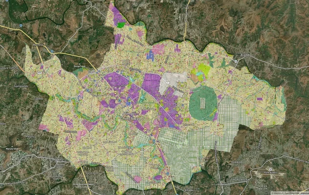
Pimpri Chinchwad PCMC Masterplan: Zone Check and Land Use Guide
View Pimpri Chinchwad Masterplan as a live map overlay – check any plot's land use zone for free on 1acre.in. Pimpri Chi...
More Layers in Maharashtra
Mumbai Development Plan 2034: Zone Check and Land Use Guide
View Mumbai Masterplan as a live map overlay – check any plot's land use zone for free on 1acre.in. Mumbai masterplan 20...
Nagpur Masterplan 2032: Zone Check and Land Use Guide
View Nagpur Masterplan as a live map overlay – check any plot's land use zone for free on 1acre.in. Nagpur Metropolitan ...
Pimpri Chinchwad PCMC Masterplan: Zone Check and Land Use Guide
View Pimpri Chinchwad Masterplan as a live map overlay – check any plot's land use zone for free on 1acre.in. Pimpri Chi...
Frequently Asked Questions
As of March 2025, J Kumar Infraprojects holds the Letter of Acceptance from CIDCO for a Rs 1,020.70 crore contract. Construction has a 30-month timeline. Bombay High Court permission for mangrove felling (8.222 hectares) is separately required before full-scale work can begin. In June 2025 the stretch through CBD Belapur came under review after residents' objections, and that is the latest published update on the alignment as of October 2026.
The 913-day project timeline, per the tender document, allocates 90 days for design and approvals followed by 823 days for construction and handover. With the LoA issued in March 2025, that schedule points to completion around mid-to-late 2027.
The road provides a direct interchange on the Sion-Panvel Expressway and runs parallel to NMIA, reducing travel time from Kharghar to the airport from approximately 40 minutes to 10 minutes. It also links the Nerul Water Transport Terminal and the International Corporate Park.
The project has CRZ clearance from MoEF&CC and MCZMA approval. It still requires Bombay High Court permission under PIL No. 87/2006 to cut 8.222 hectares of mangrove forest land. Environmental groups have flagged ongoing landfilling near the alignment as a potential violation of clearance conditions.
The road creates an interchange on the Sion-Panvel Expressway at Jalmarg and provides an alternative route through Sectors 10-11 in Belapur, directly reducing peak-hour load on the highway, which is Kharghar's most congested arterial link.
Yes. Properties in Sector 16 (the origin node) and along CBD Belapur Sectors 10-11 (which use existing 30m roads on the alignment) carry the most direct value upside. Flat prices in Kharghar have appreciated 16.7% over three years; the road adds an airport-access premium on top of that trend.
J Kumar Infraprojects (JKIL) won the bid after four bidders submitted technical proposals in December 2024. JKIL was the lowest bidder among three qualified bids. Observers have noted the firm's prior involvement in the Kharghar metro girder contract, which experienced delays, making adherence to the 30-month schedule worth monitoring closely.
CIDCO publishes a nodal plan for each Navi Mumbai node, including Kharghar, on cidco.maharashtra.gov.in under Navi Mumbai, Nodal Scheme. The Kharghar PDF shows sector numbers, land use labels, Kharghar railway station, the proposed metro alignment, Central Park and the proposed golf course. Use it to find a plot's sector and land use, then compare it with the coastal road alignment on this map layer.
Kharghar became part of the Panvel Municipal Corporation when the corporation came into existence on 1 October 2016, along with the CIDCO areas of Taloja, Kalamboli, Kamothe and New Panvel. CIDCO planned the node and still publishes its nodal plan. Confirm with both offices which one handles approvals for your plot before you buy.
It starts at Jalmarg in Sector 16, Kharghar, with an interchange on the Sion-Panvel Expressway. It runs through CBD Belapur between Sectors 10 and 11 on existing 30 metre roads, crosses Amra Marg by an underpass and ends near Delhi Public School in Nerul, joining Palm Beach Marg near the Passenger Water Terminal.
Not formally, according to the latest report. In June 2025, after protests by Belapur residents, the Chief Minister reportedly asked officials to study a sea route from Kharghar Sector 16 to Nerul jetty linking to Sector 11 Belapur, or a double-decker road at Sector 15 Belapur. Check with CIDCO which alignment is final before relying on it.
Most searches for the Kharghar highway mean the Sion-Panvel Expressway, Kharghar's most congested arterial link. The coastal road joins it at an interchange at Jalmarg and offers a parallel route through CBD Belapur Sectors 10 and 11, which should take some peak-hour load off the highway once the road opens.
Source
Official City and Industrial Development Corporation (CIDCO) documents
Official Website
cidco.maharashtra.gov.in/Page?Token=831AAA8551
Coordinate Reference System
EPSG:4326 (WGS 84)
Geometry Type
Polygon / MultiPolygon
Data Format
Raster Tiles (from GeoTIFF)
Last Verified
2026
Status
Active
Was this layer helpful?
Anything wrong, outdated, or missing we want to hear it.