Vadhvan Tawa Connector Expressway

Vadhvan Tawa Connector Expressway Preview
Try the Vadhvan Tawa Connector Expressway on the map
Sign in once and explore the layer for a full day.
- No card details needed
- Find nearby verified lands for sale
Overview
The Vadhvan Tawa Connector Expressway land buying opportunity is real, but the corridor comes with rules that will end a deal before it starts if you skip the paperwork. The NHAI has designated the 32.18 km stretch from Vadhvan Deep Sea Port to Tawa junction on NH-48 as National Highway 248 Spur (NH-248S), with the contract awarded to J. Kumar–SDPL JV at Rs 23.6 billion on EPC (Engineering, Procurement, and Construction) mode, to be completed in 30 months. A separate 104 km greenfield Maharashtra State Road Development Corporation (MSRDC) expressway from Igatpuri to Tawa is under development (see details below). This page covers what zone you are buying in, what laws govern transfer, and which corridors have investable land today.
Tribal Land and Coastal Regulation Zone (CRZ) Rules: Two Barriers Buyers Routinely Miss Near This Corridor
Palghar district has a large Scheduled Tribe population, and much of the Dahanu taluka land around the Vadhvan port alignment is tribal-owned. Section 36A of the Maharashtra Land Revenue Code, 1966 is the law that controls this. No tribal land can be transferred to a non-tribal by sale, gift, mortgage, or lease without prior sanction of the Collector. Any transfer without that sanction is void, and the Collector can restore the land to the tribal owner with no compensation owed to the buyer. The Bombay High Court upheld this rule as recently as May 2025 in a Dahanu case.
The table below maps the two main legal barriers for Palghar land near the expressway corridor.
Restriction
Law
Document to Check
Who Grants Permission
Tribal land sale to non-tribal
Section 36A, Maharashtra Land Revenue Code, 1966
7/12 extract ,remarks column
District Collector, Palghar
Construction within 500m of High Tide Line (HTL)
CRZ Notification 2019
Official CZMP map, NCSCM
Maharashtra Coastal Zone Management Authority
Agricultural land conversion
Maharashtra Agricultural Lands (Ceiling) Act
7/12 and mutation entries
Sub-Divisional Officer
The 7/12 extract is the single most important document in this corridor. If it shows the owner's caste as a Scheduled Tribe and the buyer is non-tribal, the sale requires Collector approval before any token or advance changes hands. Skipping this step voids the entire transaction regardless of what the registered sale deed says.
The second trap is CRZ. A PIL in the Bombay High Court has already alleged CRZ violations in the Dahanu area. Any land within 500 metres of the High Tide Line in a CRZ-III B rural area carries a 200 metre No Development Zone where no construction is permitted. Coastal land near the port site listed at attractive prices often sits inside this No Development Zone (NDZ). Before buying, verify the plot's distance from the High Tide Line (HTL) using the Coastal Zone Management Plan (CZMP) maps issued by the National Centre for Sustainable Coastal Management (NCSCM) at 1:25,000 scale.
Boisar, Tarapur, and Saphale: Where Investable Land Actually Sits Along This Corridor
The active investment corridor runs inland, not on the coast. Dahanu agricultural land with CRZ exposure has development restrictions; land in Boisar, Tarapur, and Saphale, further from the HTL and along the NH-48 alignment, attracts buyers specifically because of proximity to the Vadhvan port project and upcoming road links.
The table below shows the key sub-markets along the NH-48 and expressway corridor as sourced from active listings.
Corridor
Distance from Vadhvan Port
Stated Advantage
Key Risk
Boisar West
~8 km
Near bullet train station, NH-48, Vadhvan port
Proximity means some parcels in land acquisition zone
Tarapur
~9 km
Industrial zone, existing road access
Green zone restrictions in some pockets
Saphale
~12 km
Near Mumbai-Vadodara Expressway entry
Verify 7/12 for tribal status
Dahanu Road / Chinchani
~4 km
Closest to port site
CRZ exposure, active land acquisition underway
Land acquisition for the 32 km Tawa Junction to Vadhvan Port road (NH-248S) commenced under a Central Government Gazette notification dated August 29, 2024. The acquisition covers 24 villages in Palghar district across Dahanu and Palghar talukas. Land acquisition is ongoing as of early 2026 and has experienced delays from the original March 2025 completion target. If a plot falls inside those 24 villages, it is likely in an acquisition zone. The government announced compensation above Rs 2 crore per hectare for acquired agricultural land in the port-area villages. That is a data point, not a floor: if your plot is outside the notified acquisition corridor, those rates do not apply and market pricing governs.
The MSRDC 104 km Igatpuri-to-Tawa corridor received cabinet approval for its alignment and land acquisition in August 2025. Land acquisition covers approximately 1,000 hectares; drone surveys have commenced. Construction tenders will be floated only after significant progress on Vadhvan Port. Parcels marketed as "on the MSRDC expressway" are speculative bets on an alignment that has not been finalized by the state government.
Was this layer helpful?
Anything wrong, outdated, or missing we want to hear it.
For Land Owners & Agents
Looking to sell your land in Maharashtra?
I want to sell my land in Maharashtra
10:32
Plz share your Land's location - We will list it on 1acre map, for Free.
10:32

For Land Buyers
Browse all verified lands & plots in Maharashtra
Every listing goes through our Preliminary Verification Process.
More Layers in Maharashtra
See all 32 layers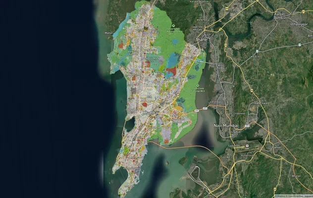
Mumbai Development Plan 2034: Zone Check and Land Use Guide
View Mumbai Masterplan as a live map overlay – check any plot's land use zone for free on 1acre.in. Mumbai masterplan 20...
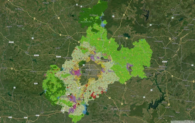
Nagpur Masterplan 2032: Zone Check and Land Use Guide
View Nagpur Masterplan as a live map overlay – check any plot's land use zone for free on 1acre.in. Nagpur Metropolitan ...
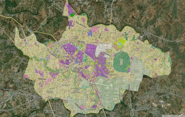
Pimpri Chinchwad PCMC Masterplan: Zone Check and Land Use Guide
View Pimpri Chinchwad Masterplan as a live map overlay – check any plot's land use zone for free on 1acre.in. Pimpri Chi...
More Layers in Maharashtra
Mumbai Development Plan 2034: Zone Check and Land Use Guide
View Mumbai Masterplan as a live map overlay – check any plot's land use zone for free on 1acre.in. Mumbai masterplan 20...
Nagpur Masterplan 2032: Zone Check and Land Use Guide
View Nagpur Masterplan as a live map overlay – check any plot's land use zone for free on 1acre.in. Nagpur Metropolitan ...
Pimpri Chinchwad PCMC Masterplan: Zone Check and Land Use Guide
View Pimpri Chinchwad Masterplan as a live map overlay – check any plot's land use zone for free on 1acre.in. Pimpri Chi...