Thane Coastal Road
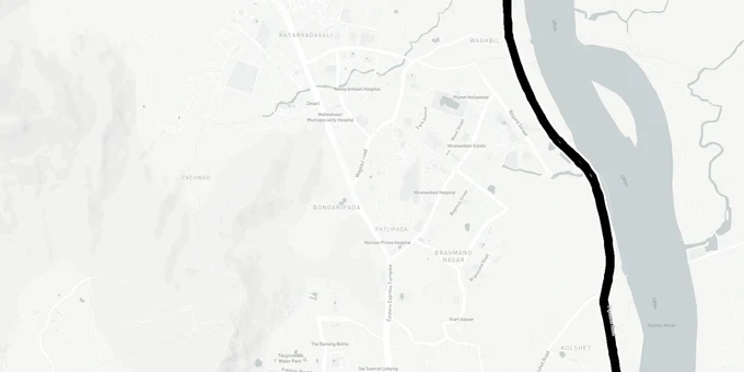
Thane Coastal Road Preview
Try the Thane Coastal Road on the map
Sign in once and explore the layer for a full day.
- No card details needed
- Find nearby verified lands for sale
Overview
The Thane Coastal Road project is an MMRDA-built, 13.45 km six-lane corridor connecting Kharegaon Toll Naka on NH-160 (old NH-3) at Balkum to Gaimukh on Ghodbunder State Highway (SH-42). Sanctioned at ₹3,364.62 crore and contracted to Navayuga Engineering Company Ltd in December 2024, the project is targeted for completion by May 2028. As of February 2026, over 50% of viaduct foundation work is done.
CRZ Zones, Mangroves and the Acquisition Risks Buyers Are Underestimating
This road runs along the Thane Creek waterfront, and that geography creates a specific set of risks that ordinary highway projects do not carry. The 8.11 km elevated viaduct section passes through 10.04 hectares of mangroves, and the project received CRZ clearance from the Maharashtra Coastal Zone Management Authority (MCZMA) only in August 2023 after a lengthy regulatory process. That timeline tells you something important: any plot or project marketing itself as "coastal road adjacent" that still sits within a CRZ-IA zone (mangrove or mangrove buffer) cannot be legally developed, regardless of how the road's proximity is framed.
The Bombay High Court has active PILs on TMC waterfront development involving CRZ norm violations along this very stretch from Mumbra and Gaimukh to Ghodbunder Road. Locals from Mogharpada village, whose families have cultivated land along the Vasai Creek since 1960, opposed acquisition as recently as 2023. Active legal challenges around the alignment mean that land parcels close to the creek, especially in the Mogharpada and Kasarvadavali belt, carry acquisition and encumbrance risk that title searches alone will not reveal.
Regulatory Traps Along the Thane Coastal Road Corridor
The table below maps the key regulatory traps specific to this corridor.
Risk
What It Means
What to Verify
CRZ-IA land near creek sold as "road-facing"
Mangrove and mangrove buffer zones cannot be built upon regardless of proximity to the road
Check MCZMA-issued CRZ zone map; confirm the plot is outside CRZ-IA and CRZ-IB boundaries
Mogharpada / Kasarvadavali plots under ongoing acquisition
MMRDA land acquisition for the alignment was still being processed as of 2023
Check the 7/12 extract and mutation records for any government acquisition notice before paying the token.
Forest clearance pending for some project portions
A civil contract awarded does not mean all clearances are in place across the full 13.45 km
Confirm forest clearance status on mmrda.maharashtra.gov.in before buying land that may be in the forest corridor
"Coastal Road Phase 2" overlap
A second MMRDA project from Gaimukh to Bhayander is in DPR stage; its alignment is not yet final
Do not treat Phase 2 land as confirmed road-adjacent; route could shift
If a broker is selling land based on the Gaimukh-Bhayander tunnel corridor, that project is still in the DPR and concept stage, with a realistic completion window of early-to-mid 2030s at best. Price that risk honestly before signing.
Balkum, Kolshet and Kasarvadavali: Where the Coastal Road Value Story Is Real
There is a genuine two-tier split in how this road affects property values. Localities that sit squarely on the confirmed 13.45 km Phase 1 alignment have a clear, contracted infrastructure trigger within a four-year window. Localities being marketed on the strength of the Phase 2 Gaimukh Bhayander tunnel are betting on a project that has not moved past DPR and concept approvals.
The table below shows the five localities with the clearest sourced exposure to the Phase 1 alignment and how they have already responded.
Locality
Coastal Road Exposure
3-Year Price Movement
Key Risk
Kharegaon (Balkum)
Direct: start point of alignment on NH-160
40.7% appreciation (99acres, last 3 years)
Already partially priced in: heavy freight during construction phase
Kolshet Industrial Area
Direct: alignment runs through this belt
53.1% appreciation (99acres, last 3 years)
Industrial zoning: residential development requires zone change under DP
Kalher
Adjacent: benefits from freight diversion off Ghodbunder
81.6% appreciation (99acres, last 3 years)
Growth partly driven by Bhiwandi warehouse demand, not just road
Kasarvadavali
Adjacent: near Gaimukh terminus, Metro 4A influence zone
Active residential demand, HRERA projects registered
Acquisition boundary disputes documented in 2023; check 7/12 carefully
Gaimukh
Direct: southern terminus of Phase 1 alignment
Emerging residential and junction market
Phase 2 Bhayander tunnel not yet contracted; speculative premium already in some ASKs
The most misunderstood play on this corridor is Kolshet. Its 53.1% price rise looks dramatic, but a large portion of that reflects industrial land repricing, not residential market movement. Buying industrial-zoned land here and expecting residential development permissions involves a DP zone change, which is a separate regulatory process entirely and not guaranteed by the road's construction.
Was this layer helpful?
Anything wrong, outdated, or missing we want to hear it.
For Land Owners & Agents
Looking to sell your land in Maharashtra?
I want to sell my land in Maharashtra
10:32
Plz share your Land's location - We will list it on 1acre map, for Free.
10:32

For Land Buyers
Browse all verified lands & plots in Maharashtra
Every listing goes through our Preliminary Verification Process.
More Layers in Maharashtra
See all 32 layers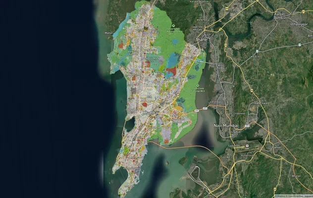
Mumbai Development Plan 2034: Zone Check and Land Use Guide
View Mumbai Masterplan as a live map overlay – check any plot's land use zone for free on 1acre.in. Mumbai masterplan 20...
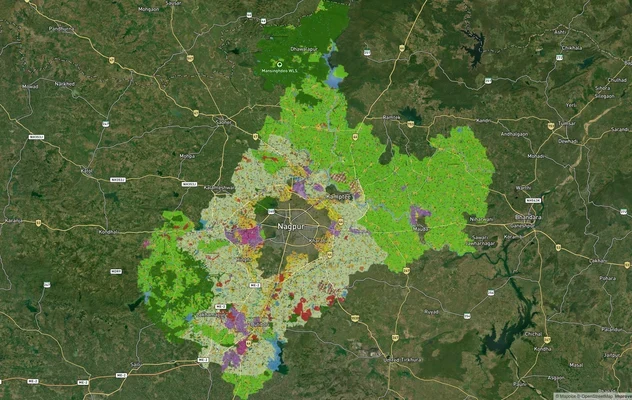
Nagpur Masterplan 2032: Zone Check and Land Use Guide
View Nagpur Masterplan as a live map overlay – check any plot's land use zone for free on 1acre.in. Nagpur Metropolitan ...
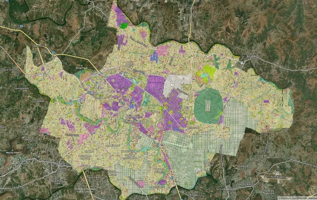
Pimpri Chinchwad PCMC Masterplan: Zone Check and Land Use Guide
View Pimpri Chinchwad Masterplan as a live map overlay – check any plot's land use zone for free on 1acre.in. Pimpri Chi...
More Layers in Maharashtra
Mumbai Development Plan 2034: Zone Check and Land Use Guide
View Mumbai Masterplan as a live map overlay – check any plot's land use zone for free on 1acre.in. Mumbai masterplan 20...
Nagpur Masterplan 2032: Zone Check and Land Use Guide
View Nagpur Masterplan as a live map overlay – check any plot's land use zone for free on 1acre.in. Nagpur Metropolitan ...
Pimpri Chinchwad PCMC Masterplan: Zone Check and Land Use Guide
View Pimpri Chinchwad Masterplan as a live map overlay – check any plot's land use zone for free on 1acre.in. Pimpri Chi...