Revas Karanja Bridge

Revas Karanja Bridge Preview
Try the Revas Karanja Bridge on the map
Sign in once and explore the layer for a full day.
- No card details needed
- Find nearby verified lands for sale
Overview
A tangible infrastructure project underpins the Revas Karanja Bridge land investment opportunity: a four-lane, 2.04 km span crossing Dharamtar Creek along Maharashtra State Highway 4 (MSH-4), part of the 498 km Revas-Redi Coastal Highway being developed by MSRDC. The construction contract has been awarded to Afcons Infrastructure, valued at Rs 2,478.42 crore (per Afcons 2024–25 annual report — verify against executed EPC contract; bid was Rs 2,963.97 crore), with a delivery window of 1,080 days. Upon completion, the road distance between the Jawaharlal Nehru Port Trust (JNPT) and Alibaug will shrink significantly from 55 km down to just 30 km. However, accessing the full details on 1acre, including which plots fall within active acquisition zones, which areas present genuine investment potential, and what amendments were made to Maharashtra land law in December 2025.
Route Changes and Dronagiri: The Land Acquisition Risk Most Buyers Ignore Near Uran Taluka
The project has already gone through one full tender cancellation and a second competitive bidding round before Afcons won at Rs 2,478.42 crore-42.56% above MSRDC's revised estimate of Rs 2,079 crore. That pricing history reflects the ground reality: alignment changes have generated documented protests, particularly in Mouje Chanje village in Uran taluka, where the revised route passes near Dronagiri Mountain.
The table below summarises the three specific risk categories for land near the MSH-4 alignment as sourced from government and credible news reporting.
Risk Category
Location
Trigger
Documented?
Revised route acquisition
Mouje Chanje, Uran taluka (Karanja side)
Alignment change through Dronagiri Mountain area
Yes - Raigad Collector meeting convened
Coastal ecology restriction
Creek and mangrove-adjacent parcels, Dharamtar Creek shoreline
Coastal Regulation Zone (CRZ) notification, mangrove boundary
Yes - applies to 500m HTL zone
Stilts road footprint
1.71 km Revas-side approach (on stilts)
MSRDC engineering design, land below road
Yes - MSRDC tender document
At Karanja, MSRDC is building 5.13 km of approach road. On the Revas side, a 1.71 km elevated approach on stilts is planned. Land that sits directly beneath or adjacent to these approach corridors is not simply "near the bridge" ,parts of it are inside the project footprint. Before paying any advance near Uran taluka, obtain the current MSRDC alignment map from the Raigad District Collector's office and cross-check your survey number against it. Brokers marketing plots as "bridge-facing" near Dronagiri do not always disclose that the route through that area has been challenged and may yet change again.
Alibaug, Revas and Karanja: Where Land Prices Are Already Moving on This Corridor
The JNPT-to-Alibaug distance reduction from 55 km to 30 km is real and the market is pricing it in. Plots in Alibaug have been appreciating at around 13.8% year-on-year through 2024, with average land rates between Rs 550 and Rs 1,650 per sq ft depending on proximity to the beach, road access, and NA status. The corridor effect does not flow uniformly across all four sub-markets.
The table below maps each sub-market on the bridge corridor to its specific driver and its specific risk.
Sub-market
Side of Bridge
Key Driver
Known Risk
Alibaug town and Mandwa belt
Revas side
Atal Setu already operational; bridge adds a second road route
Price already partially forward-priced; verify NA status before buying
Revas village approach
Revas side
1.71 km stilted approach road directly here
Footprint acquisition possible for parcels within this approach
Karanja (Uran taluka)
Karanja side
Direct connectivity to JNPT, Navi Mumbai
Active protests; alignment still contested near Dronagiri; verify survey number
Thal and Kihim
Alibaug belt, ~8 km south of Revas
Aspirational weekend-home belt linked to MTHL + bridge
No direct bridge approach here; purely connectivity-driven appreciation
The Maharashtra Land Revenue Code Second Amendment, which took effect on 31 December 2025, significantly changed how agricultural land converts to NA use in the state. Several old sections of the Maharashtra Land Revenue Code (MLRC) (including 42A, 42B, 42C, 44, and 44A) were deleted. Buyers must verify that any plot marketed as NA-converted or conversion-ready complies with the new Government Resolution dated 10 February 2026, which governs how the one-time premium for previously converted land is now calculated. Do not accept a conversion order dated before December 2025 as automatically valid without a lawyer confirming it under the amended framework.
Was this layer helpful?
Anything wrong, outdated, or missing we want to hear it.
For Land Owners & Agents
Looking to sell your land in Maharashtra?
I want to sell my land in Maharashtra
10:32
Plz share your Land's location - We will list it on 1acre map, for Free.
10:32

For Land Buyers
Browse all verified lands & plots in Maharashtra
Every listing goes through our Preliminary Verification Process.
More Layers in Maharashtra
See all 32 layers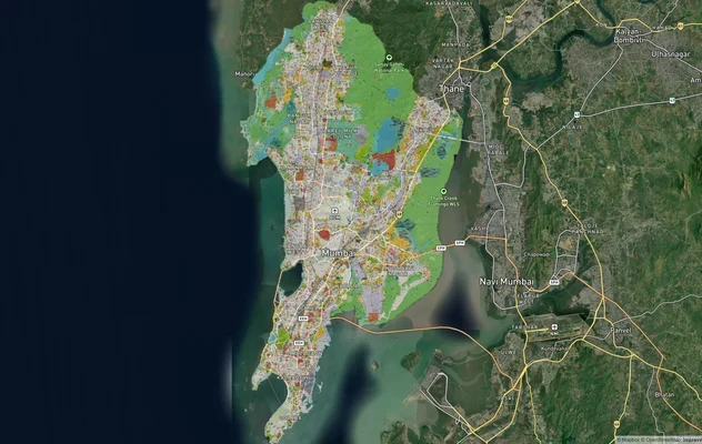
Mumbai Development Plan 2034: Zone Check and Land Use Guide
View Mumbai Masterplan as a live map overlay – check any plot's land use zone for free on 1acre.in. Mumbai masterplan 20...
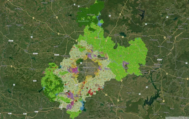
Nagpur Masterplan 2032: Zone Check and Land Use Guide
View Nagpur Masterplan as a live map overlay – check any plot's land use zone for free on 1acre.in. Nagpur Metropolitan ...
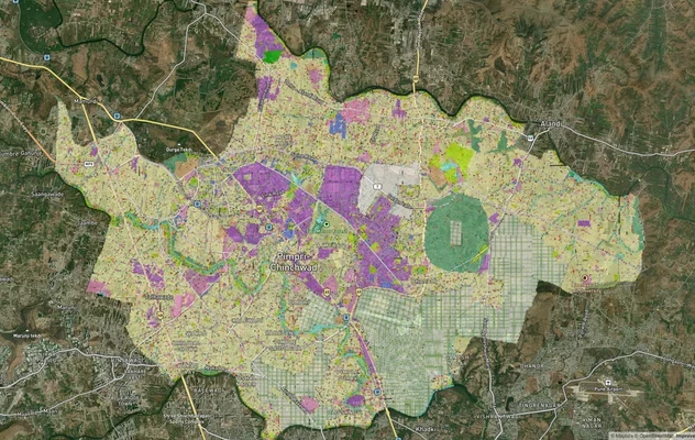
Pimpri Chinchwad PCMC Masterplan: Zone Check and Land Use Guide
View Pimpri Chinchwad Masterplan as a live map overlay – check any plot's land use zone for free on 1acre.in. Pimpri Chi...
More Layers in Maharashtra
Mumbai Development Plan 2034: Zone Check and Land Use Guide
View Mumbai Masterplan as a live map overlay – check any plot's land use zone for free on 1acre.in. Mumbai masterplan 20...
Nagpur Masterplan 2032: Zone Check and Land Use Guide
View Nagpur Masterplan as a live map overlay – check any plot's land use zone for free on 1acre.in. Nagpur Metropolitan ...
Pimpri Chinchwad PCMC Masterplan: Zone Check and Land Use Guide
View Pimpri Chinchwad Masterplan as a live map overlay – check any plot's land use zone for free on 1acre.in. Pimpri Chi...