Pune PMC Masterplan: Zone Check and Land Use Guide
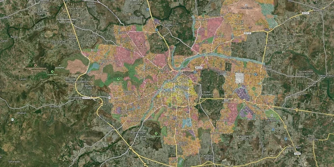
Pune City Pmc Masterplan Preview
Try the Pune PMC Masterplan on the map
Sign in once and explore the layer for a full day.
- No card details needed
- Find nearby verified lands for sale
Overview
The Pune Municipal Corporation Masterplan 2027, formally the Draft Development Plan for Old PMC Limits (2007-2027), is the operative land-use document for the old city area of 147.85 sq km, prepared under the Maharashtra Regional and Town Planning (MRTP) Act, 1966. It divides PMC's planning area into six sectors, each carrying residential, commercial, industrial, and public utility zones, with specific FSI limits and reservations. Checking a plot's classification under the Pune Municipal Corporation Masterplan 2027 before purchase is the first and most consequential diligence step any buyer in this jurisdiction must take.
DP reservations and the BDP No Development Zone trap that catches Pune plot buyers
Most buyers in Pune are aware that zones exist. Very few ask the second question: Does my plot carry a DP reservation on it? A reservation under the PMC Development Plan 2007-2027, published under Section 26(1) of the MRTP Act, 1966, means the land has been earmarked for a public purpose, such as a road, garden, school, or public utility. A reserved plot cannot be developed for any private purpose until PMC either acquires it or releases it through a formal accommodation reservation process.
Pune PMC Zone Classifications and BDP Restrictions
The BDP no development zone is the other critical classification. Plots falling within the BDP zone carry near-total restrictions on construction. Brokers routinely describe BDP-zone land as residential without disclosing this sub-classification. The table below shows the key zone and sub-zone types under the PMC DP and what each means for a buyer:
Zone / Classification
Permitted Private Development
Key Risk
Residential Zone (R-Zone)
Permitted: FSI as per UDCPR road-width table
Reservations on individual plots still possible within R-zone
Commercial / CBD Zone
Permitted with premium FSI payment to PMC
Mixed-use rules apply; purely mercantile needs independent plot
BDP No Development Zone
None until zone or reservation status changes
Sold routinely by brokers as buildable land
DP Reservation (any zone)
None until acquisition or Accommodation Reservation
Buyer bears acquisition risk; land value frozen
As of February 2026, the Maharashtra Town Planning Department made it mandatory to obtain tentative layout approval from the planning authority before any land measurement can proceed, a direct response to illegal land transactions under the MRTP Act, 1966. This means a broker who offers to "measure first, approve later" is operating outside the law.
Hadapsar, Kharadi, Baner, and Kothrud: how the PMC DP zone determines what you can actually build
The PMC Development Plan 2007-2027 divides old Pune's 147.85 sq km into six sectors, and the investment case for each corridor depends entirely on what the DP zone permits under the current UDCPR. A residential plot on a 9-meter road in the R-zone carries a basic FSI of 1.10 under UDCPR rules; the same plot on a 30-meter road can reach a total building potential of 2.50 FSI with premium and TDR loading. The zone tells you what you are allowed to become the road width tells you how much.
The table below maps PMC's primary growth corridors against their dominant zone type and what that zone practically means for construction potential:
Corridor / Locality
DP Sector
Dominant Zone
Growth Driver
Primary Risk
Hadapsar, Mundhwa, Ghorpadi
Sector VI (East)
Residential / Commercial
Magarpatta IT Park, Metro Line 4 alignment
DP reservations on fringe plots; merged village DP still draft in parts
Kharadi, Wadgaon Sheri
Sector V (Northeast)
Residential
Airport proximity, IT corridor
Road-width constrained FSI on internal lanes
Baner, Aundh, Pashan
Sector IV (Northwest)
Residential / Commercial
Metro Line 3 Hinjawadi alignment, TOD zone potential
Some Pashan plots carry water body proximity flag from revised DP
Erandwane, Kothrud, Karve Nagar
Sector III (Southwest)
Residential
Established market, Metro Line 1
High reservation density on older plots near Parvati Hill
The most misunderstood corridor is the merged villages belt, covering localities such as Lohegaon (remaining area), Mundhwa (Keshavnagar), Hadapsar (Sadesataranali), Undri, and Dhayari. PMC was assigned to prepare the DP for these 11 villages under a government resolution dated August 4, 2017, but the plan could not be published within the stipulated period, including extensions up to March 2, 2024. The assistant director of town planning, Pune branch, has since been given planning authority powers. Buying in these areas without confirming the operative DP status is the single largest zone-related risk in the PMC limits today.
Was this layer helpful?
Anything wrong, outdated, or missing we want to hear it.
For Land Owners & Agents
Looking to sell your land in Maharashtra?
I want to sell my land in Pune
10:32
Plz share your Land's location - We will list it on 1acre map, for Free.
10:32

For Land Buyers
Browse all verified lands & plots in Maharashtra
Every listing goes through our Preliminary Verification Process.
More Layers in Maharashtra
See all 32 layers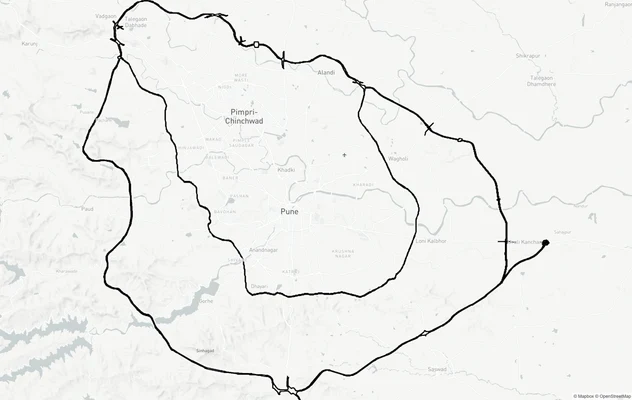
Pune Ring Roads: Route Alignment and Land Impact
View Pune Ring Roads alignment as a live map overlay – check road corridor and land impact free on 1acre.in. Pune Ring R...

Pune Bengaluru Expressway
View Pune Bengaluru Expressway alignment as a live map overlay – check land acquisition risk and plot proximity free on ...
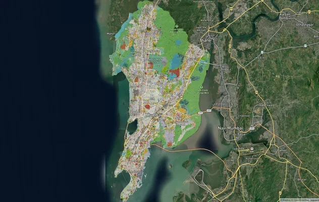
Mumbai Development Plan 2034: Zone Check and Land Use Guide
View Mumbai Masterplan as a live map overlay – check any plot's land use zone for free on 1acre.in. Mumbai masterplan 20...
More Layers in Maharashtra
Pune Ring Roads: Route Alignment and Land Impact
View Pune Ring Roads alignment as a live map overlay – check road corridor and land impact free on 1acre.in. Pune Ring R...
Pune Bengaluru Expressway
View Pune Bengaluru Expressway alignment as a live map overlay – check land acquisition risk and plot proximity free on ...
Mumbai Development Plan 2034: Zone Check and Land Use Guide
View Mumbai Masterplan as a live map overlay – check any plot's land use zone for free on 1acre.in. Mumbai masterplan 20...