PMRDA Masterplan: Pune Metropolitan Region Zone Check
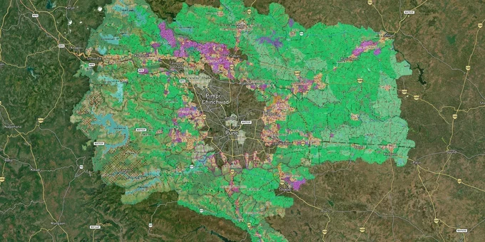
Pmrda Masterplan Preview
Try the PMRDA Masterplan on the map
Sign in once and explore the layer for a full day.
- No card details needed
- Find nearby verified lands for sale
Overview
The PMRDA Masterplan governs land use across 6,051.76 sq km, covering 814 villages within the Pune Metropolitan Region, under the authority of the Pune Metropolitan Region Development Authority (PMRDA), appointed as Special Planning Authority for 697 villages under Section 40 of the Maharashtra Regional and Town Planning Act, 1966. Development permissions follow the DCPR 2018 for the broader PMRDA area and UDCPR 2020 for the 23 villages newly merged into PMC. Obtaining a PMRDA zone certificate before buying any plot in this region is not optional.
Agricultural Non-Development Zone and the document gap that traps buyers across Pune's fringe villages
Most land in PMRDA's 814-village jurisdiction begins as agricultural. Within that classification, the most important subcategory a buyer must identify is the Agricultural Non-Development Zone. This zone explicitly prohibits private residential or commercial construction unless the land is brought under a formal Town Planning Scheme (TPS) or layout sanction. The Mahalunge-Man TPS No. 1, covering 250 hectares adjacent to Hinjewadi IT Park, is PMRDA's own example of how Agricultural Non-Development Zone land is converted: the authority declares a TPS, pools the land, and proposes a mixed-use residential, commercial, and industrial zone. Until that TPS receives final government approval, the underlying land in those 250 hectares carries no private construction right.
PMRDA Zone Classifications and Certification Process
Brokers in Talegaon, Urse, Khed, and Shirur routinely market agricultural plots as "PMRDA area" without specifying the zone. The PMRDA zone certificate, issued through the online portal at zonecertificate.pmrda.gov.in is the only document that confirms the operative zone for a specific survey number. The table below sets out what each classification means for a buyer:
Classification
Private Construction Permitted?
How to Convert
Key Risk
Residential Zone (RP / DP)
Yes, with PMRDA layout sanction and NA conversion
Apply for layout sanction under DCPR 2018
Verify layout sanction letter separately from zone certificate
Agricultural Non-Development Zone
No, until TPS or layout sanction granted
PMRDA TPS process cannot be individually initiated
Widely sold by brokers as "developable"; no individual conversion path
Green / No-Development Zone
No
Cannot be converted for private residential use
Bank financing not available; resale restricted
Commercial / Industrial Zone (RP)
Yes, for designated purpose only
Separate commercial or industrial layout sanction is needed
Residential construction on commercially zoned land is illegal
The PMRDA zone certificate is valid for three years from the date of digital issue, costs Rs 500 per survey number, and is obtained online using the 7/12 extract as the base document. Any plot purchase completed without this certificate carries unquantifiable legal risk.
Mahalunge, Wagholi, Talegaon, and Chakan: what the PMRDA zone classification means for buyers
PMRDA's 6,051.76 sq km jurisdiction spans nine talukas: Haveli, Maval, Mulshi, Khed, Shirur, Bhor, Velhe, Purandar, and Daund. The zone classification under the PMRDA Masterplan determines whether a corridor in this region is investable today, speculative, or legally frozen. Plots in PMRDA-sanctioned residential layouts within the Haveli and Maval talukas carry full bank financing eligibility and a clear development path. Plots outside TPS boundaries in Khed or Shirur talukas are a different category entirely.
The table below maps PMRDA's primary corridors against the dominant zone type and what each classification means for development rights:
Corridor / Locality
Taluka
Dominant Zone
Growth Driver
Primary Risk
Mahalunge, Maan, Hinjewadi fringes
Haveli / Maval
Agricultural NDZ (under TPS conversion)
Metro Line 3 Hinjewadi alignment (Phase 1 targeted June 2026); Mahalunge-Man TPS; ₹340 crore AMRUT 2.0 water project (proposed for approval)
TPS final approval still pending with state government as of 2024-25
Wagholi, Kesnand, Lonikand
Haveli
Residential (DP 2021)
East Pune IT corridor, Pune Ring Road alignment
Flood-line-affected plots present; verify blue flood line status
Talegaon, Urse, Dehu Road
Maval
Residential / Agricultural mix
Mumbai-Pune Expressway node, Talegaon MIDC
Agricultural NDZ prevalent in back-villages; zone certificate essential
Chakan, Rajgurunagar
Khed
Industrial / Residential mix
Chakan MIDC auto cluster, Pune-Nashik Highway
Industrial-zoned plots are marketed as residential in peripheral villages
The most misunderstood corridor is the Mahalunge-Maan belt. Because Metro Line 3 terminates near Hinjewadi and the TPS has received preliminary state approval under Section 86(1)(a) of the MRTP Act, 1966, brokers present pre-TPS land as de facto residential. The final approval of the Mahalunge-Man Town Planning Scheme is pending with the government. No construction permission can be issued on a TPS plot until that final approval is granted, published in the Maharashtra Government Gazette, and the individual plot reconstitution is completed.
Was this layer helpful?
Anything wrong, outdated, or missing we want to hear it.
For Land Owners & Agents
Looking to sell your land in Maharashtra?
I want to sell my land in Maharashtra
10:32
Plz share your Land's location - We will list it on 1acre map, for Free.
10:32

For Land Buyers
Browse all verified lands & plots in Maharashtra
Every listing goes through our Preliminary Verification Process.
More Layers in Maharashtra
See all 32 layers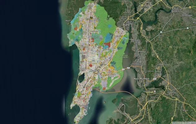
Mumbai Development Plan 2034: Zone Check and Land Use Guide
View Mumbai Masterplan as a live map overlay – check any plot's land use zone for free on 1acre.in. Mumbai masterplan 20...
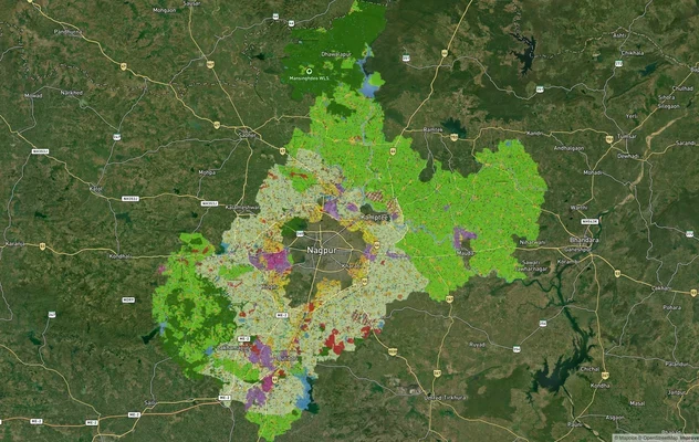
Nagpur Masterplan 2032: Zone Check and Land Use Guide
View Nagpur Masterplan as a live map overlay – check any plot's land use zone for free on 1acre.in. Nagpur Metropolitan ...
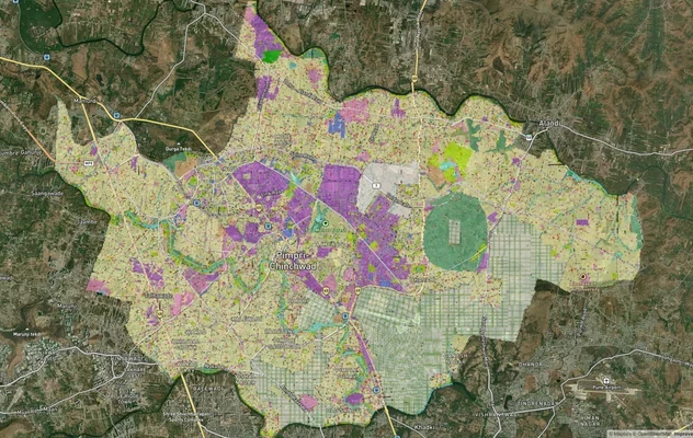
Pimpri Chinchwad PCMC Masterplan: Zone Check and Land Use Guide
View Pimpri Chinchwad Masterplan as a live map overlay – check any plot's land use zone for free on 1acre.in. Pimpri Chi...
More Layers in Maharashtra
Mumbai Development Plan 2034: Zone Check and Land Use Guide
View Mumbai Masterplan as a live map overlay – check any plot's land use zone for free on 1acre.in. Mumbai masterplan 20...
Nagpur Masterplan 2032: Zone Check and Land Use Guide
View Nagpur Masterplan as a live map overlay – check any plot's land use zone for free on 1acre.in. Nagpur Metropolitan ...
Pimpri Chinchwad PCMC Masterplan: Zone Check and Land Use Guide
View Pimpri Chinchwad Masterplan as a live map overlay – check any plot's land use zone for free on 1acre.in. Pimpri Chi...