Shaktipeeth Expressway (Nagpur-Goa): Route Map and Land Buying Guide

Shaktipeeth Expressway Preview
Try the Shaktipeeth Expressway (Nagpur-Goa) on the map
Sign in once and explore the layer for a full day.
- No card details needed
- Find nearby verified lands for sale
Overview
The Shaktipeeth Expressway is an 856.765-kilometer road project (856.765 km revised alignment approved April 2026) connecting Pavnar in Wardha district — linked to the Samruddhi Expressway via the Digras interchange — to Banda in Sawantwadi taluka, Sindhudurg district. MSRDC got cabinet approval in June 2025 with ₹20,787 crore set aside for buying land across 13 districts, including Wardha and Yavatmal near Nagpur. The route was revised from 802.592 km to 856.765 km, approved by the Maharashtra government on 1 April 2026 after farmer protests forced the government to redraw the map. The Nagpur-Goa Expressway (officially Shaktipeeth Expressway) investment story matters because this is the eastern anchor point where the highway meets the already-running Samruddhi Expressway. You need to know which villages are actually on the finalized route, how land acquisition compensation works under Maharashtra law, and where genuine development potential exists versus where brokers are just riding the hype.
Why the Compensation Structure Catches Buyers Off Guard
Here's what most people miss: MSRDC isn't using the 2013 Land Acquisition Act for this project. They're using the Maharashtra Highways Act from 1955. That's not a small detail. Under the 2013 Act, farmers on the Samruddhi route got four times the government circle rate. Under the 1955 Act, you get the government-set valuation plus solatium, which works out to roughly 40 percent less than what Samruddhi farmers received.
Joint surveys finished in 146 villages out of 395 as of June 2025. Section 15(2) notices went out in Kolhapur, Sangli, and parts of Wardha and Yavatmal. The 100-meter Right of Way means if your plot sits within 50 meters of the centerline on either side, it's in the direct acquisition zone. Before you buy anything near the corridor, pull the Section 15(1) preliminary notification from the district collector's website. If that document exists and you didn't check, you've bought land the government can freeze.
Stage
What You Should Verify
Where to Look
What Happens If You Skip This
Preliminary Notice
Section 15(1) filing
District Collector site
Land gets frozen, you find out too late
Survey Done
Joint measurement completed
Taluka records or MSRDC updates
Price speculation runs wild, timeline unclear
Final Notice
Section 15(2) in gazette
Maharashtra Gazette portal
30 days to object, then it's locked
Compensation Set
Award amount declared
Special Land Acquisition Officer
You're stuck with whatever rate they announce
Farmer protests forced the route to zigzag in Kolhapur. In Kolhapur district, most of Hatkanangale and Kagal talukas were excluded due to protests, and the route was rerouted through Bhudargad, Ajra and Chandgad instead. The revised alignment was formally approved in April 2026. Dharashiv saw farmers blocking survey teams in June 2025. If the village you're looking at shows up on the route map, confirm with MSRDC whether that segment is still active or under review. They've withdrawn and reapplied for environmental clearance more than once.
A broker telling you "interchange coming here" without showing the MSRDC DPR map is guessing. There are 26 interchanges planned across the 856.765 km route. Most villages won't get one. Walk away if they can't show you the approved location.
Wardha and Yavatmal: Where the Real Activity Is
The expressway starts at Pavnar in Wardha, where it links to Samruddhi Mahamarg. That interchange already works; people are using it now. From Wardha to Yavatmal, you're looking at about 100 km through cotton country.
Land around the Wardha interchange climbed 20 to 30 percent between 2022 and 2025, and that happened before anyone finalized where Shaktipeeth would actually run. The Yavatmal part cuts through farm zones where the land records show 7/12 and 8A designations. Agricultural land under Maharashtra revenue law. If you want to build something other than crops, you need conversion approval first.
Stretch
Why It Might Move
Why It Might Not
Pavnar (Wardha)
Samruddhi interchange already running since 2023
Prices already baked in the Samruddhi bump
Wardha to Yavatmal villages
Joint land measurement done in 146 of 395 villages as of early 2026
Farmer protests ongoing, compensation fights unsettled
Yavatmal to Hingoli
Runs through the agricultural belt
No one's published confirmed interchange spots yet
Hingoli to Nanded
Connects pilgrimage towns like Aundha Nagnath
Infrastructure here is thin, prices are speculation
You'll see projections claiming the expressway will push Maharashtra's GDP share from 14.2 percent to 20 percent. That's a government aspiration, not a guarantee tied to your plot's value. Samruddhi took eight years from DPR to partial opening. Shaktipeeth got DPR approval in July 2024, but land buying stalled multiple times. They're saying 2028-2029 completion. Add delays.
Wardha and Yavatmal are the only Vidarbha districts where survey work is substantially done. If you're looking at plots here, stick to land where the 7/12 is clean, no disputes, and you're at least 200 meters from the proposed centerline. Close enough to benefit from better roads eventually, far enough to stay out of the acquisition zone.
Was this layer helpful?
Anything wrong, outdated, or missing we want to hear it.
For Land Owners & Agents
Looking to sell your land in Maharashtra?
I want to sell my land in Maharashtra
10:32
Plz share your Land's location - We will list it on 1acre map, for Free.
10:32

For Land Buyers
Browse all verified lands & plots in Maharashtra
Every listing goes through our Preliminary Verification Process.
More Layers in Maharashtra
See all 32 layers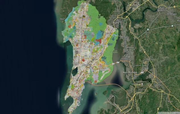
Mumbai Development Plan 2034: Zone Check and Land Use Guide
View Mumbai Masterplan as a live map overlay – check any plot's land use zone for free on 1acre.in. Mumbai masterplan 20...
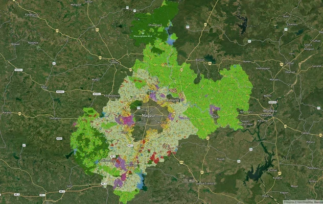
Nagpur Masterplan 2032: Zone Check and Land Use Guide
View Nagpur Masterplan as a live map overlay – check any plot's land use zone for free on 1acre.in. Nagpur Metropolitan ...
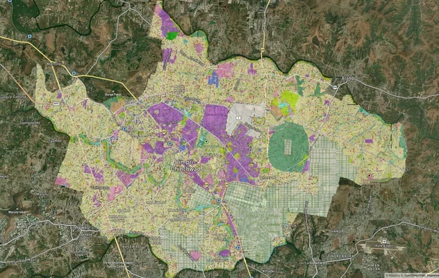
Pimpri Chinchwad PCMC Masterplan: Zone Check and Land Use Guide
View Pimpri Chinchwad Masterplan as a live map overlay – check any plot's land use zone for free on 1acre.in. Pimpri Chi...
More Layers in Maharashtra
Mumbai Development Plan 2034: Zone Check and Land Use Guide
View Mumbai Masterplan as a live map overlay – check any plot's land use zone for free on 1acre.in. Mumbai masterplan 20...
Nagpur Masterplan 2032: Zone Check and Land Use Guide
View Nagpur Masterplan as a live map overlay – check any plot's land use zone for free on 1acre.in. Nagpur Metropolitan ...
Pimpri Chinchwad PCMC Masterplan: Zone Check and Land Use Guide
View Pimpri Chinchwad Masterplan as a live map overlay – check any plot's land use zone for free on 1acre.in. Pimpri Chi...