
Bannerghatta Road
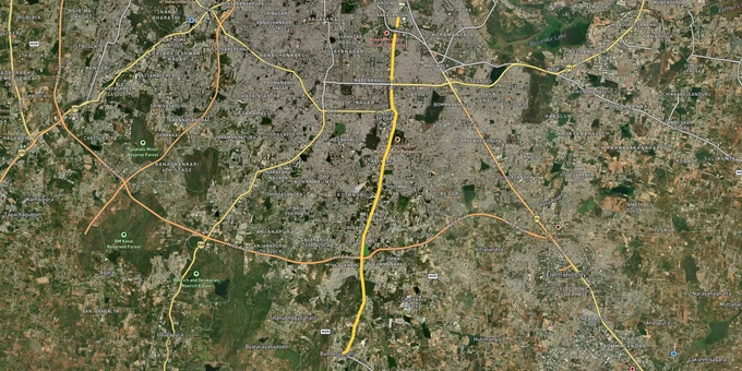

Bannerghatta Road Preview
Try the Bannerghatta Road on the map
Sign in once and explore the layer for a full day.
- No card details needed
- Find nearby verified lands for sale
Overview
Bannerghatta Road land buying is one of South Bengaluru's most active stories, but the rules sit inside two specific documents: the BDA Revised Master Plan 2031 and the Bannerghatta National Park Eco-Sensitive Zone notification. The road itself, classified officially as State Highway 87, runs 49 km from Adugodi near Hosur Road down through Bilekahalli, Gottigere and the NICE Road junction, before terminating at Anekal via Jigani. RMP 2031, prepared by the Bangalore Development Authority under the Karnataka Town and Country Planning Act 1961, governs every land use call along the urban stretch. This page maps the legal traps, the live corridor, and the questions buyers should ask before any cheque moves.
ESZ Boundaries and the Khata Question That Decides Everything
Two specific issues separate a clean Bannerghatta Road plot from one that will never see a clear title. The first is the proximity to the Bannerghatta National Park Eco-Sensitive Zone. The second is the difference between an A-Khata and a B-Khata, which is the single number that decides whether a bank will touch your loan file.
The MoEFCC October 2018 draft notification fixed the Bannerghatta ESZ at 169 sq km covering 77 villages, down from the earlier 268.9 sq km of 2016. Activists challenged the reduction, and the matter has carried legal exposure ever since. In June 2022, the Supreme Court ruled that every protected forest, national park and wildlife sanctuary across India must carry a mandatory ESZ of at least 1 km from the demarcated boundary. That floor still applies, even where the state notification proposed a narrower zone. The default 10 km buffer applies in the absence of a final notification, and as the IISc study by Prof T V Ramachandra documented, the Bannerghatta belt remains biologically and hydrologically sensitive.
The table below shows how RMP 2031 zoning interacts with the ESZ for the corridor's main pockets.
Corridor Stretch
RMP 2031 Zone
ESZ Status
Watch Out
Dairy Circle to Bilekahalli (upper Bannerghatta Road)
Inside Planning Zone A, stabilisation zone discouraging further commercialisation
Outside ESZ
Density caps under Zone A; verify FAR before redevelopment
Bilekahalli, Arekere, Hulimavu
Planning Zone B, primary intensification belt
Outside core ESZ but 1 km Supreme Court floor applies near forest fringe
Lake and stream buffers per NGT orders
Gottigere, Kalena Agrahara, Anjanapura
Mixed residential-commercial, near NICE Road junction
Partial overlap with ESZ buffer for southern pockets
Confirm village-wise inclusion in 77-village ESZ list
Bannerghatta, Ragihalli, Shivanahalli, Jigani fringe
Conservation, forest, industrial estate (Jigani)
Inside notified ESZ
Construction, quarrying and red-category industries restricted
Corridor Stretch
RMP 2031 Zone
ESZ Status
Watch Out
Dairy Circle to Bilekahalli (upper Bannerghatta Road)
Inside Planning Zone A, stabilisation zone discouraging further commercialisation
Outside ESZ
Density caps under Zone A; verify FAR before redevelopment
Bilekahalli, Arekere, Hulimavu
Planning Zone B, primary intensification belt
Outside core ESZ but 1 km Supreme Court floor applies near forest fringe
Lake and stream buffers per NGT orders
Gottigere, Kalena Agrahara, Anjanapura
Mixed residential-commercial, near NICE Road junction
Partial overlap with ESZ buffer for southern pockets
Confirm village-wise inclusion in 77-village ESZ list
Bannerghatta, Ragihalli, Shivanahalli, Jigani fringe
Conservation, forest, industrial estate (Jigani)
Inside notified ESZ
Construction, quarrying and red-category industries restricted
The A-Khata B-Khata plot Bengaluru question is the second tripwire. An A-Khata means BBMP has registered the property in its A-register with full property tax assessment, building approval and BDA sanction. A B-Khata only acknowledges receipt of property tax for a parcel that BBMP itself flags as not fully compliant with applicable laws, often because the layout was never BDA-approved or sits on revenue land waiting for conversion. Banks rarely lend cleanly on B-Khata. Construction approvals are tougher to obtain. Cross-check the khata extract against the BDA approved layout sheet, the conversion order, the encumbrance certificate and the survey number on the village map before any token money changes hands.
Growth Corridors: Where the Metro and the Forest Decide Returns
The road splits cleanly into three bands. The upper stretch from Dairy Circle to Bilekahalli is a mature urban market with deep healthcare and education anchors. The middle band from Arekere through Gottigere is the Pink Line catchment and currently the most active residential supply belt. The lower stretch from Bannerghatta town towards Jigani sits inside or adjacent to the ESZ, with industrial land at Jigani offering the only structured alternative.
The table below summarises the corridor's main investment bands and the drivers attached to each.
Band
Localities
Primary Driver
Risk
Upper (Dairy Circle to Bilekahalli)
Adugodi, Sagar Hospital, Jayadeva, NS Palya
IIM Bangalore at Bilekahalli, Apollo-Fortis hospital cluster
Limited fresh inventory; Planning Zone A density caps
Middle (Arekere to Kalena Agrahara)
Arekere, Hulimavu, Gottigere, JP Nagar 4th Phase
Pink Line elevated section (Kalena Agrahara to Tavarekere) targeted for March 2026; underground stretch by December 2026
Construction-led road disruption; rental yields rose 6-8% in 2025
Lower (Bannerghatta town to Jigani)
Bannerghatta, Koppa Gate, Anekal, Jigani
NICE Road interchange, Jigani industrial belt
ESZ overlap; quarrying and red-category restrictions
Band
Localities
Primary Driver
Risk
Upper (Dairy Circle to Bilekahalli)
Adugodi, Sagar Hospital, Jayadeva, NS Palya
IIM Bangalore at Bilekahalli, Apollo-Fortis hospital cluster
Limited fresh inventory; Planning Zone A density caps
Middle (Arekere to Kalena Agrahara)
Arekere, Hulimavu, Gottigere, JP Nagar 4th Phase
Pink Line elevated section (Kalena Agrahara to Tavarekere) targeted for March 2026; underground stretch by December 2026
Construction-led road disruption; rental yields rose 6-8% in 2025
Lower (Bannerghatta town to Jigani)
Bannerghatta, Koppa Gate, Anekal, Jigani
NICE Road interchange, Jigani industrial belt
ESZ overlap; quarrying and red-category restrictions
The Bannerghatta Road metro Pink Line is the single biggest reset on the corridor. The 18.6 km line, planned at roughly ₹11,014 crore in 2017, runs underground through most of the central city and surfaces along the southern stretch from Kalena Agrahara through Tavarekere. BMRCL has confirmed that the elevated section is targeted for operation by March 2026 and the underground stretch by December 2026. Jayadeva will be an interchange with the Yellow Line, and MG Road will interchange with the Purple Line. The Phase 3 Orange Line further extends J P Nagar Phase 4 to Kempapura and is scheduled for 2029.
Jigani industrial area land is the most misread pocket on the corridor. Brokers sell adjacent village layouts at "Jigani rate," but the KIADB-allotted Jigani estate has its own boundary, its own sanctioned use, and a separate price ladder. Anything outside that boundary is village land under panchayat layout rules. Cross-check the sanctioned KIADB layout and any ESZ overlap before treating a "near Jigani" listing at face value. The same scrutiny applies at Anekal, where the Bannerghatta Road terminates and several plot-led developments sit on revenue land that needs Section 95 conversion before any BBMP khata can issue.
Was this layer helpful?
Anything wrong, outdated, or missing we want to hear it.

Access Survey NumbersAccess Karnataka
Survey Numbers
Boundaries and numbers come from published state cadastral records. See all map layers.
Looking to sell your land in Karnataka?

Browse all verified lands & plots in Karnataka
More Layers in Karnataka
See all 25 layers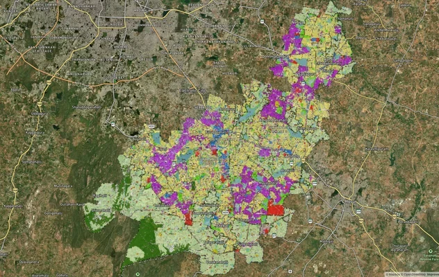
Anekal Masterplan: Zone Check and Land Use Guide
View Anekal Masterplan as a live map overlay – check any plot's land use zone for free on 1acre.in. Anekal masterplan zo...
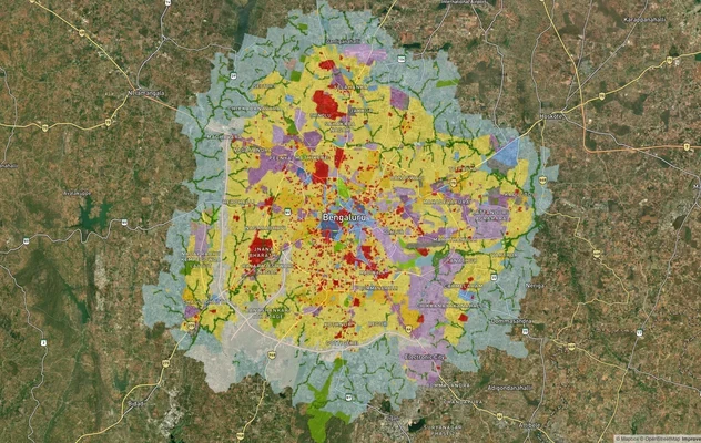
Bengaluru BDA Masterplan 2015
View Bengaluru Masterplan as a live map overlay – check any plot's land use zone for free on 1acre.in. Bengaluru BDA mas...
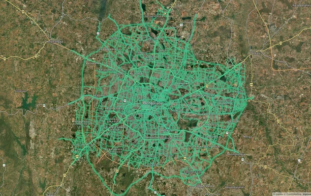
Bengaluru BDA Masterplan Roads: RMP 2015 Road Zones
View Bengaluru Masterplan - Roads alignment as a live map overlay – check road corridor and land impact free on 1acre.in...
More Layers in Karnataka
Anekal Masterplan: Zone Check and Land Use Guide
View Anekal Masterplan as a live map overlay – check any plot's land use zone for free on 1acre.in. Anekal masterplan zo...
Bengaluru BDA Masterplan 2015
View Bengaluru Masterplan as a live map overlay – check any plot's land use zone for free on 1acre.in. Bengaluru BDA mas...
Bengaluru BDA Masterplan Roads: RMP 2015 Road Zones
View Bengaluru Masterplan - Roads alignment as a live map overlay – check road corridor and land impact free on 1acre.in...