
Bengaluru-Mysuru Expressway
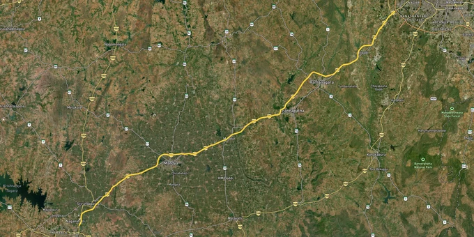

Bengaluru Mysuru Expressway Preview
Try the Bengaluru-Mysuru Expressway on the map
Sign in once and explore the layer for a full day.
- No card details needed
- Find nearby verified lands for sale
Overview
Bengaluru Mysuru Expressway land buying decisions turn on one fact most brokers will not mention upfront: the 119 km NH-275 access-controlled expressway is fully elevated and tolled, with vehicle entry restricted to designated interchanges only. The corridor cuts through 8,005 sq km of BMRDA jurisdiction across Bengaluru Urban, Bengaluru Rural and Ramanagara districts. Bypasses ring Bidadi, Ramanagara, Channapatna, Maddur, Mandya and Srirangapatna, so road frontage on Google Maps rarely translates to usable access on the ground. This page covers the zone codes, the authority that actually sanctions your layout, and the corridors where appreciation is real versus speculative.
Regulatory Red Flags Specific to NH-275 Land Buyers
Two failures sink most plot deals along this corridor. The first is mistaking a BMRDA stamp for a sanction. BMRDA does not approve layouts. It only frames the regulations and supervises the local planning authorities below it. For land within Ramanagara and Channapatna town limits, the Ramanagaram-Channapatna Urban Development Authority, commonly called RCUDA, is the only body that can issue a final layout sanction. For the surrounding rural belts the Bidadi Smart City Planning Authority, Kanakapura LPA, Magadi LPA or Anekal LPA holds that power. Any newspaper ad or brochure that prints "BMRDA approved layout" without quoting a planning authority sanction order number is a red flag. Demand the order number, the sanction date and the approved survey schedule before you sign anything. If the seller cannot produce these in writing, you are not buying a sanctioned plot. You are buying a panchayat site with no resale or loan eligibility.
The second trap is the red zone. Bidadi was declared a red zone in 2009, freezing free sale of farm land in the notified villages. The state has since approved the Greater Bengaluru Integrated Township across roughly 7,481 acres spanning nine villages in Ramanagara taluk, with fresh preliminary notifications issued in 2025. Survey numbers inside this notification cannot be sold cleanly until the parcel is denotified. Farmer protests across 26 villages remain active and compensation rates are still disputed. A third quiet trap is the lake buffer. Several survey numbers near Byramangala, Manchanabele and the Arkavathi catchment fall within conservation overlays where layout approval is prohibited entirely, even if the broker shows you a DC conversion order.
Use this screen before you transfer any earnest money on a plot in this belt.
Zone Code
Permitted Use
Requires DC Conversion?
Prohibited Without Sanction?
Residential (R)
Plotted housing, apartments
Yes, from Deputy Commissioner
Yes, RCUDA or LPA sanction
Commercial (C)
Retail, mixed-use
Yes
Yes
Industrial (I)
Manufacturing, warehousing
Yes
Yes, plus KIADB clearance where applicable
Agriculture (AG)
Farming only
Not valid for resale as residential
Construction prohibited
Green Belt / Conservation
Lake buffers, eco-sensitive land
Not permitted
Layouts illegal
Public / Semi-Public (PSP)
Schools, hospitals, civic use
Case by case
Yes
Zone Code
Permitted Use
Requires DC Conversion?
Prohibited Without Sanction?
Residential (R)
Plotted housing, apartments
Yes, from Deputy Commissioner
Yes, RCUDA or LPA sanction
Commercial (C)
Retail, mixed-use
Yes
Yes
Industrial (I)
Manufacturing, warehousing
Yes
Yes, plus KIADB clearance where applicable
Agriculture (AG)
Farming only
Not valid for resale as residential
Construction prohibited
Green Belt / Conservation
Lake buffers, eco-sensitive land
Not permitted
Layouts illegal
Public / Semi-Public (PSP)
Schools, hospitals, civic use
Case by case
Yes
DC conversion in Karnataka is necessary but not sufficient. The final planning authority sanction is what banks insist on before they sanction a home loan against the plot. A site with only a conversion order and no LPA sanction is a half-cooked file. It will register but it will not finance, and at resale the next buyer will discount it heavily once their lawyer flags the gap.
Growth Corridors and Micro-Markets on the NH-275 Belt
Not every kilometre of this corridor carries the same upside. The investable stretches share three traits: an operational bypass, a clean planning authority jurisdiction, and a connection to either the Namma Metro extension or a working industrial cluster. Speculative pockets fail at least one of those three tests. High-risk pockets sit inside active acquisition notifications, lake buffers or red zone areas. Treating the entire stretch from Kengeri to Mysuru as a single uniform market is the single biggest mistake retail buyers make on this corridor.
The table below maps each major Bidadi Ramanagara plot corridor and Channapatna Maddur land belt to its driver and the specific risk that follows it.
Corridor / Locality
Planning Authority
Growth Driver
Known Risk
Bidadi (Byramangala, Hosur, Kanchakarahalli)
Bidadi Smart City PA
Toyota cluster, GBIT project
Red zone, ongoing acquisition notice
Kengeri to Nayandahalli
BDA limits
Purple Line metro to Challaghatta
Priced in
Ramanagara town belt
RCUDA
22 km Ramanagara-Channapatna bypass
Panchayat layouts widespread
Channapatna fringe
RCUDA
Bypass exit, toy-cluster MSME demand
Limited service road access
Maddur and Mandya bypasses
Mandya LPA
7 km and 10 km bypass openings
Mostly farmland, AG zone
Srirangapatna fringe
Srirangapatna LPA
7 km bypass, Mysuru proximity
Heritage and Cauvery buffer overlays
Nidaghatta junction
RCUDA
Phase 1 and Phase 2 expressway midpoint
Service road still under construction
Corridor / Locality
Planning Authority
Growth Driver
Known Risk
Bidadi (Byramangala, Hosur, Kanchakarahalli)
Bidadi Smart City PA
Toyota cluster, GBIT project
Red zone, ongoing acquisition notice
Kengeri to Nayandahalli
BDA limits
Purple Line metro to Challaghatta
Priced in
Ramanagara town belt
RCUDA
22 km Ramanagara-Channapatna bypass
Panchayat layouts widespread
Channapatna fringe
RCUDA
Bypass exit, toy-cluster MSME demand
Limited service road access
Maddur and Mandya bypasses
Mandya LPA
7 km and 10 km bypass openings
Mostly farmland, AG zone
Srirangapatna fringe
Srirangapatna LPA
7 km bypass, Mysuru proximity
Heritage and Cauvery buffer overlays
Nidaghatta junction
RCUDA
Phase 1 and Phase 2 expressway midpoint
Service road still under construction
The most misunderstood corridor on this belt is Bidadi. Buyers see Toyota, the AI-city headlines and the 30 km drive from central Bengaluru, and assume the upside is locked in. They miss that the red zone classification has been in force since 2009 and that the 2025 GBIT preliminary notification covers thousands of acres across nine villages. If a broker shows you a Bidadi survey number, ask for the village name first, cross-check the GBIT notification list next, and confirm the parcel sits outside the acquisition area before any discussion of price. Walk away if either of those two checks fails. The second most misunderstood corridor is the Maddur to Mandya stretch. The bypass is operational, the connectivity is genuine, but most parcels available for sale are still in the AG zone with no planning authority sanction in sight. That is farm investment, not plotted investment, and pricing it like Bidadi is a costly mistake.
Was this layer helpful?
Anything wrong, outdated, or missing we want to hear it.

Access Survey NumbersAccess Karnataka
Survey Numbers
Boundaries and numbers come from published state cadastral records. See all map layers.
Looking to sell your land in Karnataka?

Browse all verified lands & plots in Karnataka
More Layers in Karnataka
See all 25 layers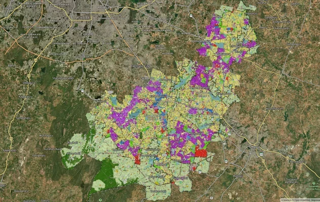
Anekal Masterplan: Zone Check and Land Use Guide
View Anekal Masterplan as a live map overlay – check any plot's land use zone for free on 1acre.in. Anekal masterplan zo...
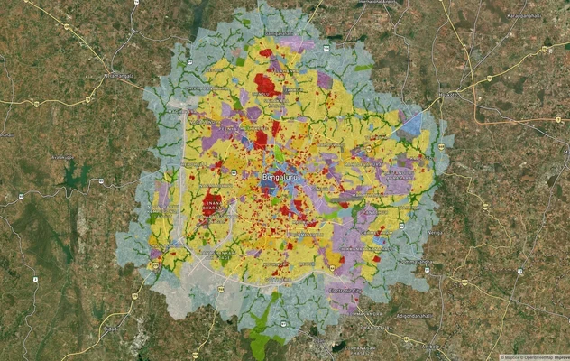
Bengaluru BDA Masterplan 2015
View Bengaluru Masterplan as a live map overlay – check any plot's land use zone for free on 1acre.in. Bengaluru BDA mas...
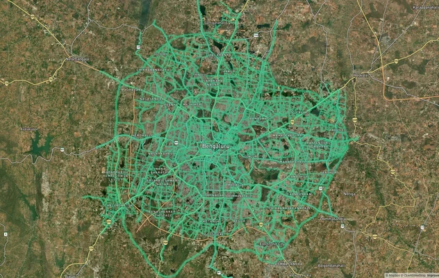
Bengaluru BDA Masterplan Roads: RMP 2015 Road Zones
View Bengaluru Masterplan - Roads alignment as a live map overlay – check road corridor and land impact free on 1acre.in...
More Layers in Karnataka
Anekal Masterplan: Zone Check and Land Use Guide
View Anekal Masterplan as a live map overlay – check any plot's land use zone for free on 1acre.in. Anekal masterplan zo...
Bengaluru BDA Masterplan 2015
View Bengaluru Masterplan as a live map overlay – check any plot's land use zone for free on 1acre.in. Bengaluru BDA mas...
Bengaluru BDA Masterplan Roads: RMP 2015 Road Zones
View Bengaluru Masterplan - Roads alignment as a live map overlay – check road corridor and land impact free on 1acre.in...
Frequently Asked Questions
No. The NH-275 access-controlled expressway is elevated and tolled, with entry permitted only at designated interchanges. Direct village access is restricted. NHAI has tendered additional service roads, underpasses and entry-exit points for completion by mid-2027.
Yes for farm use only. For residential plotting you must complete DC conversion in Karnataka and then secure a final layout sanction from the relevant local planning authority. Conversion by itself does not authorise construction, a Khata or any registered plot resale.
BMRDA only frames regulations and oversees the LPAs. The actual sanction comes from RCUDA, Bidadi Smart City PA, Kanakapura LPA, Magadi LPA, Anekal LPA, BIAAPA or Nelamangala LPA depending on jurisdiction. A "BMRDA approved layout" claim without a specific LPA sanction order number is misleading.
The Ramanagaram-Channapatna Urban Development Authority is the sole sanctioning body for layouts inside its local planning area. For Bidadi, the Bidadi Smart City Planning Authority issues sanction. Always insist on the order number, sanction date and approved layout schedule before paying any token amount.
The red zone was notified in 2009 to reserve land for the original integrated township proposal. It restricts free sale of farmland in the notified villages. The rebranded Greater Bengaluru Integrated Township revived this freeze with fresh preliminary notifications issued in 2025 across nine villages.
The Mysore Road belt, including Kengeri, Bidadi and Ramanagara, has seen reported annual gains in the 12 to 18 percent range since the expressway opened in March 2023. Appreciation is uneven and concentrated near operational bypass exits and metro extension nodes.
No. Acquisition is currently at the preliminary notification stage across nine villages in Ramanagara taluk. Farmer protests in 26 villages remain active and compensation rates are disputed. Survey numbers inside the notification cannot be sold cleanly until the matter is settled or denoted.
Service road access is incomplete along several stretches of the expressway. NHAI is constructing a full-scale service road on the Bengaluru-Mysuru side with underpasses and overpasses. Bidding is done and works are targeted for mid-2027 completion. Verify ground access before purchase.