
Mysore Road
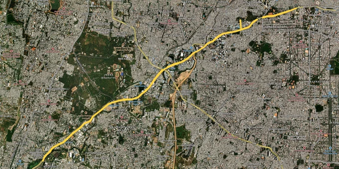

Mysore Road Preview
Try the Mysore Road on the map
Sign in once and explore the layer for a full day.
- No card details needed
- Find nearby verified lands for sale
Overview
Mysore Road land buying spans a 25-kilometer corridor starting at Kengeri flyover, running through Kumbalgodu, Rajarajeshwari Nagar, Ullal, eventually hitting the Bangalore-Mysore Expressway near Bidadi. The entire stretch falls under BDA's Revised Master Plan 2015 covering 1,306 sq km, notified via G.O. No. UDD 540 BEM AA SE 2004 dated 22 June 2007. NH-275 (old NH-209) got widened and the Bangalore-Mysore Expressway opened cutting travel time, driving massive speculation on adjacent agricultural land. Prices swing from ₹3,500 per square foot in outer Bidadi to ₹12,000 near NICE Road junction Kengeri, but none of that matters if your layout doesn't have BDA approval or sits on AG-classified land without DC conversion done. This page covers why BDA's illegal layout list comes first, the NICE corridor trap catching buyers in Kumbalgodu and Ullal, and why Kengeri commands triple what outer Bidadi does despite sitting on the same highway.
Layouts Without BDA Approval Won't Get Sanctioned or Financed
BDA's Revised Master Plan 2015 divides land into zones: Residential (R), Commercial (C), Industrial (I), Public/Semi-Public (PSP), Open Space (OS), and Agriculture (AG). If your plot shows AG classification on the masterplan, construction is prohibited until you complete two steps. First is DC Conversion, meaning the Deputy Commissioner issues an order permitting agricultural land to become non-agricultural. Second is CLU (Change of Land Use) approval through BDA confirming the land can be used for residential purposes. Both take 6 to 9 months combined and neither the layout nor individual plots can be legally sold until both orders exist.
Most layouts on Mysore Road launched between 2010-2020 skipped this entirely and formed developments directly on agricultural land with no conversion in place. The paperwork looks clean. Maybe there's a layout plan stamped somewhere. Maybe a surveyor's report. None of it matters if the underlying land hasn't been converted from agricultural use and BDA hasn't approved the layout. Banks reject loans for AG-classified plots. BDA won't issue building plan sanctions. BBMP won't transfer Khata. Your plot exists on paper but stays legally unbuildable.
The table below shows what separates financeable plots from registration nightmares on Mysore Road.
Document You Need
What It Proves
Where to Verify
What Happens Without It
BDA Layout Approval
Layout legally recognized
BDA office, illegal layout list
Building sanction impossible, Khata rejected
DC Conversion Order
AG land converted to non-AG
Deputy Commissioner office
Construction prohibited by law
CLU Certificate
Land use change approved
BDA office
Building plan rejected
Mutation Entry
Sale registered in revenue
Tehsildar office
Ownership not established
Document You Need
What It Proves
Where to Verify
What Happens Without It
BDA Layout Approval
Layout legally recognized
BDA office, illegal layout list
Building sanction impossible, Khata rejected
DC Conversion Order
AG land converted to non-AG
Deputy Commissioner office
Construction prohibited by law
CLU Certificate
Land use change approved
BDA office
Building plan rejected
Mutation Entry
Sale registered in revenue
Tehsildar office
Ownership not established
Kumbalgodu and Rajarajeshwari Nagar are where unauthorized layouts concentrate most heavily. A BDA official confirmed in 2024 that builders selling in flagged layouts hadn't followed basic guidelines. No required road widths. No footpaths. No parks. Buyers in those layouts can't get building plan sanctions, Khata transfers, or bank loans. BDA's 2024 notification confirms the largest concentration of illegal layouts falls in Bengaluru South and West taluks, which includes the entire Mysore Road corridor from Kengeri to Bidadi.
If a broker can't show you a valid DC Conversion Order and confirm the survey number sits outside BDA's illegal layout list, the transaction ends there. The illegal layout list gets updated periodically and BDA doesn't send personal notifications. Buyers discover their layout got flagged only when they try getting building sanctions or Khata transfers 2-3 years after purchase.
Now layer the NICE Road complication on top. Nandi Infrastructure Corridor Enterprises (NICE) Road runs from Tumkur Road to Hosur Road passing through Kengeri, creating a high-speed peripheral bypass. Plots within 2-3 kilometers of NICE junctions got marketed heavily from 2015-2022 as "NICE corridor facing" or "expressway adjacent." Problem is NICE Road attracts industrial and logistics demand, not pure residential. BDA's masterplan zones highway-adjacent areas for industrial and mixed-use. You buy thinking peaceful suburban living, you end up owning land that gets rezoned or sits next to warehouses and truck terminals within 5 years.
Kengeri NICE Junction Fetches Triple What Bidadi Does For One Simple Reason
The corridor breaks into three completely different markets depending on whether Purple Line Metro, BDA-approved layouts, and completed NICE Road access actually exist or developers just kept promising they'd show up eventually.
Kengeri to Kumbalgodu runs 8 kilometers and commands ₹9,000 to ₹12,000 per square foot. Why? Namma Metro Purple Line's Challaghatta and Kengeri stations opened. NICE Road junction provides highway access. BDA-approved layouts like portions of Kengeri Satellite Town and select BMRDA-sanctioned developments have functional infrastructure. Roads paved. Electricity working. Water supply connected through BWSSB. Banks approve loans here because BDA approval exists, layouts meet civic standards, and Metro connectivity creates real residential demand not speculation.
Kumbalgodu to Ullal covers the next 10 kilometers at ₹5,000 to ₹8,000 per square foot. You'll find some BDA-approved or BMRDA-sanctioned layouts here, but unauthorized developments dominate. These layouts got DC conversion done showing agricultural land became non-agricultural, but BDA layout approval never came through because infrastructure standards weren't met. Roads are narrower than required 30-40 feet. No underground sewerage. Water supply depends on borewells not BWSSB connections. Banks treat these plots completely differently. Either outright rejection or 50-60% down payment required with interest rates 2-3% higher because risk jumped.
Ullal to outer Bidadi is the final 7 kilometers running ₹3,000 to ₹5,000 per square foot. Pure speculation on Bangalore-Mysore Expressway completion, Bidadi industrial expansion, and eventual Metro extension under Suburban Rail project plans. Developers grabbed agricultural land betting expressway access drives residential demand. Here's the bet: expressway traffic increases, Bidadi KIADB industrial area expands, Metro extends by 2030, early buyers double money. Expressway opened but brought truck traffic and logistics hubs, not residential buyers. Most plots out here don't have BDA approval, sit on AG-classified land without proper DC conversion, and banks won't finance them on standard terms.
Here's how the three zones break down by approval status and Metro proximity.
Stretch
Distance from Kengeri Metro
Layout Type
Price Per Sq Ft
Main Risk
Kengeri-Kumbalgodu
0-8 km
BDA approved, Metro access
₹9,000-₹12,000
Premium locked in, limited inventory
Kumbalgodu-Ullal
8-18 km
Mixed BDA and unauthorized
₹5,000-₹8,000
Banks reject unauthorized layouts
Ullal-Outer Bidadi
18-25 km
Mostly AG land, no BDA approval
₹3,000-₹5,000
No bank loans, industrial rezoning risk
Stretch
Distance from Kengeri Metro
Layout Type
Price Per Sq Ft
Main Risk
Kengeri-Kumbalgodu
0-8 km
BDA approved, Metro access
₹9,000-₹12,000
Premium locked in, limited inventory
Kumbalgodu-Ullal
8-18 km
Mixed BDA and unauthorized
₹5,000-₹8,000
Banks reject unauthorized layouts
Ullal-Outer Bidadi
18-25 km
Mostly AG land, no BDA approval
₹3,000-₹5,000
No bank loans, industrial rezoning risk
The Kengeri Metro zone is the established winner. It appreciated 30-40% from 2020 to 2026 because Purple Line actually opened. Challaghatta and Kengeri stations are operational. Banks finance BDA-approved layouts here. Kumbalgodu followed at 15-25% but only in approved pockets. Unauthorized colonies barely moved or dropped 10-15% once buyers realized approvals weren't coming. Ullal and Bidadi are wild cards. BMRDA-approved layouts saw 12-18% appreciation. Unauthorized developments sitting on agricultural land without DC conversion haven't moved in 5 years. Some actually dropped 20-25% when BDA's illegal layout list got updated and banks started rejecting loans.
The NICE Road corridor complication remains misunderstood. Highway access sounds attractive but NICE Road was designed for freight movement, not residential development. Plots marketed as "NICE facing" or "expressway adjacent" often sit in zones BDA classified as Industrial or mixed-use under RMP 2015, not pure Residential. That classification affects FAR, permitted uses, and future rezoning potential. A plot bought for ₹8,000 per square foot expecting residential appreciation might get surrounded by logistics warehouses within 3-5 years as industrial demand follows highway access.
The Bangalore-Mysore Expressway impact zone shows similar patterns. The 111-kilometer expressway opened in phases from 2018-2022, cutting Bangalore-Mysore travel from 3-4 hours to under 2 hours. Plots near expressway exits at Ramanagara and Bidadi saw initial 20-30% jumps. Then industrial players started buying land for warehousing and manufacturing because highway logistics made sense. Residential demand didn't materialize as expected. Prices stabilized or corrected 10-15% in areas where industrial development dominated.
Was this layer helpful?
Anything wrong, outdated, or missing we want to hear it.

Access Survey NumbersAccess Karnataka
Survey Numbers
Boundaries and numbers come from published state cadastral records. See all map layers.
Looking to sell your land in Karnataka?

Browse all verified lands & plots in Karnataka
More Layers in Karnataka
See all 25 layers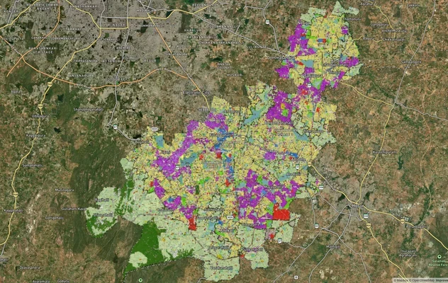
Anekal Masterplan: Zone Check and Land Use Guide
View Anekal Masterplan as a live map overlay – check any plot's land use zone for free on 1acre.in. Anekal masterplan zo...
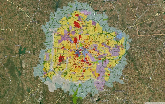
Bengaluru BDA Masterplan 2015
View Bengaluru Masterplan as a live map overlay – check any plot's land use zone for free on 1acre.in. Bengaluru BDA mas...
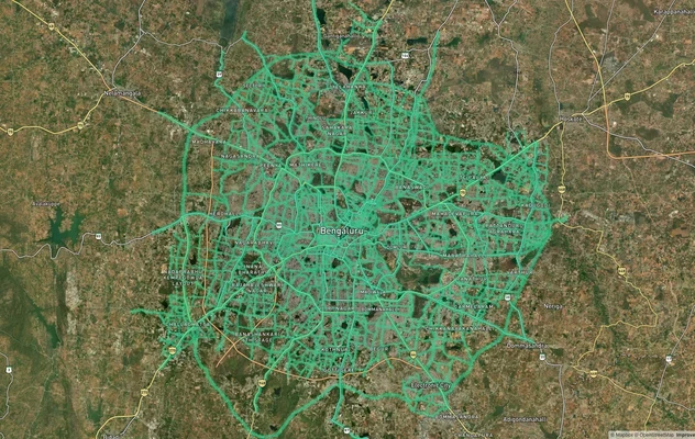
Bengaluru BDA Masterplan Roads: RMP 2015 Road Zones
View Bengaluru Masterplan - Roads alignment as a live map overlay – check road corridor and land impact free on 1acre.in...
More Layers in Karnataka
Anekal Masterplan: Zone Check and Land Use Guide
View Anekal Masterplan as a live map overlay – check any plot's land use zone for free on 1acre.in. Anekal masterplan zo...
Bengaluru BDA Masterplan 2015
View Bengaluru Masterplan as a live map overlay – check any plot's land use zone for free on 1acre.in. Bengaluru BDA mas...
Bengaluru BDA Masterplan Roads: RMP 2015 Road Zones
View Bengaluru Masterplan - Roads alignment as a live map overlay – check road corridor and land impact free on 1acre.in...