
IAF Air Funnel Zones - Bidar


Iaf Air Funnel Zones Bidar Preview
Try the IAF Air Funnel Zones - Bidar on the map
Sign in once and explore the layer for a full day.
- No card details needed
- Find nearby verified lands for sale
Overview
The Bidar Air Force Station land height restriction question turns on a fact most buyers overlook: this base does not fly occasionally, it flies constantly. Located in Bidar, Karnataka, and controlled by the Indian Air Force's Training Command, this is the second biggest pilot training centre in the country, where Air Force Academy graduates complete advanced instruction before joining combat units.
The base flies between 60 and 90 sorties every single day, generating the highest number of single-engine flying hours anywhere in India. It houses three Hawk Operational Training Squadrons and is not open to the public. It covers why Bidar's sheer flight frequency changes the practical stakes of any height restriction near it, what the 2011 runway extension likely did to the base's approach and departure footprint, and how the small civil enclave here differs from the training operations around it.
Bidar Air Force Station Land: Regulatory Red Flags You Cannot Ignore
The first red flag is flight frequency itself. A base flying 60 to 90 sorties a day is not a quiet installation with occasional traffic passing overhead. It is one of the busiest single-engine training environments in the country, and that volume means the funnel zone, the approach and departure corridor aligned with the runway, sees continuous, repeated use rather than sporadic activity.
For a buyer, this matters less as a legal distinction and more as a practical one: any height restriction here exists to protect an airspace that is genuinely in constant operational use, which makes strict enforcement and conservative No Objection Certificate processing more likely than at a base with lighter traffic.
The second red flag is the 2011 runway extension. Bidar's runway was extended to 9,000 feet as part of a broader remodel that also added new aircraft engine maintenance and testing facilities, timed to accommodate the arrival of Hawk advanced jet trainers replacing decades of older Kiran and HT-2 trainer aircraft.
A longer runway generally requires a correspondingly extended approach and departure funnel to safely accommodate faster, more capable aircraft, which means the restricted zone around Bidar today is very likely larger than it was before this 2011 upgrade. Any assumption based on an older, pre-2011 understanding of the base's footprint should be treated as outdated.
The table below sets out the base's core confirmed parameters.
Parameter
Confirmed Detail
Controlling command
Indian Air Force Training Command
Elevation
2,178 feet (664 m), on the Deccan Plateau
Runway length
Extended to 9,000 feet in 2011
Daily sortie volume
60 to 90 flights per day
Squadrons based
Three Hawk Operational Training Squadrons, with a fourth planned
Public access
Not open to the public
Parameter
Confirmed Detail
Controlling command
Indian Air Force Training Command
Elevation
2,178 feet (664 m), on the Deccan Plateau
Runway length
Extended to 9,000 feet in 2011
Daily sortie volume
60 to 90 flights per day
Squadrons based
Three Hawk Operational Training Squadrons, with a fourth planned
Public access
Not open to the public
The third red flag is the nature of the training itself, which involves more than simple point-to-point flights. Bidar is historically associated with the Indian Air Force's Surya Kiran Aerobatic Team, which flew its first six-aircraft formation sortie from this base in May 1996, and the station continues to run advanced fighter conversion training on Hawk Mk 132 aircraft alongside a dedicated Weapon System Operators' School. Training environments built around advanced manoeuvre practice, not just routine transport or patrol flights, tend to justify a more cautious approach to nearby construction, since the flight profiles involved are inherently less predictable in altitude and trajectory than a straightforward commercial approach path.
The fourth consideration is that Bidar sits on the Deccan Plateau specifically because that location offers favourable year-round flying conditions, protected from the tropical weather patterns that affect coastal Indian airbases. This means training activity here does not have the seasonal lulls that a monsoon-exposed coastal base might see, and the funnel zone should be treated as active essentially year-round rather than concentrated in particular months.
Areas and Micro-Markets Affected by the Bidar Restricted Zone
Land exposure near Bidar Air Force Station concentrates around the base's immediate perimeter and along its runway's approach and departure alignment, with a much smaller civil enclave adding a secondary layer of consideration.
Area
Position Relative to the Base
Character
Restriction Exposure
Immediate base perimeter
Directly surrounding the airfield
Training Command installation, not open to the public
Highest exposure to the funnel zone and general security perimeter
Runway approach/departure alignment
Extending along the 9,000-foot runway's flight path
Corridor of continuous daily sortie activity
Elevated exposure regardless of straight-line distance from the base itself
Bidar civil enclave (Bidar Airport)
Shares infrastructure with the military base
Small commercial operation, currently served by Star Air to Bengaluru
Subject to standard civil aviation height rules in addition to the military zone
Bidar town and surrounding district
Broader district headquarters area
Established regional centre on the Deccan Plateau
Exposure tapers with distance, but should be confirmed against the runway's specific alignment
Area
Position Relative to the Base
Character
Restriction Exposure
Immediate base perimeter
Directly surrounding the airfield
Training Command installation, not open to the public
Highest exposure to the funnel zone and general security perimeter
Runway approach/departure alignment
Extending along the 9,000-foot runway's flight path
Corridor of continuous daily sortie activity
Elevated exposure regardless of straight-line distance from the base itself
Bidar civil enclave (Bidar Airport)
Shares infrastructure with the military base
Small commercial operation, currently served by Star Air to Bengaluru
Subject to standard civil aviation height rules in addition to the military zone
Bidar town and surrounding district
Broader district headquarters area
Established regional centre on the Deccan Plateau
Exposure tapers with distance, but should be confirmed against the runway's specific alignment
The runway approach and departure alignment deserves more weight in a buyer's evaluation than simple distance from the base gate. Because Bidar's runway was extended specifically to handle faster, more capable Hawk trainers, and because the base generates such a high volume of daily sorties, land directly in line with either runway end is functionally closer to continuous aircraft activity than land the same distance away but positioned off to the side. This is the same principle that applies at any funnel-zone-governed base, but it carries extra weight at Bidar given how much of the day this runway is actually in active use.
The small civil enclave, Bidar Airport, is the most easily overlooked piece of this picture. Commercial service here is limited, currently a single route to Bengaluru operated by Star Air, but its presence means land near the shared runway infrastructure is subject to standard civil aviation height rules on top of whatever the Training Command's own security and operational restrictions require. A buyer should not assume that Bidar's primarily military character means the civil aviation NOC process is irrelevant; it simply runs alongside the military review rather than replacing it.
Was this layer helpful?
Anything wrong, outdated, or missing we want to hear it.

Access Survey NumbersAccess Karnataka
Survey Numbers
Boundaries and numbers come from published state cadastral records. See all map layers.
Looking to sell your land in Karnataka?

Browse all verified lands & plots in Karnataka
More Layers in Karnataka
See all 25 layers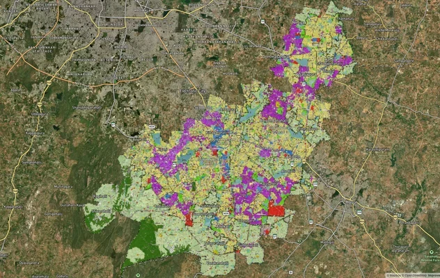
Anekal Masterplan: Zone Check and Land Use Guide
View Anekal Masterplan as a live map overlay – check any plot's land use zone for free on 1acre.in. Anekal masterplan zo...
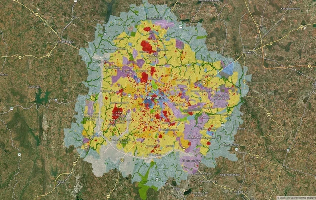
Bengaluru BDA Masterplan 2015
View Bengaluru Masterplan as a live map overlay – check any plot's land use zone for free on 1acre.in. Bengaluru BDA mas...
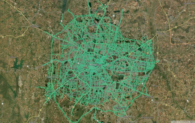
Bengaluru BDA Masterplan Roads: RMP 2015 Road Zones
View Bengaluru Masterplan - Roads alignment as a live map overlay – check road corridor and land impact free on 1acre.in...
More Layers in Karnataka
Anekal Masterplan: Zone Check and Land Use Guide
View Anekal Masterplan as a live map overlay – check any plot's land use zone for free on 1acre.in. Anekal masterplan zo...
Bengaluru BDA Masterplan 2015
View Bengaluru Masterplan as a live map overlay – check any plot's land use zone for free on 1acre.in. Bengaluru BDA mas...
Bengaluru BDA Masterplan Roads: RMP 2015 Road Zones
View Bengaluru Masterplan - Roads alignment as a live map overlay – check road corridor and land impact free on 1acre.in...