
NH-44 - North Bengaluru
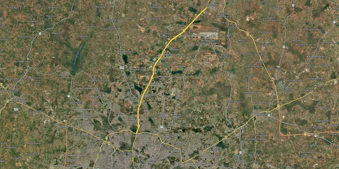

Nh 44 North Bengaluru Preview
Try the NH-44 - North Bengaluru on the map
Sign in once and explore the layer for a full day.
- No card details needed
- Find nearby verified lands for sale
Overview
NH-44 (formerly NH-7) is the primary arterial spine of North Bengaluru, running from Hebbal through Yelahanka, Chikkajala, and Devanahalli to Kempegowda International Airport and beyond. For land buyers, the highway matters because the BIAAPA Masterplan 2021 governs all land use across 228 villages in this corridor under the Karnataka Town and Country Planning Act, 1961. That plan divides the region into residential, commercial, industrial, green, and public utility zones, each with specific FAR limits and permitted uses. Your survey number's zone classification under this plan determines whether you can build, what you can build, whether an airport authority NOC is required, and whether your layout has any legal standing at all. This page covers the regulatory traps specific to the NH-44 belt, the growth corridors where infrastructure is actually delivering, and the documents you must verify before signing anything.
"BIAAPA Approved" Does Not Mean What Brokers Say It Means: The CLU and Release Order Trap on NH-44
The most expensive misunderstanding in North Bengaluru land buying is this: BIAAPA approving a layout and a developer holding the release order to sell individual plots are two entirely separate clearances. Brokers routinely show buyers a BIAAPA layout approval order and present it as full authorisation to purchase. It is not. The release order, a separate document issued by BIAAPA after the developer satisfies additional conditions, must be in hand before any individual plot can be legally sold. If a broker cannot produce both documents, stop the transaction there.
The second trap is the CLU gap. Most land along the NH-44 corridor starts as agricultural. That classification does not change because a developer has divided it into plots and marketed it as BIAAPA approved. Under the Karnataka Town and Country Planning Act, 1961, any parcel zoned residential on the BIAAPA Masterplan 2021 still requires a formal Change of Land Use (CLU) order from BIAAPA before any construction can legally proceed. Without a valid CLU, no BIAAPA building plan sanction will be issued and any structure built on the land is liable for demolition.
There is a third layer that catches buyers along Doddaballapur Road specifically: a 2017-18 delimitation transferred roughly 257 villages of Doddaballapur taluk out of BIAAPA's jurisdiction into the separate Doddaballapura Planning Authority at dbpurapa.in. Plots in those villages are not governed by the BIAAPA Masterplan 2021, which means BIAAPA zone data for that stretch is not reliable. Confirm which authority governs your specific parcel before using this map layer.
This table shows the mandatory documents to verify before paying any token amount on an NH-44 corridor plot:
Document
What to Verify
Where to Check
BIAAPA Layout Approval Order
Layout number, sanction date, zone classification
biaapa.tpa.gov.in
BIAAPA Plot Release Order
Developer holds separate release order for individual plots
biaapa.tpa.gov.in
CLU Order
Parcel formally converted from agricultural to permitted use
BIAAPA / BMRDA records
A-Khata Certificate
Plot has local body recognition and revenue standing
Respective Gram Panchayat or BBMP
Encumbrance Certificate
No liens, litigation, or prior charges on the title
Sub-Registrar Office, Devanahalli or Yelahanka
Airport Authority NOC
Required for parcels in height-restricted color-coded zones near runway
Airports Authority of India (AAI)
Document
What to Verify
Where to Check
BIAAPA Layout Approval Order
Layout number, sanction date, zone classification
biaapa.tpa.gov.in
BIAAPA Plot Release Order
Developer holds separate release order for individual plots
biaapa.tpa.gov.in
CLU Order
Parcel formally converted from agricultural to permitted use
BIAAPA / BMRDA records
A-Khata Certificate
Plot has local body recognition and revenue standing
Respective Gram Panchayat or BBMP
Encumbrance Certificate
No liens, litigation, or prior charges on the title
Sub-Registrar Office, Devanahalli or Yelahanka
Airport Authority NOC
Required for parcels in height-restricted color-coded zones near runway
Airports Authority of India (AAI)
Beyond CLU, every plot in the BIAAPA zone carries an additional layer buyers almost never check: airport height restrictions. The BIAAPA Masterplan 2021 includes color-coded zones around the KIA runway that impose strict building height limits. An airport authority NOC is mandatory before BIAAPA will sanction any building plan within restricted zones. The broker brochure for no NH-44 plot will mention this. Verify the zone color before deciding on land near Chikkajala or Devanahalli town.
Green-zone parcels are the hardest trap of all. The Yelahanka-Chikkajala belt has the highest concentration of misrepresented plots in the BIAAPA jurisdiction: the masterplan designates many parcels there as public utility or green use, not residential. No CLU application on a green-zoned parcel will succeed, regardless of what infrastructure surrounds it or what any developer claims.
NH-44 Growth Corridors: Devanahalli Has Delivered, Doddaballapur Road Is the Current Window
The NH-44 corridor is not uniformly investable. Devanahalli and the land immediately around Kempegowda International Airport have already priced in a decade of infrastructure delivery: the KIADB Aerospace Park at Bagalur, the Aerospace SEZ, IT park clusters, and proximity to the airport have made this the most-transacted plotted land zone in North Bengaluru. Plot prices in established layouts here are now between 3,500 and 4,500 rupees per square foot. For buyers entering at this stage, the appreciation upside is more moderate.
Doddaballapur Road, running northwest from Yelahanka along NH-44 toward the STRR junction, is where the current entry opportunity sits. Plot prices are 2,800 to 3,800 rupees per square foot in reputed developments, with multiple confirmed infrastructure triggers still ahead: STRR connectivity, proximity to the upcoming 5,800-acre KWIN City project, and the Madappanahalli Urban Park at 153.39 acres. The Namma Metro Phase 2B airport line began construction in February 2022 and is expected to reach the airport around 2027, which will reduce commute times from Hebbal and central Bengaluru to this corridor significantly.
This table maps the main NH-44 corridor micro-markets against their zone character under the BIAAPA Masterplan 2021 and the honest investment profile for each:
Corridor
BIAAPA Zone Character
Primary Growth Driver
Known Risk
Devanahalli Town Core
Residential / Commercial
KIA, Aerospace SEZ, KIADB Aerospace Park Bagalur
Fully priced; very few raw land opportunities below ₹4,000 per sq. ft.
Yelahanka–Chikkajala Belt
Green / Public Utility in many parcels
Proximity to Manyata Tech Park and NH-44 access
Highest misrepresentation rate in BIAAPA zone; many parcels are green-zoned and CLU is impossible
Doddaballapur Road Corridor
Residential (verify per parcel; 257 villages under Doddaballapura Planning Authority)
STRR, KWIN City (5,800 acres), proximity to L&T and Hitachi plants
Authority jurisdiction split; confirm governing body before relying on BIAAPA map
Bagalur–Hennur Belt
Residential / Transitional
KIADB Aerospace Park Bagalur operational; Hennur–Bagalur Road improving
Peripheral Ring Road (PRR/Bengaluru Business Corridor) still unbuilt; fresh tender released in early 2026, but construction not started
Shettigere–Bettenahalli (NH-44 Frontage)
Residential
Airport proximity; several Grade-A developer layouts already active
Airport NOC and height-zone verification mandatory
Corridor
BIAAPA Zone Character
Primary Growth Driver
Known Risk
Devanahalli Town Core
Residential / Commercial
KIA, Aerospace SEZ, KIADB Aerospace Park Bagalur
Fully priced; very few raw land opportunities below ₹4,000 per sq. ft.
Yelahanka–Chikkajala Belt
Green / Public Utility in many parcels
Proximity to Manyata Tech Park and NH-44 access
Highest misrepresentation rate in BIAAPA zone; many parcels are green-zoned and CLU is impossible
Doddaballapur Road Corridor
Residential (verify per parcel; 257 villages under Doddaballapura Planning Authority)
STRR, KWIN City (5,800 acres), proximity to L&T and Hitachi plants
Authority jurisdiction split; confirm governing body before relying on BIAAPA map
Bagalur–Hennur Belt
Residential / Transitional
KIADB Aerospace Park Bagalur operational; Hennur–Bagalur Road improving
Peripheral Ring Road (PRR/Bengaluru Business Corridor) still unbuilt; fresh tender released in early 2026, but construction not started
Shettigere–Bettenahalli (NH-44 Frontage)
Residential
Airport proximity; several Grade-A developer layouts already active
Airport NOC and height-zone verification mandatory
The most misread corridor along NH-44 is the Yelahanka-Chikkajala stretch. Agents price it as an airport-proximity play. The BIAAPA Masterplan 2021 tells a different story: large portions of this belt are designated public utility or green zone. No amount of infrastructure proximity changes a green-zone classification. Check the masterplan zone before anything else on this stretch, not after.
The Aerocity Phase II extension, which had been anticipated as another growth lever for the northern NH-44 belt, was cancelled by the Karnataka cabinet in July 2025 following farmer protests. The existing KIADB Aerospace Park at Bagalur remains operational and is not affected by that cancellation. Do not price NH-44 land on Aerocity Phase II as a confirmed trigger.
Was this layer helpful?
Anything wrong, outdated, or missing we want to hear it.

Access Survey NumbersAccess Karnataka
Survey Numbers
Boundaries and numbers come from published state cadastral records. See all map layers.
Looking to sell your land in Karnataka?

Browse all verified lands & plots in Karnataka
More Layers in Karnataka
See all 25 layers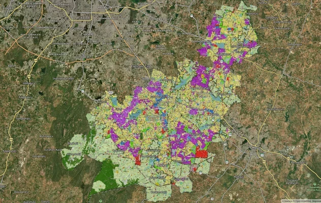
Anekal Masterplan: Zone Check and Land Use Guide
View Anekal Masterplan as a live map overlay – check any plot's land use zone for free on 1acre.in. Anekal masterplan zo...
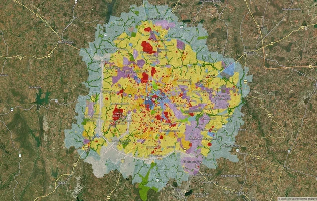
Bengaluru BDA Masterplan 2015
View Bengaluru Masterplan as a live map overlay – check any plot's land use zone for free on 1acre.in. Bengaluru BDA mas...
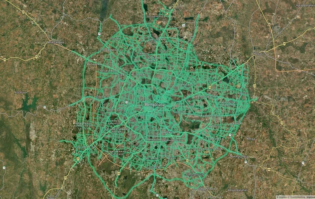
Bengaluru BDA Masterplan Roads: RMP 2015 Road Zones
View Bengaluru Masterplan - Roads alignment as a live map overlay – check road corridor and land impact free on 1acre.in...
More Layers in Karnataka
Anekal Masterplan: Zone Check and Land Use Guide
View Anekal Masterplan as a live map overlay – check any plot's land use zone for free on 1acre.in. Anekal masterplan zo...
Bengaluru BDA Masterplan 2015
View Bengaluru Masterplan as a live map overlay – check any plot's land use zone for free on 1acre.in. Bengaluru BDA mas...
Bengaluru BDA Masterplan Roads: RMP 2015 Road Zones
View Bengaluru Masterplan - Roads alignment as a live map overlay – check road corridor and land impact free on 1acre.in...