
NICE Road
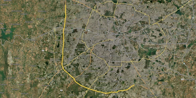

Nice Road Preview
Try the NICE Road on the map
Sign in once and explore the layer for a full day.
- No card details needed
- Find nearby verified lands for sale
Overview
NICE Road is the 41 km tolled outer peripheral road built by Nandi Infrastructure Corridor Enterprises, connecting Hosur Road near Electronic City in the southeast to Tumkur Road in the northwest. As of 2024, over 100,000 vehicles use it daily. It functions as a semi-ring connecting South and West Bengaluru outside the BDA development area. For land buyers, the road creates two distinct questions. First, the operative NICE Road section is real, tolled, and carrying traffic. Second, the broader Bengaluru-Mysuru Infrastructure Corridor project, for which over 20,000 acres were earmarked, is legally fractured: in July 2025, a single-judge bench of the Karnataka High Court led by Justice R. Devdas quashed all land acquisition notifications issued between 1998 and 2009 under Section 28 of the KIAD Act, citing 23 years of inaction and zero compensation paid to farmers. The Supreme Court subsequently dismissed NICE's challenge to that ruling. Any land along the NICE Road corridor that sits within an unresolved acquisition zone is not a clean title. This page explains what that means for buyers, where the real growth corridors are, and what documents actually confirm a safe transaction.
Legal Minefield Along the Route: Three Traps Buyers Walk Into on the NICE Road Corridor
The legal complexity around NICE Road is not theoretical. It is documented in Karnataka High Court orders, Supreme Court orders, Deccan Herald investigations, and state Cabinet proceedings. Buyers who skip this context and focus only on highway proximity are the ones ending up with titles that cannot be registered or resold.
### Trap 1: Unresolved acquisition notifications that nobody told you about
Between 1998 and 2009, the state government issued multiple land acquisition notifications for the BMIC project under the KIAD Act. No compensation was paid. Farmers continued farming. Some of those parcels entered the secondary land market and were sold by original owners who had been neither compensated nor formally dispossessed. On July 7-8, 2025, the Karnataka HC quashed all those notifications and directed fresh awards within three months based on April 2019 land values. As of May 2026, over 374 court cases stemming from BMIC land disputes remain pending. Buying any parcel whose survey number appears in KIADB's old acquisition schedule without confirming it has been formally released or re-notified puts the buyer inside active litigation.
### Trap 2: The 13,000-acre denotification pending in Cabinet
As of November 2024, the Karnataka state government was preparing to table a proposal in Cabinet to denotify approximately 13,000 acres originally notified for the NICE Road extension toward Mysuru. That denotification has not been formally completed. Land in those 13,000 acres sits in a grey zone: technically still under acquisition notification but practically abandoned. Some brokers market these parcels as investment-grade land released from acquisition. They are not released until the Cabinet notification is gazetted and the KIADB formally denotifies each survey number.
### Trap 3: BMICAPA jurisdiction without DC conversion
The operative NICE Road corridor, along with interchange zones and the Peripheral Road belt, falls under the planning jurisdiction of BMICAPA, the Bangalore Mysuru Infrastructure Corridor Area Planning Authority. This is a separate planning authority from BDA and BMRDA. Layout approvals from BDA or BMRDA do not automatically apply within BMICAPA's jurisdiction. Additionally, any land that carries an agricultural classification in the revenue record requires a formal DC conversion order under the Karnataka Land Revenue Act before any construction is permitted. Buying agricultural land on the NICE Road corridor without DC conversion and a BMICAPA layout approval means no building plan sanction, no Khata, and no home loan.
The mandatory document checklist before any payment on a NICE Road corridor plot:
Document
What to Confirm
Where to Verify
KIADB Acquisition Status
Survey number not in active or pending BMIC acquisition schedule
KIADB office, Nrupathunga Road, Bengaluru
BMICAPA Layout Approval
Layout sanctioned by BMICAPA under KTCP Act, 1961
bmicapa.tpa.gov.in
DC Conversion Order
Agricultural land formally converted; order number on revenue record
Taluk office / Revenue department
E-Khata
Local body recognition for the specific plot number
BBMP or Gram Panchayat
Encumbrance Certificate
No prior charge, mortgage, or court attachment on the survey number
Sub-Registrar, 13-year search
RERA Registration
Developer registered under Karnataka RERA for plotted projects
rera.karnataka.gov.in
Document
What to Confirm
Where to Verify
KIADB Acquisition Status
Survey number not in active or pending BMIC acquisition schedule
KIADB office, Nrupathunga Road, Bengaluru
BMICAPA Layout Approval
Layout sanctioned by BMICAPA under KTCP Act, 1961
bmicapa.tpa.gov.in
DC Conversion Order
Agricultural land formally converted; order number on revenue record
Taluk office / Revenue department
E-Khata
Local body recognition for the specific plot number
BBMP or Gram Panchayat
Encumbrance Certificate
No prior charge, mortgage, or court attachment on the survey number
Sub-Registrar, 13-year search
RERA Registration
Developer registered under Karnataka RERA for plotted projects
rera.karnataka.gov.in
One site-specific trap runs along the Mysuru Road to Hosakerehalli and Sunkadakatte-Kadabagere stretch. The Empowered Committee proceedings of April 2025 specifically discussed pending acquisition for this stretch. NICE dropped its HC petition after that meeting, reserving the right to refile. Land in this micro-belt carries ongoing uncertainty about whether fresh acquisition proceedings will commence. Confirm with the KIADB whether the specific survey number in this stretch is subject to any active or proposed notification before transacting.
NICE Road Growth Corridors: Operational Segments vs Speculative Belts
The investment case for NICE Road land breaks into three segments with very different risk profiles.
Segment
Planning Authority
Growth Driver
Specific Risk
Electronic City to Gottigere (southeast node)
BMICAPA / BDA interface zone
Namma Metro Yellow Line operational since August 2025 (RV Road to Bommasandra, 19.15 km, 16 stations); Electronic City IT corridor employment base
NICE vs BMRCL land dispute at Beratena Agrahara and Doddathoguru villages; verify survey numbers against BMRCL acquisition schedule for Yellow Line viaduct
Gottigere to Bannerghatta Road junction (south-central)
BMICAPA jurisdiction
Bannerghatta Biological Park creates green buffer and lifestyle; Kanakapura Road adjacency; Art of Living and institutional demand
DC conversion mandatory for agricultural parcels; plots between ₹3,000-15,000 per sq ft depending on conversion status
Mysuru Road to Tumkur Road (western arc)
BMICAPA; Mysuru extension under denotification consideration
Tumkur Road industrial and warehousing growth; Bidadi township proposal (8,000 acres discussed in April 2025 Empowered Committee)
Highest concentration of unresolved acquisition notifications; 13,000-acre denotification not yet gazetted; Sunkadakatte-Kadabagere stretch in active discussion
Segment
Planning Authority
Growth Driver
Specific Risk
Electronic City to Gottigere (southeast node)
BMICAPA / BDA interface zone
Namma Metro Yellow Line operational since August 2025 (RV Road to Bommasandra, 19.15 km, 16 stations); Electronic City IT corridor employment base
NICE vs BMRCL land dispute at Beratena Agrahara and Doddathoguru villages; verify survey numbers against BMRCL acquisition schedule for Yellow Line viaduct
Gottigere to Bannerghatta Road junction (south-central)
BMICAPA jurisdiction
Bannerghatta Biological Park creates green buffer and lifestyle; Kanakapura Road adjacency; Art of Living and institutional demand
DC conversion mandatory for agricultural parcels; plots between ₹3,000-15,000 per sq ft depending on conversion status
Mysuru Road to Tumkur Road (western arc)
BMICAPA; Mysuru extension under denotification consideration
Tumkur Road industrial and warehousing growth; Bidadi township proposal (8,000 acres discussed in April 2025 Empowered Committee)
Highest concentration of unresolved acquisition notifications; 13,000-acre denotification not yet gazetted; Sunkadakatte-Kadabagere stretch in active discussion
The southeastern node near Electronic City carries the clearest current appreciation case. The Namma Metro Yellow Line began full commercial operations on August 10-11, 2025, with all 16 stations from RV Road to Bommasandra running at approximately 10-minute peak-hour frequency as of early 2026. Bommasandra station sits roughly 10 minutes by road from the Gottigere-NICE Road interchange. Residential plots within verified, BMICAPA-approved layouts in this belt are now absorbing IT workforce demand that was previously concentrated entirely in Electronic City apartments.
Kanakapura Road, which intersects the NICE Road at its southeastern arc, carries its own growth momentum. Plots listed between ₹3,000 and ₹15,000 per sq ft depending on zone classification and conversion status. Projects by Prestige and Assetz are active in this corridor. Namma Metro Green Line extension to Anjanapura has reduced commute times and BMRDA-approved layouts here are seeing sustained absorption.
The western arc from Mysuru Road to Tumkur Road has the longest value runway but the highest current legal risk. The Bidadi township proposal discussed in the April 2025 Empowered Committee meeting involves 8,000 acres and represents a potential long-cycle appreciation story. The problem is that the denotification of 13,000 surplus acres and the fresh acquisition of 10,000 acres for the Bengaluru-Mysuru expressway are being discussed simultaneously, and buyers cannot determine which category a specific survey number falls into without checking KIADB records directly.
Was this layer helpful?
Anything wrong, outdated, or missing we want to hear it.

Access Survey NumbersAccess Karnataka
Survey Numbers
Boundaries and numbers come from published state cadastral records. See all map layers.
Looking to sell your land in Karnataka?

Browse all verified lands & plots in Karnataka
More Layers in Karnataka
See all 25 layers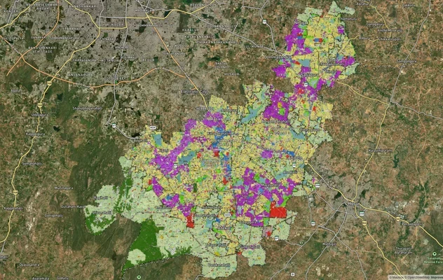
Anekal Masterplan: Zone Check and Land Use Guide
View Anekal Masterplan as a live map overlay – check any plot's land use zone for free on 1acre.in. Anekal masterplan zo...
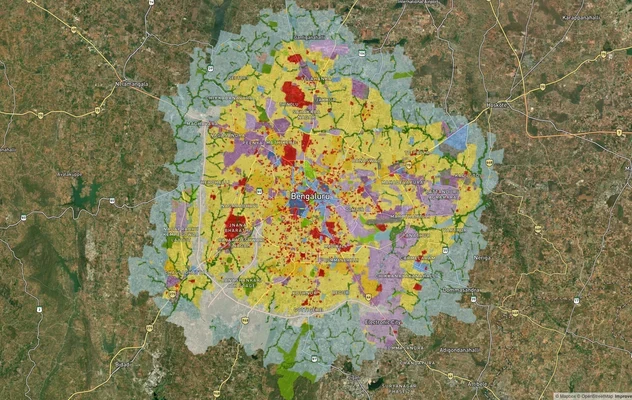
Bengaluru BDA Masterplan 2015
View Bengaluru Masterplan as a live map overlay – check any plot's land use zone for free on 1acre.in. Bengaluru BDA mas...
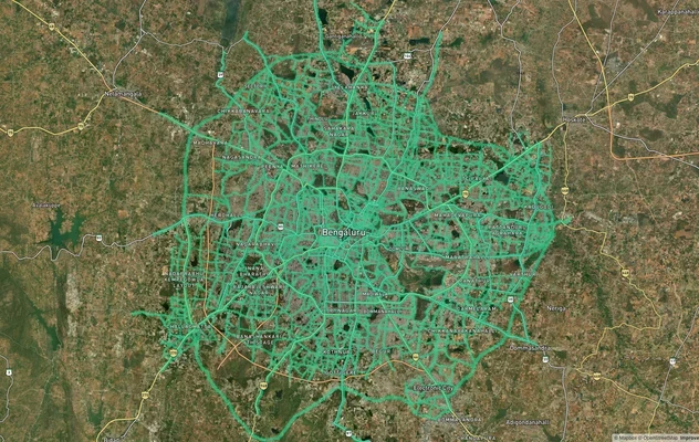
Bengaluru BDA Masterplan Roads: RMP 2015 Road Zones
View Bengaluru Masterplan - Roads alignment as a live map overlay – check road corridor and land impact free on 1acre.in...
More Layers in Karnataka
Anekal Masterplan: Zone Check and Land Use Guide
View Anekal Masterplan as a live map overlay – check any plot's land use zone for free on 1acre.in. Anekal masterplan zo...
Bengaluru BDA Masterplan 2015
View Bengaluru Masterplan as a live map overlay – check any plot's land use zone for free on 1acre.in. Bengaluru BDA mas...
Bengaluru BDA Masterplan Roads: RMP 2015 Road Zones
View Bengaluru Masterplan - Roads alignment as a live map overlay – check road corridor and land impact free on 1acre.in...