Hyderabad Heritage Sites: ASI, State, and HMDA Heritage Zones
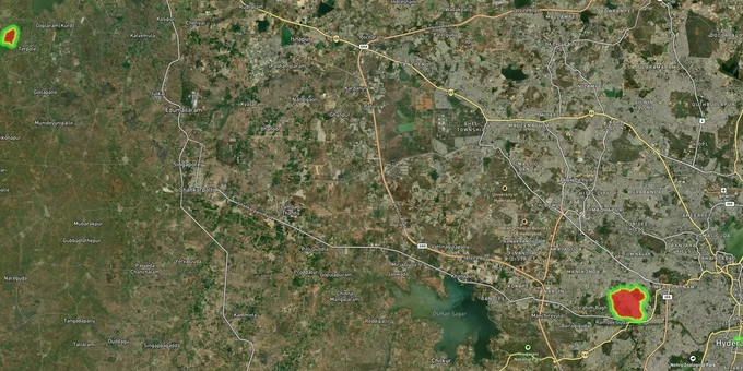
Hyderabad Heritage Sites Preview
Try the Hyderabad Heritage Sites on the map
Sign in once and explore the layer for a full day.
- No card details needed
- Find nearby verified lands for sale
Overview
The Hyderabad Heritage Sites layer on 1acre maps all plots covered by ASI protected monument zones across the city. Hyderabad carries eight ASI-protected monuments under central protection, including Golconda Fort, Charminar, Mecca Masjid, and Toli Masjid. Each creates a mandatory no-construction prohibited area of 100 metres and a regulated area extending another 200 metres beyond that. Any land sale within these zones is legal, but your right to build on it may not be.
Golconda, Charminar and the 300-Metre Trap Hyderabad Buyers Keep Falling Into
Hyderabad is one of India's densest concentrations of ASI-protected monuments, and the construction restrictions around them catch buyers every year. The AMASR Act 1958 (amended 2010) is the governing law. It creates two mandatory zones around every centrally protected monument: a prohibited area (0 to 100 metres from the monument's protected boundary) where no construction of any kind is permitted, and a regulated area (100 to 300 metres from the prohibited area boundary) where construction requires a Heritage Impact Assessment report and a NOC from the National Monuments Authority.
The trap is this: brokers sell land inside these zones without disclosing the restriction. The sale deed is valid. The registration goes through. You own the land. You cannot build on it.
The table below shows the eight ASI-centrally protected monuments in Hyderabad that generate these zones:
Monument
Location
Zone Status
Golconda Fort
Ibrahim Bagh, West Hyderabad
Prohibited: 100m + Regulated: 200m
Charminar
Ghansi Bazaar, Old City
Prohibited: 100m + Regulated: 200m
Mecca Masjid
Adjacent to Charminar, Old City
Prohibited: 100m + Regulated: 200m
Qutb Shahi Tombs
Ibrahim Bagh
Prohibited: 100m + Regulated: 200m
Toli Masjid
2 km west of Golconda
Prohibited: 100m + Regulated: 200m
British Residency
Koti, Central Hyderabad
Prohibited: 100m + Regulated: 200m
Taramati Baradari
Ibrahim Bagh
Prohibited: 100m + Regulated: 200m
Shaikpet Sarai
Shaikpet, Southwest Hyderabad
Prohibited: 100m + Regulated: 200m
The Qutb Shahi Tombs complex contains around 70 monuments including mosques and idgahs. The Golconda Fort outer wall runs 11 kilometres. The combined prohibited and regulated footprint of these eight monuments covers significant portions of Old City, Ibrahim Bagh, Shaikpet, and Koti. If a broker shows you a plot at what seems like a reasonable price in these localities, the reason for that price is often visible on the 1acre heritage layer before you ever visit.
One important additional layer: the Telangana Heritage Act 2017 created the Telangana State Heritage Authority (TSHA) and the Greater Hyderabad Heritage Committee under HMDA, covering state-notified heritage precincts beyond ASI's central list. The Telangana High Court upheld this Act in 2019. 137 buildings, 9 rock formations, 6 conservation precincts, and 169 lakes were notified in 1998–2000; the list is being expanded under the Telangana Heritage Act 2017. Violations carry imprisonment up to three years and fine up to ₹50,000 (fifty thousand rupees), plus ₹250/day continuing-offence penalty. Always check both the ASI prohibited zone map and the HMDA heritage precinct zone, because they are not the same list.
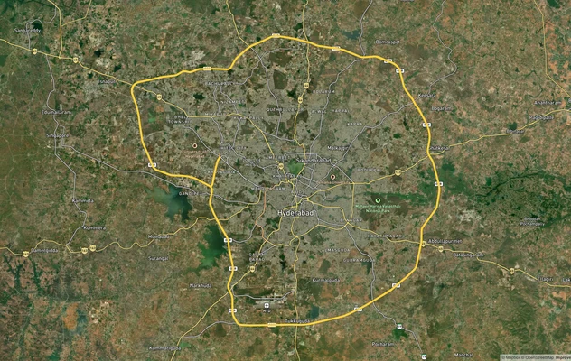
Old City, Golconda Corridor and Where Serious Investors Are Actually Looking
The Old City corridor around Charminar and Golconda, while rich in footfall and cultural value, is heavily encumbered by ASI zones and the HMDA Special Reservation Zone for heritage buildings. This makes it a complicated place for new construction-led investment. Buyers who want proximity to Hyderabad heritage sites without the construction risk are concentrating in three corridors instead.
The table below maps where heritage proximity creates value without the prohibited-zone problem:
Corridor
Proximity to Heritage
Land Opportunity
Key Risk
Shaikpet-Mehdipatnam
500m-1km from Golconda Fort outer wall
Residential conversion
Check HMDA heritage precinct boundaries
Rethibowli-Masab Tank
1-2 km from Golconda
IT-adjacent residential
FTL zones near Hussain Sagar
Banjara Hills-Jubilee Hills fringe
2-3 km from heritage corridor
Premium residential
High land cost
Uppal-LB Nagar
Away from heritage zones, near ORR
Growth corridor with no heritage restriction
Infrastructure lag
The most misunderstood corridor is Shaikpet. Because Toli Masjid sits there as an ASI-protected monument, buyers assume the entire neighbourhood is restricted. In practice, the prohibited zone covers only a tight 100-metre radius around the mosque itself. Plots 200 metres from the Toli Masjid boundary face no ASI construction bar, but every buyer should cross-check the survey number against both the ASI boundary map and the 1acre heritage sites layer before signing anything.
Buyers seeking proximity to Hyderabad's heritage corridors typically focus on land 500 metres or more outside the regulated boundary, where AMASR construction restrictions do not apply. The Aga Khan Trust's Qutb Shahi Heritage Park restoration and the Telangana Government's Sardar Mahal redevelopment near Charminar are active heritage-tourism projects. Ibrahim Bagh and Nampally sit just outside the restriction zones — verify each survey number against ASI prohibited and regulated boundaries plus the GHHC precinct list before any transaction.
Was this layer helpful?
Anything wrong, outdated, or missing we want to hear it.
For Land Owners & Agents
Looking to sell your land in Telangana?
I want to sell my land in Hyderabad HMDA
10:32
Plz share your Land's location - We will list it on 1acre map, for Free.
10:32

For Land Buyers
Browse all verified lands & plots in Telangana
Every listing goes through our Preliminary Verification Process.
More Layers in Telangana
See all 21 layers
Hyderabad HMDA Masterplan: Zone Check and Land Use Guide
View Hyderabad Masterplan as a live map overlay – check any plot's land use zone for free on 1acre.in. Hyderabad masterp...
Hyderabad Outer Ring Road (ORR)
View the Hyderabad ORR Growth Corridor on a live map overlay - check HMDA layout approval, zone status and acquisition r...
Hyderabad Regional Ring Road (RRR): Route Map and Land Impact
View RRR alignment as a live map overlay – check land acquisition risk and plot proximity free on 1acre.in. Hyderabad Re...
More Layers in Telangana
Hyderabad HMDA Masterplan: Zone Check and Land Use Guide
View Hyderabad Masterplan as a live map overlay – check any plot's land use zone for free on 1acre.in. Hyderabad masterp...
Hyderabad Outer Ring Road (ORR)
View the Hyderabad ORR Growth Corridor on a live map overlay - check HMDA layout approval, zone status and acquisition r...
Hyderabad Regional Ring Road (RRR): Route Map and Land Impact
View RRR alignment as a live map overlay – check land acquisition risk and plot proximity free on 1acre.in. Hyderabad Re...