
Vijayawada Highway - Hyd-Vijayawada, NH-65
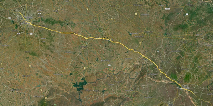

Vijayawada Highway Hyd Vijayawada Nh 65 Preview
Try the Vijayawada Highway - Hyd-Vijayawada, NH-65 on the map
Sign in once and explore the layer for a full day.
- No card details needed
- Find nearby verified lands for sale
Overview
NH-65, what most buyers and brokers simply call the Vijayawada Highway, runs east from LB Nagar through Hayathnagar, Ghatkesar, and Abdullapurmet before reaching Choutuppal and continuing toward Vijayawada. For land buyers, everything along this road falls under the HMDA Master Plan 2031 following G.O. Ms. No. 68 dated March 12, 2025, which formally extended the Hyderabad Metropolitan Region boundary all the way to the Regional Ring Road, pulling 1,355 revenue villages across 104 mandals in eleven districts, totalling 10,472 sq km, into HMDA jurisdiction. Three hard facts about this corridor must be understood before any purchase. First, HMDA has conducted active demolition drives on this highway, including at Pedda Amberpet in Abdullapurmet Mandal and at Choutuppal Municipality in early 2025. Second, all Grampanchayat-located layout permissions now route exclusively through TG-bPASS at tgbpass.telangana.gov.in, not the old DPMS portal. Third, the RRR interchange with NH-65 near Bangarigadda, Choutuppal is a confirmed NHAI node under Bharatmala Pariyojana Phase-I, with construction bids called in February 2025. This page covers what to verify, which corridor segments carry real value, and what each regulatory document actually confirms.
Regulatory Red Flags: The TG-bPASS Shift, Illegal Layout Pattern, and ORR Growth Corridor Rules
The fraud pattern running most persistently on the Vijayawada highway works like this. A developer secures HMDA layout sanction for a portion of land, then sells plots across a far larger unapproved area using the same approval number. Buyers get a number that looks real. HMDA enforcement arrives later. This is documented, not theoretical. Officials demolished five illegal constructions in Pedda Amberpet village, Abdullapurmet Mandal, after confirming the land was HMDA-acquired territory reserved for ORR project-affected persons. A separate January 2025 drive cleared three unauthorised structures in Choutuppal Municipality and three more in Ibrahimpatnam Municipality.
From April 24, 2024, HMDA issued a binding notification: all layout permissions, building permissions, and occupancy certificates for Grampanchayat-limits properties under HMDA jurisdiction must be processed exclusively through TG-bPASS. Applications filed through the old DPMS portal after that date carry no validity. The outer Vijayawada highway belt, from Abdullapurmet through Choutuppal, sits heavily in Grampanchayat-governed villages. Any layout approval document from this stretch must be cross-checked through TG-bPASS, not assumed valid because it carries an HMDA letterhead.
A second regulatory layer applies within 1 km of either side of the 162 km Outer Ring Road. G.O. Ms. No. 470 dated July 9, 2008 designates this as the ORR Growth Corridor, where Special Development Zone rules govern all layout approvals, and no property may open directly onto the ORR or radial roads. Any Grampanchayat-approved layout inside this 1 km belt that was not reviewed by HMDA has no legal standing, regardless of when it was issued.
The mandatory document checklist before any payment on a Vijayawada highway plot:
Document
What to Confirm
Where to Verify
HMDA Layout Approval Number
Sanctioned area matches plot size; approval is active
masterplan.hmda.gov.in
TG-bPASS Project Status
For Grampanchayat parcels: application filed post-April 2024 goes here only
tgbpass.telangana.gov.in
Dharani Pattadar Passbook
Seller name matches registered pattadar; land classification confirmed
dharani.telangana.gov.in
TS RERA Registration
Project listed with active developer registration
rera.telangana.gov.in
Encumbrance Certificate
Zero prior mortgage, charge, or litigation on survey number
Sub-Registrar office, 13-year search
Document
What to Confirm
Where to Verify
HMDA Layout Approval Number
Sanctioned area matches plot size; approval is active
masterplan.hmda.gov.in
TG-bPASS Project Status
For Grampanchayat parcels: application filed post-April 2024 goes here only
tgbpass.telangana.gov.in
Dharani Pattadar Passbook
Seller name matches registered pattadar; land classification confirmed
dharani.telangana.gov.in
TS RERA Registration
Project listed with active developer registration
rera.telangana.gov.in
Encumbrance Certificate
Zero prior mortgage, charge, or litigation on survey number
Sub-Registrar office, 13-year search
One additional risk applies specifically near Choutuppal. Farmers along the proposed RRR alignment near Choutuppal protested at HMDA offices, claiming market rates of Rs 5-10 crore per acre against government acquisition offers of Rs 15-20 lakh. That protest record confirms a concrete buyer risk: parcels inside the formal RRR acquisition corridor near Bangarigadda may face compulsory acquisition. Before buying in this belt, pull the specific survey number against NHAI's Package acquisition maps at the tehsil office.
Growth Corridors on Vijayawada Highway: What Has Delivered and What the Next Window Looks Like
The Vijayawada highway is not one uniform investment corridor. It splits into three distinct segments with different concretisation levels, infrastructure timelines, and risk profiles. Treating them as a single market is where buyers overpay or underestimate risk.
Segment
HMDA Plan Status
Primary Growth Driver
Specific Risk
LB Nagar to Ghatkesar (inner belt)
Fully within HMDA Master Plan 2031; urban residential zone
Established connectivity; metro proximity; high organic demand
Almost fully concretised; raw plot supply thin; buyers paying urban prices with limited appreciation runway
Ghatkesar to Abdullapurmet (mid-belt)
HMDA Master Plan 2031; ORR Growth Corridor SDZ rules apply within 1 km of ORR
ORR Exit 11 interchange operational; HMDA 40-acre Truck Dock Logistics Park at Batasingaram; Ghatkesar ITIR designation
ORR Growth Corridor setback rules apply; Grampanchayat layouts inside 1 km belt lack legal standing unless HMDA-reviewed; verify SDZ compliance
Abdullapurmet to Choutuppal (outer belt)
G.O. 68 March 2025 pulled these villages into HMDA jurisdiction; Grampanchayat-issued approvals now require TG-bPASS validation
NH-65 eight-lane expansion to Choutuppal at Rs 545 crore; TSIIC Green Industrial Park at Dandumailaram, 354 acres; Ramoji Film City adjacency; RRR interchange near Bangarigadda
Highest demolition activity on this corridor; TG-bPASS transition creates approval validity gap; RRR acquisition corridor risk near Bangarigadda
Segment
HMDA Plan Status
Primary Growth Driver
Specific Risk
LB Nagar to Ghatkesar (inner belt)
Fully within HMDA Master Plan 2031; urban residential zone
Established connectivity; metro proximity; high organic demand
Almost fully concretised; raw plot supply thin; buyers paying urban prices with limited appreciation runway
Ghatkesar to Abdullapurmet (mid-belt)
HMDA Master Plan 2031; ORR Growth Corridor SDZ rules apply within 1 km of ORR
ORR Exit 11 interchange operational; HMDA 40-acre Truck Dock Logistics Park at Batasingaram; Ghatkesar ITIR designation
ORR Growth Corridor setback rules apply; Grampanchayat layouts inside 1 km belt lack legal standing unless HMDA-reviewed; verify SDZ compliance
Abdullapurmet to Choutuppal (outer belt)
G.O. 68 March 2025 pulled these villages into HMDA jurisdiction; Grampanchayat-issued approvals now require TG-bPASS validation
NH-65 eight-lane expansion to Choutuppal at Rs 545 crore; TSIIC Green Industrial Park at Dandumailaram, 354 acres; Ramoji Film City adjacency; RRR interchange near Bangarigadda
Highest demolition activity on this corridor; TG-bPASS transition creates approval validity gap; RRR acquisition corridor risk near Bangarigadda
The outer belt from Abdullapurmet to Choutuppal is where the most active plotted land market runs in 2025 and where the infrastructure stack is densest. Four triggers are confirmed, not proposed.
NH-65 is being expanded from four to eight lanes from LB Nagar up to Choutuppal at a cost of Rs 545 crore. The work is in execution, with 24 flyovers planned across this stretch. Highway-widening at this scale directly increases land values within the adjacent 2-3 km belt by improving commute times and enabling larger logistics, commercial, and residential projects.
The TSIIC Green Industrial Park at Dandumailaram village, Choutuppal Mandal, covers 354 acres and hosts exclusively green-category industry. Multiple companies are building operational units at this site. Industrial parks of this scale typically generate measurable residential demand within 10-15 km within three to five years, which is the belt where most HMDA-approved plotted projects are launching.
Ramoji Film City, the world's largest film studio complex by area, sits adjacent to this segment. Projects marketed within 3 km of Ramoji Film City use this as a verifiable proximity data point, not a speculative amenity.
The RRR interchange with NH-65 near Bangarigadda, Choutuppal is a confirmed node on NHAI's sanctioned 340 km Regional Ring Road. NHAI invited construction bids for the northern arc with a February 14, 2025 submission deadline, moving the project from planning into active tendering. The Telangana government has allocated Rs 1,525 crore in its 2025 budget for RRR land acquisition costs, with both the northern and southern sections under active land acquisition as of mid-2025.
The HMDA Truck Dock Logistics Park at Batasingaram, covering 40 acres, was formally inaugurated and operates in the mid-belt, creating freight-driven employment that translates into residential demand in the Ghatkesar-Abdullapurmet zone.
Was this layer helpful?
Anything wrong, outdated, or missing we want to hear it.

Access Survey NumbersAccess Telangana
Survey Numbers
Boundaries and numbers come from published state cadastral records. See all map layers.
Looking to sell your land in Telangana?

Browse all verified lands & plots in Telangana
More Layers in Telangana
See all 25 layers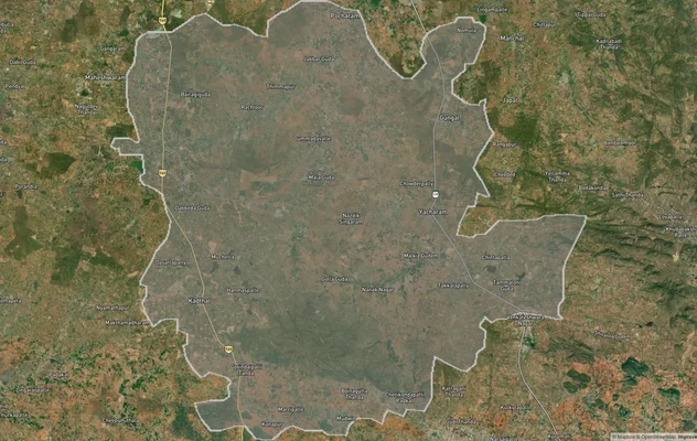
FCDA Masterplan — Bharat Future City Zone, Hyderabad
View FCDA Bharat Future City zone as a live map overlay — check future city development zones for free on 1acre.in. FCDA...
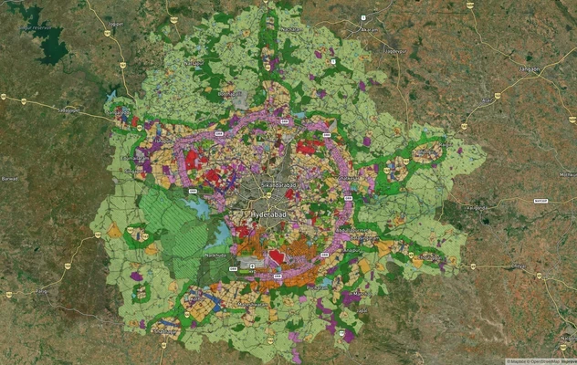
Hyderabad HMDA Masterplan: Zone Check and Land Use Guide
View Hyderabad Masterplan as a live map overlay – check any plot's land use zone for free on 1acre.in. Hyderabad masterp...
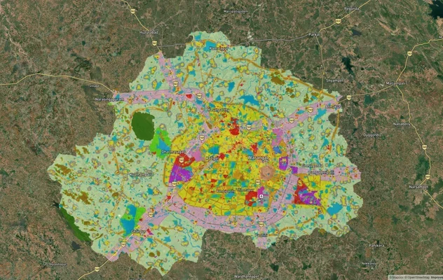
Warangal Masterplan: WUDA Zone Check and Land Use Guide
View Warangal Masterplan as a live map overlay – check any plot's land use zone for free on 1acre.in. Warangal KUDA mast...
More Layers in Telangana
FCDA Masterplan — Bharat Future City Zone, Hyderabad
View FCDA Bharat Future City zone as a live map overlay — check future city development zones for free on 1acre.in. FCDA...
Hyderabad HMDA Masterplan: Zone Check and Land Use Guide
View Hyderabad Masterplan as a live map overlay – check any plot's land use zone for free on 1acre.in. Hyderabad masterp...
Warangal Masterplan: WUDA Zone Check and Land Use Guide
View Warangal Masterplan as a live map overlay – check any plot's land use zone for free on 1acre.in. Warangal KUDA mast...