
Warangal Highway - NH-163: Hyderabad to Warangal Route Map and Land Guide


Warangal Highway Nh 163 Preview
Try the Warangal Highway - NH-163 on the map
Sign in once and explore the layer for a full day.
- No card details needed
- Find nearby verified lands for sale
Overview
The Warangal Highway is National Highway 163 (NH-163), the main road between Hyderabad and Warangal. Warangal Highway land buying decisions sit on top of two planning regimes. The NH-163 Hyderabad Warangal corridor runs roughly 145 km from Uppal through Ghatkesar, Bhongir, Jangaon and Kazipet to Hanamkonda and Warangal, and the highway continues east beyond Warangal through Mulugu district. Up to the HMDA outer limit, the Hyderabad Metropolitan Development Authority governs layouts under the HMDA Master Plan 2031. Beyond it, the Kakatiya Urban Development Authority (KUDA), Jangaon Municipality and surrounding Gram Panchayats handle approvals. The state-wide Layout Regularisation Scheme under G.O. Ms. No. 131 covers unapproved plots. This page covers the NH-163 route map and towns on the route, the current status of projects along the road, the zone rules, the document checks that matter, and the corridors where appreciation is real versus speculative.
NH-163 route map: start, end and towns on the route
For Hyderabad to Warangal, NH-163 starts at Uppal on the eastern edge of Hyderabad and runs north-east for roughly 145 km to Warangal. The highway does not end there. The Ministry of Road Transport and Highways describes the road east of the city as the Hyderabad to Bhupalapatnam section of NH-163, and its June 2026 land acquisition notification covers a stretch at km 198.7 near Venkatapur in Mulugu district. West of Hyderabad, the four-laning of NH-163 from the Telangana Police Academy to Manneguda was awarded in March 2022 but held up by National Green Tribunal proceedings; in November 2025 parts of the road in Ranga Reddy district were still single-lane.
Town or junction
Layout approval authority
What to note
Uppal
HMDA / GHMC
Hyderabad start; Uppal to Narapally elevated corridor under construction
Pocharam
HMDA
IT SEZ with the Infosys campus
Ghatkesar
HMDA
NFC Nagar and Aushapur catchment
Bibinagar
HMDA
AIIMS Bibinagar
Bhongir (Bhuvanagiri)
HMDA outer / Bhongir Municipality
HMDA outer limit cuts through this stretch
Jangaon
DTCP / Jangaon Municipality
Mid-point of the Hyderabad to Warangal road
Kazipet, Hanamkonda
KUDA
Twin city to Warangal
Warangal
KUDA / GWMC
End of the Hyderabad to Warangal run
Mulugu district
Outside this page's scope
NH-163 continues towards Bhupalapatnam
Town or junction
Layout approval authority
What to note
Uppal
HMDA / GHMC
Hyderabad start; Uppal to Narapally elevated corridor under construction
Pocharam
HMDA
IT SEZ with the Infosys campus
Ghatkesar
HMDA
NFC Nagar and Aushapur catchment
Bibinagar
HMDA
AIIMS Bibinagar
Bhongir (Bhuvanagiri)
HMDA outer / Bhongir Municipality
HMDA outer limit cuts through this stretch
Jangaon
DTCP / Jangaon Municipality
Mid-point of the Hyderabad to Warangal road
Kazipet, Hanamkonda
KUDA
Twin city to Warangal
Warangal
KUDA / GWMC
End of the Hyderabad to Warangal run
Mulugu district
Outside this page's scope
NH-163 continues towards Bhupalapatnam
Overlay your plot on the alignment in the 1acre map layer, then confirm any widening line with NHAI before paying. For an official record, the land acquisition notifications for NH-163 in the Gazette of India list the affected survey numbers village by village.
NH-163 corridor projects: status as of October 2026
Price a plot on projects that are under way, not on announcements. This table gives the latest verifiable update for each project buyers cite along NH-163.
Project
Latest update
Date of update
Uppal to Narapally elevated corridor (NH-163)
Under construction since 2018 at an estimated Rs 425 crore; the Roads and Buildings Minister told the Legislative Council it will be completed by June 2027
September 2026
Infosys, Pocharam campus
Rs 750 crore first-phase expansion announced, expected to add 17,000 jobs, with phase one due in two to three years
January 2025
AIIMS Bibinagar
Functioning institute; admission notices for the MBBS 2024 and 2025 batches
2025
Regional Ring Road, northern part (NH-161AA)
161 km six-lane Sangareddy to Choutuppal stretch, from Girmapur in Sangareddy district to Thangadapalli in Yadadri Bhuvanagiri district; NHAI extended the bid deadline to 23 September 2026 and Cabinet Committee approval was reportedly pending
August 2026
Hyderabad Metro Phase II
162.5 km proposal submitted to the Centre with no approval timeline; none of the five named Phase II-A corridors runs along NH-163
April 2026
Project
Latest update
Date of update
Uppal to Narapally elevated corridor (NH-163)
Under construction since 2018 at an estimated Rs 425 crore; the Roads and Buildings Minister told the Legislative Council it will be completed by June 2027
September 2026
Infosys, Pocharam campus
Rs 750 crore first-phase expansion announced, expected to add 17,000 jobs, with phase one due in two to three years
January 2025
AIIMS Bibinagar
Functioning institute; admission notices for the MBBS 2024 and 2025 batches
2025
Regional Ring Road, northern part (NH-161AA)
161 km six-lane Sangareddy to Choutuppal stretch, from Girmapur in Sangareddy district to Thangadapalli in Yadadri Bhuvanagiri district; NHAI extended the bid deadline to 23 September 2026 and Cabinet Committee approval was reportedly pending
August 2026
Hyderabad Metro Phase II
162.5 km proposal submitted to the Centre with no approval timeline; none of the five named Phase II-A corridors runs along NH-163
April 2026
Two points follow for buyers. First, a metro line along the Warangal Highway is not part of any approved plan, so treat brochures that promise metro access near Ghatkesar or Bhongir as speculative. Second, the Regional Ring Road had not been awarded at the last update, so plots priced on an RRR interchange carry timing risk; ask for the 3A notification that shows the plot's survey number before paying an interchange premium.
Regulatory Red Flags Specific to NH-163 Land Buyers
Three failures sink most plot deals along this corridor. The first is the HMDA approved layout plot versus revenue layout confusion. A genuine HMDA-approved layout carries a Final Layout Approval (LP) number, a Khasra-mapped sanction, road and open-space provisions, and is fully fit for plot registration, building plan submission and home-loan eligibility. The Telangana government has banned registration of unapproved properties and illegal layouts. A layout without an HMDA LP number, marketed as "approval applied" or "approval expected," is functionally an unapproved layout. Brokers along Ghatkesar, Pocharam, Bibinagar and Bhongir use phrases like "HMDA approved" loosely. Demand the LP number on the official approved layout document and verify it on the HMDA portal before any token.
The second trap is the LRS BRS regularisation Telangana route. The Layout Regularisation Scheme (LRS), notified through G.O. Ms. No. 131 in 2020, allows individual plot owners in unapproved layouts to regularise their plots by paying conversion charges scaled to the sub-registrar value. Charges range from 20 percent of plot value (for SRO values below Rs 3,000 per sq yard) to 100 percent (above Rs 50,000 per sq yard). If 10 percent open space is not available in the unapproved layout, pro-rata open space charges at 14 percent of the plot value apply. The Telangana government issued fresh guidelines in 2024 to clear pending LRS applications within three months through special district teams. LRS regularises individual plots but does not change the unapproved character of the layout itself. The Building Regularisation Scheme (BRS) handles unapproved construction separately. Buyers must treat an "LRS-eligible" plot as a regularisation-pending plot, not a sanctioned plot.
The third trap is the FTL (Full Tank Level) buffer rule. No layout or development is allowed in any water body or in its FTL. Buffer rules require 30 metres clearance from river or lake boundaries of 10 hectares and above, 9 metres from lakes, kuntas and shikam lands below 10 hectares, 9 metres from canals and 2 metres from defined nala or stormwater drains. The Warangal Highway crosses multiple kunta and lake catchments around Aushapur, Pocharam, Bibinagar and Bhongir. Plots in violation of FTL buffer rules cannot be regularised, and demolition risk is real.
Use this screen before you transfer any earnest money on a plot in this belt.
Plot Type
Authority
Approval Required
Title Risk
HMDA-approved layout
HMDA
Final LP number, master plan zoning
Low, Pricing
KUDA approved layout (beyond HMDA)
KUDA / DTCP
Layout sanction, Section 113
Medium, lower liquidity
Gram Panchayat layout
Panchayat
Tax receipts only
High, panchayat cannot approve layouts
Unapproved layout, LRS-eligible
HMDA / Municipality
LRS regularisation pending
Medium, charges apply
FTL buffer or water-body plot
Irrigation / HMDA
Not permitted
High, demolition risk
Assigned land / Government land
Revenue Department
Restricted
Government resumption
HMDA Master Plan 2031 Conservation zone
HMDA
No layout permitted
Layout illegal
Plot Type
Authority
Approval Required
Title Risk
HMDA-approved layout
HMDA
Final LP number, master plan zoning
Low, Pricing
KUDA approved layout (beyond HMDA)
KUDA / DTCP
Layout sanction, Section 113
Medium, lower liquidity
Gram Panchayat layout
Panchayat
Tax receipts only
High, panchayat cannot approve layouts
Unapproved layout, LRS-eligible
HMDA / Municipality
LRS regularisation pending
Medium, charges apply
FTL buffer or water-body plot
Irrigation / HMDA
Not permitted
High, demolition risk
Assigned land / Government land
Revenue Department
Restricted
Government resumption
HMDA Master Plan 2031 Conservation zone
HMDA
No layout permitted
Layout illegal
The minimum legal stack on this corridor is an HMDA Final LP number, a registered sale deed, a 30-year Encumbrance Certificate, the Pahani/RoR from Dharani or the new Bhu Bharati portal, and Telangana RERA registration where the plot is part of a plotted development. Anything less is a leap of faith.
Growth Corridors and Micro-Markets on the NH-163 Belt
Not every kilometre of the Warangal Highway carries the same upside. The investable belts share three traits: location inside HMDA jurisdiction with a Final LP-approved layout, proximity to a confirmed anchor (Pocharam IT SEZ, Infosys campus at Pocharam, NFC Nagar, AIIMS Bibinagar, or a Regional Ring Road exit), and minimum 30-foot internal road width inside the layout. Speculative pockets sit on gram panchayat plottings without HMDA sanction. High-risk pockets sit in FTL buffer zones or on assigned land.
The table below maps the major Ghatkesar Pocharam Bibinagar belt and the Bhongir Jangaon Kazipet stretch to their drivers and risks.
Corridor / Locality
Authority
Growth Driver
Known Risk
Uppal
HMDA / GHMC
Metro Phase II terminus, urban density; Uppal to Narapally elevated corridor due June 2027 (September 2026)
Pricing in
Pocharam
HMDA
IT SEZ with Infosys, Genpact, TCS
Highest demand, sanction critical
Ghatkesar
HMDA
NFC Nagar, Aushapur, Infosys catchment
Mixed HMDA-Panchayat plottings
Bibinagar
HMDA
AIIMS Bibinagar (functioning, MBBS batches admitted 2024 and 2025), NIMS, MMTS
LRS-eligible plottings common
Bhongir
HMDA outer / Bhongir Municipality
District HQ, Bhongir Fort tourism
KUDA-style approval boundary
Pragnapur Road, Bhongir
HMDA outer
150-feet road frontage layouts
Verify HMDA outer limit
Yadadri Bhuvanagiri
DTCP
Temple town, religious tourism
Outside HMDA limit, DTCP plots only
Jangaon
DTCP / Jangaon Municipality
Affordable district town, NH-163 mid-point
KUDA absent here, DTCP rules apply
Kazipet, Hanamkonda
KUDA
Twin city to Warangal, education
KUDA layout sanction mandatory
Warangal
KUDA / GWMC
District headquarters, Smart City pilot
Prices, limited fresh supply
Regional Ring Road junctions
HMDA / RRR Authority
RRR-NH 163 interchange catchments
Acquisition footprint considerations; northern RRR not awarded as of August 2026 (bid deadline 23 September 2026)
Corridor / Locality
Authority
Growth Driver
Known Risk
Uppal
HMDA / GHMC
Metro Phase II terminus, urban density; Uppal to Narapally elevated corridor due June 2027 (September 2026)
Pricing in
Pocharam
HMDA
IT SEZ with Infosys, Genpact, TCS
Highest demand, sanction critical
Ghatkesar
HMDA
NFC Nagar, Aushapur, Infosys catchment
Mixed HMDA-Panchayat plottings
Bibinagar
HMDA
AIIMS Bibinagar (functioning, MBBS batches admitted 2024 and 2025), NIMS, MMTS
LRS-eligible plottings common
Bhongir
HMDA outer / Bhongir Municipality
District HQ, Bhongir Fort tourism
KUDA-style approval boundary
Pragnapur Road, Bhongir
HMDA outer
150-feet road frontage layouts
Verify HMDA outer limit
Yadadri Bhuvanagiri
DTCP
Temple town, religious tourism
Outside HMDA limit, DTCP plots only
Jangaon
DTCP / Jangaon Municipality
Affordable district town, NH-163 mid-point
KUDA absent here, DTCP rules apply
Kazipet, Hanamkonda
KUDA
Twin city to Warangal, education
KUDA layout sanction mandatory
Warangal
KUDA / GWMC
District headquarters, Smart City pilot
Prices, limited fresh supply
Regional Ring Road junctions
HMDA / RRR Authority
RRR-NH 163 interchange catchments
Acquisition footprint considerations; northern RRR not awarded as of August 2026 (bid deadline 23 September 2026)
The most misunderstood corridor on this belt is the Ghatkesar to Bhongir stretch. Buyers see the Pocharam IT SEZ Infosys catchment, talk of a metro extension from Uppal to Bhuvanagiri (no such line is among the named Phase II-A corridors, and Phase II still awaited central approval in April 2026), the upgrade of Bhongir and Ghatkesar railway stations, and assume that "Warangal Highway plot" is shorthand for HMDA-approved investment. They miss that the HMDA outer boundary cuts through this stretch, that some marketed layouts beyond the boundary fall under Gram Panchayat tax receipts only, and that the Telangana ban on registration of unapproved properties has tightened enforcement. Demand the HMDA LP number specifically, not generic "approval." The second misunderstood corridor is the Bhongir-Jangaon stretch. The Regional Ring Road Yadadri connectivity will lift values, but most plots between Bhongir and Jangaon currently fall outside HMDA and follow DTCP rules, with thinner urban depth and longer appreciation cycles.
Warangal ring road map and the Warangal masterplan layer
Many searches for a Warangal route map are really about the Warangal ring roads, which are separate from NH-163. In June 2024 the Chief Minister asked officials to prepare a Master Plan 2050 for Warangal and to complete land acquisition for the city's inner and outer ring roads. The outer ring road is planned to connect the national highways around the city, with a link road to the Kakatiya Textile Park. No length or completion date was given.
For a plot near Kazipet, Hanamkonda or Warangal, check three things before paying:
- Whether the plot sits on or next to a ring road alignment in the KUDA master plan
- The KUDA layout sanction number, since KUDA approval is mandatory in this belt
- Whether any land acquisition notice names the survey number
Use the Warangal masterplan layer to see planned zones around the city, and treat ring road frontage as a future benefit until acquisition and construction start.
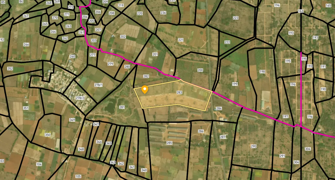
Access Survey NumbersAccess Telangana
Survey Numbers
Boundaries and numbers come from published state cadastral records. See all map layers.
Looking to sell your land in Telangana?

Browse all verified lands & plots in Telangana
More Layers in Telangana
See all 26 layers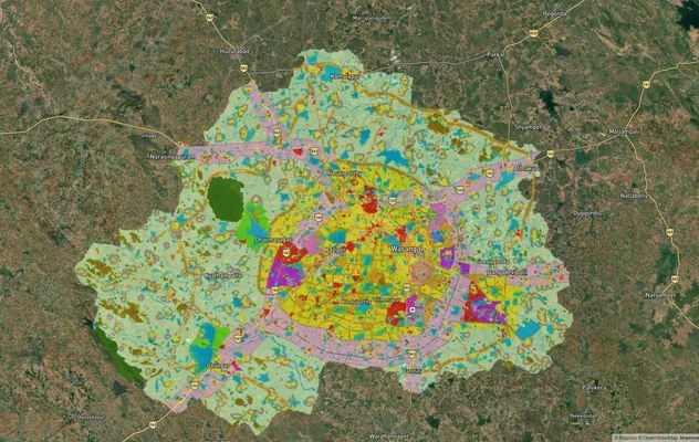
Warangal Masterplan: WUDA Zone Check and Land Use Guide
View Warangal Masterplan as a live map overlay – check any plot's land use zone for free on 1acre.in. Warangal KUDA mast...

Warangal - Khammam Expressway
View Warangal - Khammam Expressway alignment as a live map overlay – check land acquisition risk and plot proximity free...
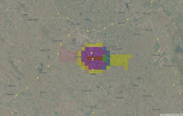
Warangal Air Funnel Zones: Building Height Restrictions
View Warangal Air Funnel Zones on a live map – check height clearance restrictions on any plot for free on 1acre.in. War...
More Layers in Telangana
Warangal Masterplan: WUDA Zone Check and Land Use Guide
View Warangal Masterplan as a live map overlay – check any plot's land use zone for free on 1acre.in. Warangal KUDA mast...
Warangal - Khammam Expressway
View Warangal - Khammam Expressway alignment as a live map overlay – check land acquisition risk and plot proximity free...
Warangal Air Funnel Zones: Building Height Restrictions
View Warangal Air Funnel Zones on a live map – check height clearance restrictions on any plot for free on 1acre.in. War...
Frequently Asked Questions
Yes. An HMDA approved layout plot carries a Final LP number, Master Plan zoning compliance, road and open-space provisions, and full eligibility for registration, building plan and home loans. Panchayat layouts only have tax receipts. The Telangana government has banned registration of unapproved properties statewide.
HMDA covers Hyderabad Metropolitan Region including Ghatkesar, Pocharam, Bibinagar and the outer edge near Bhongir. KUDA (Kakatiya Urban Development Authority) handles Hanamkonda, Warangal and Kazipet. DTCP governs municipalities like Jangaon between the two. Approval competency differs at each authority's boundary on the corridor.
Yes, but with conditions. The Layout Regularisation Scheme under G.O. Ms. No. 131 (2020) regularises individual plots with conversion charges from 20 percent to 100 percent of sub-registrar value, plus 14 percent for open-space shortfall. Plots in FTL buffer zones or water bodies cannot be regularised at all.
Dharani is the Telangana digital land records portal. The Bhu Bharati Bill 2024 introduces a new framework replacing parts of Dharani. Verification involves checking the Pahani, the survey number, the recorded owner, and any encumbrance. Mismatch between brochure and Dharani record is the most common early warning.
Pocharam, Aushapur, Ankushapur, Rampalli and Kondapur (the Ghatkesar Kondapur, not the IT Kondapur in west Hyderabad) sit closest to the Infosys, TCS, Genpact and NFC Nagar belt. Demand from IT employees within a 10 to 15 minute drive supports the strongest pricing along the Ghatkesar Pocharam Bibinagar belt.
Yes. The Telangana government has banned registration of unapproved properties and illegal layouts. Sub-registrars are directed not to execute sale deeds in identified unapproved layouts. LRS regularisation is the only legal pathway for owners of pre-existing unapproved plots, but new sales in unapproved layouts are restricted.
No layout development is permitted within the Full Tank Level of a water body. Buffer requirements: 30 metres from river/lake boundaries of 10 hectares and above, 9 metres from smaller lakes, kuntas and shikam lands, 9 metres from canals, 2 metres from nala or stormwater drain boundaries. Violations cannot be regularised.
The Regional Ring Road interchange points near Yadadri, Bhongir and Jangaon lift logistics value and pull peripheral plot demand. The expressway is fenced with 33 radial roads connecting the Inner Ring Road and the upcoming Regional Ring Road. Plot values rise within the catchment of confirmed interchanges, not across the entire corridor.
The Hyderabad to Warangal highway is National Highway 163 (NH-163). It leaves Hyderabad at Uppal and runs roughly 145 km through Ghatkesar, Bibinagar, Bhongir, Jangaon, Kazipet and Hanamkonda to Warangal. Beyond Warangal the same highway continues through Mulugu district on what MoRTH calls the Hyderabad to Bhupalapatnam section.
For most buyers the relevant run is Uppal in Hyderabad to Warangal. The highway itself is longer: west of Hyderabad it runs from the Telangana Police Academy towards Manneguda, where four-laning was delayed by green tribunal proceedings, and east of Warangal it continues through Mulugu district on the Hyderabad to Bhupalapatnam section. Check the alignment near your plot on the map layer.
The official records are the land acquisition notifications for NH-163 published in the Gazette of India, which name the section, the chainage and the affected survey numbers village by village. Search the gazette for NH-163 and the village name. Use the map layer on this page to see where the alignment runs relative to your plot.
In September 2026 Telangana's Roads and Buildings Minister told the Legislative Council that the Uppal to Narapally elevated corridor on NH-163, under construction since 2018 at an estimated Rs 425 crore, will be completed by June 2027. Until it opens, expect traffic delays at the Hyderabad end of the Warangal Highway.
Source
Official Hyderabad Metropolitan Development Authority (HMDA) documents
Official Website
www.hmda.gov.in
Coordinate Reference System
EPSG:4326 (WGS 84)
Geometry Type
LineString / MultiLineString
Data Format
Vector (GeoJSON) + Raster Tiles
Last Verified
2026
Status
Active
Was this layer helpful?
Anything wrong, outdated, or missing we want to hear it.