Hyderabad Regional Ring Road (RRR): Route Map and Land Impact
Rrr Preview
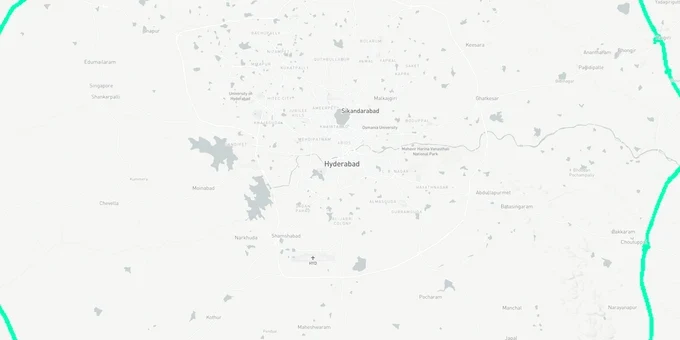
Try the Hyderabad Regional Ring Road (RRR) on the map
Sign in once and explore the layer for a full day.
- No card details needed
- Find nearby verified lands for sale
Overview
Hyderabad Regional Ring Road land investment is being shaped by a 340 km access-controlled expressway (originally approved as four-lane under Bharatmala; six-lane upgrade proposed by Telangana government — Centre’s approval for revised cost of ₹15,627 crore pending as of April 2026) encircling Hyderabad at 30 to 50 km beyond the existing Outer Ring Road. Executed by the National Highways Authority of India (NHAI) under Bharatmala Pariyojana Phase-I, the RRR spans eight districts, 33 mandals, and 163 revenue village panchayats across Ranga Reddy, Vikarabad, Nalgonda, Sangareddy, Siddipet, Medak, Yadadri Bhuvanagiri, and Mahabubnagar. The two halves of this project are at completely different stages of execution, and that gap changes the risk profile of every plot near each corridor. This page covers the acquisition traps buyers are missing, which corridor has delivery certainty, and how to verify any survey number before committing funds.
Section 22-A, Bhudhaar and the Acquisition Overlap That Is Trapping RRR-Adjacent Buyers
The RRR land market has a specific fraud problem. Telangana replaced the Dharani portal with Bhu Bharati on 14 April 2025 under the Telangana Bhu Bharati (Record of Rights in Land) Act, 2025. The new system links every land record to the owner's Aadhaar through MeeSeva biometric verification and introduced the 14-digit Bhudhaar ID as a permanent land identifier; this has significantly closed the gap for fake mutation attacks. But it has not eliminated the core trap unique to the RRR corridor: sellers who are knowingly or unknowingly transacting land that is already flagged under Section 22-A of the Telangana Land Revenue Act as prohibited, or land whose survey number has been partially entered into the acquisition list by the Collector.
The Bhu Bharati portal documents a specific grievance category for this: pattadars whose entire survey number was mis-entered as acquired when only a portion of it falls inside the RRR reservation. The correction process requires uploading the original acquisition order to the Collector's review queue. Until approved, the entire survey number is blocked for transactions, and any buyer who completed a sale before the flag appeared cannot retrieve their payment through the sub-registrar. HMDA's August 2025 primary notification further complicated the picture: it listed survey numbers across 163 villages for objection, but the final notification was not published before the data powering this layer was collected. Alignment can still shift post-objection review.
The table below shows the four document checks that are non-negotiable for any RRR-adjacent survey number in Telangana.
Document / Check
What It Confirms
Where to Verify
Failure Risk
Bhu Bharati Land Details Search
Current ownership, land classification, Prohibited Status (నిషేధిత స్థితి)
bhubharati.telangana.gov.in > Land Details Search
Entire survey blocked if 22-A flagged; bank loans refused
Section 22-A Prohibited Search
Land not classified as assigned, Wakf, ceiling surplus, or government
bhubharati.telangana.gov.in > Prohibited Land Search
Transactions blocked in system; delisting requires court order + Chief Commissioner of Land Administration (CCLA) clearance
HMDA Annexure-A and Annexure-B PDFs
Survey number not inside 100-metre RRR road reservation
hmda.gov.in > Proposed Alignment section
Acquisition compensation pays original pattadar, not subsequent buyer
Encumbrance Certificate (EC) via IGRS
No pending liens, mortgages, or court stays on the survey number
registration.telangana.gov.in
Undisclosed encumbrance surfaces after registration
If a survey number appears in the HMDA Annexure-A or Annexure-B lists, the land acquisition process is active or imminent for at least a portion of that parcel. The sub-registrar will still register the sale deed; that registration does not transfer the acquisition compensation to you.
Northern Corridor Has Blacktop on the Ground; Southern Arc Still Needs Central Clearance
The gap between these two corridors is not incremental. It is structural. The northern segment, 158 km from Sangareddy through Narsapur, Toopran, Gajwel, Jagdevpur, Bhuvanagiri, Bhongir, and Choutuppal, received environmental clearance on 18 March 2025, had tenders floated on 28 December 2024, and as of mid-2025 had approximately 48 percent of the required 1,785.5 acres acquired with compensation disbursed in Yadadri and Medak districts. Bitumen laying began on a 30 km Medak–Toopran–Bhongir stretch in June 2025. The Telangana CM declared March 2026 as the Phase 1 opening target. That is infrastructure certainty at a visible stage.
The southern segment, 182 km from Choutuppal through Ibrahimpatnam, Kandukur, Amangal, Chevella, Shankarpally, and back to Sangareddy, is a different situation entirely. Cabinet approved one of three proposed alignments on 23 June 2025, selecting the route with 99 percent agricultural land to simplify acquisition and avoid forest land. The DPR consultant (RV Associates) was appointed with a six-month deadline. Only 12 percent of required land had been acquired as of mid-2025. MoRTH's final clearance is still pending, with traffic studies flagging fewer than 6,000 vehicles per hour as a viability concern. Completion is projected for 2027–2028 at best.
The table below maps the six most actively discussed corridors against their actual project status.
Corridor
Phase
Project Status
Key Risk for Buyers
Sangareddy, Narsapur, Toopran
Northern
Preparatory road work and blacktop laid on 30 km service stretch Jun 2025; main NHAI expressway tenders not yet opened pending Centre's cost approval
Confirm survey number outside 100m reservation; interchange locations still being finalized
Gajwel, Bhongir, Choutuppal
Northern
NHAI tenders floated Nov 2024 but not yet opened — Centre yet to clear revised cost of ₹15,627 crore; construction commencement expected FY 2026-27 at earliest
Land near interchanges carries higher acquisition risk; exact exit boundaries not final
Bhuvanagiri, Yadagirigutta (east)
Northern
Construction underway; high religious tourism demand
Verify HMDA/DTCP layout approval; no speculation on interchange exit location yet
Ibrahimpatnam, Kandukur
Southern
Detailed Project Report (DPR) under preparation; 12% land acquired
Multi-year execution risk; agricultural land requires Non-Agricultural Land Assessment (NALA) conversion before any construction
Amangal, Maheshwaram
Southern
Cabinet alignment approved Jun 2025; MoRTH clearance pending
Do not price in completed expressway before 2027-2028; southern premium is speculative
Chevella, Shankarpally
Southern
Alignment finalized; acquisition in early stages
Financially attractive entry but significant execution uncertainty remains
The most common mistake buyers make is treating the northern and southern corridors as one contiguous investment thesis. They are not. Land near Bhongir or Gajwel is priced on a project approaching its first operational milestone. Land near Amangal or Chevella is priced on a project still waiting for its central clearance..
Was this layer helpful?
Anything wrong, outdated, or missing we want to hear it.
For Land Owners & Agents
Looking to sell your land in Telangana?
I want to sell my land in Hyderabad
10:32
Plz share your Land's location - We will list it on 1acre map, for Free.
10:32

For Land Buyers
Browse all verified lands & plots in Telangana
Every listing goes through our Preliminary Verification Process.
More Layers in Telangana
See all 21 layers
FCDA Masterplan — Bharat Future City Zone, Hyderabad
View FCDA Bharat Future City zone as a live map overlay — check future city development zones for free on 1acre.in. FCDA...

Hyderabad HMDA Masterplan: Zone Check and Land Use Guide
View Hyderabad Masterplan as a live map overlay – check any plot's land use zone for free on 1acre.in. Hyderabad masterp...
Warangal Masterplan: WUDA Zone Check and Land Use Guide
View Warangal Masterplan as a live map overlay – check any plot's land use zone for free on 1acre.in. Warangal KUDA mast...
More Layers in Telangana
FCDA Masterplan — Bharat Future City Zone, Hyderabad
View FCDA Bharat Future City zone as a live map overlay — check future city development zones for free on 1acre.in. FCDA...
Hyderabad HMDA Masterplan: Zone Check and Land Use Guide
View Hyderabad Masterplan as a live map overlay – check any plot's land use zone for free on 1acre.in. Hyderabad masterp...
Warangal Masterplan: WUDA Zone Check and Land Use Guide
View Warangal Masterplan as a live map overlay – check any plot's land use zone for free on 1acre.in. Warangal KUDA mast...