
Hyderabad Outer Ring Road - ORR
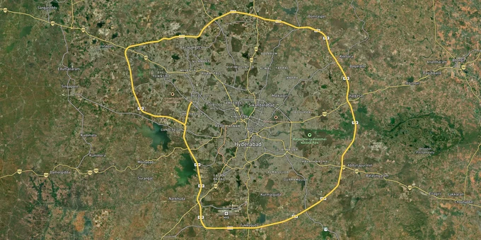

Hyderabad Outer Ring Road Orr Preview
Try the Hyderabad Outer Ring Road - ORR on the map
Sign in once and explore the layer for a full day.
- No card details needed
- Find nearby verified lands for sale
Overview
The Nehru Outer Ring Road is a 158 km, 8-lane access-controlled expressway encircling Hyderabad, fully operational and administered by HMDA through the Hyderabad Growth Corridor Limited (HGCL). It links Rajiv Gandhi International Airport at Shamshabad with the western IT and financial district, the northern pharma-biotech belt, and the south-eastern aerospace and hardware clusters. Its interchange network has expanded beyond the original 19, with new access points added and more proposed. For a land buyer, the ORR is not one market. Whether a plot is buildable, bankable, and resaleable is decided by three things most brokers skip: the Multi-Purpose Use Zone that HMDA applies to the Growth Corridor along the 1 km belt on either side of the road, the gap between a Gram Panchayat layout and an HMDA-sanctioned (LP) layout, and lake Full Tank Level (FTL) and catchment restrictions in the western fringe. This page covers the approval chain that separates a legal plot from a regularisation gamble, and the radial corridors where land value is grounded in real infrastructure rather than proximity alone.
The HMDA Approval Chain and the Gram Panchayat Layout Trap
Most plots sold along the ORR fall into one of two camps: HMDA-approved layouts with a Layout Permission (LP) number, and Gram Panchayat (GP) layouts approved only by the village panchayat. They look identical in a brochure. They are not the same asset. A GP layout without HMDA sanction is not eligible for a bank loan, cannot guarantee released (mortgage-free) plots, and depends on the Layout Regularisation Scheme (LRS) to become legitimate, a process that is still pending for a large backlog of applications.
The other recurring failure is the land record itself. Telangana's land records portal Bhu Bharati (formerly Dharani) shows ownership and extent, but an entry there does not confirm zoning, layout approval, or that the plot sits outside a lake buffer. Government assigned lands, allotted to the landless poor, cannot be legally sold, and several pockets near the ORR carry assigned-land litigation.
The table below shows the document chain that separates a legally transactable plot from one that fails at financing or registration.
Document
What It Confirms
What It Does Not Confirm
HMDA Layout Permission (LP) number
Layout sanctioned by HMDA; mortgage plots released to buyers
That a specific plot is free of litigation or assigned-land status
Bhu Bharati (Dharani) passbook
Ownership and extent in the state land record
Zoning, layout sanction, or buildability
NALA conversion order
Agricultural land converted to non-agricultural use
HMDA layout sanction or building permission
LRS proceedings (for a GP plot)
An application to regularise an unapproved layout
A completed, guaranteed regularisation
FTL and buffer certificate (lakes)
Plot lies outside the Full Tank Level and buffer zone
Plot-level title; confirm the survey number, not just the layout
Document
What It Confirms
What It Does Not Confirm
HMDA Layout Permission (LP) number
Layout sanctioned by HMDA; mortgage plots released to buyers
That a specific plot is free of litigation or assigned-land status
Bhu Bharati (Dharani) passbook
Ownership and extent in the state land record
Zoning, layout sanction, or buildability
NALA conversion order
Agricultural land converted to non-agricultural use
HMDA layout sanction or building permission
LRS proceedings (for a GP plot)
An application to regularise an unapproved layout
A completed, guaranteed regularisation
FTL and buffer certificate (lakes)
Plot lies outside the Full Tank Level and buffer zone
Plot-level title; confirm the survey number, not just the layout
If a seller cannot produce the HMDA LP number and a clean Bhu Bharati record for your specific survey number, the price is irrelevant; you are buying a regularisation risk, not a plot.
Radial Corridors: Where ORR Land Value Is Real vs Speculative
The ORR is a ring, and each radial behaves differently depending on its employment anchor and its zoning. Inside the 1 km Growth Corridor, HMDA's Multi-Purpose Use Zone allows a mix of residential, commercial and institutional development; beyond it, the general master-plan zoning and Gram Panchayat layouts dominate. The table maps the major corridors to the infrastructure that actually drives demand and the specific risk that follows each.
Corridor (ORR exits)
Confirmed Anchor
Zone / Status
Primary Buyer Risk
West - Kokapet, Narsingi, Tellapur, Financial District
IT and financial hub; HMDA Neopolis land auctions
Largely HMDA-sanctioned; premium pricing
High entry cost; western fringe near the lake catchment, check GO restrictions
North-West - Patancheru, Bachupally, Nizampet
Established residential; Patancheru industrial belt
Mix of HMDA and older GP layouts
Industrial-pollution legacy near Patancheru; verify layout approval
North - Kompally, Medchal, Shamirpet
Genome Valley biotech cluster at Shamirpet
Fast-growing; many GP layouts
GP plots without HMDA LP; LRS dependence
East - Ghatkesar, Pocharam, Uppal
IT campuses including Infosys at Pocharam; Warangal highway
Mixed residential and industrial
Unapproved ventures marketed as IT-adjacent
South-East - Adibatla, Tukkuguda, Maheshwaram
Aerospace SEZ (TCS Adibatla), Hardware Park, Fab City
Industrial and SEZ with a residential fringe
Assigned-land and SEZ-acquisition pockets
South - Shamshabad, Shadnagar, Mucherla
RGIA airport; proposed Pharma City and Regional Ring Road
Long-horizon; partly notified for acquisition
Airport air-funnel zoning; long gestation
Corridor (ORR exits)
Confirmed Anchor
Zone / Status
Primary Buyer Risk
West - Kokapet, Narsingi, Tellapur, Financial District
IT and financial hub; HMDA Neopolis land auctions
Largely HMDA-sanctioned; premium pricing
High entry cost; western fringe near the lake catchment, check GO restrictions
North-West - Patancheru, Bachupally, Nizampet
Established residential; Patancheru industrial belt
Mix of HMDA and older GP layouts
Industrial-pollution legacy near Patancheru; verify layout approval
North - Kompally, Medchal, Shamirpet
Genome Valley biotech cluster at Shamirpet
Fast-growing; many GP layouts
GP plots without HMDA LP; LRS dependence
East - Ghatkesar, Pocharam, Uppal
IT campuses including Infosys at Pocharam; Warangal highway
Mixed residential and industrial
Unapproved ventures marketed as IT-adjacent
South-East - Adibatla, Tukkuguda, Maheshwaram
Aerospace SEZ (TCS Adibatla), Hardware Park, Fab City
Industrial and SEZ with a residential fringe
Assigned-land and SEZ-acquisition pockets
South - Shamshabad, Shadnagar, Mucherla
RGIA airport; proposed Pharma City and Regional Ring Road
Long-horizon; partly notified for acquisition
Airport air-funnel zoning; long gestation
The most misread fringe is the western catchment around Gandipet, Osman Sagar and Himayat Sagar, historically protected under GO 111. The government moved to repeal GO 111 in 2022, but the matter has been before the courts and the development status remains contested. Do not buy GO 111 land about to open up on a broker's word; confirm the current notified status for the exact village before paying any advance.
Was this layer helpful?
Anything wrong, outdated, or missing we want to hear it.

Access Survey NumbersAccess Telangana
Survey Numbers
Boundaries and numbers come from published state cadastral records. See all map layers.
Looking to sell your land in Telangana?

Browse all verified lands & plots in Telangana
More Layers in Telangana
See all 25 layers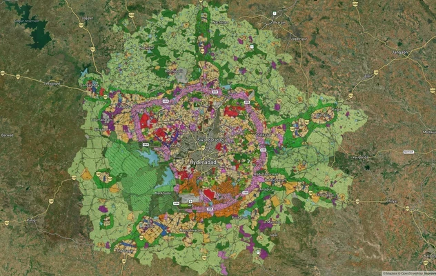
Hyderabad HMDA Masterplan: Zone Check and Land Use Guide
View Hyderabad Masterplan as a live map overlay – check any plot's land use zone for free on 1acre.in. Hyderabad masterp...
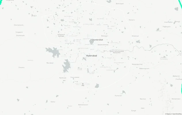
Hyderabad Regional Ring Road (RRR): Route Map and Land Impact
View RRR alignment as a live map overlay – check land acquisition risk and plot proximity free on 1acre.in. Hyderabad Re...
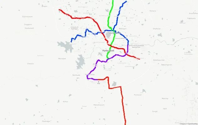
Hyderabad Metro Lines: Route Map and Corridor Impact
View Metro Lines route as a live map overlay – check metro corridor impact on plots free on 1acre.in. Hyderabad metro la...
More Layers in Telangana
Hyderabad HMDA Masterplan: Zone Check and Land Use Guide
View Hyderabad Masterplan as a live map overlay – check any plot's land use zone for free on 1acre.in. Hyderabad masterp...
Hyderabad Regional Ring Road (RRR): Route Map and Land Impact
View RRR alignment as a live map overlay – check land acquisition risk and plot proximity free on 1acre.in. Hyderabad Re...
Hyderabad Metro Lines: Route Map and Corridor Impact
View Metro Lines route as a live map overlay – check metro corridor impact on plots free on 1acre.in. Hyderabad metro la...