
Sagar Highway (Nagarjuna Sagar Road) route map and land guide


Sagar Highway Nh 765 Preview
Try the Sagar Highway (Nagarjuna Sagar Road) route map and land guide on the map
Sign in once and explore the layer for a full day.
- No card details needed
- Find nearby verified lands for sale
Overview
Sagar Highway, locally called Nagarjuna Sagar Highway or Sagar Road, runs southeast from Hyderabad towards Nagarjuna Sagar through Ibrahimpatnam (including Bongloor), Yacharam, and Manchal mandals in Ranga Reddy district. These mandals were planned under the HMDA Master Plan 2031, which covers 5,965 sq km across 55 mandals in five districts. Since March 2025, 36 villages that were part of HMDA have moved to the new Future City Development Authority (FCDA), whose seven mandals include Ibrahimpatnam, Manchal and Yacharam, so the planning authority now has to be checked village by village. Sagar Highway land buying needs care because the corridor sits between Adibatla Aerospace SEZ, the former Pharma City lands at Mucherla (now part of Bharat Future City), and the proposed Regional Ring Road. This page covers the route from Hyderabad, the Sagar Ring Road junction, the NH 765 mix-up, the GP layout trap specific to this corridor, verified HMDA-approved pockets, and the mandal-level zone checks that decide whether your purchase is registerable. View the alignment on the 1acre Sagar Highway map layer before you shortlist a plot.
Sagar Highway route map: Hyderabad to Nagarjuna Sagar
Sagar Highway is the road from Hyderabad to the Nagarjuna Sagar dam. Unofficial lists of Telangana state highways give it as SH 19, about 131 km long, running via Ibrahimpatnam and Peddavoora; a December 2025 traffic police advisory called it NH-565, so confirm the number with the Telangana Roads and Buildings department. Inside the city it begins near the Sagar Ring Road junction in the LB Nagar area. It then passes Turkayamjal, where congestion on the Nagarjunasagar Road has been raised in Parliament, crosses the Outer Ring Road at Bongloor and continues via Mangalpally X Road to Ibrahimpatnam. Beyond the ORR it runs through Yacharam in Ranga Reddy district and on towards Peddavoora and Nagarjuna Sagar.
The table lists the main points on the Sagar road map in order from Hyderabad.
Point on the route
Location
What to know as a buyer
Sagar Ring Road (Sagar X Road)
LB Nagar area, Hyderabad
City end of Sagar Road; fully urban, not a highway land market
Turkayamjal
Hyderabad's south-east edge
Congested stretch; a flyover has been sought in Parliament
Bongloor, ORR Exit 12
Outer Ring Road interchange
The Nagarjuna Sagar ORR exit number is 12
Mangalpally X Road
Between the ORR and Ibrahimpatnam
Gateway to the Adibatla and Mangalpally pocket
Ibrahimpatnam
Ranga Reddy district
Mandal headquarters; GP layouts common, check the LP number
Yacharam
Ranga Reddy district
Future City belt; check whether the village is under HMDA or FCDA
Peddavoora
On the way to the dam
Rural stretch; confirm which planning authority covers the village
Nagarjuna Sagar
End of the highway
Dam and tourism town
Point on the route
Location
What to know as a buyer
Sagar Ring Road (Sagar X Road)
LB Nagar area, Hyderabad
City end of Sagar Road; fully urban, not a highway land market
Turkayamjal
Hyderabad's south-east edge
Congested stretch; a flyover has been sought in Parliament
Bongloor, ORR Exit 12
Outer Ring Road interchange
The Nagarjuna Sagar ORR exit number is 12
Mangalpally X Road
Between the ORR and Ibrahimpatnam
Gateway to the Adibatla and Mangalpally pocket
Ibrahimpatnam
Ranga Reddy district
Mandal headquarters; GP layouts common, check the LP number
Yacharam
Ranga Reddy district
Future City belt; check whether the village is under HMDA or FCDA
Peddavoora
On the way to the dam
Rural stretch; confirm which planning authority covers the village
Nagarjuna Sagar
End of the highway
Dam and tourism town
Use the table to fix a plot's location before comparing prices. A plot described as being 'on Sagar Road' can be anywhere from an inner-city junction to a farm 100 km out, so ask for the village and survey number, not just the road name.
Sagar Ring Road and Sagar X Road: the city junction
Sagar Ring Road is not a separate ring road. It is the name Hyderabad commuters use for the busy junction where Sagar Road meets the city road network in the LB Nagar area, and it is also called Sagar X Road. Traffic advisories for the LB Nagar junction send vehicles from Dilsukhnagar towards Sagar Ring Road, which places it on the south-eastern side of the inner city, close to the Bairamalguda junction. When the right-hand-side flyover at Bairamalguda opened in August 2020, officials said it would clear 43 percent of the traffic at the Sagar Road junction.
Many people looking for the Nagarjuna Sagar ring road or a Sagar ring road map mean this junction. It is a different point from the place where Sagar Highway meets the Outer Ring Road, which is the Bongloor interchange, ORR Exit 12.
The difference matters when you compare land. A listing 'near Sagar Ring Road' is an urban property inside Hyderabad, priced and approved under city rules. A plot 'on Sagar Highway' is usually beyond the ORR, in HMDA or FCDA limits, where layout approval, zoning and acquisition checks decide whether it can be registered. Before you pay an advance, confirm which of the two the seller means and check the exact location on the map layer.
Sagar Highway number: is it NH 765?
The corridor is often labelled NH 765 in listings and on maps, so many buyers expect the NH 765 route to be Sagar Road. Official records use NH 765 for a different road. In the Lok Sabha, NH 765 is described as the Hyderabad to Srisailam highway, which leads to the Srisailam temple; the newly declared NH 167K starts at km 67 of NH 765 at Kalwakurthy. A 2026 Ministry of Road Transport and Highways tender under the 2026-27 annual plan covers four-laning from km 4.2 to km 9.9 on the Hyderabad to Srisailam road, NH 765.
Traffic police also treat the two roads separately. In a December 2025 advisory, heavy vehicles joining NH 765 from the Outer Ring Road were told to exit at Pedda Golkonda, ORR Exit 15, while traffic for the Nagarjuna Sagar Highway was routed through the Bongloor rotary, Exit 12, and Mangalpally X Road.
The Hyderabad to Nagarjuna Sagar road itself appears as state highway SH 19 in unofficial lists, while a December 2025 traffic police advisory called it NH-565. So the short answer to 'what is the Nagarjuna Sagar highway number' is that it is not NH 765, which is the Srisailam highway; confirm the current number with the Telangana Roads and Buildings department.
Road
Number
Route
ORR exit
Sagar Highway (Nagarjuna Sagar Road)
SH 19 in unofficial lists; NH-565 in a December 2025 police advisory
Hyderabad, Ibrahimpatnam, Peddavoora, Nagarjuna Sagar
Exit 12, Bongloor
Srisailam Highway
NH 765
Hyderabad, Kalwakurthy, Srisailam
Exit 15, Pedda Golkonda (for heavy vehicles)
Road
Number
Route
ORR exit
Sagar Highway (Nagarjuna Sagar Road)
SH 19 in unofficial lists; NH-565 in a December 2025 police advisory
Hyderabad, Ibrahimpatnam, Peddavoora, Nagarjuna Sagar
Exit 12, Bongloor
Srisailam Highway
NH 765
Hyderabad, Kalwakurthy, Srisailam
Exit 15, Pedda Golkonda (for heavy vehicles)
If a seller's papers say a plot is 'on NH 765', check which road is meant. Widening plans, building lines and acquisition notices differ between the two roads, so confirm the road name on the survey sketch.
Why the GP layout trap on Nagarjuna Sagar Highway is still catching buyers
The Sagar Highway corridor runs through Ibrahimpatnam, Yacharam, and Manchal mandals, all of which fall within the HMDA Master Plan 2031 area, though some of their villages have come under the Future City Development Authority (FCDA) since March 2025. That fact carries a specific legal consequence. In these villages, only HMDA, FCDA or DTCP, depending on the village, hold the power to sanction layout plans. Gram panchayats do not. Yet GP layout sales remain the most common fraud pattern along this corridor, with brokers marketing panchayat-approved plots as being functionally equivalent to HMDA-approved ones. They are not.
By late 2024, the HMDA had identified 348 unauthorized layouts across 10 Ranga Reddy mandals, including Ibrahimpatnam, and added their survey numbers to the Sub-Registrar Prohibited (22-A) List. A plot on that list cannot be registered. Some of these layouts had been openly sold for years under Gram Panchayat sarpanch approvals, and buyers who paid advances before the ban found themselves holding unregisterable assets. The Telangana government's 2020 ban on GP layout registrations inside HMDA limits is the operative rule. The current Congress government began enforcing it actively from late 2024.
Two things have changed since then. First, in March 2025, 36 HMDA villages moved to the new Future City Development Authority, whose jurisdiction includes villages in Ibrahimpatnam, Manchal and Yacharam mandals, so an LP number has to be checked with the authority that now covers the village. Second, the Layout Regularisation Scheme (LRS) is still open only to people who applied in 2020. In August 2026 the state extended the 25 percent fee rebate for those applicants to 30 November. A buyer of a GP plot whose layout has no 2020 LRS application gets no help from this rebate.
The table below shows the approval types present on this corridor and what each means for registration and loans.
Approval Type
Issuing Authority
Registerable?
Bank Loan Eligible?
LP Number on HMDA Portal?
HMDA Layout Permission
HMDA (via DPMS/TG-bPASS)
Yes
Yes
Yes, verify at hmda.gov.in
GP / Sarpanch Approval
Gram Panchayat
No (within HMDA limits)
No
Not applicable
DTCP Approved (Yacharam outskirts)
Directorate of Town and Country Planning
Yes, in DTCP jurisdiction only
Yes
Verify at dtcp.telangana.gov.in
Approval Type
Issuing Authority
Registerable?
Bank Loan Eligible?
LP Number on HMDA Portal?
HMDA Layout Permission
HMDA (via DPMS/TG-bPASS)
Yes
Yes
Yes, verify at hmda.gov.in
GP / Sarpanch Approval
Gram Panchayat
No (within HMDA limits)
No
Not applicable
DTCP Approved (Yacharam outskirts)
Directorate of Town and Country Planning
Yes, in DTCP jurisdiction only
Yes
Verify at dtcp.telangana.gov.in
If a developer's brochure shows an LP number, but you cannot find it on the HMDA portal under the relevant mandal (or with FCDA, if the village now falls under FCDA), treat that plot as an illegal layout. Every legitimate HMDA approval has a traceable LP number; asking for it and verifying it takes under five minutes on hmda.gov.in.
Adibatla, Bongloor, and Yacharam: where the Sagar Highway investment thesis actually holds
Not every pocket on this corridor carries the same risk. The zones closest to confirmed employment anchors have genuine demand foundations, while areas beyond the ORR operate on longer time horizons.
The table below maps each major investment pocket along the Sagar Highway by its HMDA mandal, primary demand driver, approximate land rate, and realistic buyer risk level.
Pocket / Locality
Mandal
Primary Demand Driver
Approx. Rate (2024-25)
Buyer Risk Level
Adibatla / Mangalpally
Ibrahimpatnam
TCS campus (75 acres), Aerospace SEZ, Foxconn manufacturing
₹15,000-40,000/sq yd
Low, with LP number confirmed
Bongloor (ORR Exit 12)
Ibrahimpatnam
ORR access, HMDA Logistics Park (Mangalpally, 22 acres), BDL
₹15,000-22,000/sq yd
Low to Medium
Ibrahimpatnam town
Ibrahimpatnam
Ranga Reddy Collectorate, education cluster, ORR proximity
₹15,000-18,000/sq yd
Medium; many GP layouts present
Gungal / Yacharam
Yacharam
Pharma City Mucherla corridor, connecting road to Srisailam Highway
₹11,000-15,000/sq yd
Medium; DTCP or HMDA, verify each
Manchal belt
Manchal
Regional Ring Road southern alignment, longer horizon
Under ₹10,000/sq yd
High; purely RRR-dependent
Pocket / Locality
Mandal
Primary Demand Driver
Approx. Rate (2024-25)
Buyer Risk Level
Adibatla / Mangalpally
Ibrahimpatnam
TCS campus (75 acres), Aerospace SEZ, Foxconn manufacturing
₹15,000-40,000/sq yd
Low, with LP number confirmed
Bongloor (ORR Exit 12)
Ibrahimpatnam
ORR access, HMDA Logistics Park (Mangalpally, 22 acres), BDL
₹15,000-22,000/sq yd
Low to Medium
Ibrahimpatnam town
Ibrahimpatnam
Ranga Reddy Collectorate, education cluster, ORR proximity
₹15,000-18,000/sq yd
Medium; many GP layouts present
Gungal / Yacharam
Yacharam
Pharma City Mucherla corridor, connecting road to Srisailam Highway
₹11,000-15,000/sq yd
Medium; DTCP or HMDA, verify each
Manchal belt
Manchal
Regional Ring Road southern alignment, longer horizon
Under ₹10,000/sq yd
High; purely RRR-dependent
Adibatla is the corridor's most defensible pocket. TCS operates a 75-acre campus there; Foxconn has a manufacturing facility at Kongarkalan; BDL spans 540 acres; and the Aerospace SEZ, at 1,500 acres, continues attracting precision engineering firms. These are operating businesses, not proposed ones. An HMDA-approved layout within 5 km of TCS Adibatla at ₹15,000-40,000 per sq yd reflects a real employment base, not a speculative corridor bet.
The Manchal belt beyond the ORR is the corridor's most misunderstood zone. As of August 2026, the detailed project report for the 201 km southern part of the Regional Ring Road was still being finalised, after the state approved a changed alignment through Choutuppal, Amangal and Sangareddy. Even the 161 km northern part, with 99.06 percent of its land notified, had not reached contract award. Plots sold against a proposed RRR alignment in Manchal carry alignment risk on top of GP layout risk. Verify both the approval type and the RRR acquisition notification status before committing capital there.
Bharat Future City and FCDA limits on the Sagar Highway belt
In March 2025 the Telangana government set up the Future City Development Authority (FCDA) to plan the Future City project. Its jurisdiction covers 765.28 sq km in Ranga Reddy district: 56 revenue villages, of which 36 were moved out of HMDA and 20 were added. The villages lie in seven mandals: Amangal, Ibrahimpatnam, Kadthal, Kandukur, Maheshwaram, Manchal and Yacharam. Three of these, Ibrahimpatnam, Manchal and Yacharam, are Sagar Highway mandals.
Land acquired earlier for Pharma City at Mucherla has been repurposed for Bharat Future City, a proposed development of about 30,000 acres, of which about 16,000 acres are proposed for land pooling. As of February 2026, acquisition was reported as largely complete in Yacharam, Kandukur and Kadthal, with 432 acres held up in court cases.
Check
Why it matters on Sagar Highway
Is the village under HMDA or FCDA?
Since March 2025 the planning authority differs by village
Who issued the layout permission?
Verify the permission with that authority, not with the seller
Is the survey number in acquired or pooled land?
Land taken for Future City cannot be safely bought
Does the plot sit on a planned Future City road?
New road corridors can take part of a plot
Check
Why it matters on Sagar Highway
Is the village under HMDA or FCDA?
Since March 2025 the planning authority differs by village
Who issued the layout permission?
Verify the permission with that authority, not with the seller
Is the survey number in acquired or pooled land?
Land taken for Future City cannot be safely bought
Does the plot sit on a planned Future City road?
New road corridors can take part of a plot
Check the plot against the 1acre Future City map layer as well as this one before you pay an advance.
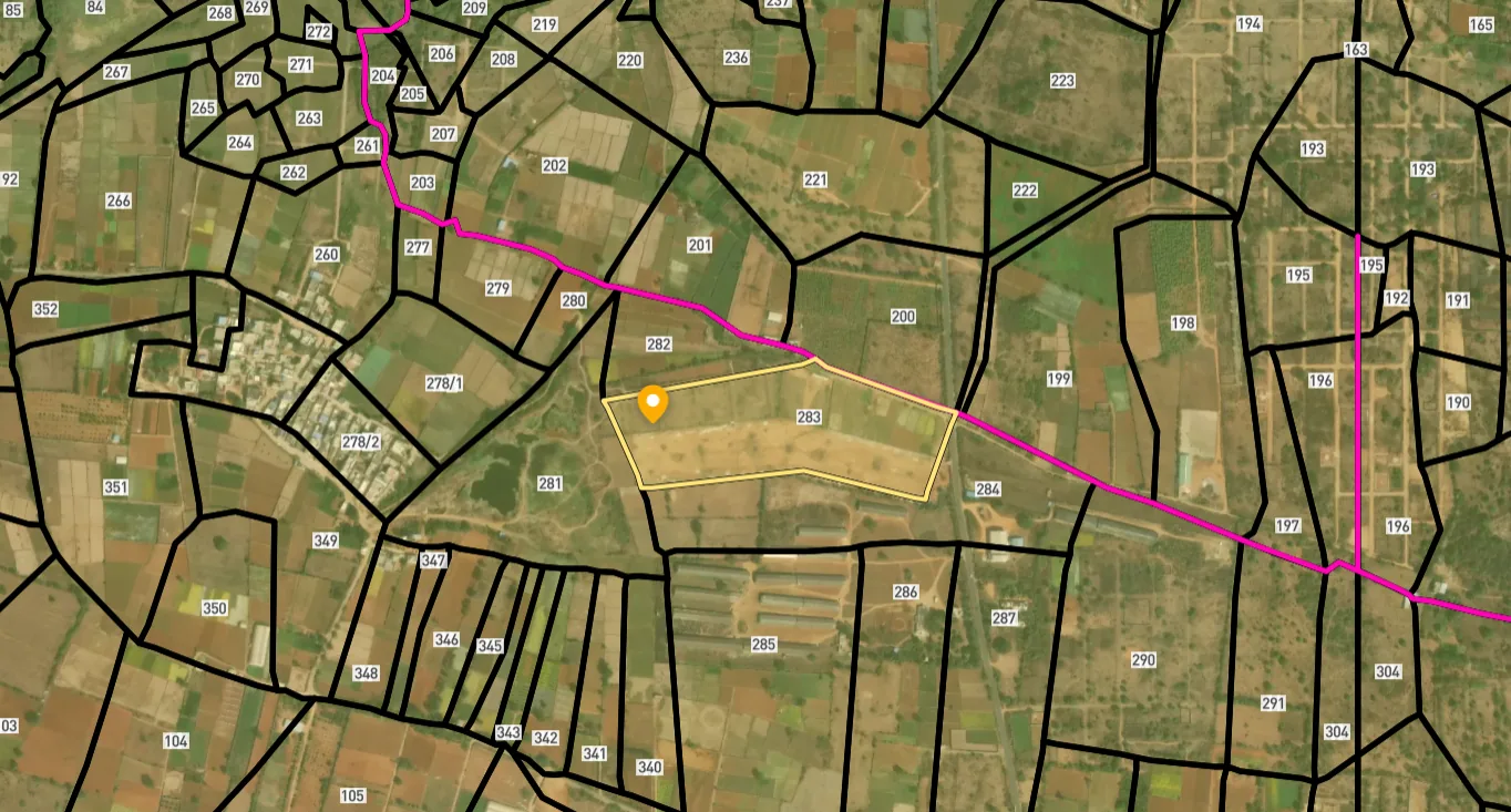
Access Survey NumbersAccess Telangana
Survey Numbers
Boundaries and numbers come from published state cadastral records. See all map layers.
Looking to sell your land in Telangana?

Browse all verified lands & plots in Telangana
More Layers in Telangana
See all 26 layers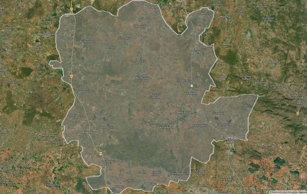
FCDA Masterplan — Bharat Future City Zone, Hyderabad
View FCDA Bharat Future City zone as a live map overlay — check future city development zones for free on 1acre.in. FCDA...
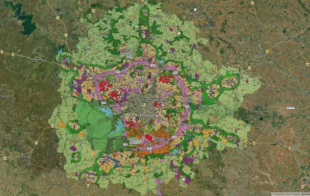
Hyderabad HMDA Masterplan: Zone Check and Land Use Guide
View Hyderabad Masterplan as a live map overlay – check any plot's land use zone for free on 1acre.in. Hyderabad masterp...
Warangal Masterplan: WUDA Zone Check and Land Use Guide
View Warangal Masterplan as a live map overlay – check any plot's land use zone for free on 1acre.in. Warangal KUDA mast...
More Layers in Telangana
FCDA Masterplan — Bharat Future City Zone, Hyderabad
View FCDA Bharat Future City zone as a live map overlay — check future city development zones for free on 1acre.in. FCDA...
Hyderabad HMDA Masterplan: Zone Check and Land Use Guide
View Hyderabad Masterplan as a live map overlay – check any plot's land use zone for free on 1acre.in. Hyderabad masterp...
Warangal Masterplan: WUDA Zone Check and Land Use Guide
View Warangal Masterplan as a live map overlay – check any plot's land use zone for free on 1acre.in. Warangal KUDA mast...
Frequently Asked Questions
Ask the seller for the layout permission number. Search that LP number on hmda.gov.in under Online Services and match it to the mandal and survey number. Any HMDA-approved layout returns a verifiable result. A plot without a traceable LP number is a GP layout and is not registerable inside HMDA limits.
Ibrahimpatnam, Yacharam, and Manchal mandals all fall within HMDA limits under the Master Plan 2031. Since March 2025, the Future City Development Authority (FCDA), formed partly from 36 former HMDA villages, covers villages in these three mandals, so check which authority covers the village. Buying in any of these mandals means GP approval carries no legal sanctioning authority. Only HMDA, FCDA or DTCP approvals are valid for registration and bank loans, depending on the village.
The HMDA Master Plan 2031 covers 5,965 sq km and divides land into 12 zones, including R1 to R4 residential, manufacturing, peri-urban, and agricultural. A plot zoned for manufacturing cannot be used for residential construction without a change of land use approval. Check the municipal-level master plan map for the exact survey number before transacting.
Pharma City at Mucherla sits between Kandukur, Kadthal, and Maisigandi. The land acquired for it has since been repurposed for Bharat Future City, a proposed development of about 30,000 acres planned by the Future City Development Authority. Acquired land is not open for private residential purchase, but areas along the connecting road through Yacharam and Rachloor carry real residential demand. Verify the zone classification and the HMDA, FCDA or DTCP approval status before buying near the connecting road.
The RRR's southern corridor passes through Manchal and areas beyond the ORR. As of August 2026, the 161 km northern part had 99.06 percent of its land notified, but NHAI had extended its bid deadline for a sixth time, and the DPR for the 201 km southern part was still being finalised. Plots in the Manchal belt carry early-stage RRR-dependent appreciation with no confirmed timeline. Do not pay premium pricing on unconfirmed alignment land.
HMDA-approved plots near TCS Adibatla and the Aerospace SEZ at Mangalpally and Bongloor were quoted between ₹15,000 and ₹40,000 per sq yard in 2024-25. Highway-facing plots with HMDA layout permission command a premium over interior parcels. Yacharam pockets beyond the ORR started from ₹11,000 per sq yard for DTCP-approved layouts. Treat these as indicative and confirm current asking rates and the government market value before you negotiate.
Banks lend against HMDA, FCDA or DTCP approved layouts only. A GP layout plot, even one with panchayat approval, does not qualify for a housing loan. Confirm the LP number with your bank's legal team before paying an advance; the loan sanction itself is a useful secondary check on approval legitimacy.
The most common trap is a GP-approved layout marketed as "HMDA approved." Brokers use HMDA approval language in brochures for layouts that carry only a sarpanch certificate. As of late 2024, HMDA has listed 348 such unauthorised layouts across Ranga Reddy mandals, including Ibrahimpatnam, on the Sub-Registrar Prohibited 22-A List. A plot on that list blocks registration at the Sub-Registrar Office automatically.
Unofficial lists give the Hyderabad to Nagarjuna Sagar road as state highway SH 19, about 131 km long, and a December 2025 traffic police advisory called it NH-565. It is often mislabelled NH 765, but official records use NH 765 for the Hyderabad to Srisailam highway via Kalwakurthy. If a document says a plot is on NH 765, confirm which of the two roads it means before you rely on it.
Sagar Highway meets the Hyderabad Outer Ring Road at the Bongloor interchange, ORR Exit 12. Traffic advisories route Nagarjuna Sagar traffic through the Bongloor rotary and Mangalpally X Road towards Ibrahimpatnam. Exit 15 at Pedda Golkonda serves the Srisailam highway, NH 765, not Sagar Road.
Sagar Ring Road, also called Sagar X Road, is the junction in the LB Nagar area of south-east Hyderabad where Sagar Road meets the city road network, close to Bairamalguda. It is not a separate ring road and it is not the Outer Ring Road. Land listed 'near Sagar Ring Road' is urban property, unlike plots on Sagar Highway beyond the ORR.
From the Sagar Ring Road junction near LB Nagar, Sagar Highway runs south-east past Turkayamjal, crosses the Outer Ring Road at Bongloor (Exit 12), passes Mangalpally X Road, then continues through Ibrahimpatnam and Yacharam in Ranga Reddy district and on via Peddavoora to Nagarjuna Sagar dam, a distance unofficial lists put at about 131 km.
Source
Official Hyderabad Metropolitan Development Authority (HMDA) documents
Official Website
www.hmda.gov.in
Coordinate Reference System
EPSG:4326 (WGS 84)
Geometry Type
LineString / MultiLineString
Data Format
Vector (GeoJSON) + Raster Tiles
Last Verified
2026
Status
Active
Was this layer helpful?
Anything wrong, outdated, or missing we want to hear it.