Hyderabad Lakes: FTL and Buffer Zone Check
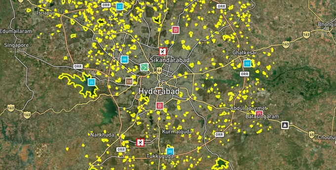
Lakes Preview
See the Hyderabad Lakes on the map
- Included with your premium subscription.
Overview
The Hyderabad lake FTL and buffer zone layer on 1acre displays Full Tank Level boundaries and no-construction buffer distances for lakes across the Hyderabad Metropolitan Development Authority (HMDA) jurisdiction, sourced from HMDA's official data under G.O.Ms.No.168 (2012). HMDA has identified 3,532 lakes in the metropolitan region. As of September 2024, final FTL and buffer zone notifications had been issued for only 765 of those lakes as of November 2024, with The Telangana High Court ordered completion by 4 November 2024; that deadline was missed and the Court is now directly monitoring progress. HYDRAA (Hyderabad Disaster Response and Asset Protection Agency), formed in July 2024, has been demolishing FTL and buffer zone violations since September 2024. This page covers the legal distances that prohibit construction, which neighbourhoods face active demolition risk, and how to use the 1acre Lakes layer to verify any plot before you commit.
HYDRAA Demolitions and the FTL Trap: Why an HMDA NOC Is No Longer Enough
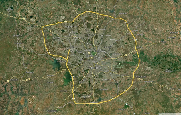
The dominant legal risk in Hyderabad real estate since mid-2024 is buying property within a lake's FTL or buffer zone. HYDRAA (Hyderabad Disaster Response and Asset Protection Agency), formed on 19 July 2024, operates within the Telangana Core Urban Region up to the Outer Ring Road and has already reclaimed 43.94 acres and demolished 18 properties within the ORR limits. The critical problem for buyers: HMDA and GHMC previously issued building and layout permissions based on NOCs from the irrigation and revenue departments. Those NOCs have in multiple documented cases proven unreliable. Demolitions proceeded regardless of prior permissions.
The governing regulation is G.O.Ms.No.168, issued by the MA&UD Department on 7 April 2012, which established the buffer zone distances that HYDRAA now enforces. HYDRAA has clarified that residential properties constructed before July 2024 with valid government approvals will not be demolished, but commercial buildings in FTL or buffer zones face demolition regardless of construction date. Any structure whose building permission has been withdrawn is treated as illegal.
Water Body Type
Buffer Zone Distance from FTL / Boundary
Building Permission Possible?
Lakes / Tanks / Kuntas above 10 hectares
30 metres from FTL
No construction within zone
Lakes / Kuntas below 10 hectares; nalas above 10 m width
9 metres from FTL / boundary
No construction within zone
Canals, vagu, nalas up to 10 m width
2 metres from defined boundary
No construction within zone
Rivers (within Municipal Corporation / Municipality / Nagar Panchayat limits)
50 metres from river boundary
No construction within zone. Outside municipal limits, buffer increases to 100 metres from river boundary.
Osman Sagar / Himayat Sagar catchment (G.O. 111)
10 km radius catchment area
Heavy restrictions; industrial and large construction prohibited
In the Nalla Cheruvu case at Kukatpally, HYDRAA found that 14 of the lake's 27 acres had been encroached. More than 50 structures including apartment buildings occupied four acres of buffer zone, with 25 additional buildings standing directly inside three acres of FTL. At Neknampur in Manikonda, four villas from a complex costing approximately Rs 2 crore each were demolished in January 2025 after Manikonda municipality cancelled building permissions that should never have been granted. An HMDA-issued NOC does not override the FTL boundary. If the lake's FTL line runs through the plot, the property is in jeopardy.
Which Hyderabad Neighbourhoods Carry the Highest FTL and Buffer Zone Risk
The risk is not uniformly distributed. Areas near major cheruvus (lakes) in the western and north-western zones, as well as lakeside micro-markets in south Hyderabad, face the greatest exposure. Confirmed HYDRAA demolitions from 2024 to 2025 are concentrated in specific localities, and those same localities are where buyers need to run the FTL check before signing any agreement.
Nalla Cheruvu (Kukatpally), Durgam Cheruvu (Madhapur), Neknampur / Ibrahim Cheruvu (Manikonda), and Medikunta Cheruvu (Nanakramguda) have all seen active HYDRAA action or formal inspections. The 13 lakes identified as suffering rampant encroachments include Sunnam Cheruvu near Kukatpally, Gosaikunta Cheruvu at Goulidoddi, Nallagandla Cheruvu in Nallagandla, Maddela Kunta near Saroornagar, Nalla Cheruvu in Uppal, Amber Cheruvu in Kukatpally, and Chinna Damera Cheruvu in Dundigal. Property demand near Kukatpally Lake, Osman Sagar (Gandipet), Himayat Sagar, Saroornagar Lake, Nagole Lake, Durgam Cheruvu, and Peerzadiguda Lake dropped sharply from July 2024 onwards as HYDRAA's demolition drive proceeded.
Locality / Lake
Documented HYDRAA Action
FTL Risk Level
Buffer Zone Width
Kukatpally / Nalla Cheruvu
16 sheds demolished Sep 2024; 4 acres reclaimed
High
30 m (lake above 10 ha)
Manikonda / Neknampur
4 villas demolished Jan 2025; permissions cancelled
High
30 m
Madhapur / Kavuri Hills
Sports academy demolished Sep 2024
High
30 m
Gachibowli
16 illegal structures removed; 6.28 acres reclaimed
Medium-High
Verify per lake size
Nanakramguda / Medikunta Cheruvu
Commissioner inspection; violations documented
Medium-High
30 m
Ameenpur / Kistareddypet
25 RCC structures demolished Sep 2024
High
Verify per lake
Osman Sagar / Himayat Sagar (G.O. 111)
Ongoing restrictions since 1996; 84 villages covered
Very High
10 km catchment radius
The most misread zone is the G.O. 111 catchment area around Osman Sagar and Himayat Sagar. Covering 84 villages within a 10 km radius of both reservoirs, G.O. 111 prohibits heavy construction and industrial use.
The previous BRS government issued G.O. 69on 12 April 2022to remove the restrictions under G.O. 111 for all 84 villages. The Telangana High Court subsequently directed the state in September 2023 to form a High-Powered Committee before any changes could take effect. That committee process remains incomplete, and G.O. 111 restrictions remain fully in force as of the date of writing. No timeline for resolution has been set. Buyers in Gandipet, Tellapur, Chevella Road, and Mokila must confirm G.O. 111 applicability before treating any plotted development there as legally safe.
Was this layer helpful?
Anything wrong, outdated, or missing we want to hear it.
For Land Owners & Agents
Looking to sell your land in Telangana?
I want to sell my land in Hyderabad HMDA
10:32
Plz share your Land's location - We will list it on 1acre map, for Free.
10:32

For Land Buyers
Browse all verified lands & plots in Telangana
Every listing goes through our Preliminary Verification Process.
More Layers in Telangana
See all 21 layers
Hyderabad HMDA Masterplan: Zone Check and Land Use Guide
View Hyderabad Masterplan as a live map overlay – check any plot's land use zone for free on 1acre.in. Hyderabad masterp...
Hyderabad Outer Ring Road (ORR)
View the Hyderabad ORR Growth Corridor on a live map overlay - check HMDA layout approval, zone status and acquisition r...
Hyderabad Regional Ring Road (RRR): Route Map and Land Impact
View RRR alignment as a live map overlay – check land acquisition risk and plot proximity free on 1acre.in. Hyderabad Re...
More Layers in Telangana
Hyderabad HMDA Masterplan: Zone Check and Land Use Guide
View Hyderabad Masterplan as a live map overlay – check any plot's land use zone for free on 1acre.in. Hyderabad masterp...
Hyderabad Outer Ring Road (ORR)
View the Hyderabad ORR Growth Corridor on a live map overlay - check HMDA layout approval, zone status and acquisition r...
Hyderabad Regional Ring Road (RRR): Route Map and Land Impact
View RRR alignment as a live map overlay – check land acquisition risk and plot proximity free on 1acre.in. Hyderabad Re...