Baghpat Baraut Khekra Masterplan: Zone Check and Land Use Guide
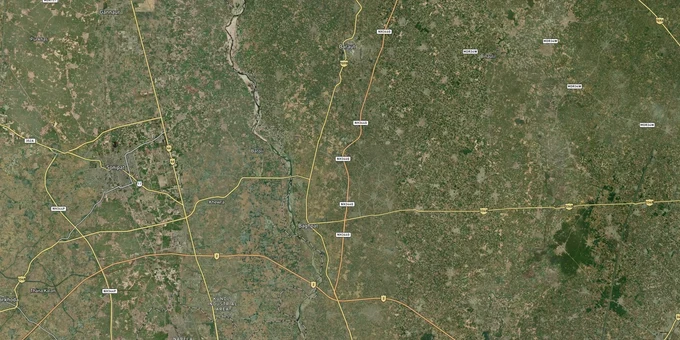
Baghpat Baraut Khekra Masterplan Preview
Try the Baghpat Baraut Khekra Masterplan on the map
Sign in once and explore the layer for a full day.
- No card details needed
- Find nearby verified lands for sale
Overview
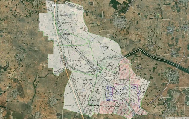
The Baghpat Baraut Khekra masterplan 2031 covers land use across Baghpat district's 1,321 sq km, governed by the Baghpat Baraut Khekra Development Authority (BBKDA), established in 2008 under the Uttar Pradesh Urban Planning and Development Act, 1973. The district sits within the National Capital Region across three tehsils: Baghpat, Baraut, and Khekra. The draft masterplan 2031 was prepared in June 2022 but has not yet received final UP government approval. This page covers what that unapproved status means for buyers, where BBKDA is actively demolishing illegal colonies, and which corridors carry the most credible land value.
The masterplan is still a draft and BBKDA has demolished illegal colonies at Tattiri (Baghpat town) and Baraut in 2025
The single most important fact about the Baghpat Baraut Khekra masterplan 2031 is that it is not yet a notified, final document. BBKDA prepared the GIS-based draft in June 2022. The Meerut Divisional Commissioner's office was still hearing objections in August 2023, with 568 objections received and disposed of. As of early 2026, the masterplan 2031 has not been notified. Residential, industrial, and commercial building plan approvals are therefore still governed by the older framework and the authority's discretion.
This matters because sellers are actively marketing land against proposed zones that have no legal force yet. In April 2025, BBKDA demolished illegal colonies at Tattiri (Baghpat town) and Baraut (Agrawal Mandi, Baraut tehsil), clearing 17,000 sq m of unauthorised construction carried out without any map approval. The ADM confirmed on site that the colonies had been built without BBKDA's building plan sanction, and no formal layout approval existed for any of them.
The table below shows the three documents a buyer must hold and verify before any payment within the BBKDA jurisdiction.
Document
Issuing Authority
What It Confirms
Known Problem in Baghpat
BBKDA Layout Approval Order
Baghpat Baraut Khekra Development Authority
Colony is approved under the applicable masterplan; plots may receive building map sanction
Colonies marketed against the draft masterplan 2031 proposals, which have no legal status yet
UP Real Estate Regulatory Authority (RERA) Registration Number
UP RERA (up-rera.in)
Developer has submitted all mandatory approvals; project is registered for residential or commercial use
Projects registered with UP RERA in Baghpat must also hold a valid BBKDA layout sanction; RERA registration alone does not confirm BBKDA approval
Bhulekh / Khatauni
Revenue Department, UP (upbhulekh.gov.in)
Current ownership and land type (agricultural or otherwise) confirmed in revenue records
Agricultural land sold for residential or industrial use without change of land use permission from BBKDA
If a seller's only proof is that the land falls within a zone shown on the draft masterplan 2031 map, that is not an approval. The map is a proposal. Building construction on land without a sanctioned BBKDA map is illegal, and BBKDA is actively demolishing such constructions.
Baraut's Delhi Dehradun Economic Corridor nodes and Khekra's industrial belt: where the real demand is
The draft BBKDA masterplan 2031 identifies three distinct investment corridors, each with different zone character and risk profiles. Understanding which corridor your plot sits in determines both what you can build and how much of the projected land value depends on a plan that has not been approved.
In Baraut, the draft plan concentrates growth around the intersection of Meerut Road and Muzaffarnagar Road with the Delhi Dehradun Economic Corridor. The elevated road from Akshardham to the Eastern Peripheral Expressway brings Baraut within 30 minutes of Delhi. Private industrial townships are already forming here: Durga Industrial Township is operational, and Ramprastha Next has announced an industrial project for this corridor. Land rates for new industrial development in this belt were in the range of Rs 20,000 to 30,000 per square meter as of 2023, compared to Rs 80,000 to 1,00,000 per square metre in established zones like Tronica City and Kundali.
In Khekra, the draft plan proposes industrial development toward Hasanpur Masuri and Subhanpur. In Baghpat town, the plan proposes an industrial and commercial zone in front of the collectorate, with residential to industrial transition toward Tatiri.
The table below maps each corridor to its draft zone character and current risk level.
Corridor
Draft Zone Character (BBKDA Masterplan 2031 Proposal)
Primary Growth Driver
Key Risk
Baraut (Meerut Road / Muzaffarnagar Road intersection)
Commercial and residential expansion; Delhi Dehradun Economic Corridor node
Eastern Peripheral Expressway access; 30-minute reach to Delhi; active industrial township formation
Draft masterplan not notified; zone designations have no legal force; verify BBKDA layout approval before purchase
Khekra (Hasanpur Masuri / Subhanpur belt)
Proposed industrial zone
Proximity to Trans Delhi Signature City (Tronica City); Kharkhoda industrial belt; affordable industrial land entry
No final layout approvals can be issued against an unnotified masterplan; BBKDA approval at plot level is essential
Baghpat town (Agrawal Mandi / Tatiri belt)
Proposed residential to industrial transition; commercial corridor near collectorate
District headquarters; sugarcane and agri-industry base
Active demolition zone: BBKDA razed 17,000 sq m of illegal colonies here in April 2025
The most misunderstood corridor is Tatiri. The draft masterplan proposed residential to industrial transition in this belt, which attracted colonisers to form layouts without BBKDA sanction. BBKDA has already acted with demolitions. Buyers holding plots in this area without a sanctioned BBKDA layout order are in a legally exposed position regardless of what the draft map shows.
Was this layer helpful?
Anything wrong, outdated, or missing we want to hear it.
For Land Owners & Agents
Looking to sell your land in Delhi?
I want to sell my land in Delhi
10:32
Plz share your Land's location - We will list it on 1acre map, for Free.
10:32

For Land Buyers
Browse all verified lands & plots in Delhi NCR
Every listing goes through our Preliminary Verification Process.
More Layers in Delhi NCR
See all 30 layers
Alwar UIT Masterplan 2031: Zone Check and Land Use Guide
View Alwar Masterplan as a live map overlay – check any plot's land use zone for free on 1acre.in. Alwar Master Plan 205...
Arogya Dham Badsa Masterplan: Zone Check and Land Use Guide
View Arogya Dham Badsa Masterplan as a live map overlay – check any plot's land use zone for free on 1acre.in. Arogya Dh...
Delhi Master Plan 2041: DDA Zone Check and Land Use Guide
View Delhi Masterplan as a live map overlay – check any plot's land use zone for free on 1acre.in. Delhi masterplan land...
More Layers in Delhi NCR
Alwar UIT Masterplan 2031: Zone Check and Land Use Guide
View Alwar Masterplan as a live map overlay – check any plot's land use zone for free on 1acre.in. Alwar Master Plan 205...
Arogya Dham Badsa Masterplan: Zone Check and Land Use Guide
View Arogya Dham Badsa Masterplan as a live map overlay – check any plot's land use zone for free on 1acre.in. Arogya Dh...
Delhi Master Plan 2041: DDA Zone Check and Land Use Guide
View Delhi Masterplan as a live map overlay – check any plot's land use zone for free on 1acre.in. Delhi masterplan land...