
Sonipat Masterplan: Zone Check and Land Use Guide


Sonipat Masterplan Preview
Try the Sonipat Masterplan on the map
Sign in once and explore the layer for a full day.
- No card details needed
- Find nearby verified lands for sale
Overview
The Sonipat Kundli masterplan zone that covers your survey number determines whether you can build on it at all. The Sonipat-Kundli Multifunctional Urban Complex Development Plan 2031 was first published as a draft by the Haryana Government in Gazette Extraordinary No. 176-2020/Ext. on 25 November 2020. The plan was published as the Development Plan 2031. Before relying on any copy of it, confirm on the DTCP Haryana website (tcpharyana.gov.in) whether that version is the 2020 draft or a final notified plan, because zoning in a draft can change before it is finalised. It governs 20,220 hectares of residential, commercial, industrial, and mixed-use land across 92 planned sectors. The plan targets a population of 25,06,600 and is administered by the Department of Town and Country Planning (DTCP), Haryana. This page covers the Sonipat master plan 2031 map and its sectors, where the official PDF is published, the villages in the controlled area, whether a 2041 plan exists, the two legal traps most buyers overlook, the three corridors shaping investor decisions, and the exact steps to verify a parcel before signing.
Sonipat master plan 2031 map: sector-wise land use
The Sonipat master plan 2031 map is the drawing of the Development Plan 2031, which divides the Sonipat-Kundli Multifunctional Urban Complex into about 92 planned sectors across 20,220 hectares. The plan is built for a population of 25,06,600. Each sector carries one main land use, and the colour on the map shows which.
Sonipat master plan 2031 map: sector-wise land use
Land use in the 2031 plan
Area (hectares)
Sectors named in reports
Residential
About 7,071
About 92 sectors planned for residential use across the complex
Commercial
About 606
Sectors 3, 25, 40, 85 and 86
Industrial
Over 4,940
Kundli, Rai and Barhi belts along NH-44 and the KMP Expressway
Open space
1,933
Includes 60 m green belts along national highways
Other uses (transport, utilities, public and semi-public)
Remainder of the 20,220 ha
Shown on the plan drawing
Land use in the 2031 plan
Area (hectares)
Sectors named in reports
Residential
About 7,071
About 92 sectors planned for residential use across the complex
Commercial
About 606
Sectors 3, 25, 40, 85 and 86
Industrial
Over 4,940
Kundli, Rai and Barhi belts along NH-44 and the KMP Expressway
Open space
1,933
Includes 60 m green belts along national highways
Other uses (transport, utilities, public and semi-public)
Remainder of the 20,220 ha
Shown on the plan drawing
A sector-wise view tells you more than a district map. Searches for a Sonipat sector map or a sector plan usually mean one of two things: the development plan drawing, which shows every sector's land use, or a DTCP-approved layout plan inside one sector, which comes with a colony licence. The development plan does not approve any plot. A plot in a residential sector still needs a DTCP licence for the colony, or a CLU for individual development. Before buying, find the sector number for the khasra, check its colour on the plan, and confirm the licence or CLU number. You can view the plan's sector boundaries over satellite imagery on the 1acre map layer.
Sonipat master plan 2031 PDF download and the notified land use map
The official plan files are published by the Department of Town and Country Planning, Haryana, on tcpharyana.gov.in under Development Plans, district Sonipat. 1acre does not host them. In Haryana, the notified land use map of a town is its published development plan drawing, so this is also where to find the notified land use map for Sonipat. DTCP lists development plans for 74 towns and 566 controlled areas across Haryana.
Sonipat master plan 2031 PDF download and the notified land use map
Document on the DTCP website
What it contains
Notification
Later version of the Development Plan 2031, Sonipat-Kundli MUC
Notification text and zoning regulations; plan drawing
Check on DTCP whether it is listed as the final plan, with its notification number and date
Draft Development Plan 2031, Sonipat-Kundli MUC
Draft notification; draft drawing; existing land use plans in three sheets
CCP(NCR)/DDP/SKMUC-2031/2020/1561, 25 November 2020
Final Development Plan 2021, Sonipat
Earlier plan, with explanatory note and amendments of 2016 and 2017
CCP(NCR)SCA/2003/1917, 2 September 2003
Controlled areas list
The 37 controlled areas covered by the 2031 plan, with notification numbers
Notified between 1964 and 2010
Document on the DTCP website
What it contains
Notification
Later version of the Development Plan 2031, Sonipat-Kundli MUC
Notification text and zoning regulations; plan drawing
Check on DTCP whether it is listed as the final plan, with its notification number and date
Draft Development Plan 2031, Sonipat-Kundli MUC
Draft notification; draft drawing; existing land use plans in three sheets
CCP(NCR)/DDP/SKMUC-2031/2020/1561, 25 November 2020
Final Development Plan 2021, Sonipat
Earlier plan, with explanatory note and amendments of 2016 and 2017
CCP(NCR)SCA/2003/1917, 2 September 2003
Controlled areas list
The 37 controlled areas covered by the 2031 plan, with notification numbers
Notified between 1964 and 2010
For a Sonipat master plan 2031 PDF download, check on DTCP whether the file is the 2020 draft, which was open for objections, or a final notified plan, and use the latest version DTCP lists. A Sonipat map PDF from a listing site may show the draft or an unofficial redraw. Use the DTCP drawing and confirm sector boundaries at the DTCP district office in Sonipat when a plot sits near a sector road or a zone edge.
Sonipat map with villages: controlled areas and free zone land
The 2031 plan applies only inside notified controlled areas. DTCP's list for the Sonipat-Kundli complex has 37 controlled areas, and most are named after a village or a school in a village. This is the closest official answer to a Sonipat map with villages.
Sonipat map with villages: controlled areas and free zone land
Notified
Controlled areas
Villages named in the notifications
1964 to 1986
Six areas around the Sonepat municipal town, and one around the Kamla Nehru Shiksha Kendra
Sonepat town and its north and west
1981
Areas around village schools and the HSIIDC Industrial Estate
Shafiabad Pana Paposion, Nathupur, Bajidpur, Kundli, Rasoi, Nangal Kalan, Sewli, Jakhauli, Pabsira, Manoli, Aterna, Khatkar, Bakipur, Dhesra, Janti Khurd
2005 (dated)
Area around the high school
Akbarpur Barota
2006
Areas around village schools and a temple
Hassanpur, Milakpur, Jainpur, Nasirpur Khadar, Murthal, Machraula, Barauli, Jhundpur, Nandnaur, Mehndipur, Basaudi
2009
Area around four villages
Dhatauri, Hasanpur, Milakpur, Murthal
2010
Area around two villages
Manoli, Khurampur
Notified
Controlled areas
Villages named in the notifications
1964 to 1986
Six areas around the Sonepat municipal town, and one around the Kamla Nehru Shiksha Kendra
Sonepat town and its north and west
1981
Areas around village schools and the HSIIDC Industrial Estate
Shafiabad Pana Paposion, Nathupur, Bajidpur, Kundli, Rasoi, Nangal Kalan, Sewli, Jakhauli, Pabsira, Manoli, Aterna, Khatkar, Bakipur, Dhesra, Janti Khurd
2005 (dated)
Area around the high school
Akbarpur Barota
2006
Areas around village schools and a temple
Hassanpur, Milakpur, Jainpur, Nasirpur Khadar, Murthal, Machraula, Barauli, Jhundpur, Nandnaur, Mehndipur, Basaudi
2009
Area around four villages
Dhatauri, Hasanpur, Milakpur, Murthal
2010
Area around two villages
Manoli, Khurampur
Sellers often call land outside these areas free zone land. There is no official Sonipat free zone area list. The term means only that the plot is outside a controlled area, so the development plan's zoning does not apply to it. It does not mean the land is free of rules: building along scheduled roads is restricted under the same 1963 Act, municipal limits have their own building rules, and agricultural land still needs the right permissions before non-farm use. Treat a free zone claim as a reason to check the controlled area boundary, not as a clearance.
Is there a Sonipat master plan 2041?
As of October 2026, DTCP's list shows no 2041 development plan for the Sonipat-Kundli Multifunctional Urban Complex. The plan that applies to Sonipat city and Kundli is the Development Plan 2031; confirm on DTCP Haryana whether the version you rely on is the draft or the final plan. Searches for a Sonipat master plan 2041 PDF, including a phase 2 version, do not match any plan DTCP has published for the complex. The 2041 plans in Sonipat district cover the other towns:
Is there a Sonipat master plan 2041?
Town in Sonipat district
2041 plan status on the DTCP list
Notification date
Kharkhauda
Final Development Plan 2041
6 October 2021
Ganaur
Final Development Plan 2041
2 August 2022
Gohana
Final Development Plan 2041
5 June 2026
Sonipat-Kundli MUC
No 2041 plan; Development Plan 2031 applies
Confirm draft or final status on DTCP
Town in Sonipat district
2041 plan status on the DTCP list
Notification date
Kharkhauda
Final Development Plan 2041
6 October 2021
Ganaur
Final Development Plan 2041
2 August 2022
Gohana
Final Development Plan 2041
5 June 2026
Sonipat-Kundli MUC
No 2041 plan; Development Plan 2031 applies
Confirm draft or final status on DTCP
DTCP's list also states that final development plans have now been published for all towns in Sonipat district. Kharkhauda matters for buyers near the Maruti Suzuki plant, because its 2041 plan, not the Sonipat-Kundli plan, governs land there. A new body may shape the next plan. The Sonipat Metropolitan Development Authority Act, 2023 (Haryana Act No. 28 of 2023, published 3 October 2023) lets the state declare a Sonipat Metropolitan Area from the district's controlled areas and gives the authority infrastructure, mobility and land functions. Until a new plan is notified, rely on the 2031 plan.
The CLU trap and unregulated development risk have cost Sonipat buyers dearly.
The Sonipat-Kundli complex sits within a controlled area defined under the Punjab Scheduled Roads and Controlled Areas Restriction of Unregulated Development Act, 1963. Under this Act, any land within the controlled area requires a Change of Land Use (CLU) certificate from DTCP Haryana before any non-agricultural development begins. This is not a procedural formality. In 2025, the Supreme Court of India (2025 INSC 419) confirmed in a case involving Sonipat industrial land that construction without a valid CLU in a controlled area is a substantive violation, not a technicality, and that the absence of a CLU disqualifies any claim to regularisation. The second trap is the history of IMT land acquisition fraud in the district. The Sonipat-Kharkhoda Industrial Model Township case established the pattern: land acquired under public interest notifications was later selectively denotified and released to private builders after sale at suppressed prices, with 418 of 600+ notified acres released in a court-condemned transaction. The Punjab and Haryana High Court in February 2014 described it as a "colourable exercise of power." Buyers in fringe villages near proposed industrial or residential sector boundaries face this risk whenever sellers claim proximity to an upcoming IMT or Sector as justification for a premium. The table below shows the documents that must be verified for any Sonipat Kundli masterplan zone transaction.
The CLU trap and unregulated development risk have cost Sonipat buyers dearly.
Document
Issuing Authority
What It Confirms
Risk if Absent
CLU Certificate
DTCP Haryana, Sonipat
Legal authorization to develop in a controlled area
Supreme Court-confirmed violation; no regularisation
DTCP Licence / Layout Approval
DTCP Haryana
Plotted colony or sector layout is sanctioned
Unapproved colony, no registry, no bank loan
Jamabandi (Record of Rights)
Revenue Dept. Haryana (Jamabandi portal)
Ownership, mutation, encumbrances
Title dispute, false ownership claim
RERA Haryana Registration
Haryana RERA (hrera.org.in)
Project registered under the Real Estate Act 2016
No statutory delivery obligation
Sector Plan Notification
DTCP / Haryana Govt. Gazette
The sector is officially notified in the 2031 plan (confirm on DTCP whether that version is draft or final)
Speculative layout with no legal backing
Document
Issuing Authority
What It Confirms
Risk if Absent
CLU Certificate
DTCP Haryana, Sonipat
Legal authorization to develop in a controlled area
Supreme Court-confirmed violation; no regularisation
DTCP Licence / Layout Approval
DTCP Haryana
Plotted colony or sector layout is sanctioned
Unapproved colony, no registry, no bank loan
Jamabandi (Record of Rights)
Revenue Dept. Haryana (Jamabandi portal)
Ownership, mutation, encumbrances
Title dispute, false ownership claim
RERA Haryana Registration
Haryana RERA (hrera.org.in)
Project registered under the Real Estate Act 2016
No statutory delivery obligation
Sector Plan Notification
DTCP / Haryana Govt. Gazette
The sector is officially notified in the 2031 plan (confirm on DTCP whether that version is draft or final)
Speculative layout with no legal backing
If a seller cannot show a DTCP Haryana CLU certificate or a licensed layout number that you can verify at tcpharyana.gov.in, the plot sits in an unregulated development and carries the risk the Supreme Court has confirmed as non-regularisable.
Kundli, Kharkhoda, and the Rai-Nathupur belt: three corridors with very different risk profiles under the Sonipat Kundli masterplan zone
Sonipat's land market has fractured into three distinct tiers, and zone classification under the DDP 2031 is the primary variable separating them. DDP 2031 here means the Development Plan 2031; confirm on DTCP Haryana whether the version you rely on is the draft or the final plan. Kharkhoda town itself is covered by its own Final Development Plan 2041, notified in October 2021. Kundli is the most mature tier. The DDP 2031 designates significant residential and commercial land across sectors adjacent to the Kundli Industrial Zone on NH-44. Land prices in Kundli surged 190% between 2020 and 2025, reaching approximately ₹61,216 per sq. yd. according to 99acres and MagicBricks data. The DTCP-licensed sectors in this pocket have established supply from developers with formal approvals, and they are closest to the proposed Delhi Metro Yellow Line extension. On 25 March 2025, the Ministry of Housing and Urban Affairs gave in-principle approval for the 26.5-km Yellow Line extension from Samaypur Badli to Nathupur in Sonipat, covering 21 stations and targeting 50,000 daily commuters. Haryana is funding 80% of the project cost. Kharkhoda forms the emerging second tier. The Maruti Suzuki manufacturing plant, worth ₹18,000 crore, under development in Kharkhoda, is the single largest employment anchor in the district. The DDP 2031 identifies industrial sectors in this belt, and housing demand from auto ancillary workers is driving residential plot sales in adjacent villages. The risk is that much of the available land is in villages outside notified sectors, requiring CLU before any residential development can begin. The Rai-Nathupur belt is the third tier, directly along the KMP Expressway. The 135-km Kundli-Manesar-Palwal (KMP) Expressway connects NH-44 at Kundli to NH-48 at Manesar and NH-19 at Palwal, and warehousing, logistics, and auto-component manufacturing have clustered along its northern stretch near Rai Industrial Area and Barhi.
Kundli, Kharkhoda, and the Rai-Nathupur belt: three corridors with very different risk profiles under the Sonipat Kundli masterplan zone
Corridor
DDP 2031 Zone Status
Growth Driver
Primary Risk
Kundli (NH-44 belt)
Residential and commercial sectors; licensed layouts
Metro extension, Kundli Industrial Zone
Price inflation: verify DTCP licence number
Kharkhoda
Industrial sectors; residential fringe villages
Maruti Suzuki ₹18,000 cr plant
CLU mandatory; fringe villages unregulated
Rai / Barhi (KMP corridor)
Industrial zones: Barhi Textile Park
KMP logistics, warehousing, Rai Industrial Area
Commercial-zone land, not residential by default
Nathupur / Sector boundary
Residential sectors in DDP 2031
Metro end station; affordable price point
Verify sector notification before buying
Corridor
DDP 2031 Zone Status
Growth Driver
Primary Risk
Kundli (NH-44 belt)
Residential and commercial sectors; licensed layouts
Metro extension, Kundli Industrial Zone
Price inflation: verify DTCP licence number
Kharkhoda
Industrial sectors; residential fringe villages
Maruti Suzuki ₹18,000 cr plant
CLU mandatory; fringe villages unregulated
Rai / Barhi (KMP corridor)
Industrial zones: Barhi Textile Park
KMP logistics, warehousing, Rai Industrial Area
Commercial-zone land, not residential by default
Nathupur / Sector boundary
Residential sectors in DDP 2031
Metro end station; affordable price point
Verify sector notification before buying
The most misunderstood corridor is the KMP belt near Rai and Barhi. Sellers describe this land as "an industrial zone with residential future value." The DDP 2031 designates over 4,940 hectares in Sonipat-Kundli as industrial. Buying industrial-zoned land expecting residential conversion requires a formal CLU, and that CLU is not guaranteed for land the plan designates as industrial.
Data Sources & Verification
This page is based on DTCP Haryana's published development plan list for Sonipat district, read in October 2026, and on the Haryana act setting up the Sonipat Metropolitan Development Authority. Plan names, notification numbers and dates, the 2041 plans and the controlled-area villages come from DTCP. The land use areas and commercial sector numbers are as reported from the DTCP plan and are flagged for checking against the plan text. Facts that could not be confirmed were left out.
* DTCP Haryana, Development Plans and Notifications page: draft (25 November 2020) Development Plan 2031 for Sonipat-Kundli and its later listed version (final notification not confirmed from a readable source), the 2021 plan, the 2041 plans for Kharkhauda, Ganaur and Gohana, document list, 74 towns and 566 controlled areas * DTCP Haryana, Kundli 2031 controlled areas list: the 37 controlled areas and the villages named in them * Haryana Act No. 28 of 2023 (PRS Legislative Research copy): Sonipat Metropolitan Development Authority Act, assent and publication dates, area covered * PRS Legislative Research, Sonipat Metropolitan Development Authority Bill, 2023: functions of the authority * Housing.com (December 2023), citing DTCP Haryana: land use areas, population, commercial sector numbers
For Land Owners & Agents
Looking to sell your land in Delhi?
I want to sell my land in Delhi
10:32
Plz share your Land's location - We will list it on 1acre map, for Free.
10:32

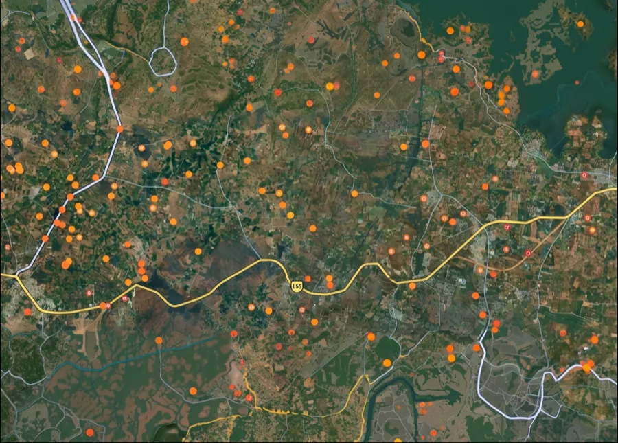
For Land Buyers
Browse all verified lands & plots in Delhi NCR
Every listing goes through our Preliminary Verification Process.
More Layers in Delhi NCR
See all 30 layers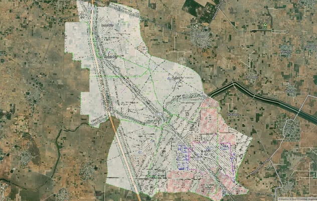
Arogya Dham Badsa Masterplan: Zone Check and Land Use Guide
View Arogya Dham Badsa Masterplan as a live map overlay – check any plot's land use zone for free on 1acre.in. Arogya Dh...
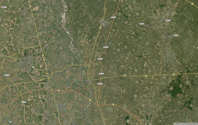
Baghpat Baraut Khekra Masterplan: Zone Check and Land Use Guide
View Bhagpat-Baraut-Khekra Masterplan as a live map overlay – check any plot's land use zone for free on 1acre.in. Baghp...
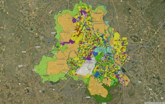
Delhi Master Plan 2041 (MPD-2047): Village List, Zones
Delhi Master Plan 2041 was notified as MPD-2047 in August 2026: see villages, zones A to P, the DDA land use map and PDF...
More Layers in Delhi NCR
Arogya Dham Badsa Masterplan: Zone Check and Land Use Guide
View Arogya Dham Badsa Masterplan as a live map overlay – check any plot's land use zone for free on 1acre.in. Arogya Dh...
Baghpat Baraut Khekra Masterplan: Zone Check and Land Use Guide
View Bhagpat-Baraut-Khekra Masterplan as a live map overlay – check any plot's land use zone for free on 1acre.in. Baghp...
Delhi Master Plan 2041 (MPD-2047): Village List, Zones
Delhi Master Plan 2041 was notified as MPD-2047 in August 2026: see villages, zones A to P, the DDA land use map and PDF...
Frequently Asked Questions
The Development Plan 2031 for Sonipat-Kundli Multifunctional Urban Complex was published as a draft on 25 November 2020 under Gazette No. 176-2020/Ext.; confirm on DTCP Haryana whether the version you rely on is that draft or a final notified plan. It governs 20,220 hectares across 92 sectors. DTCP Haryana administers all CLU, licensing, and building approvals. For land within the controlled area, no development is legal without prior DTCP authorization.
Yes, for any non-agricultural use. The Punjab Scheduled Roads and Controlled Areas Restriction of Unregulated Development Act, 1963, applies across the Sonipat-Kundli controlled area. The Supreme Court in 2025 INSC 419 confirmed that construction without a valid CLU is an unregulated development violation; the absence of a CLU certificate means the plot cannot be regularised after the fact.
On 25 March 2025, the Ministry of Housing and Urban Affairs gave in-principle approval for the 26.5-km Yellow Line extension from Samaypur Badli to Nathupur, covering 21 stations. Haryana is funding 80% of the ₹6,230 crore cost. Land prices near the proposed terminal at Nathupur and in Kundli have already factored in this approval.
Search the DTCP Haryana portal at tcpharyana.gov.in using the district name (Sonipat) and the colony or layout name. All DTCP-licensed colonies are listed. For CLU status, the same portal has a CLU section filtered by district. If the layout or colony does not appear, it is unlicensed and should not be purchased.
At minimum: Jamabandi from the Haryana Jamabandi portal confirming current ownership and mutation; DTCP licence or CLU for the specific survey number; confirmation that the land is in a notified residential sector and not an industrial zone under DDP 2031; and RERA Haryana registration if buying from a developer project.
Not by default. The DDP 2031 designates over 4,940 hectares in Sonipat-Kundli as industrial, much of it along the KMP corridor near Rai, Barhi, and Kharkhoda. Residential development on industrial-zoned land requires a formal CLU from DTCP Haryana. Confirm the specific zone classification for your survey number before assuming residential development rights.
Yes. Plotted developments meeting the applicable threshold must register with Haryana RERA (hrera.org.in). Registration gives buyers statutory rights, including delivery timelines and penalty provisions. Search the RERA portal by project name or promoter name before paying any advance. Unregistered projects in Sonipat carry no binding timeline and offer buyers no legal recourse under the Real Estate Act.
Check before relying on it. DTCP Haryana published the draft Development Plan 2031 for the Sonipat-Kundli Multifunctional Urban Complex on 25 November 2020 for objections. Later reports refer to a Final Development Plan 2031, but its notification could not be confirmed from a readable source for this update. Before using any copy to check a plot's sector and zone, confirm on tcpharyana.gov.in, under Development Plans, district Sonipat, whether it is the draft or the final notified plan.
Not for Sonipat city and Kundli. As of October 2026, DTCP lists no 2041 plan for the Sonipat-Kundli complex, and the Development Plan 2031 applies; confirm on DTCP Haryana whether the version you rely on is the draft or the final plan. In Sonipat district, Kharkhauda (October 2021), Ganaur (August 2022) and Gohana (June 2026) have final 2041 plans. A file sold as a Sonipat master plan 2041 PDF is not a DTCP plan for the city.
On the DTCP Haryana website, tcpharyana.gov.in, under Development Plans, district Sonipat. The entry for the 2031 plan carries the 2020 draft, its existing land use sheets and the plan drawing; check there whether a final notification is listed and which version the drawing belongs to. The site also lists the controlled areas the plan covers.
It is a sales term for land outside the notified controlled areas, where the development plan's zoning does not apply. DTCP publishes no free zone list; it publishes the list of controlled areas instead. Outside them, building along scheduled roads is still restricted under the 1963 Act, and municipal rules apply within city limits, so check the boundary for the exact khasra before buying.
DTCP's list of 37 controlled areas for the 2031 plan names villages including Kundli, Nathupur, Rasoi, Bajidpur, Jakhauli, Sewli, Nangal Kalan, Manoli, Aterna, Khatkar, Bakipur, Dhesra, Janti Khurd, Murthal, Barauli, Jhundpur, Nandnaur, Mehndipur, Basaudi and Dhatauri, along with the areas around Sonepat town. Many are notified around a village school, so confirm whether a specific khasra is inside the boundary.
Source
Official Town and Country Planning Department (DGTCP), Haryana – Sonipat documents
Official Website
tcpharyana.gov.in
Coordinate Reference System
EPSG:4326 (WGS 84)
Geometry Type
Polygon / MultiPolygon
Data Format
Vector (GeoJSON) + Raster Tiles
Last Verified
2026
Status
Active
Was this layer helpful?
Anything wrong, outdated, or missing we want to hear it.