
Delhi-Dehradun Expressway in Uttar Pradesh: route, exits and land rules


Delhi Dehradun Expressway Preview
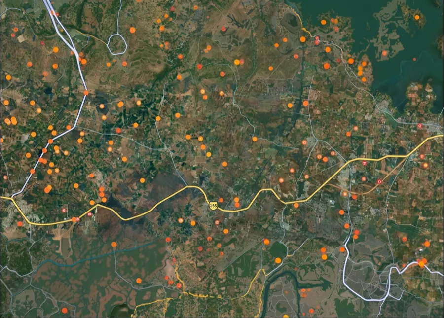
Try the Delhi-Dehradun Expressway in Uttar Pradesh on the map
Sign in once and explore the layer for a full day.
- No card details needed
- Find nearby verified lands for sale
Overview
The Delhi-Dehradun Expressway (NH-709B, officially the Delhi-Saharanpur-Dehradun Economic Corridor) is a 210 km, 4 to 12 lane access-controlled expressway costing approximately Rs 12,000 crore, built in four phases by NHAI under Bharatmala. It runs from Akshardham in Delhi to Asharodi near Dehradun. Most of the route lies in Uttar Pradesh: it enters at the Mandola-Loni border in Ghaziabad district, meets the Eastern Peripheral Expressway at Khekra, and passes Baghpat, Baraut, Shamli and Saharanpur before reaching Ganeshpur at the Uttarakhand border.
Status as of October 2026: the Prime Minister inaugurated the full corridor on 14 April 2026, after the first 32 km from Akshardham to Khekra was reported open to the public in December 2025. The latest update came in July 2026, with repairs after a rain-related cave-in on the Shamli stretch. The 51 km spur to Haridwar was reported to be about 92% complete in June 2026.
Delhi Dehradun Expressway land buying decisions hinge on one fact most brochures avoid: three different state regimes govern land transactions along this single road. This page covers the Uttar Pradesh stretch first, with its entry and exit points, districts, villages and UP conversion rules, then the three-state title rules, the conversion realities, and the corridors where appreciation is real versus speculative.
Delhi-Dehradun Expressway key facts
The table gives the official figures and the dated status of each phase. Phases 1 to 3 run through Delhi and Uttar Pradesh; Phase 4 crosses into Uttarakhand.
Item
Detail
NH number
Usually given as NH-709B (Delhi-Saharanpur-Dehradun Economic Corridor); confirm on signage
Length
213 km per PIB, often quoted as 210 km
Cost
Over Rs 12,000 crore (PIB); Rs 11,868.6 crore reported at inauguration
Lanes and speed
12 lanes on Phase 1, four to six on Phase 4, six elsewhere; 100 km/h limit
Structures
10 interchanges, 3 railway overbridges, 4 major bridges, 12 wayside amenities
Phase 1
Akshardham to Eastern Peripheral Expressway at Khekra, 32 km: reported open since December 2025
Phase 2
Khekra to Saharanpur bypass, 118 km greenfield: open since 14 April 2026
Phase 3
Saharanpur bypass to Ganeshpur, 40 km: open since 14 April 2026
Phase 4
Ganeshpur to Dehradun (Asharodi), 20 km: open since 14 April 2026
Haridwar spur
51 km from Halgoya Mustkam to NH-58: reported about 92% complete in June 2026
UP districts
Ghaziabad, Baghpat, Muzaffarnagar, Shamli, Saharanpur
Item
Detail
NH number
Usually given as NH-709B (Delhi-Saharanpur-Dehradun Economic Corridor); confirm on signage
Length
213 km per PIB, often quoted as 210 km
Cost
Over Rs 12,000 crore (PIB); Rs 11,868.6 crore reported at inauguration
Lanes and speed
12 lanes on Phase 1, four to six on Phase 4, six elsewhere; 100 km/h limit
Structures
10 interchanges, 3 railway overbridges, 4 major bridges, 12 wayside amenities
Phase 1
Akshardham to Eastern Peripheral Expressway at Khekra, 32 km: reported open since December 2025
Phase 2
Khekra to Saharanpur bypass, 118 km greenfield: open since 14 April 2026
Phase 3
Saharanpur bypass to Ganeshpur, 40 km: open since 14 April 2026
Phase 4
Ganeshpur to Dehradun (Asharodi), 20 km: open since 14 April 2026
Haridwar spur
51 km from Halgoya Mustkam to NH-58: reported about 92% complete in June 2026
UP districts
Ghaziabad, Baghpat, Muzaffarnagar, Shamli, Saharanpur
The latest update came in July 2026, after a rain-related cave-in on 1 July on the Shamli stretch, which Amar Ujala placed near Karaunda Mahajan and Khedamastan. The section was repaired, and Amar Ujala reported that the contractor's project manager and the consultant's team leader were removed after an inquiry found quality lapses. NDTV reported in July 2026 that the Centre told Parliament the road is under a 10-year defect liability period, so the contractor bears repair costs.
Delhi-Dehradun Expressway entry and exit points in Uttar Pradesh
The expressway is access-controlled, so you can join or leave it only at interchanges. NHAI counts 10 interchanges on the full corridor, and MoRTH has described 16 entry and exit points in all, including those in Delhi. The table lists the main points in Uttar Pradesh from south to north, with the section lengths NHAI gave when the stretches opened for trials in December 2025.
Entry or exit point
District
Connects to
Distance to next point
Mandola-Loni (Delhi border)
Ghaziabad
Loni, Delhi section
Phase 1 continues to Khekra (32 km from Akshardham)
Khekra
Baghpat
Eastern Peripheral Expressway, Baghpat
27 km to Lohadda
Lohadda
Baghpat
Baraut
30 km to Karaunda Mahajan
Karaunda Mahajan
Shamli
Meerut-Shamli road (NH-709A), Shamli
26 km to Khyawari
Khyawari
Shamli
Hasanpur Luhari area
37 km to the Saharanpur bypass
Saharanpur bypass
Saharanpur
Saharanpur city
About 40 km to Ganeshpur
Halgoya
Saharanpur
Haridwar spur (under construction)
On the Phase 3 stretch
Ganeshpur
Saharanpur
Start of the forest section to Dehradun
20 km to Asharodi
Entry or exit point
District
Connects to
Distance to next point
Mandola-Loni (Delhi border)
Ghaziabad
Loni, Delhi section
Phase 1 continues to Khekra (32 km from Akshardham)
Khekra
Baghpat
Eastern Peripheral Expressway, Baghpat
27 km to Lohadda
Lohadda
Baghpat
Baraut
30 km to Karaunda Mahajan
Karaunda Mahajan
Shamli
Meerut-Shamli road (NH-709A), Shamli
26 km to Khyawari
Khyawari
Shamli
Hasanpur Luhari area
37 km to the Saharanpur bypass
Saharanpur bypass
Saharanpur
Saharanpur city
About 40 km to Ganeshpur
Halgoya
Saharanpur
Haridwar spur (under construction)
On the Phase 3 stretch
Ganeshpur
Saharanpur
Start of the forest section to Dehradun
20 km to Asharodi
The Karaunda Mahajan interchange, often called the Karaunda interchange, sits at about km 56.5 of the Phase 2 alignment, where the Meerut-Shamli road crosses. In 2021, PIB described the major interchanges as serving Haridwar, Muzaffarnagar, Shamli, Yamunanagar, Baghpat, Meerut and Baraut. Plots marketed as expressway-facing gain little unless they sit within easy reach of one of these points.
Delhi-Dehradun Expressway route map and villages in Uttar Pradesh
In Uttar Pradesh the route runs north from the Mandola-Loni border in Ghaziabad district, through Baghpat district past Khekra and Baraut, into Muzaffarnagar and Shamli districts, and on to the Saharanpur bypass and Ganeshpur in Saharanpur district. Phase 2, from Khekra to the Saharanpur bypass, is a new greenfield alignment through farmland, so most villages on it had land acquired for the road.
Villages reported on the alignment include:
District
Villages reported on the route
Baghpat
Katha, Pali, Kashmabad alias Dubhda, Mukarampur, Acharajkheda, Lohadda, Hilwari, Alawalpur
Muzaffarnagar
Biral, Kamruddin Nagar, Fugana, Rajpur Chhajpur
Shamli
Kasampur, Khanpur, Khiyawari, Gogwan Jalalpur
Saharanpur
Baduli Naya Gaon, Halgoya Mustkam, Nainsob Mustkam, Jainpur Mustkam, Rasoolpur Kheri Ahtmal
District
Villages reported on the route
Baghpat
Katha, Pali, Kashmabad alias Dubhda, Mukarampur, Acharajkheda, Lohadda, Hilwari, Alawalpur
Muzaffarnagar
Biral, Kamruddin Nagar, Fugana, Rajpur Chhajpur
Shamli
Kasampur, Khanpur, Khiyawari, Gogwan Jalalpur
Saharanpur
Baduli Naya Gaon, Halgoya Mustkam, Nainsob Mustkam, Jainpur Mustkam, Rasoolpur Kheri Ahtmal
This is a partial list drawn from news reports. The full village-wise record is in the land acquisition notifications issued under Section 3A of the National Highways Act, 1956, published in the Gazette of India and listed on MoRTH's Bhoomirashi land acquisition portal. For a route map, view the alignment and exits on the 1acre map layer, then match your khasra number against the 3A notification for your village. A khasra listed in a 3A notification has been acquired, wholly or in part, for the road.
Regulatory Red Flags Specific to Delhi Dehradun Expressway Land Buyers
Three failures sink most plot deals along this corridor. The first is the three-state title regime Delhi UP Uttarakhand. In Delhi, the Master Plan 2041 governs use through the Delhi Development Authority, and only DDA-allotted or licensed colonies provide a clean residential title. In Uttar Pradesh, agricultural land needs a declaration under Section 80 of the UP Revenue Code, 2006 before it can host residential plotting. Section 80 replaced the old Section 143 conversion under the UP Zamindari Abolition and Land Reforms Act, though brokers still call it a "143". Where the land lies in an area notified under a development authority, the Code requires that authority's prior permission. Layout sanction must come from the Saharanpur Development Authority, the Shamli Town and Country Planning department, or the relevant Awas Vikas scheme. In Uttarakhand, the Mussoorie Dehradun Development Authority handles building permissions in urban areas, while rural and hill parcels fall under state revenue and panchayat administration. The same expressway-facing plot can therefore carry three different document stacks depending on which state it sits in.
The second trap is the Uttarakhand Bhu Kanoon 2025 outsider ban. As reported by Times of India and India Today, the 2025 amendment to the Uttarakhand land law, passed by the Assembly on 21 February 2025 and approved by the Governor (reported on 2 May 2025), prohibits non-domicile buyers from purchasing agricultural or horticultural land in 11 of 13 districts, including Dehradun. Haridwar and Udham Singh Nagar are outside the ban, and the amended law does not extend to areas within municipal corporations, nagar palikas, nagar panchayats and cantonment boards. Residential purchase by outsiders is capped at 250 square metres, one-time only: the buyer files an affidavit with the sub-registrar that neither they nor their family have bought more than 250 square metres for residential use elsewhere in the state. A 500 square metre commercial cap is also often quoted; confirm it in the Act. The discretionary power of the District Magistrate to approve larger outsider purchases has been removed. A digital monitoring portal now tracks every outsider purchase. Affidavit declaration of intended use is mandatory at registration. Misdeclaration triggers a government repossession clause: the land returns to the state. Plots on the Dehradun district side of the Ganeshpur to Asharodi stretch, outside municipal limits, fall squarely under these Bhu Kanoon rules. Ganeshpur itself is in Saharanpur district, Uttar Pradesh.
The third trap is the access-control reality. The expressway has only a limited set of authorised entry-exit points. Phase 1 opens at Akshardham, Geeta Colony, ISBT Dilshad Garden, Khajuri Pusta Marg and Signature Bridge. Further interchanges are at Mandola, Khekra, Loni, Lohadda near Baraut, Karaunda Mahajan, Khyawari, Halgoya, the Saharanpur Bypass, Ganeshpur and Asharodi. NHAI counts 10 interchanges on the full corridor. Plots advertised as "expressway-facing" rarely connect to it directly. Service road provision is partial and concentrated near interchanges.
Use this screen before you transfer any earnest money on a plot in this belt.
Layer
State
Approval Required
Construction Allowed?
DDA-licensed colony
Delhi
DDA / Master Plan 2041
Yes, urban density rules
Awas Vikas / SDA scheme
Uttar Pradesh
UP Town and Country Planning
Yes, with layout sanction
Agricultural land, UP
Uttar Pradesh
Section 80 declaration (old Section 143) + DA sanction
No, without conversion
MDDA layout, Uttarakhand
Uttarakhand
Mussoorie Dehradun DA
Yes, under bylaws
Outsider purchase, Uttarakhand
Uttarakhand
Bhu Kanoon 2025 limits
250 sq m residential cap
Forest / Rajaji buffer
UP and Uttarakhand
MoEF&CC + Forest Dept
Restricted
Elevated wildlife corridor zone
UP and Uttarakhand
Notified eco-sensitive
No new construction
Layer
State
Approval Required
Construction Allowed?
DDA-licensed colony
Delhi
DDA / Master Plan 2041
Yes, urban density rules
Awas Vikas / SDA scheme
Uttar Pradesh
UP Town and Country Planning
Yes, with layout sanction
Agricultural land, UP
Uttar Pradesh
Section 80 declaration (old Section 143) + DA sanction
No, without conversion
MDDA layout, Uttarakhand
Uttarakhand
Mussoorie Dehradun DA
Yes, under bylaws
Outsider purchase, Uttarakhand
Uttarakhand
Bhu Kanoon 2025 limits
250 sq m residential cap
Forest / Rajaji buffer
UP and Uttarakhand
MoEF&CC + Forest Dept
Restricted
Elevated wildlife corridor zone
UP and Uttarakhand
Notified eco-sensitive
No new construction
The minimum legal stack varies by state. In Delhi, a DDA Khasra-mapped sanction and freehold conversion certificate. In UP, a Section 80 declaration (the old Section 143 order) plus development authority layout sanction plus an Awas Vikas or licensed coloniser trail. In Uttarakhand, an MDDA building permit plus, for outsiders, the Bhu Kanoon affidavit and, where a purchase needs permission, state government approval, since district magistrates no longer grant it.
Land checks for plots near the expressway in Uttar Pradesh
Most of the expressway's length, and most plots sold on it, are in Uttar Pradesh. UP has no outsider restriction like Uttarakhand's, but the paperwork is where deals fail. Run these checks before paying a token amount.
Check
Where
Why it matters
Land type in the Khatauni
UP Bhulekh land records
Agricultural land cannot be sold as a residential plot
Section 80 declaration
SDM order, recorded in the Khatauni
Replaced the old Section 143; without it, plotting is not legal
Development authority permission
Authority for the notified area
Required before a Section 80 declaration in a notified development area
Layout and RERA
Development authority, UP RERA
Plotted projects of 500 sq m or eight plots need registration
3A notification
Gazette of India, Bhoomirashi portal
Shows whether the khasra was acquired for the road
Land ceiling
UP Revenue Code, Section 89
Section 89 limits how much land a family can hold through purchase; confirm the current ceiling and exceptions
Distance to an exit
Entry and exit table above
Access control means frontage alone adds little
Check
Where
Why it matters
Land type in the Khatauni
UP Bhulekh land records
Agricultural land cannot be sold as a residential plot
Section 80 declaration
SDM order, recorded in the Khatauni
Replaced the old Section 143; without it, plotting is not legal
Development authority permission
Authority for the notified area
Required before a Section 80 declaration in a notified development area
Layout and RERA
Development authority, UP RERA
Plotted projects of 500 sq m or eight plots need registration
3A notification
Gazette of India, Bhoomirashi portal
Shows whether the khasra was acquired for the road
Land ceiling
UP Revenue Code, Section 89
Section 89 limits how much land a family can hold through purchase; confirm the current ceiling and exceptions
Distance to an exit
Entry and exit table above
Access control means frontage alone adds little
Brokers on this corridor still describe converted land as having a "143". Ask for the Section 80 order itself and a fresh Khatauni showing the declaration, since the Code requires every declaration to be recorded in the record of rights.
Ganeshpur to Asharodi: the stretch near Dehradun
Asharodi is where the expressway reaches Dehradun: the Asharodi check post on the southern edge of Dehradun district, Uttarakhand. The last 20 km, Phase 4, runs from Ganeshpur in Saharanpur district of Uttar Pradesh, reached from the south via Biharigarh, to Asharodi. Most of it is a 12 km elevated road through the Shivalik forest at the edge of Rajaji National Park, followed by a 370 m tunnel near the Daat Kali temple.
Point
State and district
What is there
Biharigarh
UP, Saharanpur
Approach from the Saharanpur side
Ganeshpur
UP, Saharanpur
Start of Phase 4 and the elevated corridor
Daat Kali tunnel
Dehradun end
370 m tunnel, 340 m of it covered
Asharodi check post
Uttarakhand, Dehradun
Exit into Dehradun city
Point
State and district
What is there
Biharigarh
UP, Saharanpur
Approach from the Saharanpur side
Ganeshpur
UP, Saharanpur
Start of Phase 4 and the elevated corridor
Daat Kali tunnel
Dehradun end
370 m tunnel, 340 m of it covered
Asharodi check post
Uttarakhand, Dehradun
Exit into Dehradun city
The Daat Kali to Asharodi section was reported open on all six lanes in February 2025, and the whole stretch opened with the corridor on 14 April 2026. A camera-trap study by NHAI and the Wildlife Institute of India, reported by NDTV in April 2026, recorded 18 wild species, including elephants, using the underpasses between Ganeshpur and Asharodi.
For land, Ganeshpur and most of the forest section are in Uttar Pradesh but lie in the Rajaji eco-sensitive zone, where construction is restricted. Plots at Asharodi fall under Uttarakhand's Bhu Kanoon rules.
Growth Corridors and Micro-Markets on the NH-709B Belt
Not every kilometre of the Delhi Dehradun corridor carries the same upside. The investable belts share three traits: location within 5 to 10 km of an authorised interchange, clean state-specific sanction in the underlying layout, and a confirmed anchor (DDA scheme in Delhi, Awas Vikas scheme in Shamli or Saharanpur, MDDA layout in Dehradun, or an HSIIDC-style industrial estate). Speculative pockets sit on unconverted agricultural land away from interchanges. High-risk pockets sit in Uttarakhand restricted-district stretches for non-domicile buyers, and in Rajaji National Park's eco-sensitive zone.
The table below maps the Baghpat Shamli Saharanpur belt and the Ganeshpur Asharodi Dehradun stretch to drivers and risks.
Corridor / Interchange
State
Growth Driver
Known Risk
Akshardham, Geeta Colony
Delhi
DDA layouts, urban
Pricing already in
Khajuri Pusta, Signature Bridge
Delhi
New entry points, MCD area
Yamuna floodplain proximity
Loni, Mandola Vihar
UP (Ghaziabad / Baghpat)
EPE junction, GDA jurisdiction
Mixed urban-rural sanction
Khekra (EPE junction)
UP (Baghpat)
EPE interchange, logistics
near junction
Baraut, Baghpat town
UP (Baghpat)
District towns, agricultural belt
Section 80 conversion gap
Shamli, Karaunda Mahajan
UP (Shamli)
Sugarcane belt, NH-709A link
Limited DA reach in fringe villages
Saharanpur East Bypass
UP (Saharanpur)
SDA scheme, district HQ
Section 80 plus SDA sanction critical
Saharanpur-Roorkee-Haridwar spur
UP and Uttarakhand
50.7 km Haridwar link, Char Dham access
Reported about 92% complete in June 2026, opening after the main expressway
Ganeshpur (Rajaji edge)
UP (Saharanpur), at the Uttarakhand border
Park entry, tourism
Forest land and eco-sensitive zone
Daat Kali Devi tunnel zone
Uttarakhand
Engineering anchor, scenic
Slope and tunnel-zone construction limits
Asharodi, Dehradun outskirts
Uttarakhand
South Dehradun exit, MDDA
Bhu Kanoon 2025 cap for outsiders
Corridor / Interchange
State
Growth Driver
Known Risk
Akshardham, Geeta Colony
Delhi
DDA layouts, urban
Pricing already in
Khajuri Pusta, Signature Bridge
Delhi
New entry points, MCD area
Yamuna floodplain proximity
Loni, Mandola Vihar
UP (Ghaziabad / Baghpat)
EPE junction, GDA jurisdiction
Mixed urban-rural sanction
Khekra (EPE junction)
UP (Baghpat)
EPE interchange, logistics
near junction
Baraut, Baghpat town
UP (Baghpat)
District towns, agricultural belt
Section 80 conversion gap
Shamli, Karaunda Mahajan
UP (Shamli)
Sugarcane belt, NH-709A link
Limited DA reach in fringe villages
Saharanpur East Bypass
UP (Saharanpur)
SDA scheme, district HQ
Section 80 plus SDA sanction critical
Saharanpur-Roorkee-Haridwar spur
UP and Uttarakhand
50.7 km Haridwar link, Char Dham access
Reported about 92% complete in June 2026, opening after the main expressway
Ganeshpur (Rajaji edge)
UP (Saharanpur), at the Uttarakhand border
Park entry, tourism
Forest land and eco-sensitive zone
Daat Kali Devi tunnel zone
Uttarakhand
Engineering anchor, scenic
Slope and tunnel-zone construction limits
Asharodi, Dehradun outskirts
Uttarakhand
South Dehradun exit, MDDA
Bhu Kanoon 2025 cap for outsiders
The most misunderstood corridor on this belt is the Saharanpur East Bypass to Ganeshpur stretch. Buyers see the new interchange, the upcoming Saharanpur-Roorkee-Haridwar spur, and assume the upside is locked in. They miss that the spur was tendered to Krishna Constellation in December 2021 with later completion than the main expressway (reported about 92% complete in June 2026), that the road touches the Rajaji National Park wildlife corridor at Ganeshpur, and that the eco-sensitive zone limits adjoining construction even where layouts elsewhere have sanction. The second misunderstood pocket is the Asharodi-Dehradun stretch. The corridor terminus delivers genuine value to Dehradun, but Uttarakhand Bhu Kanoon 2025 outsider ban rules cap non-domicile purchases at 250 square metres residential outside municipal limits. Buyers from outside the state are not buying the same product on this stretch that they can buy in Baraut or Saharanpur.
For Land Owners & Agents
Looking to sell your land in Delhi?
I want to sell my land in Delhi
10:32
Plz share your Land's location - We will list it on 1acre map, for Free.
10:32

For Land Buyers
Browse all verified lands & plots in Delhi NCR
Every listing goes through our Preliminary Verification Process.
More Layers in Delhi NCR
See all 30 layers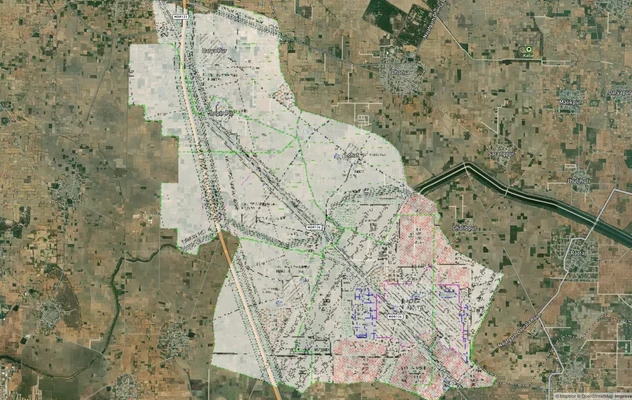
Arogya Dham Badsa Masterplan: Zone Check and Land Use Guide
View Arogya Dham Badsa Masterplan as a live map overlay – check any plot's land use zone for free on 1acre.in. Arogya Dh...
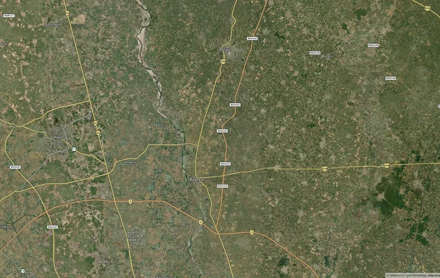
Baghpat Baraut Khekra Masterplan: Zone Check and Land Use Guide
View Bhagpat-Baraut-Khekra Masterplan as a live map overlay – check any plot's land use zone for free on 1acre.in. Baghp...
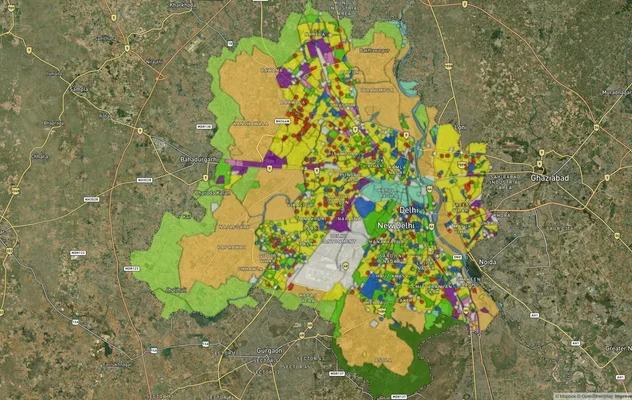
Delhi Master Plan 2041 (MPD-2047): Village List, Zones
Delhi Master Plan 2041 was notified as MPD-2047 in August 2026: see villages, zones A to P, the DDA land use map and PDF...
More Layers in Delhi NCR
Arogya Dham Badsa Masterplan: Zone Check and Land Use Guide
View Arogya Dham Badsa Masterplan as a live map overlay – check any plot's land use zone for free on 1acre.in. Arogya Dh...
Baghpat Baraut Khekra Masterplan: Zone Check and Land Use Guide
View Bhagpat-Baraut-Khekra Masterplan as a live map overlay – check any plot's land use zone for free on 1acre.in. Baghp...
Delhi Master Plan 2041 (MPD-2047): Village List, Zones
Delhi Master Plan 2041 was notified as MPD-2047 in August 2026: see villages, zones A to P, the DDA land use map and PDF...
Frequently Asked Questions
Yes. Prime Minister Narendra Modi inaugurated the full corridor, from Akshardham in Delhi to Dehradun, on 14 April 2026, after the first 32 km from Akshardham to Khekra was reported open to the public in December 2025. Travel time is about 2.5 hours end-to-end. The 51 km spur to Haridwar was reported to be about 92% complete in June 2026.
Delhi uses Master Plan 2041 under DDA. UP requires a Section 80 declaration under the UP Revenue Code, 2006 (the old Section 143 conversion under the Zamindari Abolition and Land Reforms Act) plus development authority layout sanction. Uttarakhand uses MDDA for urban areas and Bhu Kanoon 2025 outsider rules for the rest. The same expressway-facing plot has different document stacks in each state.
No, as the law was reported in February and May 2025. The 2025 amendment, passed in February 2025 and approved by the Governor in May 2025, bars non-domicile buyers from agricultural or horticultural land in 11 of 13 districts, including Dehradun; Haridwar and Udham Singh Nagar are excluded. Outside municipal limits, outsiders can buy up to 250 square metres for residential use, one-time only, with a mandatory affidavit and a state-monitored digital portal.
Yes. The 50.7 km six-lane Saharanpur-Roorkee-Haridwar spur branches off near Halgoya at the 108 km milestone and connects to the Haridwar west ring road at Bahadarabad. It provides direct Char Dham access and is expected to lift values in Roorkee, Bahadarabad and the Haridwar fringes. The spur was reported to be about 92% complete in June 2026.
The 12 km elevated wildlife corridor near Rajaji Tiger Reserve preserves animal movement with 6-metre vertical clearance underneath, sound barriers and light barriers. Adjoining land falls under MoEF&CC eco-sensitive zone limits. Construction is restricted. Plots inside the buffer cannot be developed under standard residential bylaws.
Yes. Baghpat plots fall under GDA or local Town and Country Planning, Shamli plots come under Shamli district town planning, and Saharanpur plots fall under the Saharanpur Development Authority. A Section 80 declaration under the UP Revenue Code, 2006, which replaced Section 143 of the UP Zamindari Abolition and Land Reforms Act, is uniformly required for agricultural-to-residential change.
Yes. UP RERA registration is mandatory for plotted developments of 500 sq m or eight plots and above on the UP stretch. Uttarakhand RERA applies similarly on the Dehradun side. Verification on up-rera.in and uk-rera.in confirms sanction, possession timeline and escrow. Unregistered projects offer no statutory protection.
The 121 km Ambala-Shamli Expressway is a planned 6-lane greenfield project at an estimated cost of Rs 3,700 crore, designed to interchange with NH-709B at Shamli. Tenders were invited in January 2022. Once operational, it will lift Shamli and Saharanpur values by providing direct Haryana access toward Yamunanagar, Karnal and Kurukshetra.
Official project documents identify the Delhi-Dehradun Expressway as NH-709B, the Delhi-Saharanpur-Dehradun Economic Corridor, and MoRTH has referred to the Delhi to Saharanpur section as National Highway 709B. In Uttar Pradesh it runs on this alignment from the Mandola-Loni border through Ghaziabad, Baghpat, Muzaffarnagar, Shamli and Saharanpur districts to Ganeshpur.
From south to north, the main points in Uttar Pradesh are Mandola-Loni, Khekra at the Eastern Peripheral Expressway, Lohadda near Baraut, Karaunda Mahajan on the Meerut-Shamli road, Khyawari in Shamli district, the Saharanpur bypass, Halgoya for the Haridwar spur, and Ganeshpur at the Uttarakhand border. NHAI counts 10 interchanges on the full corridor.
Asharodi is the Dehradun end of the expressway, at the Asharodi check post on the southern edge of Dehradun district in Uttarakhand. The 20 km stretch from Ganeshpur in Saharanpur district to Asharodi includes a 12 km elevated wildlife corridor and a tunnel near the Daat Kali temple. From Asharodi, traffic enters Dehradun city.
The Karaunda Mahajan interchange is on the Uttar Pradesh stretch, where the expressway crosses the Meerut-Shamli road, at about km 56.5 of the Phase 2 alignment in the Shamli belt. It lies 30 km north of Lohadda near Baraut and 26 km south of Khyawari, and gives Shamli and Meerut-side traffic access to the corridor.
Yes. Villages whose land was acquired are listed in the land acquisition notifications issued under Section 3A of the National Highways Act, 1956, published in the Gazette of India and on MoRTH's Bhoomirashi portal. Villages reported on the UP route include Lohadda in Baghpat, Fugana in Muzaffarnagar, Khiyawari in Shamli and Halgoya Mustkam in Saharanpur.
Source
Official National Highways Authority of India (NHAI) documents
Official Website
nhai.gov.in
Coordinate Reference System
EPSG:4326 (WGS 84)
Geometry Type
LineString / MultiLineString
Data Format
Vector (GeoJSON) + Raster Tiles
Last Verified
2026
Status
Active
Was this layer helpful?
Anything wrong, outdated, or missing we want to hear it.