
Gurugram Masterplan 2031: Zone Check and Land Use Guide
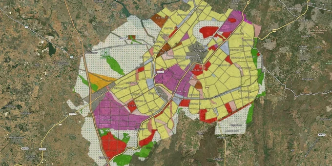

Gurugram Masterplan Preview
Try the Gurugram Masterplan 2031 on the map
Sign in once and explore the layer for a full day.
- No card details needed
- Find nearby verified lands for sale
Overview
The Gurugram Masterplan 2031 is the governing land-use plan for the Gurgaon-Manesar Urban Complex, published by the Town and Country Planning Department, Haryana on 15 November 2012. It covers 33,726 hectares of urbanisable area and targets a population of 42.5 lakh by 2031. Checking Gurgaon zone classification before buying land is not a procedural step, your plot's zone determines what you can legally build, whether a CLU is mandatory, and how easily the land can be financed or transferred. This layer on 1acre requires a Premium subscription and maps masterplan zones directly onto verified listings, so buyers confirm zone status before visiting any site.
CLU Traps and DTCP Violations That Have Cost Gurugram Buyers Their Capital
Gurugram's land market concentrates its fraud at masterplan zone transitions. The gap between a parcel's recorded agricultural status and a broker's verbal claim of "approved residential zone" is precisely where most buyer losses occur, and the courts have documented the pattern in detail.
The table below maps each zone in the Gurugram Masterplan 2031 against the CLU obligation and the legal risk that DTCP and the courts have formally documented.
Zone
Colour Code
Permitted Base Use
CLU Required Before Development?
Documented Risk
Residential
Yellow
Housing, plotted development, group housing
No, if inside a licensed colony
Unauthorized floors, FAR excess, commercial use in residential zone
Commercial
Blue
Offices, malls, business parks
Yes, for non-commercial land
Fake de-licensing orders; illegal conversion
Industrial
Purple
Warehouses, IT parks, hi-tech manufacturing
Yes, for non-industrial land
Illegal commercial activity inside industrial zone
Agricultural / Unzoned
Green / uncoloured
Farming only
Yes, mandatory before any structure
Highest fraud incidence; forged CLU the primary instrument
Aravalli / Eco-Sensitive
Separately notified
Development prohibited
Not grantable under judicial orders
Supreme Court blanket ban in Gurugram, Faridabad, and Mewat since 2009
Zone
Colour Code
Permitted Base Use
CLU Required Before Development?
Documented Risk
Residential
Yellow
Housing, plotted development, group housing
No, if inside a licensed colony
Unauthorized floors, FAR excess, commercial use in residential zone
Commercial
Blue
Offices, malls, business parks
Yes, for non-commercial land
Fake de-licensing orders; illegal conversion
Industrial
Purple
Warehouses, IT parks, hi-tech manufacturing
Yes, for non-industrial land
Illegal commercial activity inside industrial zone
Agricultural / Unzoned
Green / uncoloured
Farming only
Yes, mandatory before any structure
Highest fraud incidence; forged CLU the primary instrument
Aravalli / Eco-Sensitive
Separately notified
Development prohibited
Not grantable under judicial orders
Supreme Court blanket ban in Gurugram, Faridabad, and Mewat since 2009
GMDA change of land use permission is the single regulatory gate between agricultural land and any lawful structure in Gurugram's controlled area. Without it, a building is illegal and subject to demolition under Section 10(2) of the Haryana Development and Regulation of Urban Areas Act, 1975. In the Manesar land scam, the CBI registered a case under IPC sections 420, 465, 467, 468, 471, and 120-B after CLU was granted through forged documents during a lapsed government acquisition process, with 34 individuals chargesheeted. In a separate matter, the Supreme Court ordered an SIT inquiry after a prime Gurugram plot worth over Rs 60 crore was transferred through fake documents, with officials at the Sub-Registrar's office implicated (Pratibha Manchanda vs State of Haryana, 2023 LiveLaw SC 514).
The Punjab and Haryana High Court issued a writ of mandamus directing action against 4,033 unauthorized constructions in DLF City for FAR violations and commercial use in residential zones, noting in its order that a powerful lobby of land mafia groups was operating in connivance with local administration. DTCP also issued over 300 notices in DLF Phase 3 for unauthorized extensions beyond approved building plans. A second category of risk, buying in an unlicensed colony on the assumption that regularization will follow, disqualifies a plot from HUDA services, bank loans, and RERA registration simultaneously. If the seller cannot produce the DTCP licence number, the approved layout plan, and the matching zone colour from the Gurugram Masterplan 2031 for the specific khasra number, treat that as a hard stop, not a negotiating point.
Dwarka Expressway to Sohna Road: Where the Gurugram Masterplan 2031 Draws the Real Value Line
Not every yellow zone in the Gurugram Masterplan 2031 delivers the same return profile. Three corridors, Dwarka Expressway, Golf Course Road, and New Gurgaon, sit at very different points on the infrastructure delivery curve, and understanding which is urbanisable-now versus urbanisable-eventually changes how you price the holding risk on any parcel.
The table below maps the primary growth corridors against their masterplan zone designation, the growth driver behind each, and the risk factor most buyers underestimate.
Corridor
Sectors
Zone (Masterplan 2031)
Growth Driver
Key Risk
Dwarka Expressway
113, 114, 115
Residential (Yellow)
4 km from IGI Airport; direct Delhi connectivity
High entry prices; legacy litigation on some parcels
Golf Course Road
53-57, 65-67
Residential / Commercial (Yellow / Blue)
Premium offices and established luxury housing
Around 71% price appreciation over 5 years creates overvaluation risk
New Gurgaon
Sectors 81-95
Residential (Yellow)
Affordable and mid-range plotted development
Infrastructure lag in the latest sector additions
Global City Gurugram
Sectors 36B-37
Commercial / IT (Blue)
1,080-acre planned IT and commercial hub
Early-stage; operational services pending
Sohna Road / South Gurgaon
70s and 80s
Residential (Yellow)
Southern Peripheral Road; emerging supply
Some parcels fall under South Gurgaon's separate planning jurisdiction
Corridor
Sectors
Zone (Masterplan 2031)
Growth Driver
Key Risk
Dwarka Expressway
113, 114, 115
Residential (Yellow)
4 km from IGI Airport; direct Delhi connectivity
High entry prices; legacy litigation on some parcels
Golf Course Road
53-57, 65-67
Residential / Commercial (Yellow / Blue)
Premium offices and established luxury housing
Around 71% price appreciation over 5 years creates overvaluation risk
New Gurgaon
Sectors 81-95
Residential (Yellow)
Affordable and mid-range plotted development
Infrastructure lag in the latest sector additions
Global City Gurugram
Sectors 36B-37
Commercial / IT (Blue)
1,080-acre planned IT and commercial hub
Early-stage; operational services pending
Sohna Road / South Gurgaon
70s and 80s
Residential (Yellow)
Southern Peripheral Road; emerging supply
Some parcels fall under South Gurgaon's separate planning jurisdiction
The most misunderstood corridor in this masterplan is New Gurgaon, covering Sectors 81 to 95. Buyers see yellow on the GMDA master development plan zone map and assume full urban services are already operational. They are not, not uniformly. The 2031 revision converted former SEZ designations on the northern side of Pataudi Road into new residential and commercial zones, creating sectors 95A, 95B, 89A, 89B, 88A, 88B, and 99A across villages including Wazirpur, Hayatpur, Mohammedpur, and Harsaru. Water, sewerage, and internal road access are still being phased in, with rollout varying block by block. Sohna Road parcels that appear to sit inside the Gurugram Masterplan 2031 boundary require a separate cross-check: some fall under South Gurgaon's independent planning jurisdiction and are not administered by GMDA at all. On 1acre's [LAYER PAGE NEEDED | confirm before linking] Sohna overlay, that jurisdictional boundary is marked clearly. Verify the HUDA residential zone designation and the specific sector block status before signing any agreement, zone colour alone is not sufficient.
Was this layer helpful?
Anything wrong, outdated, or missing we want to hear it.
For Land Owners & Agents
Looking to sell your land in Delhi?
I want to sell my land in Delhi
10:32
Plz share your Land's location - We will list it on 1acre map, for Free.
10:32


For Land Buyers
Browse all verified lands & plots in Delhi NCR
Every listing goes through our Preliminary Verification Process.
More Layers in Delhi NCR
See all 30 layers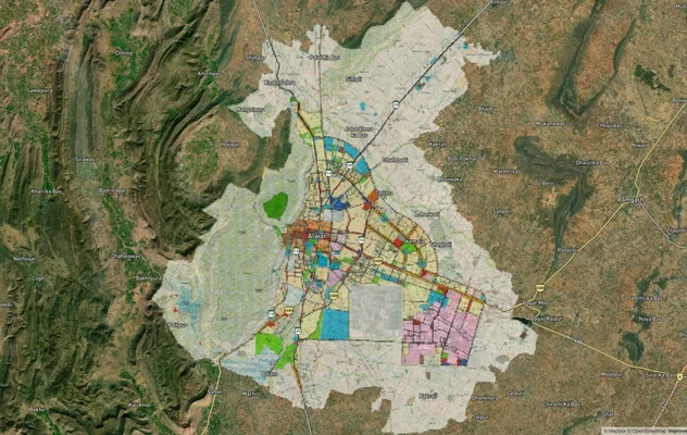
Alwar UIT Masterplan 2031: Zone Check and Land Use Guide
View Alwar Masterplan as a live map overlay – check any plot's land use zone for free on 1acre.in. Alwar Master Plan 205...
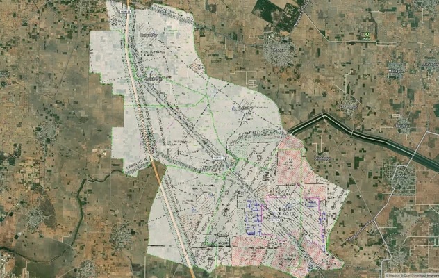
Arogya Dham Badsa Masterplan: Zone Check and Land Use Guide
View Arogya Dham Badsa Masterplan as a live map overlay – check any plot's land use zone for free on 1acre.in. Arogya Dh...
Baghpat Baraut Khekra Masterplan: Zone Check and Land Use Guide
View Bhagpat-Baraut-Khekra Masterplan as a live map overlay – check any plot's land use zone for free on 1acre.in. Baghp...
More Layers in Delhi NCR
Alwar UIT Masterplan 2031: Zone Check and Land Use Guide
View Alwar Masterplan as a live map overlay – check any plot's land use zone for free on 1acre.in. Alwar Master Plan 205...
Arogya Dham Badsa Masterplan: Zone Check and Land Use Guide
View Arogya Dham Badsa Masterplan as a live map overlay – check any plot's land use zone for free on 1acre.in. Arogya Dh...
Baghpat Baraut Khekra Masterplan: Zone Check and Land Use Guide
View Bhagpat-Baraut-Khekra Masterplan as a live map overlay – check any plot's land use zone for free on 1acre.in. Baghp...