Gohana Masterplan 2041: DTCP Zone Check and Land Use Guide
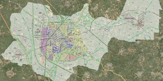
Gohana Masterplan Preview
Try the Gohana Masterplan 2041 on the map
Sign in once and explore the layer for a full day.
- No card details needed
- Find nearby verified lands for sale
Overview
The Gohana Masterplan 2041 is a Draft Development Plan (DDP) prepared by the Department of Town and Country Planning, Haryana (DGTCP), for Gohana town in the Sonipat District. The plan covers the controlled area around Gohana, proposing land use across residential, commercial, industrial, and agricultural zones to guide development through 2041. The map is publicly available on tcpharyana.gov.in. This page covers the draft status and its legal implications for buyers, the key CLU risk that catches buyers off-guard in Gohana, and the road corridors most directly affected by the plan.
Draft Status in Gohana Creates a Specific CLU Trap for Buyers
The Gohana Masterplan 2041 is currently a draft development plan, not a finalized one. That distinction is not a technicality; it changes the rules on the ground. Under Haryana's Punjab Scheduled Roads and Controlled Areas Restriction of Unregulated Development Act, 1963, any construction or colonization within the controlled area around Gohana requires a license from DGTCP Haryana. Brokers routinely sell plots in unlicensed colonies by telling buyers that the DDP zone map will change after finalization. This is the most common fraud pattern in Gohana's periphery villages.
The table below shows what the draft status means practically for each zone category.
Zone Type
Construction Allowed Without CLU?
License Required From
Common Misrepresentation
Residential Zone
No
DGTCP Haryana
Brokers claim "pucca zone" means no permission needed
Commercial Zone
No
DGTCP Haryana
Shown as freehold with no regulatory caveat
Industrial Zone
No
DGTCP / HSIIDC
Marketed as DSIDC-compliant without verification
Agricultural Zone
No
CLU mandatory before any non-farm use
Sold as "conversion ready" without actual CLU
The Supreme Court ruled in February 2026 that a post-facto CLU cannot legalize a development that violated the operative master plan at the time of construction (Harbinder Singh Sekhon v. State of Punjab). If your plot was built in a Gohana agricultural zone without CLU before you bought it, that permission cannot be fixed after the fact, no matter what the seller says.
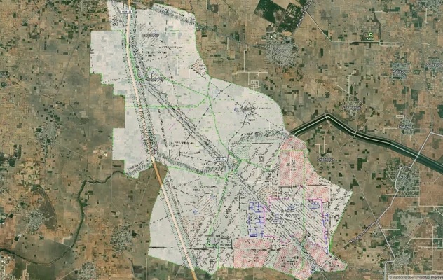
NH-352A and Gohana-Baroda Road: Where the Masterplan 2041 Matters Most to Buyers
Gohana's 2041 plan coincides with two infrastructure projects that directly alter corridor values. NH-352A, the Jind-Gohana-Sonipat four-lane highway under Bharatmala Pariyojana, runs 78.8 km with a proposed 60-meter right-of-way. Land within this corridor's influence falls under the controlled area of the Gohana DDP 2041. Separately, Haryana Minister Dr. Arvind Sharma confirmed in March 2026 that a rail overbridge on Gohana-Mahm Road and a railway underpass on Gohana-Baroda Road have received government approval, directly improving the two most-used land corridors in the plan's expanded area.
The table below maps the key corridors against their planning risk level.
Corridor
Infrastructure Driver
Zone Risk for Buyer
NH-352A belt (Gohana-Sonipat section)
Bharatmala 4-laning, 60m ROW
High: land acquisition risk within 30m of the centerline
Gohana-Mahm Road
Approved Rail Overbridge
Moderate: values rising, unlicensed colonies proliferating
Gohana-Baroda Road
Approved Railway Underpass
Moderate: high buyer interest, CLU gaps common in fringe villages
Core town area
Municipal development
Low: within MC limits, DGTCP CLU rules apply via ULB post-2014
The Gohana-Baroda Road corridor is the most misread. Buyers assume the railway underpass approval means the land is already within the final plan. It is not; the DDP 2041 is still in the draft stage, and agricultural zone land near this corridor still requires a CLU before any residential colony license can be issued.
Was this layer helpful?
Anything wrong, outdated, or missing we want to hear it.
For Land Owners & Agents
Looking to sell your land in Delhi?
I want to sell my land in Delhi
10:32
Plz share your Land's location - We will list it on 1acre map, for Free.
10:32

For Land Buyers
Browse all verified lands & plots in Delhi NCR
Every listing goes through our Preliminary Verification Process.
More Layers in Delhi NCR
See all 30 layers
Alwar UIT Masterplan 2031: Zone Check and Land Use Guide
View Alwar Masterplan as a live map overlay – check any plot's land use zone for free on 1acre.in. Alwar Master Plan 205...
Arogya Dham Badsa Masterplan: Zone Check and Land Use Guide
View Arogya Dham Badsa Masterplan as a live map overlay – check any plot's land use zone for free on 1acre.in. Arogya Dh...

Baghpat Baraut Khekra Masterplan: Zone Check and Land Use Guide
View Bhagpat-Baraut-Khekra Masterplan as a live map overlay – check any plot's land use zone for free on 1acre.in. Baghp...
More Layers in Delhi NCR
Alwar UIT Masterplan 2031: Zone Check and Land Use Guide
View Alwar Masterplan as a live map overlay – check any plot's land use zone for free on 1acre.in. Alwar Master Plan 205...
Arogya Dham Badsa Masterplan: Zone Check and Land Use Guide
View Arogya Dham Badsa Masterplan as a live map overlay – check any plot's land use zone for free on 1acre.in. Arogya Dh...
Baghpat Baraut Khekra Masterplan: Zone Check and Land Use Guide
View Bhagpat-Baraut-Khekra Masterplan as a live map overlay – check any plot's land use zone for free on 1acre.in. Baghp...