Delhi Master Plan 2041: DDA Zone Check and Land Use Guide
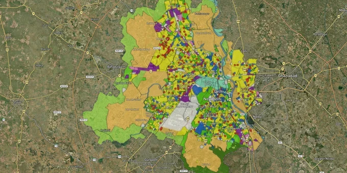
Delhi Masterplan Preview
Try the Delhi Master Plan 2041 on the map
Sign in once and explore the layer for a full day.
- No card details needed
- Find nearby verified lands for sale
Overview
Delhi masterplan land zone classification is governed by the Master Plan for Delhi 2021 (MPD-2021), notified in January 2007. The draft MPD-2041, prepared by the Delhi Development Authority (DDA), received approximately 33,000 public objections after its June 2021 release and remains unnotified by the Ministry of Housing and Urban Affairs as of April 2026. Union Minister Khattar stated in October 2024 that notification was imminent, but the plan continues to await final MoHUA approval. MPD-2021 remains the operative law. Every land transaction in DDA-governed Delhi today is subject to MPD-2021 zone rules, not the 2041 draft. This page covers the operative zone codes, the regulatory traps specific to Delhi NCR, and the corridors where zone-linked appreciation is verifiable.
Dwarka Expressway, YEIDA, and Narela: NCR Corridors Where Delhi Masterplan Land Zones Drive Real Value
The NCR land story splits cleanly into two categories: corridors with confirmed infrastructure behind them and corridors priced on expectation alone. Most buyers conflate the two, and the financial consequences last years. The table below maps the key NCR corridors to their planning authority, because DDA zone rules stop precisely at the NCT Delhi boundary.
Corridor
Planning Authority
Zone or Plan Status
Primary Growth Driver
Key Risk
Dwarka and Dwarka Expressway belt
DDA (Zones K1, K2, G)
Land Pooling zones; aligned with MPD-2041 intent
Urban Extension Road 2 (UER-2) integration, Diplomatic Enclave 2, IGI Airport proximity
Voluntary Land Pooling; possession timelines typically 5+ years after allotment
YEIDA / Yamuna Expressway belt
YEIDA (separate UP authority)
YEIDA sector masterplan; not DDA governed
Noida International Airport (Jewar) construction; industrial and logistics park growth
YEIDA is a distinct authority; DDA rules and protections do not apply
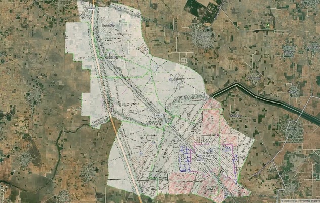
Narela sub-city
DDA (Zone P-II)
DDA development area; affordable housing schemes
RRTS connectivity, planned sub-city infrastructure rollout
Development pace historically slow; infrastructure delivery has lagged timelines
Sonipat and Bahadurgarh (NCR fringe)
DGTCP Haryana
DGTCP controlled area plans
Namo Bharat RRTS corridor; industrial expansion from Delhi's northern border
Multi-authority overlaps; confirm whether the plot falls within the DGTCP controlled zone
Sohna and New Gurgaon
GMDA / HRERA
Haryana DTCP sectoral plans
Golf Course Extension Road corporate growth; IMT Sohna
Entirely different regulatory framework from Delhi DDA; governed by HRERA, not DDA
Corridor
Planning Authority
Zone or Plan Status
Primary Growth Driver
Key Risk
Dwarka and Dwarka Expressway belt
DDA (Zones K1, K2, G)
Land Pooling zones; aligned with MPD-2041 intent
Urban Extension Road 2 (UER-2) integration, Diplomatic Enclave 2, IGI Airport proximity
Voluntary Land Pooling; possession timelines typically 5+ years after allotment
YEIDA / Yamuna Expressway belt
YEIDA (separate UP authority)
YEIDA sector masterplan; not DDA governed
Noida International Airport (Jewar) construction; industrial and logistics park growth
YEIDA is a distinct authority; DDA rules and protections do not apply
Narela sub-city
DDA (Zone P-II)
DDA development area; affordable housing schemes
RRTS connectivity, planned sub-city infrastructure rollout
Development pace historically slow; infrastructure delivery has lagged timelines
Sonipat and Bahadurgarh (NCR fringe)
DGTCP Haryana
DGTCP controlled area plans
Namo Bharat RRTS corridor; industrial expansion from Delhi's northern border
Multi-authority overlaps; confirm whether the plot falls within the DGTCP controlled zone
Sohna and New Gurgaon
GMDA / HRERA
Haryana DTCP sectoral plans
Golf Course Extension Road corporate growth; IMT Sohna
Entirely different regulatory framework from Delhi DDA; governed by HRERA, not DDA
The most misunderstood corridor is YEIDA. Because "Delhi NCR" functions as a loose marketing term, buyers regularly purchase land in YEIDA sectors expecting DDA masterplan governance. That governance does not exist there. YEIDA operates under its own masterplan, under a Uttar Pradesh authority, with distinct zone codes and different building regulations. Confirm jurisdiction before reading any masterplan layer.
Was this layer helpful?
Anything wrong, outdated, or missing we want to hear it.
For Land Owners & Agents
Looking to sell your land in Delhi?
I want to sell my land in Delhi
10:32
Plz share your Land's location - We will list it on 1acre map, for Free.
10:32

For Land Buyers
Browse all verified lands & plots in Delhi NCR
Every listing goes through our Preliminary Verification Process.
More Layers in Delhi NCR
See all 30 layers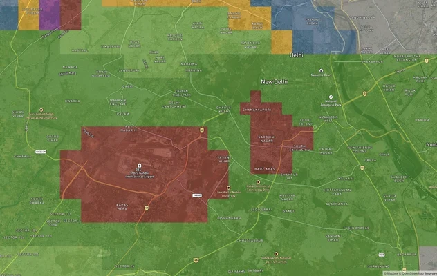
Delhi Air Funnel Zones: Building Height Restrictions
View Delhi Air Funnel Zones on a live map – check height clearance restrictions on any plot for free on 1acre.in. Delhi ...

Alwar UIT Masterplan 2031: Zone Check and Land Use Guide
View Alwar Masterplan as a live map overlay – check any plot's land use zone for free on 1acre.in. Alwar Master Plan 205...
Arogya Dham Badsa Masterplan: Zone Check and Land Use Guide
View Arogya Dham Badsa Masterplan as a live map overlay – check any plot's land use zone for free on 1acre.in. Arogya Dh...
More Layers in Delhi NCR
Delhi Air Funnel Zones: Building Height Restrictions
View Delhi Air Funnel Zones on a live map – check height clearance restrictions on any plot for free on 1acre.in. Delhi ...
Alwar UIT Masterplan 2031: Zone Check and Land Use Guide
View Alwar Masterplan as a live map overlay – check any plot's land use zone for free on 1acre.in. Alwar Master Plan 205...
Arogya Dham Badsa Masterplan: Zone Check and Land Use Guide
View Arogya Dham Badsa Masterplan as a live map overlay – check any plot's land use zone for free on 1acre.in. Arogya Dh...