Ambala - Shamli Expressway
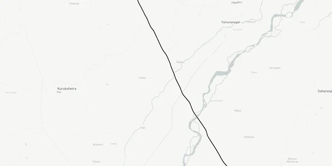
Ambala Shamli Expressway Preview
Try the Ambala - Shamli Expressway on the map
Sign in once and explore the layer for a full day.
- No card details needed
- Find nearby verified lands for sale
Overview
The Ambala Shamli Expressway land corridor covers 121.78 kilometres of six-lane greenfield access-controlled highway, running from Sadopur village in Ambala district to Gogwan Jalalpur in Shamli district, where it connects to the Delhi Dehradun Expressway. Part of the 450-kilometre Bareilly Ludhiana Economic Corridor under Bharatmala Pariyojana, it passes through Ambala, Kurukshetra, Karnal, and Yamunanagar districts in Haryana, then Saharanpur and Shamli in Uttar Pradesh. Total land acquisition covers approximately 750 hectares across six districts. Construction is active and the Haryana government has confirmed a December 2026 completion target.
The total project cost is approximately Rs 4,600 crore, including civil construction across three EPC (Engineering, Procurement and Construction) packages awarded in 2022.
What Buyers Near the Sadopur to Gogwan Jalalpur Corridor Must Verify
Construction is moving. Approach roads, overbridges and road-laying work were actively underway in January 2026 across the Haryana stretch, and Shamli district was at 40% completion as of November 2024; overall project completion is targeted for December 2026 per NHAI officials. That progress also means brokers are selling corridor plots as though the road is already open.
Three risks are specific to this greenfield alignment and do not apply generically to other Haryana highways.
The first is Right of Way encroachment. This is a fully greenfield corridor through agricultural land between Sadopur and Gogwan Jalalpur. The expressway has no existing road to follow, so the ROW boundary has been cut through fields. NHAI's acquisition schedule covers approximately 750 hectares. Plots advertised as "adjacent to the expressway" sometimes sit partly within that notified boundary. Pull the khasra number from the Haryana land records portal and cross-check against the NHAI acquisition notification for the relevant package before signing.
The second is the Barara spur misrepresentation. The expressway route includes a spur from Barara to NH 344 by upgrading HR-SH4. Brokers in the Barara belt are pricing agricultural plots as if this spur puts them directly on a major interchange. The spur is a state highway upgrade, not a greenfield expressway intersection. Treat land near the Barara spur separately from land at the main alignment interchanges.
The table below identifies the specific risk by segment for land near the expressway Ambala to Shamli corridor.
Segment
Districts
Construction Status
Primary Land Risk
Sadopur to Ranipur Barsi
Ambala, Kurukshetra
Active, road laying underway
ROW boundary through agricultural fields
Ranipur Barsi to Adhoya Musalman
Yamunanagar, Karnal
Under construction
HR-SH4 spur misread as interchange land
Adhoya Musalman to Chandro
Karnal, Saharanpur (UP)
Under construction
Yamuna river bridge section; adjacent low-lying land at flood risk
Chandro to Gogwan Jalalpur
Shamli (UP)
40% complete as of Nov 2024
Delhi Dehradun Expressway interchange speculation overpricing
The Gogwan Jalalpur interchange with the Delhi Dehradun Expressway is the single most overpriced node on this corridor. The Delhi Dehradun Expressway opened in April 2026. That event has reset price expectations in Shamli district significantly upward. If you are buying in Gogwan Jalalpur or Thanabhawan, verify that the plot has a sanctioned layout from the Shamli district authority and is not simply agricultural land sold on the back of interchange proximity.
Where the Real Demand Will Land: Saha, Radaur and the Haryana Bypass Towns
The Ambala Shamli Expressway land corridor produces a different land market in Haryana than the UP end. In Haryana, the expressway runs as a bypass of established towns: Saha gets a southwestern bypass, Barara gets a southwestern bypass, and Radaur is bypassed to its west. That pattern matters because bypass land near small industrial towns typically attracts logistics and warehousing demand first, residential demand second.
The Saha Growth Centre is the most consequential node on the Haryana side. The state government widened Ambala Saha Road at 23 km from NH 152D specifically to improve access to this industrial zone, and a plan to purchase 2,300 acres to expand the development centre is on record. The expressway's Saha bypass brings the Growth Centre into a dual-access corridor: NH 152D on one side and the new expressway on the other. Land between these two roads, with clear title and a sanctioned approach from either highway, is the most defensible long-term play in this section.
The table below gives the realistic investment profile for the four main pockets along the Haryana stretch.
Corridor Pocket
District
Growth Driver
Hold Period
Watch-Out
Saha bypass zone
Ambala
Saha Growth Centre dual-access
3-5 years
Confirm distance from Growth Centre boundary
Barara bypass belt
Ambala
NH 344 spur connectivity
4-6 years
Spur is SH upgrade, not greenfield interchange
Radaur bypass west
Yamunanagar
Kurukshetra proximity, agri-logistics
4-6 years
Yamuna river flood zone adjacency
Gangoh eastern bypass
Saharanpur (UP)
Saharanpur industrial corridor
5-7 years
Separate UP land records check required
Radaur is the most misread corridor pocket on this expressway. Brokers cite Kurukshetra proximity and the spiritual tourism angle. The real driver is agri-logistics, given Radaur's position between Yamuna River crossings and Karnal district's agriculture belt. That is a slower, more industrial demand cycle than residential. Buy for warehousing and cold storage adjacency, not residential appreciation, and only after confirming the plot sits above the Yamuna flood plain level.
Was this layer helpful?
Anything wrong, outdated, or missing we want to hear it.
For Land Owners & Agents
Looking to sell your land in Uttar Pradesh?
I want to sell my land in Ayodhya
10:32
Plz share your Land's location - We will list it on 1acre map, for Free.
10:32

For Land Buyers
Browse all verified lands & plots in Uttar Pradesh
Every listing goes through our Preliminary Verification Process.
More Layers in Uttar Pradesh
See all 29 layers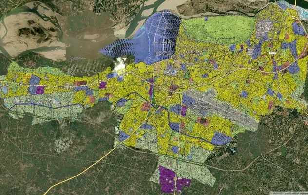
Ayodhya Masterplan
View Ayodhya Masterplan as a live map overlay – check any plot's land use zone for free on 1acre.in. Ayodhya masterplan ...
Lucknow Masterplan
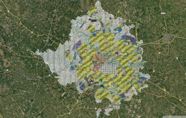
View Lucknow Masterplan as a live map overlay – check any plot's land use zone for free on 1acre.in. Lucknow masterplan ...
Varanasi Masterplan
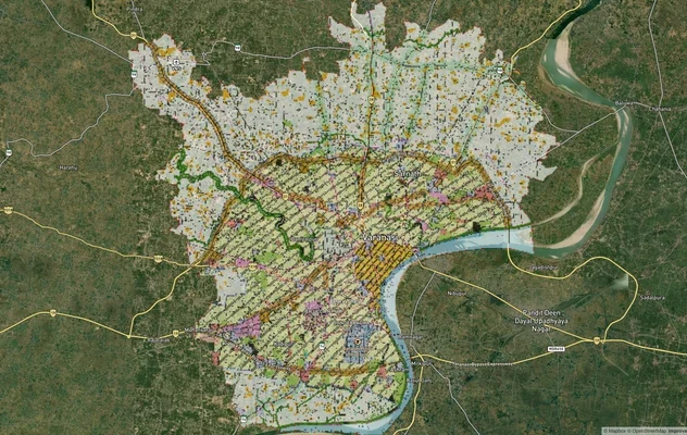
View Varanasi Masterplan as a live map overlay – check any plot's land use zone for free on 1acre.in. VDA Master Plan 20...
More Layers in Uttar Pradesh
Ayodhya Masterplan
View Ayodhya Masterplan as a live map overlay – check any plot's land use zone for free on 1acre.in. Ayodhya masterplan ...
Lucknow Masterplan
View Lucknow Masterplan as a live map overlay – check any plot's land use zone for free on 1acre.in. Lucknow masterplan ...
Varanasi Masterplan
View Varanasi Masterplan as a live map overlay – check any plot's land use zone for free on 1acre.in. VDA Master Plan 20...