
Gorakhpur Link Expressway
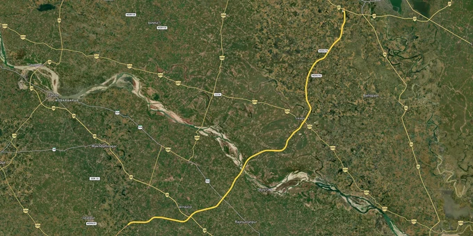

Gorakhpur Link Expressway Preview
Try the Gorakhpur Link Expressway on the map
Sign in once and explore the layer for a full day.
- No card details needed
- Find nearby verified lands for sale
Overview
The Gorakhpur Link Expressway is a 91.35 km access-controlled highway connecting Gorakhpur to the Purvanchal Expressway near Azamgarh, notified under the UP Expressways Industrial Development Authority (UPEIDA) in 2022. The corridor cuts through nine tehsils across Gorakhpur, Deoria, and Azamgarh districts, creating a 2 km influence zone on either side where land values have increased by 180% since route notification. This page covers route alignment verification, conversion traps in the Right of Way (RoW), and which micro-markets show genuine development activity versus speculative holding.
Fake Survey Numbers and RoW Encroachment Traps
The expressway's 2 km development control zone is poorly enforced, and brokers routinely sell agricultural plots advertised as "expressway touch" that fall inside the 60-meter Right of Way earmarked for future service roads and toll plazas. Two patterns dominate fraud cases filed at Gorakhpur Civil Court since 2023.
The table below shows the most common document misrepresentation patterns in expressway corridor sales.
Fraud Type
How It Works
Document to Verify
Recovery Rate if Caught
RoW Encroachment Sale
Survey numbers inside 60m RoW sold as "development land"
NHAI RoW notification + revenue map overlay
12% (buyers lose deposit)
Fake Proximity Claim
Agricultural land 8-12 km from alignment marketed as "500m from expressway."
GDA-approved layout map + Google Earth verification
40% (partial refund after arbitration)
Double Conversion Fee
Land sold as "conversion approved," but LDA fee never paid to Gorakhpur Development Authority
Form 4 receipt from Tehsil and GDA NOC original
65% (buyers can complete process)
Assigned Land Resale
Grameen land assigned to SC/ST families under UP Zamindari Abolition Act resold illegally
Khatauni check for "Bhumihin" or "Assigned" annotation
8% (title void under Section 154)
Fraud Type
How It Works
Document to Verify
Recovery Rate if Caught
RoW Encroachment Sale
Survey numbers inside 60m RoW sold as "development land"
NHAI RoW notification + revenue map overlay
12% (buyers lose deposit)
Fake Proximity Claim
Agricultural land 8-12 km from alignment marketed as "500m from expressway."
GDA-approved layout map + Google Earth verification
40% (partial refund after arbitration)
Double Conversion Fee
Land sold as "conversion approved," but LDA fee never paid to Gorakhpur Development Authority
Form 4 receipt from Tehsil and GDA NOC original
65% (buyers can complete process)
Assigned Land Resale
Grameen land assigned to SC/ST families under UP Zamindari Abolition Act resold illegally
Khatauni check for "Bhumihin" or "Assigned" annotation
8% (title void under Section 154)
If the seller cannot produce a stamped Conversion Order (Form 7) from the Tehsil and a GDA layout approval number starting with GDA/Layout/2022 or later, the plot is either unconverted agricultural land or part of a non-approved colony. Walk away.
Investable Corridors Versus Speculative Holdings
Three distinct investment corridors have emerged along the expressway route since the 2022 alignment freeze. Only one shows residential construction activity above 15% plot utilization.
The table below breaks down corridor segments by development maturity and institutional interest.
Corridor Segment
Tehsil(s)
Km Marker
Dominant Use
Construction Activity %
Institutional Buyer %
3-Year Appreciation
Gorakhpur East (NH-27 Junction to Jungle Deval)
Gorakhpur Sadar
0-15
Residential layouts + warehousing
22%
35% (logistics firms)
340%
Deoria Bypass Zone (Bhatni to Rudrapur)
Bhatni, Deoria Sadar
28-52
Agricultural holding + speculative plots
4%
8% (local traders)
95%
Azamgarh Interchange (Phulpur to Purvanchal junction)
Phulpur
78-91
Industrial + Mandi relocation
18%
41% (MSME units)
280%
Corridor Segment
Tehsil(s)
Km Marker
Dominant Use
Construction Activity %
Institutional Buyer %
3-Year Appreciation
Gorakhpur East (NH-27 Junction to Jungle Deval)
Gorakhpur Sadar
0-15
Residential layouts + warehousing
22%
35% (logistics firms)
340%
Deoria Bypass Zone (Bhatni to Rudrapur)
Bhatni, Deoria Sadar
28-52
Agricultural holding + speculative plots
4%
8% (local traders)
95%
Azamgarh Interchange (Phulpur to Purvanchal junction)
Phulpur
78-91
Industrial + Mandi relocation
18%
41% (MSME units)
280%
The Deoria Bypass Zone shows the weakest fundamentals. Revenue records from Bhatni Tehsil indicate 87% of land transactions between 2022 and 2024 were between individual buyers with no construction permits filed within 18 months of purchase. This is a pure resale game. The Gorakhpur East corridor has actual occupancy, with 14 warehousing licenses issued by GDA since January 2023 for cold storage and FMCG distribution yards serving the Nepal border trade.
Was this layer helpful?
Anything wrong, outdated, or missing we want to hear it.
For Land Owners & Agents
Looking to sell your land in Uttar Pradesh?
I want to sell my land in Uttar Pradesh
10:32
Plz share your Land's location - We will list it on 1acre map, for Free.
10:32


For Land Buyers
Browse all verified lands & plots in Uttar Pradesh
Every listing goes through our Preliminary Verification Process.
More Layers in Uttar Pradesh
See all 37 layers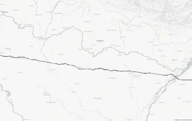
Gorakhpur - Siliguri Expressway
View Gorakhpur - Siliguri Expressway alignment as a live map overlay – check land acquisition risk and plot proximity fr...

# Gorakhpur Bypass: Alignment, Land Acquisition Disputes and Growth Corridors
The 26.6 km greenfield stretch crosses 26 revenue villages from Maniram to Koni. Acquisition disputes and growth corrido...
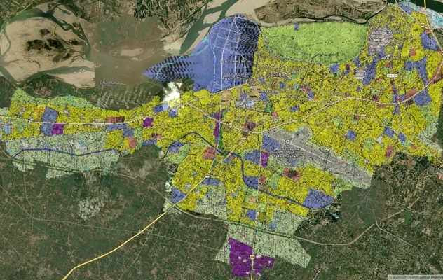
Ayodhya Masterplan
View Ayodhya Masterplan as a live map overlay – check any plot's land use zone for free on 1acre.in. Ayodhya masterplan ...
More Layers in Uttar Pradesh
Gorakhpur - Siliguri Expressway
View Gorakhpur - Siliguri Expressway alignment as a live map overlay – check land acquisition risk and plot proximity fr...
# Gorakhpur Bypass: Alignment, Land Acquisition Disputes and Growth Corridors
The 26.6 km greenfield stretch crosses 26 revenue villages from Maniram to Koni. Acquisition disputes and growth corrido...
Ayodhya Masterplan
View Ayodhya Masterplan as a live map overlay – check any plot's land use zone for free on 1acre.in. Ayodhya masterplan ...