
Lucknow Outer Ring Road (Kisan Path): route map, villages and land checks


Lucknow Outer Ring Road Preview
Try the Lucknow Outer Ring Road (Kisan Path) on the map
Sign in once and explore the layer for a full day.
- No card details needed
- Find nearby verified lands for sale
Overview
The Lucknow Outer Ring Road, numbered NH-230 and popularly called Kisan Path, is a 104 km circumferential national highway around Lucknow. It links the radial roads to Sultanpur, Raebareli, Kanpur, Hardoi, Sitapur and Ayodhya (Faizabad) at the city edge and connects with the Lucknow-Agra Expressway. It covers 43 villages in Lucknow and 61 villages in Barabanki, with the foundation laid in 2016 and full inauguration in March 2024. Roughly 1,500 acres of farmland were acquired across both districts, and the road now crosses five national and six state highways at the city periphery.
Lucknow Outer Ring Road land buying decisions begin with a fact most brokers rush past: a plot near the road is not a plot approved for building. The Lucknow Development Authority (LDA) governs land use within the Lucknow Master Plan 2031, which covers over 71,000 hectares and integrates 197 villages. This page covers the route map, the villages along the road, the zone rules, the LDA approvals that matter, and the corridors where appreciation is real versus speculative.
Lucknow Outer Ring Road (Kisan Path) route map
The Lucknow Outer Ring Road is a closed loop around the city, so the useful way to read its route map is by the radial roads it crosses. Each crossing is an access point and a pricing node for land nearby. The 2016 foundation announcement listed the roads below, in this order. You can view the full alignment on the 1acre map layer and check how far a survey number sits from it.
No.
Road crossed or connected
1
Sultanpur Road
2
Nagram Road
3
Raebareli Road
4
Kanpur Road
5
Mohan Road
6
Hardoi Road
7
Sitapur Road
8
Kursi Road
9
Dewa Road
10
Lucknow-Agra Expressway
No.
Road crossed or connected
1
Sultanpur Road
2
Nagram Road
3
Raebareli Road
4
Kanpur Road
5
Mohan Road
6
Hardoi Road
7
Sitapur Road
8
Kursi Road
9
Dewa Road
10
Lucknow-Agra Expressway
Reports at completion also describe a cloverleaf interchange where the ring road meets Ayodhya (Faizabad) Road.
The road was announced as 94 km in 2016 and described as 104 km when it was completed in 2024. The 2016 plan provided for 8 flyovers, 5 railway overbridges, 4 large and 42 small bridges, 26 vehicle underpasses, 3 pedestrian underpasses and 2 interchanges. Local reports just before opening counted about 150 exit points and a cloverleaf interchange at Ayodhya Road. The Prime Minister dedicated three four-lane packages of the Lucknow Ring Road on 10 March 2024.
Distances along the ring road matter more than distance to the city centre. A plot 500 metres from an interchange gains access; a plot the same distance from a stretch with no exit may not.
Villages along the Lucknow Outer Ring Road
The ring road touches two districts. It covers 43 villages in Lucknow district and 61 in Barabanki district, about 104 in all. Several localities on or near the alignment come up repeatedly in LDA enforcement and scheme records.
District
Villages on the alignment
Localities in LDA enforcement and scheme records
Where the official list is published
Lucknow
43
Mohanlalganj, Gosainganj, Dubagga, Sairpur, Mohan Road
NHAI land acquisition notifications under the National Highways Act, 1956, in the Gazette of India; LDA Master Plan 2031 village list
Barabanki
61
—
NHAI land acquisition notifications in the Gazette of India; Barabanki district land records
District
Villages on the alignment
Localities in LDA enforcement and scheme records
Where the official list is published
Lucknow
43
Mohanlalganj, Gosainganj, Dubagga, Sairpur, Mohan Road
NHAI land acquisition notifications under the National Highways Act, 1956, in the Gazette of India; LDA Master Plan 2031 village list
Barabanki
61
—
NHAI land acquisition notifications in the Gazette of India; Barabanki district land records
A full village-by-village list is not published by the LDA as text. The authoritative record is the set of NHAI notifications that list each village with its khasra (plot) numbers, and the district collector's award for each village. For a single plot, a faster check is to open the LDA One Map portal or the LDA master plan map, enter the khasra number, and confirm both the zone and whether the plot sits in any acquired-land schedule.
Being in a ring road village does not make a plot approved. Inclusion in Master Plan 2031 and LDA layout sanction are separate steps, covered in the next section.
Regulatory Red Flags Specific to NH-230 Land Buyers
Three failures sink most plot deals along this corridor. The first is buying outside an LDA approved layout. The Master Plan 2031 brought 197 surrounding villages into the planning area, but inclusion in the plan does not equal approval to plot. LDA layout sanction, a separate Khasra-mapped building plan and a Completion Certificate are three distinct documents. A plot registered at the sub-registrar's office is not automatically legal, as residents in the Mohan Road belt discovered when bulldozers arrived in December 2025. The LDA demolished structures across an area its records still classify as Anant Nagar Housing Scheme acquired land. Six petitioners are currently before the Allahabad High Court contesting the absence of individual notice, with the underlying dispute hinging on when the LDA formally entered the area versus when sales and registrations took place.
The second trap is unauthorised plotting on agricultural land. In November 2025, the LDA bulldozed 10 illegal plotting sites across Gosainganj, Dubagga and adjoining areas. Around 50 bighas in Gosainganj alone were cleared. The pattern is consistent: farmers or middlemen carve agricultural land into 1,000 square foot plots, sell through registered sale deeds, but never obtain LDA layout sanction or Master Plan zone clearance. The buyer holds a registry but no Khata, no building plan and no protection against demolition. Over 46,000 people in Lucknow have been documented as victims of illegal plotting, which is why the GIS-based Master Plan portal was launched.
The third trap is missing UP RERA registration. Any plotted development of 500 square metres or more, or any layout with eight or more plots, must be RERA-registered. A plot sold from a non-registered project carries no statutory protection under the Real Estate (Regulation and Development) Act, 2016. RERA registration is verifiable on the up-rera.in portal in minutes, yet buyers routinely skip this check on cheaper peri-urban plots near Kisan Path and Faizabad Road.
Use this screen before you transfer any earnest money on a plot in this belt.
Zone Code
Permitted Use
Requires LDA Approval?
Construction Allowed?
Residential (R1, R2)
Plotted housing, apartments
Yes, layout sanction needed
Yes, with building plan
Mixed Use
Residential and limited commercial
Yes
Yes, subject to FAR
Commercial
Retail, office, hospitality
Yes
Yes, separate clearances
Industrial
Manufacturing, warehousing
Yes, plus UPSIDA where applicable
Yes
Agricultural
Farming only
Conversion required for resale
Construction prohibited without conversion
Green / Eco-sensitive
Parks, water bodies, river buffer
Not for development
Layouts illegal
Transit Influence Zone
500 m on either side of metro alignment
Higher FAR under TOD Policy 2022
Yes, with TOD norms
Zone Code
Permitted Use
Requires LDA Approval?
Construction Allowed?
Residential (R1, R2)
Plotted housing, apartments
Yes, layout sanction needed
Yes, with building plan
Mixed Use
Residential and limited commercial
Yes
Yes, subject to FAR
Commercial
Retail, office, hospitality
Yes
Yes, separate clearances
Industrial
Manufacturing, warehousing
Yes, plus UPSIDA where applicable
Yes
Agricultural
Farming only
Conversion required for resale
Construction prohibited without conversion
Green / Eco-sensitive
Parks, water bodies, river buffer
Not for development
Layouts illegal
Transit Influence Zone
500 m on either side of metro alignment
Higher FAR under TOD Policy 2022
Yes, with TOD norms
Apartments are now permitted on plots as small as 200 square metres under Master Plan 2031, but only where the abutting road width is at least 9 metres. This is a hard threshold, not a guideline, and it is enforced at the building plan approval stage.
Growth Corridors and Micro-Markets on the NH-230 Belt
Not every kilometre of the ring road carries the same upside. The investable corridors share three traits: LDA sanction in the underlying layout, alignment with an announced Master Plan 2031 scheme, and a confirmed feeder road from the ring road itself. Speculative pockets miss at least one of these. High-risk pockets sit inside acquired-but-disputed LDA scheme areas like Anant Nagar, or on unauthorised farm plottings in Gosainganj and Dubagga.
The table below maps each major Kisan Path Faizabad Road plot belt and each Sultanpur Road IT City catchment to its driver and the specific risk that follows it.
Corridor / Locality
Authority
Growth Driver
Known Risk
Kisan Path (between Sultanpur and Faizabad Roads)
LDA
First operational ring road stretch
Pricing already in
Sultanpur Road
LDA, UPSIDC
IT City, Wellness City, land pooling
Pooling negotiation pending in some pockets
Mohan Road
LDA
Anant Nagar Housing Scheme (~800 acres)
Pending HC writ on demolitions
Faizabad Road (NH-27)
LDA
Airport spillover, Gomti Nagar Extn
High base price
Sitapur Road (NH-24)
LDA
Northern industrial belt, IIM Road
Recent ring road completion
Raebareli Road (NH-30)
LDA
South corridor, defence sector links
Slower urbanisation
Kanpur Road
LDA
Existing density, Scooters India belt
Limited fresh layouts
Gosainganj and Dubagga
LDA
Affordable peri-urban land
Active demolition of illegal plottings
Hardoi Road (SH-40)
LDA
Newest residential push
Thin LDA scheme presence
Corridor / Locality
Authority
Growth Driver
Known Risk
Kisan Path (between Sultanpur and Faizabad Roads)
LDA
First operational ring road stretch
Pricing already in
Sultanpur Road
LDA, UPSIDC
IT City, Wellness City, land pooling
Pooling negotiation pending in some pockets
Mohan Road
LDA
Anant Nagar Housing Scheme (~800 acres)
Pending HC writ on demolitions
Faizabad Road (NH-27)
LDA
Airport spillover, Gomti Nagar Extn
High base price
Sitapur Road (NH-24)
LDA
Northern industrial belt, IIM Road
Recent ring road completion
Raebareli Road (NH-30)
LDA
South corridor, defence sector links
Slower urbanisation
Kanpur Road
LDA
Existing density, Scooters India belt
Limited fresh layouts
Gosainganj and Dubagga
LDA
Affordable peri-urban land
Active demolition of illegal plottings
Hardoi Road (SH-40)
LDA
Newest residential push
Thin LDA scheme presence
The most misunderstood corridor on this belt is Mohan Road. Buyers see the new connectivity from the ring road, the proximity to the Lucknow-Kanpur Expressway alignment, and assume the upside is locked in. They miss that the Anant Nagar Housing Scheme covers roughly 800 acres of LDA-acquired land along this stretch, and that registered sales from before the LDA's formal entry are now being challenged through demolition action. If a broker shows you a Mohan Road plot, ask for the Khasra number, cross-check it on the LDA Land Use Portal, and confirm it sits outside the Anant Nagar acquired-land schedule before any discussion of price. The second misunderstood corridor is Sultanpur Road. The IT City and Wellness City announcements are real, and the land pooling policy (549-plus plots in its original structure) has moved to allotment: in July 2026 the LDA posted lottery results for pooling in Wellness City and IT City Phase II. Buying from a private aggregator inside the pooling zone is high risk until your plot appears in a published LDA allotment list.
Lucknow ring road status in October 2026: pooling, acquisition and court cases
Status lines on this page are dated so you can judge how current they are. As of October 2026:
Item
Latest verifiable update
What it means for buyers
Ring road
Three four-lane packages dedicated on 10 March 2024
Road is open; check whether your access point has an exit
Sultanpur Road land pooling
Lottery results for pooling in IT City Phase II and Wellness City posted by the LDA in July 2026
Allotment has started; buy only plots shown in an LDA allotment list
IT City and Wellness City acquisition
Social impact assessment notices posted by the LDA for about 1,696.78 acres (IT City) and about 485.01 hectares (Wellness City); the Wellness City report has gone to an expert group
Parts of these schemes are moving through acquisition, not only pooling
IT City villages
LDA press release, October 2026: Rs 100 crore earmarked for villages under the IT City project
Village works are funded; check plot status before paying a premium
Anant Nagar (Mohan Road)
The LDA scheme covers about 785 acres; Phase V lottery results posted in October 2026
The scheme is active; private plots inside its schedule remain at risk
Mohan Road High Court petitions
No published outcome found as of October 2026
Check the case status on the Allahabad High Court website before buying in the belt
Item
Latest verifiable update
What it means for buyers
Ring road
Three four-lane packages dedicated on 10 March 2024
Road is open; check whether your access point has an exit
Sultanpur Road land pooling
Lottery results for pooling in IT City Phase II and Wellness City posted by the LDA in July 2026
Allotment has started; buy only plots shown in an LDA allotment list
IT City and Wellness City acquisition
Social impact assessment notices posted by the LDA for about 1,696.78 acres (IT City) and about 485.01 hectares (Wellness City); the Wellness City report has gone to an expert group
Parts of these schemes are moving through acquisition, not only pooling
IT City villages
LDA press release, October 2026: Rs 100 crore earmarked for villages under the IT City project
Village works are funded; check plot status before paying a premium
Anant Nagar (Mohan Road)
The LDA scheme covers about 785 acres; Phase V lottery results posted in October 2026
The scheme is active; private plots inside its schedule remain at risk
Mohan Road High Court petitions
No published outcome found as of October 2026
Check the case status on the Allahabad High Court website before buying in the belt
If a broker cites a court order, a pooling allotment or a de-notification, ask for the order number and date and verify it on the LDA or High Court website.
For Land Owners & Agents
Looking to sell your land in Uttar Pradesh?
I want to sell my land in Uttar Pradesh
10:32
Plz share your Land's location - We will list it on 1acre map, for Free.
10:32

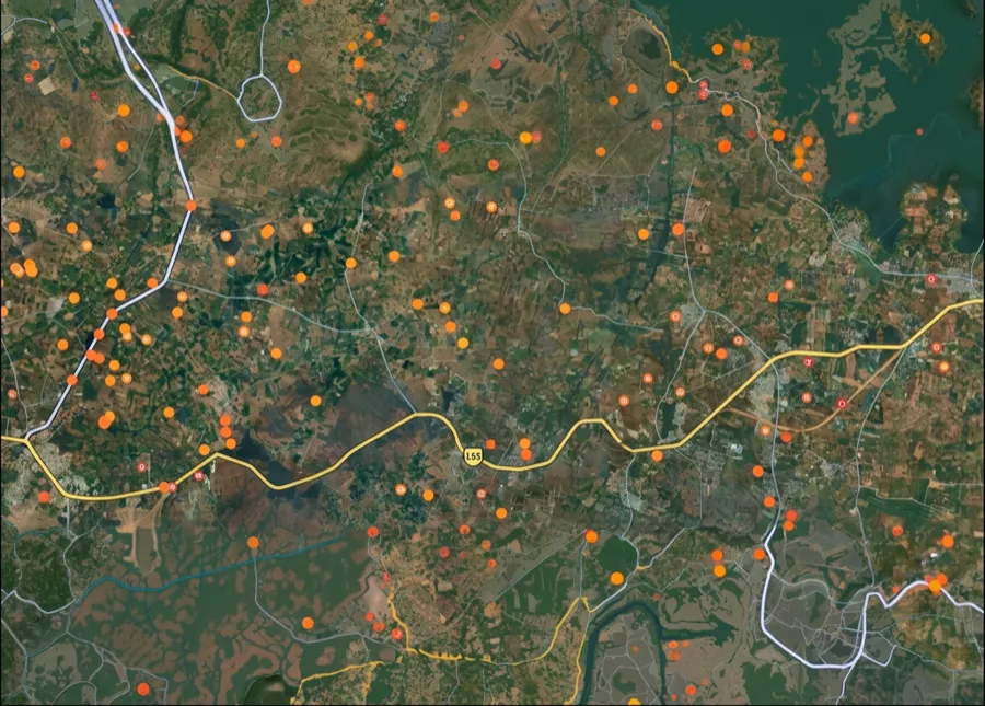
For Land Buyers
Browse all verified lands & plots in Uttar Pradesh
Every listing goes through our Preliminary Verification Process.
More Layers in Uttar Pradesh
See all 38 layers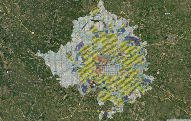
Lucknow Masterplan
View Lucknow Masterplan as a live map overlay – check any plot's land use zone for free on 1acre.in. Lucknow masterplan ...
Lucknow Kanpur Expressway (Awadh, NE-6): Route Map & Status
Lucknow Kanpur Expressway (Awadh, NE-6) route map, six entry and exit points and October 2026 toll and repair status, th...
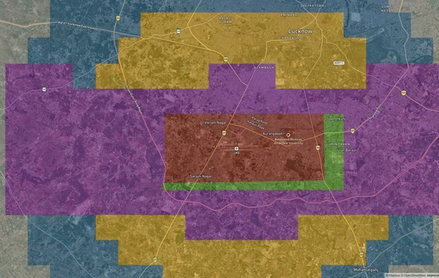
Lucknow Air Funnel Zones
View Lucknow Air Funnel Zones on a live map – check height clearance restrictions on any plot for free on 1acre.in. Luck...
More Layers in Uttar Pradesh
Lucknow Masterplan
View Lucknow Masterplan as a live map overlay – check any plot's land use zone for free on 1acre.in. Lucknow masterplan ...
Lucknow Kanpur Expressway (Awadh, NE-6): Route Map & Status
Lucknow Kanpur Expressway (Awadh, NE-6) route map, six entry and exit points and October 2026 toll and repair status, th...
Lucknow Air Funnel Zones
View Lucknow Air Funnel Zones on a live map – check height clearance restrictions on any plot for free on 1acre.in. Luck...
Frequently Asked Questions
The 104 km NH-230 Kisan Path corridor was inaugurated in March 2024. Heavy vehicles have been redirected away from the city core, and residential demand has shifted to peripheral villages. Appreciation in Kisan Path, Faizabad Road and Sultanpur Road belts reportedly ranged 30 to 40 percent over the previous two to three years.
An LDA approved plot Lucknow carries a layout sanction order, an approved Khasra schedule and a building plan eligibility. Verification is done through the LDA Land Use Portal and the Janmitra service. A simple sub-registrar registry does not equal LDA approval, and the gap is what demolition drives target.
The LDA has published a GIS-based Master Plan 2031 portal that lets buyers enter a Khasra or plot number and view the zone classification, plotting status and any encumbrance. Residential, mixed-use, agricultural and eco-sensitive zones are colour-coded and legally binding.
Under the land pooling Sultanpur Road policy, farmers contribute land and the LDA develops infrastructure, returning a portion of developed plots. Around 549 plots were structured under this model around the IT City. In July 2026 the LDA posted lottery results for pooling in IT City Phase II and Wellness City. Buying inside the pooling zone before your plot appears in a published allotment list carries unresolved title risk.
The Anant Nagar Mohan Road scheme covers approximately 800 acres of LDA-acquired land. Sales by private parties on parcels falling inside the acquired schedule are being treated as unauthorised. Six residents have filed a writ before the Allahabad High Court contesting absence of individual notice prior to the demolitions.
A UP RERA registered plot project provides statutory disclosure of layout sanction, possession timeline and escrow protection. Plotted developments of 500 sq m or more, or with eight or more plots, must register. The up-rera.in portal allows instant verification, and unregistered projects carry no statutory consumer protection.
Gosainganj, Dubagga, Sairpur and parts of Mohanlalganj have seen repeated LDA enforcement action. In April 2025 alone, approximately 50 bighas were cleared in Gosainganj and 2 bighas in Sairpur. Plots advertised at suspiciously low rates in these pockets typically lack layout sanction.
Yes. Master Plan 2031 permits apartment construction on plots of 200 square metres or larger, subject to the abutting road being at least 9 metres wide. The Transit Oriented Development Policy 2022 grants higher Floor Area Ratio within 500 metres of the metro corridor.
Yes. Kisan Path is the popular name for the Lucknow Outer Ring Road, which is numbered NH-230. The names are used for the same 104 km loop that links the Sultanpur, Raebareli, Kanpur, Hardoi, Sitapur and Ayodhya roads around the city. Local usage sometimes applies Kisan Path to the older eastern stretch between Sultanpur Road and Faizabad Road, so check the exact location on the map.
The Lucknow Outer Ring Road is 104 km long. It was announced as a 94 km project when the foundation stone was laid in 2016, and was described as 104 km when it was completed and dedicated in March 2024. It runs through Lucknow and Barabanki districts and crosses the main radial roads out of the city.
The Lucknow Outer Ring Road is National Highway 230 (NH-230), built by the National Highways Authority of India. On an NH-230 route map it appears as a loop around Lucknow, crossing the main roads to Sitapur, Raebareli, Kanpur, Ayodhya and Sultanpur. You can view the NH-230 alignment on the 1acre map layer and check plots near it.
The road covers 43 villages in Lucknow district and 61 in Barabanki district. The official village list with khasra numbers is in the NHAI land acquisition notifications published in the Gazette of India under the National Highways Act, 1956. For a single plot, enter the khasra number on the LDA One Map portal to see its zone and any acquisition schedule.
Source
Official National Highways Authority of India (NHAI) documents
Official Website
nhai.gov.in
Coordinate Reference System
EPSG:4326 (WGS 84)
Geometry Type
LineString / MultiLineString
Data Format
Vector (GeoJSON) + Raster Tiles
Last Verified
2026
Status
Active
Was this layer helpful?
Anything wrong, outdated, or missing we want to hear it.