Varanasi Masterplan
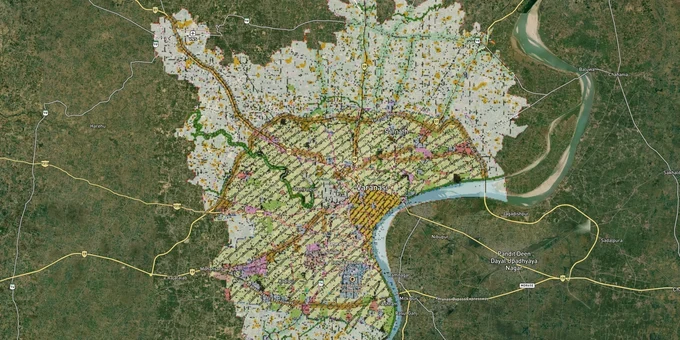
Varanasi Masterplan Preview
Try the Varanasi Masterplan on the map
Sign in once and explore the layer for a full day.
- No card details needed
- Find nearby verified lands for sale
Overview
The VDA Master Plan 2031 Varanasi governs land use across a jurisdiction of 1,073 sq km administered by the Varanasi Development Authority (VDA), established in 1974. The plan, prepared on a GIS platform under the AMRUT programme, covers Varanasi city, Ramnagar, Mughalsarai, and 850 revenue villages added between 2006 and 2024. It classifies land into residential, commercial, industrial, institutional, heritage conservation, green, and agricultural zones. This page covers the premium Varanasi Masterplan layer on 1acre, the regulatory traps buyers encounter in this jurisdiction, and the corridors where zone designation directly determines what you can build and hold.
Sarnath, Ramnagar and the Corridors the VDA Master Plan Treats Differently
Not all corridors under the VDA Master Plan 2031 Varanasi carry the same development rights, and buyers who treat them as equivalent will make expensive mistakes. The heritage zones around Sarnath and the Ganga Ghats operate under additional restrictions from the Archaeological Survey of India (ASI); the VDA master plan explicitly notes strict zoning regulations around protected heritage sites to prevent encroachments. Ramnagar and Mughalsarai, though included in VDA limits, fall under separate zone maps within the same master plan framework.
The table below maps the primary corridors to their zone context and investment considerations, sourced from VDA official documents and the AMRUT GIS master plan structure:
Corridor / Locality
Zone Designation (VDA Master Plan 2031)
Growth Driver
Known Risk
Sarnath area (Pandeypur to Azamgarh road zone)
Tourism/Institutional + limited Residential
UNESCO heritage site; tourism infrastructure; VDA approved 5-star hotel expansion from 196 to 302 rooms in this zone
ASI buffer zone overlay; heritage site restrictions apply; verify any parcel within 300m of the Sarnath protected monument boundary directly with VDA and ASI (200m is the prohibited construction zone; 300m is the regulated zone under the AMASR Act, 1958)
Ramnagar
Separate master plan and Zoning Regulation (ZR) published by VDA
Industrial heritage; Ramnagar Fort; river crossing connectivity
Buyers must verify under the Ramnagar Master Plan and ZR, not the core Varanasi map
Mughalsarai (now Pandit Deen Dayal Upadhyaya Nagar)
Included in VDA limits; covered by Mughalsarai Master Plan 2031
Major railway junction; logistics and warehousing demand
Falls under Chandauli district administration but within VDA planning limits; revenue records are in Chandauli, not Varanasi
Lalpur Residential Scheme
VDA-developed residential scheme zone
VDA-built scheme with completed RCC drain infrastructure (KC drain phases 1, 2 and Edhe phases confirmed by VDA)
Verify allotment status through VDA e-auction portal directly
Naganwa (Assi Ghat to Sant Ravidas Park stretch)
Road enhancement and public realm zone
Active VDA placemaking project; Ganga frontage
Ongoing road and landscaping work; verify setback requirements before any construction near this corridor
Transport Nagar Yojna Phase 1
Dedicated commercial/logistics land parcel
596 registrations active; Bird's Eye View available via housing.com digital tour
Verify current allotment availability through VDA e-auction portal
The most misunderstood corridor is Mughalsarai. Buyers assume that because Mughalsarai is in VDA limits, its revenue records are in Varanasi. They are not. Mughalsarai is part of Chandauli district, and the Khatauni for any parcel there must be verified on UP Bhulekh under Chandauli district, not Varanasi. Using the wrong district in your search will return no record, which some sellers exploit by claiming the land is unencumbered.
Was this layer helpful?
Anything wrong, outdated, or missing we want to hear it.
For Land Owners & Agents
Looking to sell your land in Uttar Pradesh?
I want to sell my land in Uttar Pradesh
10:32
Plz share your Land's location - We will list it on 1acre map, for Free.
10:32

For Land Buyers
Browse all verified lands & plots in Uttar Pradesh
Every listing goes through our Preliminary Verification Process.
More Layers in Uttar Pradesh
See all 32 layers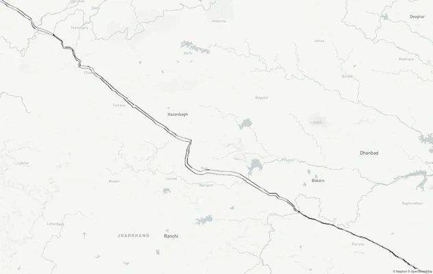
Varanasi - Kolkata Expressway
View Varanasi - Kolkata Expressway alignment as a live map overlay – check land acquisition risk and plot proximity free...
Ayodhya Masterplan
View Ayodhya Masterplan as a live map overlay – check any plot's land use zone for free on 1acre.in. Ayodhya masterplan ...
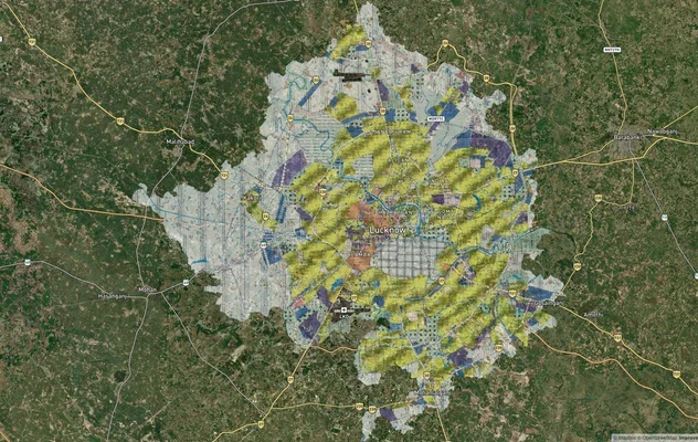
Lucknow Masterplan
View Lucknow Masterplan as a live map overlay – check any plot's land use zone for free on 1acre.in. Lucknow masterplan ...
More Layers in Uttar Pradesh
Varanasi - Kolkata Expressway
View Varanasi - Kolkata Expressway alignment as a live map overlay – check land acquisition risk and plot proximity free...
Ayodhya Masterplan
View Ayodhya Masterplan as a live map overlay – check any plot's land use zone for free on 1acre.in. Ayodhya masterplan ...
Lucknow Masterplan
View Lucknow Masterplan as a live map overlay – check any plot's land use zone for free on 1acre.in. Lucknow masterplan ...