Lucknow Masterplan
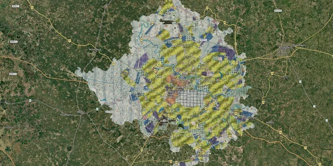
Lucknow Masterplan Preview
Try the Lucknow Masterplan on the map
Sign in once and explore the layer for a full day.
- No card details needed
- Find nearby verified lands for sale
Overview
The Lucknow masterplan zone designation of a plot decides what you can legally build on it, whether a bank will fund it, and whether your layout has LDA approval at all. The Lucknow Master Plan 2031 is prepared by the Lucknow Development Authority (LDA) and covers over 71,000 hectares across 197 integrated villages. The plan expands the residential zone from 20,578 hectares to 30,750 hectares and projects a population of 65 to 80 lakh by 2031. This page covers the two regulatory traps costing buyers the most money in Lucknow, the growth corridors where zone classification directly shapes returns, and the exact steps to verify a parcel before signing.
Illegal plotting across 197 LDA villages and the Gomti catchment trap has cost buyers crores
Two distinct fraud patterns characterise Lucknow's land market, and both are specific to how the LDA Master Plan 2031 defines jurisdiction and land-use restrictions.
The first is unauthorised plotting across the 197 villages now under LDA jurisdiction. As of late 2025, over 46,000 people in Lucknow had fallen victim to illegal plotting. The enforcement record confirms this is active, not historic: in April 2025, LDA demolished unauthorised plots covering approximately 50 bighas in Gosainganj and 2 bighas in Sairpur after sellers exploited a 17-bigha approved plan to market plots across 150 bighas. Identical patterns have been documented in Sarojininagar, Malihabad, and Bakshi Ka Talab. The mechanism is consistent: sellers show buyers a genuine LDA-approved layout plan for a small parcel and sell plots in the surrounding unapproved land based on proximity to it. Layout plans approved by the Zila Panchayat for villages outside LDA jurisdiction must include a main road 12 metres wide, internal roads 9 metres wide, and a boundary wall; a layout that lacks these standards is unapproved regardless of what the seller claims.
The second trap is the Gomti River catchment area. LDA's own investigation disclosed a ₹100 crore land scam involving a 6,070 square metre parcel in Maleshemau village near Shaheed Path that had been excluded from LDA acquisition because it falls within the Gomti catchment. That land was subsequently claimed through a false ownership declaration in 2006 and sold to a developer via a registered deed. Land within the Gomti catchment area cannot be legally developed. Under the original Master Plan 2031, construction was also prohibited within 200 metres of the old Gomti embankment. In December 2025, an amendment was notified permitting construction within a new 200-metre zone from Kisan Path to Shaheed Path, following completion of the 57-km Gomti Green Corridor; land outside this newly delineated zone remains subject to the prohibition.
The table below shows the key documents that must be verified for any land or plot purchase in Lucknow.
Document
Issuing Authority
What It Confirms
Risk if Absent
LDA Layout Approval Number
Lucknow Development Authority
Layout is sanctioned under the LDA Master Plan 2031
Demolition, no bank loan, no resale
Zila Panchayat Layout Approval
Zila Panchayat Office
Approval for villages outside LDA jurisdiction (477 villages)
Unapproved layout, total fund loss
Bhulekh UP Khatauni (Record of Rights)
Revenue Department UP
Ownership, plot extent, pending litigation
Title dispute, false ownership claim
RERA UP Registration
UP RERA Authority
Project registered under the Real Estate Act 2016
No statutory delivery obligation
Gomti Catchment / Green Corridor Status
LDA / GIS portal
Plot not in restricted river buffer
Construction prohibited, no OC possible
If a seller cannot produce an LDA layout approval number that you can independently verify on the LDA land use portal at lda.landuse.upda.co.in, the plot is unapproved and carries full demolition risk.
Gomti Nagar Extension, Shaheed Path, and the Outer Ring Road belt: three Lucknow masterplan zone corridors with very different risk profiles
Not all growth corridors in the LDA Master Plan 2031 carry the same risk profile. Three tiers have emerged based on infrastructure, LDA sanction status, and proximity to restricted zones.
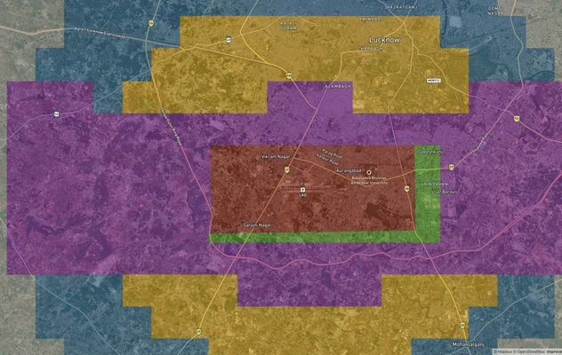
Gomti Nagar Extension and the Shaheed Path corridor form the primary tier. The LDA Master Plan 2031 identifies this zone as premium residential and mixed-use, and LDA itself has developed schemes in Gomti Nagar Extension with group housing and retail corridors. IT employers, including HCL and TCS, anchored in IT City, drive persistent rental demand. The Metro Influence Zone (MIZ), defined as 500 metres on either side of the Lucknow Metro alignment per the UP TOD Policy 2022 and the Lucknow Masterplan Convergence 2031, overlaps parts of this corridor, conferring higher permitted FAR and mixed-use rights. The Gomti catchment scam, however, originated near Shaheed Path in Maleshemau village, confirming that document verification remains essential even in premium zones.
The Outer Ring Road (ORR) belt forms the emerging second tier. The LDA Master Plan 2031 proposes a 104-km Outer Ring Road connecting Kanpur Road, Barabanki-Faizabad Road, Kakori-Hardoi Road, and Sultanpur Road at an estimated cost of ₹5,000 crore. LDA's new schemes, Udyog Nagar near the Agra Expressway and Naimish Nagar in Bakshi Ka Talab, are specifically positioned along this belt, combining residential, institutional, and industrial zones.
The third tier covers the 197 integrated villages that are now under LDA jurisdiction. These villages attract buyers seeking lower per-square-metre prices, and they carry the highest risk of encountering unapproved layouts.
Corridor
Master Plan 2031 Zone Status
Growth Driver
Primary Risk
Gomti Nagar Extension / Shaheed Path
Residential and mixed-use; MIZ overlay near metro
IT employers, metro, Lulu Mall, Phoenix Palace
Gomti catchment parcels, LDA scheme land scams
Sultanpur Road / Faizabad Road
Planned residential expansion
ORR connectivity, airport proximity
Layout approval status in fringe villages
Outer Ring Road belt: Udyog Nagar / Naimish Nagar
Planned townships (residential + industrial)
New LDA schemes, expressway access
Document gaps in newly integrated areas
Gosainganj / Malihabad / Bakshi Ka Talab
Rural areas within 477 Zila Panchayat villages
Lower land prices
Illegal plotting on unapproved extensions
The most misunderstood corridor is Bakshi Ka Talab and the adjacent rural areas. LDA's expansion to 197 villages leaves 477 villages under the Zila Panchayat authority. Buyers see "near Lucknow" listings without realising the applicable approval authority is the Zila Panchayat, not LDA; the approval standards are different, and the enforcement track record in these fringe areas is significantly weaker.
Was this layer helpful?
Anything wrong, outdated, or missing we want to hear it.
For Land Owners & Agents
Looking to sell your land in Uttar Pradesh?
I want to sell my land in Uttar Pradesh
10:32
Plz share your Land's location - We will list it on 1acre map, for Free.
10:32

For Land Buyers
Browse all verified lands & plots in Uttar Pradesh
Every listing goes through our Preliminary Verification Process.
More Layers in Uttar Pradesh
See all 32 layers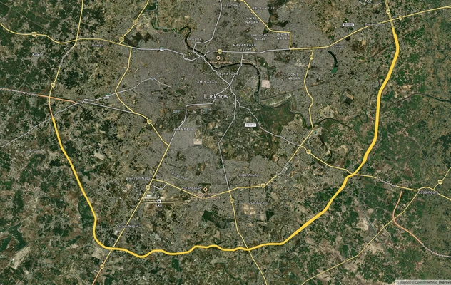
Lucknow Outer Ring Road
View the Lucknow Outer Ring Road corridor on a live map overlay – check zoning, approvals and acquisition risk free on 1...
Lucknow - Kanpur Expressway
View Lucknow - Kanpur Expressway alignment as a live map overlay – check land acquisition risk and plot proximity free o...
Lucknow Air Funnel Zones
View Lucknow Air Funnel Zones on a live map – check height clearance restrictions on any plot for free on 1acre.in. Luck...
More Layers in Uttar Pradesh
Lucknow Outer Ring Road
View the Lucknow Outer Ring Road corridor on a live map overlay – check zoning, approvals and acquisition risk free on 1...
Lucknow - Kanpur Expressway
View Lucknow - Kanpur Expressway alignment as a live map overlay – check land acquisition risk and plot proximity free o...
Lucknow Air Funnel Zones
View Lucknow Air Funnel Zones on a live map – check height clearance restrictions on any plot for free on 1acre.in. Luck...