
Shamli Gorakhpur Expressway Phase 1 & Phase 2
Overview
The Shamli-Gorakhpur Expressway land records question comes with a real-time warning attached, one worth reading closely before anything else on this page. As this project has moved from planning toward execution, the district administration in Shamli has already restricted ordinary land transactions along the proposed route, a step that changes what "checking the land records" actually means for anyone buying nearby right now. This roughly 700 to 750-kilometre greenfield corridor, estimated to cost around 35,000 crore rupees, is designed to link western Uttar Pradesh, starting near Shamli at the junction of the Delhi-Dehradun Expressway and the Ambala-Shamli Expressway, all the way to Gorakhpur in the state's east, cutting a journey that currently takes roughly 12 hours down to somewhere between six and seven and a half hours once fully open. The project runs through about 22 districts and connects into several of UP's other major expressways along the way, which is a large part of its long-term appeal. Land here is checked through Bhulekh UP, the state's Revenue Department portal, but for anyone looking at a plot near the confirmed alignment, the paperwork question this month is less about ownership history and far more about whether that land can even be freely sold right now at all. This guide covers both halves of that question in turn.
Regulatory Red Flags Along the Shamli-Gorakhpur Corridor
Start with the most urgent, specific fact about this exact project, because it genuinely changes how a buyer should approach any nearby plot today. Once its Detailed Project Report was finalised, the Shamli district administration moved quickly to restrict land transactions along the proposed alignment. The District Magistrate appointed an Additional District Magistrate to serve as a dedicated Special Land Acquisition Officer, tasked specifically with fast-tracking the acquisition process, and the administration signalled it would shortly issue a formal notification restricting sales across the affected area. This is the kind of step governments take specifically to stop landowners from subdividing plots or artificially inflating a plot's value the moment word of an upcoming acquisition spreads through a village, and it means that land inside or near the confirmed corridor in Shamli district may already carry real restrictions on ordinary buying and selling, regardless of whatever a seller's paperwork happens to show today.
For a buyer, this changes the entire calculation in a fairly fundamental way. A plot that looks perfectly saleable on Bhulekh UP right now, with a clean Khatauni and no visible dispute anywhere on the record, can still fall inside a district notification freezing transactions, especially once a formal preliminary notification under India's land acquisition law is issued for that specific stretch. That kind of notification typically follows the same pattern nationwide: once the government formally identifies land for a public project and issues this preliminary step, subsequent private transfers can lose their ordinary legal footing entirely, and any purchase made after that point may not be honoured the same way an earlier purchase would be once compensation eventually gets paid out to whoever the record shows as the rightful owner at the relevant date. Anyone considering land near the western end of this corridor, close to Shamli itself, should ask directly at the district administration or the Tehsildar office whether the specific survey number in question actually falls inside a notified restriction zone, rather than relying on a Bhulekh printout alone to settle that question one way or the other.
Beyond this district-specific freeze, ordinary verification still matters everywhere else along the wider corridor too, and buyers further east should not assume the Shamli situation is unique to that one district alone. Bhulekh UP, the state's free Revenue Department portal, gives access to the Khatauni, the record of rights showing ownership and land classification, and the Khasra, the plot-level detail showing area and land type, both searchable by village, tehsil, and district. A separate portal, Bhu Naksha UP, provides the actual cadastral map showing plot boundaries, and buyers should genuinely check both rather than treating either one alone as a complete picture of the land in question. Critically, the free copy shown on either portal is explicitly meant for informational reference only; anything used for a court matter, a bank loan, or formal registration still needs a certified copy obtained directly from the Tehsildar's office, no exceptions. A gap between what an online printout shows and what the certified copy actually confirms is exactly the kind of detail that tends to surface late, often only once a sale is already partway through and much harder to walk back.
Regulatory Red Flags Along the Shamli-Gorakhpur Corridor
Land Record Term
What It Proves
Needs Separate Check?
Blocks Registration Without It?
Commonly Missed?
Khatauni
Current ownership, land type, and rights
No
Yes
A free portal copy is often mistaken for a certified one
Khasra / Gata number
Plot-level area, soil type, and classification
No
Yes
Boundary can shift slightly after a resurvey
Bhu Naksha map
Physical plot boundary and shape
No
Not directly, but essential for confirming extent
Rarely cross-checked against the Khatauni text record
District transaction restriction
Confirms whether a plot sits inside a notified freeze zone
Yes, district administration or Tehsildar
Yes, if formally notified
Not visible on an ordinary Bhulekh search
Land acquisition notification
Confirms formal status of a plot inside the acquisition process
Yes, district land acquisition office
Determines compensation eligibility, not ordinary registration
Buyers frequently assume a plot is unaffected until it is too late
Land Record Term
What It Proves
Needs Separate Check?
Blocks Registration Without It?
Commonly Missed?
Khatauni
Current ownership, land type, and rights
No
Yes
A free portal copy is often mistaken for a certified one
Khasra / Gata number
Plot-level area, soil type, and classification
No
Yes
Boundary can shift slightly after a resurvey
Bhu Naksha map
Physical plot boundary and shape
No
Not directly, but essential for confirming extent
Rarely cross-checked against the Khatauni text record
District transaction restriction
Confirms whether a plot sits inside a notified freeze zone
Yes, district administration or Tehsildar
Yes, if formally notified
Not visible on an ordinary Bhulekh search
Land acquisition notification
Confirms formal status of a plot inside the acquisition process
Yes, district land acquisition office
Determines compensation eligibility, not ordinary registration
Buyers frequently assume a plot is unaffected until it is too late
Given that this corridor is still moving through tendering and land acquisition at the same time, in more than one district simultaneously, the safest approach for land anywhere near the western Shamli stretch is to check directly with the district administration before assuming a plot is freely transferable, and to treat any Bhulekh printout as the honest starting point for verification rather than the final word on the matter.
Growth Corridors Along the Shamli-Gorakhpur Route
This corridor's real strength lies in what it connects to at both ends, rather than functioning as a standalone road running quietly through empty ground with no larger purpose. Phase 1 begins near Shamli exactly at the junction of the Delhi-Dehradun Expressway and the Ambala-Shamli Expressway, meaning traffic from Delhi will eventually be able to move directly onto this new corridor without relying on the older, far more congested routes through Meerut, Hapur, or Ghaziabad that currently absorb most of that same traffic. This single junction point is doing a great deal of work for the project's overall case: it effectively stitches together Haryana, Punjab, and Uttarakhand traffic with one fast route straight into eastern Uttar Pradesh, rather than requiring travellers to piece together a completely separate journey through the state's more congested middle stretch.
Phase 2, running roughly 392 kilometres from Powayan in Shahjahanpur district all the way to Gorakhpur, has been moving through its own separate approval process, with NHAI applying for final forest clearance as recently as mid-2026. As of September 2026, four new tenders were floated under the Hybrid Annuity Mode, with bids due to close in early November that same year, but no corridor-wide completion date has actually been fixed yet, since contracts still need proper evaluation and award before construction can meaningfully begin on the specific sections those tenders cover. This matters quite a bit for anyone reading optimistic headlines about a neat six-hour Shamli-to-Gorakhpur journey: that particular projection depends on approvals, land acquisition, and construction all proceeding roughly on schedule together, none of which is remotely guaranteed simply because a DPR has been finalised somewhere or a tender has been floated on paper.
The corridor's own district list gives a clearer, more grounded sense of where genuine demand is likely to build first rather than where marketing material suggests it should. On the western side, Shamli, Saharanpur, Muzaffarnagar, Bijnor, and Amroha anchor the stretch closest to the Delhi-Dehradun and Ambala-Shamli junction, while the eastern stretch runs through Bahraich, Balrampur, Siddharthnagar, Sant Kabir Nagar, and finally into Gorakhpur itself. Along the way, the corridor is designed to connect with the Ganga Expressway, the Purvanchal Expressway, and the Lucknow-Gorakhpur Expressway, meaning land sitting near any of these existing interchange points genuinely stands to benefit from more than one expressway's worth of connectivity at once, rather than depending purely on this single project's own, still-uncertain timeline.
Growth Corridors Along the Shamli-Gorakhpur Route
Location
Growth Driver
Known Consideration
Shamli (western junction point)
Direct connection to Delhi-Dehradun and Ambala-Shamli Expressways
District has already restricted transactions along the proposed alignment
Powayan, Shahjahanpur (Phase 2 start)
Beginning of the 392-km Phase 2 stretch toward Gorakhpur
Final forest clearance was still pending as of mid-2026
Interchange points with Ganga, Purvanchal, and Lucknow-Gorakhpur Expressways
Multiple expressway connections converging in one place
Confirm actual interchange proximity, not just general corridor membership
Gorakhpur (eastern terminus)
Established eastern UP hub, endpoint of the full corridor
Timeline still depends on tender awards and construction progress
Location
Growth Driver
Known Consideration
Shamli (western junction point)
Direct connection to Delhi-Dehradun and Ambala-Shamli Expressways
District has already restricted transactions along the proposed alignment
Powayan, Shahjahanpur (Phase 2 start)
Beginning of the 392-km Phase 2 stretch toward Gorakhpur
Final forest clearance was still pending as of mid-2026
Interchange points with Ganga, Purvanchal, and Lucknow-Gorakhpur Expressways
Multiple expressway connections converging in one place
Confirm actual interchange proximity, not just general corridor membership
Gorakhpur (eastern terminus)
Established eastern UP hub, endpoint of the full corridor
Timeline still depends on tender awards and construction progress
The honest read on this corridor is that it offers a genuinely significant long-term connectivity story, tying together some of UP's busiest existing expressways into one coherent east-west network, but it remains firmly stuck in the land-acquisition and tendering stage across most of its length outside the immediate Shamli junction area. Buyers should weigh the Shamli district's own transaction restrictions as a serious, current fact rather than dismiss it as a bureaucratic footnote, and should treat every travel-time projection for the full corridor as a target tied to a still-unfinished approval and construction process, rather than as a settled, guaranteed outcome already locked in.
क्या यह लेयर सहायक थी?
Anything wrong, outdated, or missing we want to hear it.
ज़मीन मालिकों और एजेंटों के लिए
Uttar Pradesh में अपनी ज़मीन बेचना चाहते हैं?
मैं Uttar Pradesh में अपनी ज़मीन बेचना चाहता हूँ
10:32
कृपया अपनी ज़मीन का स्थान साझा करें - हम इसे 1acre मैप पर सूचीबद्ध करेंगे, मुफ़्त.
10:32


ज़मीन खरीदारों के लिए
Uttar Pradesh में सभी सत्यापित ज़मीन और प्लॉट ब्राउज़ करें
प्रत्येक लिस्टिंग हमारी प्रारंभिक सत्यापन प्रक्रिया से गुज़रती है।
Uttar Pradesh में और लेयर्स
सभी 38 लेयर्स देखें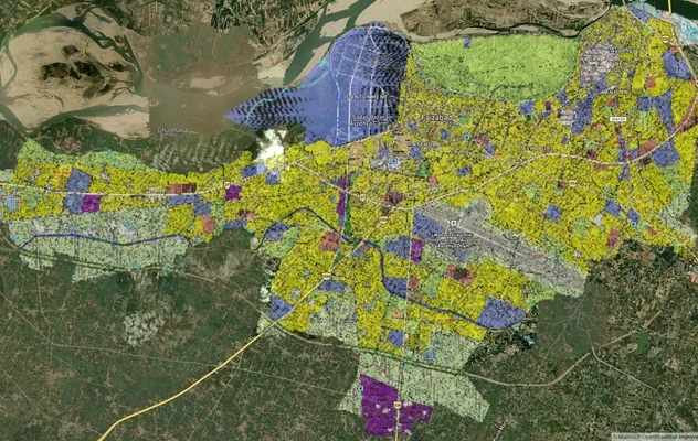
अयोध्या मास्टरप्लान
1acre.in पर अयोध्या मास्टरप्लान को लाइव मैप ओवरले के रूप में देखें – किसी भी प्लॉट का लैंड यूज़ ज़ोन मुफ्त में चेक करें....
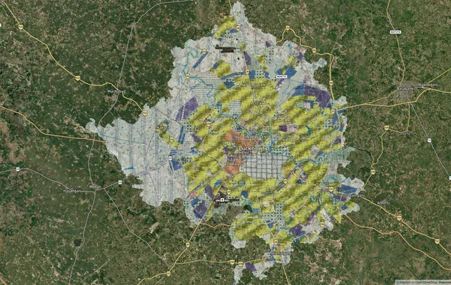
लखनऊ मास्टरप्लान
लखनऊ मास्टरप्लान को लाइव मैप ओवरले की तरह देखें – 1acre.in पर किसी भी प्लॉट का लैंड यूज़ ज़ोन मुफ्त में चेक करें. लखनऊ म...
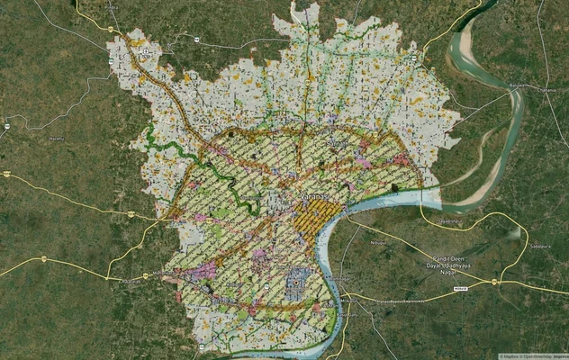
वाराणसी मास्टरप्लान
वाराणसी मास्टरप्लान को लाइव मैप ओवरले के रूप में देखें – 1acre.in पर किसी भी प्लॉट का लैंड यूज़ ज़ोन मुफ़्त में चेक करें...
Uttar Pradesh में और लेयर्स
अयोध्या मास्टरप्लान
1acre.in पर अयोध्या मास्टरप्लान को लाइव मैप ओवरले के रूप में देखें – किसी भी प्लॉट का लैंड यूज़ ज़ोन मुफ्त में चेक करें....
लखनऊ मास्टरप्लान
लखनऊ मास्टरप्लान को लाइव मैप ओवरले की तरह देखें – 1acre.in पर किसी भी प्लॉट का लैंड यूज़ ज़ोन मुफ्त में चेक करें. लखनऊ म...
वाराणसी मास्टरप्लान
वाराणसी मास्टरप्लान को लाइव मैप ओवरले के रूप में देखें – 1acre.in पर किसी भी प्लॉट का लैंड यूज़ ज़ोन मुफ़्त में चेक करें...