
Amravati Road, Nagpur: highway route map, NMRDA zones and layout checks


Amravati Road Preview
Try the Amravati Road, Nagpur on the map
Sign in once and explore the layer for a full day.
- No card details needed
- Find nearby verified lands for sale
Overview
Amravati Road is the Nagpur end of National Highway 53 (numbered NH-6 before the national highways were renumbered), the highway that runs west from Nagpur through Wadi, Gondkhairi and Kondhali towards Amravati. Inside the metropolitan area it is a residential and industrial corridor; beyond the outer ring road it becomes farmland and farmhouse plots.
Nagpur Amravati Road land buying sits inside a planning framework that most buyers underestimate until something goes wrong. The Nagpur Metropolitan Area Masterplan 2032, administered by the Nagpur Metropolitan Region Development Authority (NMRDA) across 3,567 sq km covering 721 villages in nine tehsils, is the operative land-use document for every parcel along this corridor. The plan classifies land into residential, commercial, industrial, agricultural, public utility, and forest zones, with Agriculture A1 and A2 as the two most commonly misrepresented categories. This page covers the Amravati Road corridor layer on 1acre, the NMRDA Release Letter trap that derails buyers here, and which specific pockets carry real investment logic.
Nagpur Amravati road and highway route
The Nagpur Amravati highway is NH-53, part of the Asian Highway 46 network. Before the national highways were renumbered it was NH-6, and older documents and many sale deeds still use that number. Within Nagpur the stretch is simply called Amravati Road (अमरावती रोड).
The table lists the main places on the corridor in order going west from the city.
Order
Place
District
What it means for land
1
Dabha and Hazaripahad
Nagpur
Inner residential belt with NMRDA-sanctioned layouts
2
Wadi
Nagpur
Industrial and logistics belt, rental demand
3
Gondkhairi
Nagpur
Start of the NHAI outer ring road; NMRDA improvement scheme area
4
Bazargaon and the outer highway belt
Nagpur
Agriculture A1 and A2 zones, farmhouse plotting
5
Kondhali
Nagpur
Highway town on the Nagpur-Amravati highway
6
Karanja
Wardha
Highway town between Nagpur and Amravati
7
Talegaon
Not confirmed
Highway town nearer Amravati
8
Amravati
Amravati
Western end of this corridor
Order
Place
District
What it means for land
1
Dabha and Hazaripahad
Nagpur
Inner residential belt with NMRDA-sanctioned layouts
2
Wadi
Nagpur
Industrial and logistics belt, rental demand
3
Gondkhairi
Nagpur
Start of the NHAI outer ring road; NMRDA improvement scheme area
4
Bazargaon and the outer highway belt
Nagpur
Agriculture A1 and A2 zones, farmhouse plotting
5
Kondhali
Nagpur
Highway town on the Nagpur-Amravati highway
6
Karanja
Wardha
Highway town between Nagpur and Amravati
7
Talegaon
Not confirmed
Highway town nearer Amravati
8
Amravati
Amravati
Western end of this corridor
For an Amravati road map at plot level, the useful view is not the highway line alone but the highway plus zone boundaries. You can view the route on the 1acre map layer with the NMRDA zone overlay and check how far a survey number sits from the road and from the outer ring road junction at Gondkhairi.
Highway frontage changes value but also brings building line rules. NMRDA publishes building line distances from major roads, so check the setback before you price a roadside plot.
Agriculture A1, A2 Zone Misrepresentation and the NMRDA Release Letter That Cancels Your Registration
Two document failures repeat themselves on Amravati Road plots more than anywhere else in Nagpur's western belt. Both are entirely avoidable if you know what to ask for before you agree on a price.
The first is zone misrepresentation. The NIT Proposed Land Use map under the Nagpur Metropolitan Area Masterplan 2032 distinguishes between Agriculture A1 and Agriculture A2 zones, alongside residential, commercial, and other classifications. A parcel sitting in an Agriculture A1 or A2 zone cannot be legally used for residential construction without formal NA (non-agricultural) conversion and NMRDA layout sanction. Sellers along the outer stretches of Amravati Road, particularly in mouza areas beyond Dabha, routinely market A1 and A2 classified parcels as "residential plots" or "NA-ready land." The 7/12 extract may show a non-agricultural annotation, but that annotation alone does not confirm NMRDA layout sanction. These are two entirely separate approvals, and brokers conflate them constantly.
The second failure is the Release Letter. In every NMRDA-sanctioned layout, a portion of the plots is mortgaged to the authority as security until the developer completes the layout's development works including roads, drainage, and utilities. Until NMRDA issues the Release Letter (RL) for each individual plot, the registration of that plot is legally invalid. Banks will not finance a plot without the RL in hand. Buyers who sign sale agreements and pay advances on plots without the RL have been left with assets they cannot register or sell for years while developers drag their feet on infrastructure delivery.
The table below maps the four document combinations buyers encounter along Nagpur's Amravati Road corridor and the legal consequence of each.
Scenario
7/12 Status
NMRDA Layout Sanction
Release Letter Issued
Bank Loan Eligible
Registration Valid
A
Agricultural (A1/A2)
No
No
No
No
B
NA annotated
No
No
No
No (sanction missing)
C
NA annotated
Yes
No
No
No (RL mandatory)
D
NA annotated
Yes
Yes
Yes
Yes
Scenario
7/12 Status
NMRDA Layout Sanction
Release Letter Issued
Bank Loan Eligible
Registration Valid
A
Agricultural (A1/A2)
No
No
No
No
B
NA annotated
No
No
No
No (sanction missing)
C
NA annotated
Yes
No
No
No (RL mandatory)
D
NA annotated
Yes
Yes
Yes
Yes
One thing no government portal will display next to a plot listing: unsanctioned NA plots in Gram Panchayat areas along the Amravati Road fringe carry no bank financing, no MahaRERA registration, and no legal recourse if the developer defaults. These layouts are marketed specifically to buyers who do not know to ask for the sanction letter. If a seller cannot produce the NMRDA layout sanction letter and a plot-specific Release Letter before you sign anything, that is your answer. Walk away.
NMRDA sanctioned layout list: how to check an Amravati Road layout
Searches for the NMRDA sanctioned layout list usually come from buyers who have been shown a plot and want to know if the layout is legal. NMRDA publishes the documents below on the Downloads page of its website (nmrda.org/downloads).
Document on the NMRDA Downloads page
Section
What to use it for
List of approved layout in Metro Region
Right to Information
Check that the layout name and mouza appear as approved
List of building permissions in Metro Region
Right to Information
Check building permissions in the metro region
Metro plot release
Metro Region Building Form
The form used to release a plot from the layout mortgage
NMRDA layout form and charges for development permission (layout)
Metro Region Layout Form
What a developer must file for sanction
Metro Region Development Plan and Metro Region DCR
DCR
Zone and building rules for the metropolitan area
Sanctioned modification sheets (6 March 2020) and notifications
Notification
Zone maps and later changes
Additional use permissible in agriculture zone
Notification
What NMRDA allows in agriculture zones
Document on the NMRDA Downloads page
Section
What to use it for
List of approved layout in Metro Region
Right to Information
Check that the layout name and mouza appear as approved
List of building permissions in Metro Region
Right to Information
Check building permissions in the metro region
Metro plot release
Metro Region Building Form
The form used to release a plot from the layout mortgage
NMRDA layout form and charges for development permission (layout)
Metro Region Layout Form
What a developer must file for sanction
Metro Region Development Plan and Metro Region DCR
DCR
Zone and building rules for the metropolitan area
Sanctioned modification sheets (6 March 2020) and notifications
Notification
Zone maps and later changes
Additional use permissible in agriculture zone
Notification
What NMRDA allows in agriculture zones
How to check a plot on Amravati Road:
- Get the layout name, mouza, khasra number and the developer's sanction letter number.
- Find the layout in the approved layout list. If it is not there, ask NMRDA in writing before you pay.
- Ask for the plot-specific Release Letter; the plot release form is the document NMRDA uses for it.
- Match the mouza and khasra against the zone sheets to confirm the plot is not in Agriculture A1 or A2.
The list is a starting point, not proof. A layout can be approved while a particular plot in it is still mortgaged, which is why the Release Letter check still applies.
Dabha, Wadi, Wanadongri and Where Amravati Road Investment Actually Makes Sense
Not every stretch of Nagpur's Amravati Road carries the same investment logic. The corridor runs from the city's western edge toward Amravati district, and the opportunity changes sharply depending on where along that route a parcel sits.
Dabha and Hazaripahad sit closest to the city and carry the strongest near-term fundamentals. Current plot rates in this pocket run between Rs 2,500 and Rs 4,200 per sq ft, reflecting their position in the western residential belt that benefits from proximity to Nagpur University, engineering colleges, and Wadi's industrial employment base. The average cost of a 1,000 sq ft residential plot in the Amravati Road locality runs around Rs 38.5 lakh at current market levels. Dabha is also one of the pockets specifically named under NMRDA's sanctioned layout list, which means buyers here have a clearer path to bank-financed, legally registered plots than on the outer stretches.
Wadi sits adjacent and draws consistent rental demand from industrial and logistics workers tied to the western MIDC belt. Wanadongri, connecting the Amravati Road axis with Hingna, offers entry prices in the Rs 2,200 per sq ft range, the most affordable in this belt, while sitting inside the Nagpur Metro's western expansion catchment. The Nagpur Metro Phase 1 corridor, as documented in the detailed project report, connects Automotive Square on Kamptee Road through the Amravati Road and Wardha Road intersection, making the inner Amravati Road belt a transit-accessible zone rather than a purely peripheral one. Phase 2, approved by the Union Cabinet in December 2022 (43.8 km, 30 stations, Rs 6,708 crore), includes a 6.7 km Lokmanya Nagar to Hingna corridor; civil work on Phase 2 was under way in May 2025.
The outer ring road adds a longer-horizon dimension. NHAI's project constructs a new 40 km four-lane cement concrete road from Gondkhairi on Amravati Road to Bhilgaon-Sirpur on the Kamptee-Jabalpur section of NH-44, with a direct interchange with the Samruddhi Expressway. The inner ring road alignment also passes through Wadi and Dabha. When heavy vehicle traffic diverts to the outer ring road, inner Amravati Road pockets gain livability and residential demand at the same time.
Corridor
NMRDA Zone Status
Current Plot Rate
Key Driver
Primary Risk
Dabha / Hazaripahad
Residential (NMRDA sanctioned layouts present)
Rs 2,500–4,200/sq ft
University belt; NMRDA coverage
Verify RL before each plot
Wadi
Mixed Residential / Industrial edge
Rs 2,500–3,500/sq ft
MIDC employment; ring road diversion
A1/A2 misrepresentation on fringe
Wanadongri
Residential (verify sanction per layout)
Rs 2,200–3,000/sq ft
Metro catchment; affordable entry
Unsanctioned GP layouts active here
Bazargaon / Outer NH (beyond Dabha)
Agriculture A1/A2 dominant
Rs 350–1,500/sq ft
Farmhouse and long-horizon land
No NMRDA sanction; no bank loan
Hingna Road intersection
Residential / Industrial
Rs 2,500–4,200/sq ft
Western MIDC; Metro Phase 2 corridor
Zone boundary shifts; verify parcel-level
Corridor
NMRDA Zone Status
Current Plot Rate
Key Driver
Primary Risk
Dabha / Hazaripahad
Residential (NMRDA sanctioned layouts present)
Rs 2,500–4,200/sq ft
University belt; NMRDA coverage
Verify RL before each plot
Wadi
Mixed Residential / Industrial edge
Rs 2,500–3,500/sq ft
MIDC employment; ring road diversion
A1/A2 misrepresentation on fringe
Wanadongri
Residential (verify sanction per layout)
Rs 2,200–3,000/sq ft
Metro catchment; affordable entry
Unsanctioned GP layouts active here
Bazargaon / Outer NH (beyond Dabha)
Agriculture A1/A2 dominant
Rs 350–1,500/sq ft
Farmhouse and long-horizon land
No NMRDA sanction; no bank loan
Hingna Road intersection
Residential / Industrial
Rs 2,500–4,200/sq ft
Western MIDC; Metro Phase 2 corridor
Zone boundary shifts; verify parcel-level
The most misread stretch is Bazargaon and the outer highway belt beyond Dabha. Multiple farmhouse layout projects in this zone actively market plots at Rs 350 to Rs 399 per sq ft against 350-acre project branding. These parcels sit in A1/A2 agricultural zones with no NMRDA layout sanction, no Release Letter, and no bank loan pathway. The low price is not a value opportunity. It is the zone speaking clearly about what it permits. Use the 1acre Premium Nagpur Amravati Road layer to cross-reference your survey number against the NIT land use map and NMRDA zone designation before you book a site visit, let alone a plot.
Amravati Road project status in October 2026
Dated lines for the projects that shape Amravati Road land, as of October 2026:
Project
Latest verifiable update
What to check
Nagpur Metro Phase 2
Approved by the Union Cabinet in December 2022: 43.8 km, 30 stations, Rs 6,708 crore. Foundation and segment casting under way in May 2025
Distance from the Lokmanya Nagar to Hingna corridor for Wanadongri and Hingna Road plots
NMRDA outer ring road
NMRDA's Downloads page lists a document titled 'Sept 10 2025 ORR', a government resolution on ring road land acquisition and lists by tahsil, including Hingna and Kalmeshwar
Whether your village appears in the tahsil list before you buy
Gondkhairi improvement scheme
NMRDA publishes an improvement scheme for Gondkhairi on its Downloads page
Whether the plot is reserved or reconstituted under the scheme
NHAI outer ring road from Gondkhairi
No dated completion status confirmed for this page
Confirm the current status with NHAI before paying an access premium
Project
Latest verifiable update
What to check
Nagpur Metro Phase 2
Approved by the Union Cabinet in December 2022: 43.8 km, 30 stations, Rs 6,708 crore. Foundation and segment casting under way in May 2025
Distance from the Lokmanya Nagar to Hingna corridor for Wanadongri and Hingna Road plots
NMRDA outer ring road
NMRDA's Downloads page lists a document titled 'Sept 10 2025 ORR', a government resolution on ring road land acquisition and lists by tahsil, including Hingna and Kalmeshwar
Whether your village appears in the tahsil list before you buy
Gondkhairi improvement scheme
NMRDA publishes an improvement scheme for Gondkhairi on its Downloads page
Whether the plot is reserved or reconstituted under the scheme
NHAI outer ring road from Gondkhairi
No dated completion status confirmed for this page
Confirm the current status with NHAI before paying an access premium
A ring road or metro line raises demand only for land with clean title and the right zone. Land inside an acquisition list may be bought by the state at the notified rate instead of the market rate, so check the lists first.
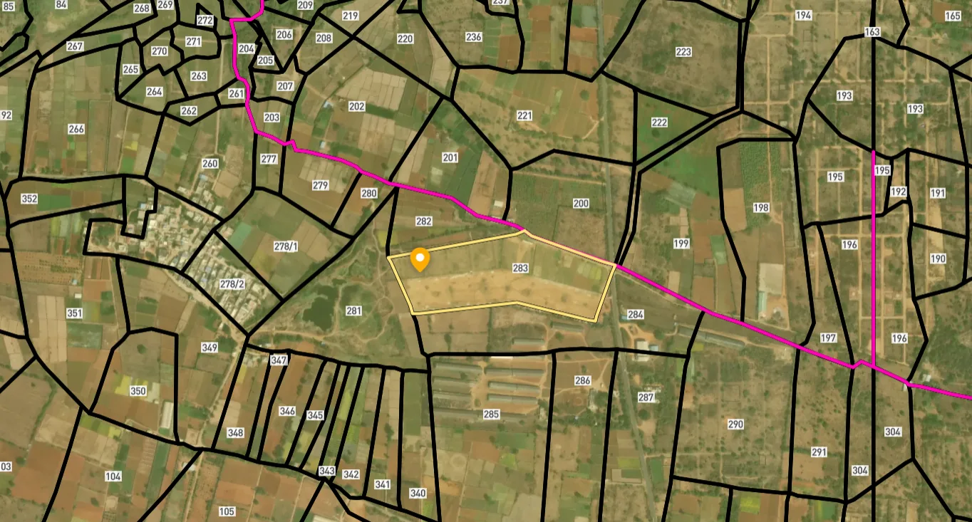
Access Survey NumbersAccess Maharashtra
Survey Numbers
Boundaries and numbers come from published state cadastral records. See all map layers.
Looking to sell your land in Maharashtra?

Browse all verified lands & plots in Maharashtra
More Layers in Maharashtra
See all 60 layers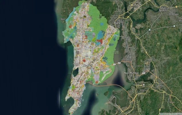
Mumbai Development Plan 2034: Zone Check and Land Use Guide
View Mumbai Masterplan as a live map overlay – check any plot's land use zone for free on 1acre.in. Mumbai masterplan 20...
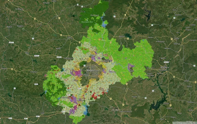
Nagpur Masterplan 2032: Zone Check and Land Use Guide
View Nagpur Masterplan as a live map overlay – check any plot's land use zone for free on 1acre.in. Nagpur Metropolitan ...
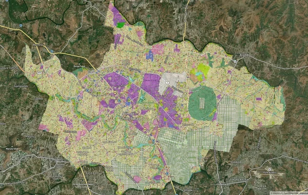
Pimpri Chinchwad PCMC Masterplan: Zone Check and Land Use Guide
View Pimpri Chinchwad Masterplan as a live map overlay – check any plot's land use zone for free on 1acre.in. Pimpri Chi...
More Layers in Maharashtra
Mumbai Development Plan 2034: Zone Check and Land Use Guide
View Mumbai Masterplan as a live map overlay – check any plot's land use zone for free on 1acre.in. Mumbai masterplan 20...
Nagpur Masterplan 2032: Zone Check and Land Use Guide
View Nagpur Masterplan as a live map overlay – check any plot's land use zone for free on 1acre.in. Nagpur Metropolitan ...
Pimpri Chinchwad PCMC Masterplan: Zone Check and Land Use Guide
View Pimpri Chinchwad Masterplan as a live map overlay – check any plot's land use zone for free on 1acre.in. Pimpri Chi...
Frequently Asked Questions
NMRDA is the Nagpur Metropolitan Region Development Authority, the statutory body governing planned development across 3,567 sq km of the Nagpur Metropolitan Area. Only NMRDA-sanctioned layouts are legally valid for residential registration, eligible for bank financing, and protected from future demolition or rezoning disputes.
No. National and private banks finance only NMRDA or NIT-approved layouts in Nagpur. A plot with only a 7/12 NA annotation, but without NMRDA layout sanction and a Release Letter, falls outside every bank's lending criteria entirely.
In NMRDA-sanctioned layouts, plots are mortgaged to the authority until the developer completes roads, drainage, and utilities. NMRDA releases individual plots from this mortgage by issuing a Release Letter. Without it, plot registration is legally invalid regardless of any other document.
Both A1 and A2 classify land as agricultural under the Nagpur Metropolitan Area Masterplan 2032. Neither permits residential construction without formal NA conversion and NMRDA layout sanction. Sellers misrepresent A1 and A2 parcels as residential plots along the outer Amravati Road belt routinely.
Dabha and Hazaripahad carry the strongest combination of NMRDA-sanctioned layout coverage, proximity to Nagpur University employment, and inner ring road benefit. Wadi adds industrial rental demand. Wanadongri offers the lowest entry price in the belt with Metro Phase 2 catchment potential.
Verify the 7/12 extract for land classification, the NA conversion order, the NMRDA layout sanction letter, and the plot-specific Release Letter. For new projects, confirm MahaRERA registration. All four must be in place. Missing any single one is a valid reason to stop the transaction.
Yes, directly. The NHAI Outer Ring Road starts from Gondkhairi on Amravati Road. When heavy vehicle traffic diverts from the inner road to the ORR, livability in Dabha and Wadi improves. Inner belt residential demand typically rises as transit quality improves on the same corridor.
Government ready reckoner rates in Nagpur are published annually by Maharashtra's Revenue Department. Market rates along Amravati Road typically run 20 to 40 percent above the ready reckoner rate, depending on road width, sanction status, and infrastructure proximity. Check the current rate for your specific mouza at the Maharashtra Revenue Department portal before finalising stamp duty calculations.
The Nagpur Amravati road is National Highway 53 (NH-53) and is part of the Asian Highway 46 network. Before the national highways were renumbered it was NH-6, so older maps, layouts and sale deeds may still show NH-6. Within Nagpur the stretch is known as Amravati Road and runs west through Wadi and Gondkhairi.
NMRDA publishes a 'List of approved layout in Metro Region' on the Downloads page of its website, under Right to Information. Search it for the layout name and mouza. If the layout is missing, ask NMRDA in writing before paying. An approved layout still needs a plot-specific Release Letter before the plot can be registered.
Amravati Road starts in western Nagpur and runs as NH-53 past Dabha, Hazaripahad and Wadi, then Gondkhairi, where the NHAI outer ring road begins, and on through Bazargaon and Kondhali towards Karanja, Talegaon and Amravati. You can view the route and the zone overlay on the 1acre map layer before visiting a plot.
Use the NMRDA development plan documents on its Downloads page: the Metro Region Development Plan, the zone sheets and the sanctioned modification notifications. Find the mouza sheet, locate the khasra and read the zone colour. If it shows Agriculture A1 or A2, residential construction needs NA conversion and layout sanction first.
Source
Official Nagpur Metropolitan Region Development Authority (NMRDA) documents
Coordinate Reference System
EPSG:4326 (WGS 84)
Geometry Type
LineString / MultiLineString
Data Format
Vector (GeoJSON) + Raster Tiles
Last Verified
2026
Status
Active
Was this layer helpful?
Anything wrong, outdated, or missing we want to hear it.