Maharashtra CRZ

Maharashtra Crz Preview
Try the Maharashtra CRZ on the map
Sign in once and explore the layer for a full day.
- No card details needed
- Find nearby verified lands for sale
Overview
The Maharashtra CRZ layer plots the Coastal Regulation Zone footprint along the state's 720 km Konkan coastline, the longest on India's west coast after Gujarat. It mirrors the Coastal Zone Management Plan prepared by NCSCM (National Centre for Sustainable Coastal Management) for Mumbai (CZMP published September 2021) and for Thane, Raigad, Palghar, Ratnagiri, and Sindhudurg (NCZMA (National Coastal Zone Management Authority) approved 2023), under CRZ Notification 2019 (G.S.R. 37(E)). The Maharashtra Coastal Zone Management Authority (MCZMA) is the regulatory body. This page shows what falls inside CRZ-I, CRZ-II, CRZ-III A, CRZ-III B, and CRZ-IV across all six coastal districts.
Regulatory Red Flags Inside the Mangrove Buffer
Maharashtra's CRZ map is enforced harder than most states because of standing Bombay High Court orders. PIL 87 of 2006 (judgement 17.09.2018) treats all mangroves, on government or private land, as forests, with a 50 metre buffer that automatically becomes CRZ-I A. The 12 December 2025 order added that mangrove destruction without final Stage-II forest clearance is illegal, with compensatory afforestation required prior to or simultaneous with any felling.
The fact-pack on what each zone permits in Maharashtra, drawn from CRZ Notification 2019 and the approved CZMPs.
Zone Code
Permitted Use
Requires CRZ Clearance?
Prohibited Without?
Commonly Misrepresented?
CRZ-I A
Mangroves + 50 m buffer, sand dunes, Koliwadas
No new construction; only utility/strategic
Any building
Sold as "private mangrove plot"
CRZ-I B
Inter-tidal between LTL (Low Tide Line) and High Tide Line
Salt works, pipelines only
Houses, resorts
Marketed as "creekfront"
CRZ-II
Built-up Mumbai municipal area
Yes, on landward side of existing road
Construction on seaward side
Confused with CRZ-III rural
CRZ-III A
Densely populated rural; NDZ 50 m from HTL (High Tide Line)
Beyond NDZ only
Construction inside 50 m
Quoted as "approved layout"
CRZ-III B
Sparse rural; NDZ 200 m from HTL
Beyond NDZ only
Anything inside 200 m
Sold without disclosure
CRZ-IV A
Sea up to 12 nautical miles
Fishing, traditional use
Solid waste, mining
Not applicable to plots
CRZ-IV B
Tidal creeks (Thane Creek, Ulhas estuary)
Fishing only
Reclamation, dwellings
Sold as "creek view"
If a Maharashtra parcel sits within 50 metres of any mangrove patch, no MCZMA letter, BMC (Brihanmumbai Municipal Corporation) permission, or developer brochure makes that buildable. The mangrove buffer is a Bombay High Court injunction, not a soft guideline. The No Development Zone (NDZ) in CRZ-III stacks on top of this, not under it.
Growth Corridors Across Mumbai, MMR and the Konkan Coast
Maharashtra's coastal real estate splits into three personalities. Mumbai is CRZ-II urban with redevelopment rights expanded under the September 2021 CZMP. The MMR ring (Thane, Raigad, Palghar) is mixed CRZ-III with the MMR CZMP 2019 approved by NCZMA in August 2023, allowing more vertical construction. The deep Konkan coast Ratnagiri Sindhudurg is mostly CRZ-III B with strict 200 m NDZ.
The corridors most asked about, mapped against CRZ classification.
Corridor / Locality
Zone (CZMP 2019)
Growth Driver
Known Risk
South Mumbai (Worli to Nariman Point)
CRZ-II
Coastal Road, redevelopment
CRZ clearance challenged for coral and fishing impact
Western suburbs (Versova to Bhayandar)
CRZ-II + mangrove pockets
Coastal Road Phase II, 26.3 km
45,675 mangroves (103.65 hectares) approved for removal with SC conditions, March 2026
Thane Creek belt
CRZ-IV B + CRZ-I A mangroves
Navi Mumbai, JNPT proximity
50 m buffer + creek NDZ stacks
Alibaug, Raigad coast
CRZ-III A and III B mix
Weekend home market, second residences
NDZ varies village to village by Census 2011 density
Ratnagiri (Ganpatipule, Jaigad)
CRZ-III B largely
Tourism, port; 237 km district coast
200 m NDZ; high-erosion segments flagged
Sindhudurg (Malvan, Tarkarli, Vengurla)
CRZ-III B + CRZ-I A
MTDC (Maharashtra Tourism Development Corporation) tourism push, Devbag estuary
Karli estuary erosion; Critical Vulnerable Coastal Area
Palghar (Dahanu to Vasai)
CRZ-III + mangroves
MMR fringe, Bullet Train corridor
Dahanu eco-fragile area separate clearance
The most misunderstood corridor is the Mumbai western suburbs. Buyers see redevelopment FSI bumps under the 2022 CZMP and assume mangrove-adjacent plots are unlocked. The 50 m mangrove buffer remains CRZ-I A regardless of the FSI table, and The Bombay High Court's December 12, 2025 order permitted the BMC to proceed with the Versova-Bhayandar Coastal Road subject to conditions. The Supreme Court on March 20, 2026 declined to halt the project, ruling it would have a 'significant and beneficial impact on the general public.' The project requires removal of 45,675 mangroves across 103.65 hectares, with compensatory afforestation on equivalent non-forest land in Chandrapur. This does not weaken the mangrove buffer rule — the December 2025 HC order explicitly states mangrove destruction without Stage-II approval is illegal.
Was this layer helpful?
Anything wrong, outdated, or missing we want to hear it.
For Land Owners & Agents
Looking to sell your land in Maharashtra?
I want to sell my land in Maharashtra
10:32
Plz share your Land's location - We will list it on 1acre map, for Free.
10:32

For Land Buyers
Browse all verified lands & plots in Maharashtra
Every listing goes through our Preliminary Verification Process.
More Layers in Maharashtra
See all 32 layers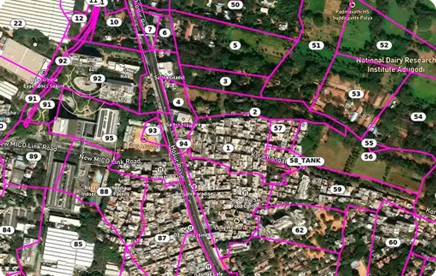
Maharashtra Survey Number Map — Find Any Plot's 7/12 Free | 1acre.in
See any plot's survey number in Maharashtra on a free live map. 7/12 (Satbara), Gat Number, 8A and Mahabhulekh explained...
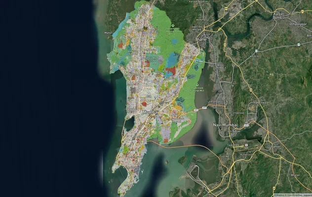
Mumbai Development Plan 2034: Zone Check and Land Use Guide
View Mumbai Masterplan as a live map overlay – check any plot's land use zone for free on 1acre.in. Mumbai masterplan 20...
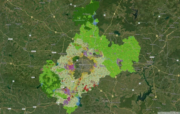
Nagpur Masterplan 2032: Zone Check and Land Use Guide
View Nagpur Masterplan as a live map overlay – check any plot's land use zone for free on 1acre.in. Nagpur Metropolitan ...
More Layers in Maharashtra
Maharashtra Survey Number Map — Find Any Plot's 7/12 Free | 1acre.in
See any plot's survey number in Maharashtra on a free live map. 7/12 (Satbara), Gat Number, 8A and Mahabhulekh explained...
Mumbai Development Plan 2034: Zone Check and Land Use Guide
View Mumbai Masterplan as a live map overlay – check any plot's land use zone for free on 1acre.in. Mumbai masterplan 20...
Nagpur Masterplan 2032: Zone Check and Land Use Guide
View Nagpur Masterplan as a live map overlay – check any plot's land use zone for free on 1acre.in. Nagpur Metropolitan ...