New Purandar Airport
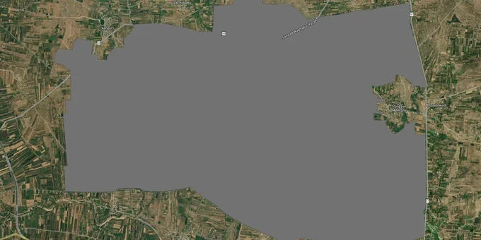
New Purandar Airport Preview
Try the New Purandar Airport on the map
Sign in once and explore the layer for a full day.
- No card details needed
- Find nearby verified lands for sale
Overview
The Purandar Greenfield Airport, formally named Chhatrapati Sambhajiraje International Airport, is Pune's second international airport sited in Purandar taluka, approximately 20-25 km southeast of the city. MIDC leads land acquisition across seven villages under the Maharashtra Industrial Development Act, 1961. Approximately 2,823 hectares are approved for acquisition; 90% farmer consent was secured by September 2025, with construction commencement targeted for October–November 2026 with a three-year completion deadline, pointing to an operational date of 2029–2030. This Premium layer on 1acre maps the acquisition boundary so buyers can confirm whether any specific survey number falls inside the notified zone before transacting.
Maharashtra has cleared a state-guaranteed Rs 6,000 crore HUDCO loan for land acquisition, with Rs 500 crore already released to the district administration.
MIDC Acquisition Under the 1961 Act: What Purandar Airport Land Inside the Seven Villages Actually Means
The Maharashtra government is acquiring 2,823 hectares across seven villages under the Maharashtra Industrial Development Act, 1961, not the central LARR (Land Acquisition, Rehabilitation and Resettlement Act, 2013) Act of 2013. That distinction matters: the MIDC Act empowers the state industrial corporation to declare the area as industrial land and proceed with compulsory acquisition independently. Once MIDC issues the acquisition notification for a survey number, any private sale executed thereafter is legally challengeable and cannot be registered without risk. All seven villages (Vanpuri, Udachiwadi, Kumbharvalan, Ekhatpur, Munjwadi, Khanwadi, and Pargaon Memane) fall entirely inside the notified 2,753-hectare industrial boundary, with a further 70 hectares from the forest department.
In a High-Power Committee meeting held on April 24, 2026, The base compensation rate was officially fixed at Rs 1.61 crore per acre (District Collector announcement, May 6, 2026). The effective average payout is approximately Rs 2 crore per acre once houses, trees, wells, and orchards are included. Farmers who voluntarily surrender their land receive 4 times the current market value plus 10% of developed land; those who do not volunteer proceed through the compulsory route at the base rate.
The table below shows the seven acquisition villages and their status as of mid-2026:
Village
MIDC Status
Notes
Pargaon Memane
Approved; surveys complete
Core airport zone
Khanwadi
Approved; consent secured
Compensation finalized
Munjwadi
Approved; initial objections
2,000+ total objections across all villages
Ekhatpur
Approved; surveys done
Proceeding
Kumbharvalan
Approved; farmer consent
Finalized
Udachiwadi
Approved; consent secured
Proceeding
Vanpuri
Approved; some resistance
Compensation approved
Land measurement across all seven villages was targeted for completion by October 2025; any plot listed for private sale inside these villages after that date carries a serious legal defect regardless of what documents the seller presents. A second risk compounds this: most agricultural land near the airport remains unconverted to NA (Non-Agricultural) status. Land without NA conversion cannot legally be used for construction under PMRDA (Pune Metropolitan Region Development Authority) rules. Brokers selling plots in Saswad, Jejuri, and Dive Ghat via Power of Attorney or unregistered Agreement of Sale, without a valid NA order attached, are presenting legally defective titles. MahaRERA (Maharashtra Real Estate Regulatory Authority) has been actively pursuing unregistered agents operating in fringe zones like Purandar; demand a RERA-registered developer and a current NA conversion certificate before any discussion of price.
Saswad to Dive Ghat: Which Corridors Outside Purandar Airport's Acquisition Zone Hold Real Investment Value
The seven acquisition villages are not purchasable. The investable corridor runs in the ring outside those boundaries, along approach roads from Pune, the Pune Outer Ring Road, and the Pune-Satara highway. The Pune ORR is the most consequential variable here: it determines which approach route serves airport traffic, and plots near the ORR junction to the airport access road carry a logical long-term premium, but only once both the ORR section and the access road are actually complete.
The table below shows micro-markets outside the acquisition zone, with the realistic land signal and primary risk at each:
Corridor
Distance from Airport
Land Signal
Key Risk
Saswad
5-8 km (approach road)
Nearest town; plotted development active
Agricultural; NA conversion required
Jejuri
~10 km (Pune-Satara NH)
Speculative buying visible; highway access
Verify NA and PMRDA approval
Dive Ghat
Near approach corridor
Highway-adjacent; logistics interest
Limited residential demand anchor
Rajewadi
Satara railway route
Proposed railway spur to airport
Railway is proposed, not under construction
Pune ORR junction
Connecting to airport
Access road tenders floated
ORR still under construction in this stretch
Saswad is the most grounded entry point: it is the nearest established town on the approach road, active plotted development is visible, and it sits outside the acquisition boundary. The core risk is the same as across the entire corridor: a large share of land remains agricultural and unconverted. Without a valid NA order from PMRDA, any plot in Purandar taluka is legally just farmland, with no construction rights. Pune Metro Phase 2 proposes two new lines connecting to the airport, but no construction start date is confirmed. The proposed Rajewadi railway spur is in early planning only. Do not price land near either of these on infrastructure that has not reached tender stage.
Was this layer helpful?
Anything wrong, outdated, or missing we want to hear it.
For Land Owners & Agents
Looking to sell your land in Maharashtra?
I want to sell my land in Maharashtra
10:32
Plz share your Land's location - We will list it on 1acre map, for Free.
10:32

For Land Buyers
Browse all verified lands & plots in Maharashtra
Every listing goes through our Preliminary Verification Process.
More Layers in Maharashtra
See all 32 layers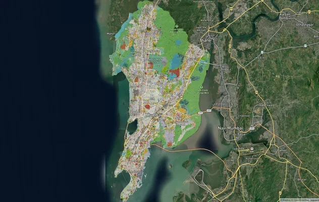
Mumbai Development Plan 2034: Zone Check and Land Use Guide
View Mumbai Masterplan as a live map overlay – check any plot's land use zone for free on 1acre.in. Mumbai masterplan 20...
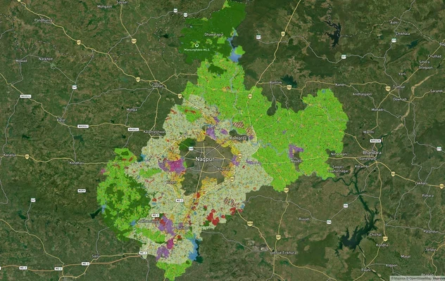
Nagpur Masterplan 2032: Zone Check and Land Use Guide
View Nagpur Masterplan as a live map overlay – check any plot's land use zone for free on 1acre.in. Nagpur Metropolitan ...
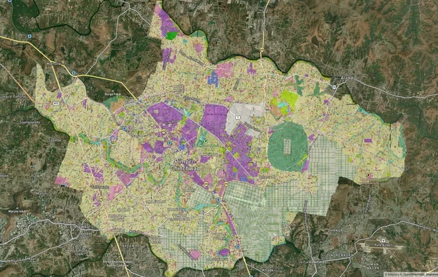
Pimpri Chinchwad PCMC Masterplan: Zone Check and Land Use Guide
View Pimpri Chinchwad Masterplan as a live map overlay – check any plot's land use zone for free on 1acre.in. Pimpri Chi...
More Layers in Maharashtra
Mumbai Development Plan 2034: Zone Check and Land Use Guide
View Mumbai Masterplan as a live map overlay – check any plot's land use zone for free on 1acre.in. Mumbai masterplan 20...
Nagpur Masterplan 2032: Zone Check and Land Use Guide
View Nagpur Masterplan as a live map overlay – check any plot's land use zone for free on 1acre.in. Nagpur Metropolitan ...
Pimpri Chinchwad PCMC Masterplan: Zone Check and Land Use Guide
View Pimpri Chinchwad Masterplan as a live map overlay – check any plot's land use zone for free on 1acre.in. Pimpri Chi...