
Ajara-Kudal Highway


Ajara Kudal Highway Preview
Try the Ajara-Kudal Highway on the map
Sign in once and explore the layer for a full day.
- No card details needed
- Find nearby verified lands for sale
Overview
Ajara Kudal Highway NH-548H land acquisition covers the widening of the Amboli Ghat-Ajara-Sankeshwar section, a 62 km stretch of a broader 104 km Bharatmala inter-corridor route connecting Sankeshwar in Karnataka to Banda near Sawantwadi in Maharashtra, at an estimated cost of Rs 574 crore. Ajara-Kudal Highway is a live on 1acre. The Kolhapur district administration has issued formal 3A and 3D land acquisition notifications for the Amboli-to-Sankeshwar stretch, and the alignment runs through the ecologically sensitive Sahyadri hill range of the Western Ghats. This page covers the highway's exact route, its Western Ghats exposure, and where growth is concentrating along it.
Western Ghats Eco-Sensitive Zone and the Land Acquisition Process
NH-548H, also known by its earlier state highway designation SH-134, traverses roughly 42 villages including Banda, Satuli, Amboli, Ajara, Gadhinglaj, and Sankeshwar, crossing the Deccan Plateau into the Konkan coast via a series of hairpin bends through the Sahyadri mountains. Two bypasses are planned at Ajara and Gadhinglaj, each proposed as a 2+2 lane, access-controlled road with service roads on either side and a 60-metre right of way, specifically to route through-traffic around the two most densely populated villages.
Western Ghats Eco-Sensitive Zone and the Land Acquisition Process
Stage
What It Means
Buyer Action
Section 3A Notification
Formal notice of intent to acquire land for the highway
Check whether your survey number falls in a notified village along the Amboli-Sankeshwar stretch
Section 3D Notification
Final declaration confirming acquisition
Confirm whether your specific plot has moved from 3A to 3D status
Ajara/Gadhinglaj bypass
2+2 lane access-controlled bypass around town centres
Land directly on the existing highway through these towns may be bypassed rather than widened
Stage
What It Means
Buyer Action
Section 3A Notification
Formal notice of intent to acquire land for the highway
Check whether your survey number falls in a notified village along the Amboli-Sankeshwar stretch
Section 3D Notification
Final declaration confirming acquisition
Confirm whether your specific plot has moved from 3A to 3D status
Ajara/Gadhinglaj bypass
2+2 lane access-controlled bypass around town centres
Land directly on the existing highway through these towns may be bypassed rather than widened
This stretch runs directly through a region the Maharashtra state government has separately petitioned to have classified as Western Ghats Eco-Sensitive Area, covering more than 2,000 villages across the state. Once such a classification is finalised, restrictions typically apply to large-scale construction, mining, and certain industrial activity within the zone. While the highway itself proceeds under its own environmental clearance process, any private land nearby that a buyer hopes to develop, whether for a resort, homestay, or commercial project, faces separate scrutiny once ESA rules for the surrounding villages are finalised. Confirm both the highway's land acquisition notification status for your specific plot and whether your village is among those proposed for Western Ghats ESA classification before assuming standard development rules apply.
Where Growth Concentrates Along the Amboli-Ajara Corridor
The highway sits inside one of Maharashtra's more overlapping infrastructure zones: it shares Ajra and Bhudargad talukas with a separate, much larger project, the Maharashtra Shaktipeeth Expressway (Pawanar to Patradevi, Nagpur-Goa), which has its own active land acquisition notifications in the same talukas.
Where Growth Concentrates Along the Amboli-Ajara Corridor
Location
Growth Driver
Known Risk
Amboli
Established hill-station tourism destination, Western Ghats biodiversity hotspot
Eco-sensitive zone restrictions likely to tighten around large-scale development
Ajara / Gadhinglaj
Highway bypass towns, existing six-lane stretch already in Gadhinglaj municipal limits
Bypass construction may shift commercial value away from the existing town-centre highway frontage
Sankeshwar (Karnataka border)
Junction with NH-48, gateway to the corridor
Interstate junction; check which state's land regulations apply to a given parcel
Overlapping Shaktipeeth Expressway zone (Ajra, Bhudargad)
Separate, larger Nagpur-Goa expressway acquiring land in the same talukas
Two independent acquisition processes may affect the same or adjacent villages; verify which applies to your plot
Location
Growth Driver
Known Risk
Amboli
Established hill-station tourism destination, Western Ghats biodiversity hotspot
Eco-sensitive zone restrictions likely to tighten around large-scale development
Ajara / Gadhinglaj
Highway bypass towns, existing six-lane stretch already in Gadhinglaj municipal limits
Bypass construction may shift commercial value away from the existing town-centre highway frontage
Sankeshwar (Karnataka border)
Junction with NH-48, gateway to the corridor
Interstate junction; check which state's land regulations apply to a given parcel
Overlapping Shaktipeeth Expressway zone (Ajra, Bhudargad)
Separate, larger Nagpur-Goa expressway acquiring land in the same talukas
Two independent acquisition processes may affect the same or adjacent villages; verify which applies to your plot
The most important thing for a buyer here is recognising that Ajara and Bhudargad talukas currently have two separate, large infrastructure land acquisition processes running in parallel, this highway's Amboli-Sankeshwar widening, and the unrelated Shaktipeeth Expressway. A plot near Ajara could be affected by either, both, or neither notification depending on its exact location. Given the corridor also touches an established tourism destination in Amboli with genuine hospitality demand, and a Western Ghats ESA classification process still pending finalisation, land here carries more overlapping regulatory layers than a typical single-project highway corridor.
Was this layer helpful?
Anything wrong, outdated, or missing we want to hear it.

Access Survey NumbersAccess Maharashtra
Survey Numbers
Boundaries and numbers come from published state cadastral records. See all map layers.
Looking to sell your land in Maharashtra?

Browse all verified lands & plots in Maharashtra
More Layers in Maharashtra
See all 61 layers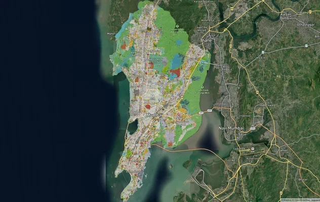
Mumbai Development Plan 2034: Zone Check and Land Use Guide
View Mumbai Masterplan as a live map overlay – check any plot's land use zone for free on 1acre.in. Mumbai masterplan 20...
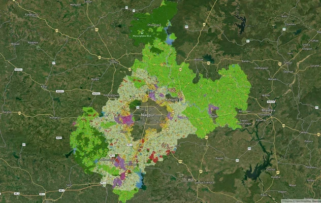
Nagpur Masterplan 2032: Zone Check and Land Use Guide
View Nagpur Masterplan as a live map overlay – check any plot's land use zone for free on 1acre.in. Nagpur Metropolitan ...
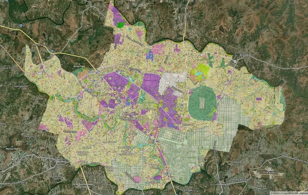
Pimpri Chinchwad PCMC Masterplan: Zone Check and Land Use Guide
View Pimpri Chinchwad Masterplan as a live map overlay – check any plot's land use zone for free on 1acre.in. Pimpri Chi...
More Layers in Maharashtra
Mumbai Development Plan 2034: Zone Check and Land Use Guide
View Mumbai Masterplan as a live map overlay – check any plot's land use zone for free on 1acre.in. Mumbai masterplan 20...
Nagpur Masterplan 2032: Zone Check and Land Use Guide
View Nagpur Masterplan as a live map overlay – check any plot's land use zone for free on 1acre.in. Nagpur Metropolitan ...
Pimpri Chinchwad PCMC Masterplan: Zone Check and Land Use Guide
View Pimpri Chinchwad Masterplan as a live map overlay – check any plot's land use zone for free on 1acre.in. Pimpri Chi...