
Orange Gate to Marine Drive underground twin tunnel, Mumbai


Orange Gate Marine Drive Underground Twin Tunnel Preview
Try the Orange Gate to Marine Drive underground twin tunnel, Mumbai on the map
Sign in once and explore the layer for a full day.
- No card details needed
- Find nearby verified lands for sale
Overview
Orange Gate Marine Drive Tunnel Mumbai refers to MMRDA's underground twin-tunnel road project connecting the Eastern Freeway at Orange Gate to Marine Drive near Churchgate, running beneath South Mumbai's island city at depths of up to 52 metres. MMRDA gives the corridor length as 9.96 km, of which about 7 km is underground. The Orange Gate-Marine Drive Underground Twin Tunnel is a live map layer on 1acre. Approved at a cost of roughly Rs 8,056 crore, with tunnelling launched by the Chief Minister on 3 December 2025 and a targeted completion of December 2028, the project runs beneath nearly 700 buildings, including over a hundred heritage structures, several railway corridors, and Metro Line 3. This page covers where Orange Gate is, the route and project details, the realignment debate triggered by heritage-area residents and the revised Marine Drive exit cleared by the state coastal authority in June 2026, and what that signals for anyone with property interests near the route.
Where is Orange Gate in Mumbai
Orange Gate is a gate of the Mumbai Port area on P D'Mello Road in South Mumbai, at the southern end of the Eastern Freeway. Searches for 'Orange Gate, MbPT' use the short form of Mumbai Port Trust, the port body the gate belongs to; the area is now under the Mumbai Port Authority. For drivers, Orange Gate is the southern end of the Eastern Freeway, which runs north towards Chembur and links to the Atal Setu (Mumbai Trans Harbour Link).
Orange Gate is where the tunnel begins. MMRDA launched its tunnel boring machine (TBM) at Orange Gate on 3 December 2025, and the 2023 project design provides a viaduct at Orange Gate for vehicle access into the tunnel. From there the twin tunnels run west beneath the railway corridors, Metro Line 3 and the dense, heritage-rich streets of the island city to Marine Drive, where they connect with the Mumbai Coastal Road.
Question
Answer
Where is Orange Gate in Mumbai?
On P D'Mello Road, in the Mumbai Port area of South Mumbai
What is it known for?
Southern end of the Eastern Freeway
Tunnel role
Eastern end of the tunnel; TBM launch site
Other end of the tunnel
Marine Drive, linking to the Mumbai Coastal Road
Question
Answer
Where is Orange Gate in Mumbai?
On P D'Mello Road, in the Mumbai Port area of South Mumbai
What is it known for?
Southern end of the Eastern Freeway
Tunnel role
Eastern end of the tunnel; TBM launch site
Other end of the tunnel
Marine Drive, linking to the Mumbai Coastal Road
For property buyers, Orange Gate is an established port and freeway node. The surface changes here are the tunnel approach and the road widening at the Eastern Freeway end that MMRDA included in its revised design, rather than fresh land acquisition.
Orange Gate to Marine Drive tunnel route map
The Orange Gate to Marine Drive tunnel route map is easiest to read as a line from the Eastern Freeway in the east to Marine Drive in the west, deep below the island city. MMRDA's figures give a 9.96 km corridor with about 7 km underground, at depths of 12 to 52 metres. The table lists the entry and exit points, connecting roads and the main structures the tunnel passes beneath, in order from Orange Gate.
From Orange Gate
Point or feature
What happens there
1
Orange Gate, P D'Mello Road (Eastern Freeway end)
Eastern entry and exit; viaduct access; TBM launched December 2025
2
Central and Harbour Railway tracks
TBM crossed seven operational tracks without stopping train services (reported August 2026)
3
Metro Line 3 (Aqua Line) and Western Railway corridor
Tunnel passes beneath both; under Metro Line 3 at a depth of over 50 metres
4
South Mumbai island city
Runs under about 700 buildings, including over 100 heritage structures; the 2023 design described the alignment as mainly under Sardar Vallabhbhai Patel Road
5
Marine Drive, original plan
Exit after B D Somani Chowk, near Wankhede Stadium
6
Marine Drive, revised design
Western exit moved north, near Saifee Hospital towards Girgaum Chowpatty; coastal clearance granted in June 2026
7
Mumbai Coastal Road
Onward connection from Marine Drive
From Orange Gate
Point or feature
What happens there
1
Orange Gate, P D'Mello Road (Eastern Freeway end)
Eastern entry and exit; viaduct access; TBM launched December 2025
2
Central and Harbour Railway tracks
TBM crossed seven operational tracks without stopping train services (reported August 2026)
3
Metro Line 3 (Aqua Line) and Western Railway corridor
Tunnel passes beneath both; under Metro Line 3 at a depth of over 50 metres
4
South Mumbai island city
Runs under about 700 buildings, including over 100 heritage structures; the 2023 design described the alignment as mainly under Sardar Vallabhbhai Patel Road
5
Marine Drive, original plan
Exit after B D Somani Chowk, near Wankhede Stadium
6
Marine Drive, revised design
Western exit moved north, near Saifee Hospital towards Girgaum Chowpatty; coastal clearance granted in June 2026
7
Mumbai Coastal Road
Onward connection from Marine Drive
MMRDA has not published a detailed public route map of the revised alignment, and this page does not host one. View the alignment on the 1acre map layer, and check the exit position against the latest MMRDA notice before relying on it for a specific building.
Orange Gate tunnel project details
MMRDA (Mumbai Metropolitan Region Development Authority) is building the Orange Gate tunnel project as a twin-tube road tunnel. The figures below are those MMRDA gave at the tunnelling launch in December 2025 and in later progress reports. Earlier reports cited different lengths (9.23 km and 9.5 km in 2023) and costs (Rs 7,765 crore and Rs 7,500 crore), mainly because the design has been revised.
Detail
Figure
Authority
MMRDA
Contractor
Larsen & Toubro (L&T), contract awarded in 2023
Project cost
Rs 8,056 crore
Corridor length
9.96 km, about 7 km of it underground
First tunnel under construction
About 3.45 km
Depth
12 to 52 metres
Lanes
Two traffic lanes and one emergency lane per tube; 80 km/h limit
Tunnel boring machine
Slurry shield, 12.19 m cutterhead, about 82 m long
Launch
3 December 2025
Main tunnelling began
28 February 2026
Progress
About 650 metres excavated by July 2026
Southbound tunnel to Marine Drive
Target December 2027
Project completion
Target December 2028
Travel time once open
About five minutes, Orange Gate to Marine Drive
Detail
Figure
Authority
MMRDA
Contractor
Larsen & Toubro (L&T), contract awarded in 2023
Project cost
Rs 8,056 crore
Corridor length
9.96 km, about 7 km of it underground
First tunnel under construction
About 3.45 km
Depth
12 to 52 metres
Lanes
Two traffic lanes and one emergency lane per tube; 80 km/h limit
Tunnel boring machine
Slurry shield, 12.19 m cutterhead, about 82 m long
Launch
3 December 2025
Main tunnelling began
28 February 2026
Progress
About 650 metres excavated by July 2026
Southbound tunnel to Marine Drive
Target December 2027
Project completion
Target December 2028
Travel time once open
About five minutes, Orange Gate to Marine Drive
As of October 2026, the latest published update, in August 2026, reported that the TBM had passed beneath seven Central and Harbour Railway tracks with trains running. The main open approval is the Union Environment Ministry's decision on the seaward promenade extension at Marine Drive.
Marine Drive's heritage objections and the revised tunnel exit
Within a week of the Chief Minister launching the tunnel boring machine, MMRDA began considering altering the tunnel's alignment following strong objections from Marine Drive residents.
The Marine Drive Citizens Association raised concerns that the original alignment, connecting Orange Gate under the Mumbai Port Authority to D Road near Churchgate adjacent to Wankhede Stadium, would disturb the iconic Art Deco heritage precinct, worsen construction-phase traffic, and cause air pollution.
Residents specifically criticised the original Opera House entry point as impractical, and MMRDA reportedly considered alternatives including reclaiming land beyond the National Centre for Performing Arts, routing the alignment outside NCPA entirely, or positioning tunnel entry points near Oval Maidan instead.
Concern Raised
What Residents Argued
MMRDA's Response
Heritage building safety
Original alignment risked structural implications not adequately studied
Considering alternative, "safer and less intrusive" locations
Opera House entry point
Termed impractical by residents
To be replaced under a new proposal
Construction-phase disruption
Traffic diversions and air pollution concerns near the heritage stretch
Alternative alignments including NCPA-adjacent options under discussion
Concern Raised
What Residents Argued
MMRDA's Response
Heritage building safety
Original alignment risked structural implications not adequately studied
Considering alternative, "safer and less intrusive" locations
Opera House entry point
Termed impractical by residents
To be replaced under a new proposal
Construction-phase disruption
Traffic diversions and air pollution concerns near the heritage stretch
Alternative alignments including NCPA-adjacent options under discussion
This is not the Marine Drive Precinct's first fight over development near its heritage buildings. Residents previously took the BMC and Maharashtra's Urban Development Department to the Bombay High Court over a proposal to double building heights in the precinct, arguing it would destroy the value and integrity of the area's Art Deco heritage and jeopardise Mumbai's UNESCO World Heritage nomination bid. That litigation forced the civic body to hold off enforcing its guidelines pending a Supreme Court decision on a related petition. Given this precedent, any property owner near the tunnel's southern portal should track MMRDA's finalised route rather than the originally announced one.
Update: the revised Marine Drive exit (October 2026)
In April 2026 MMRDA proposed moving the tunnel's western exit north, from near Wankhede Stadium to the area near the PM Hindu Swimming Bath and Boat Club, close to Girgaum Chowpatty, to spread exiting traffic along Marine Drive. The Maharashtra Coastal Zone Management Authority (MCZMA) cleared the revised design at its meeting on 16 June 2026, with conditions on traffic management, noise barriers and low-tide construction. The design reorganises Marine Drive's lanes, with three dedicated lanes for vehicles leaving the tunnel towards Nariman Point, and addresses a bottleneck near Saifee Hospital at the tunnel's western exit. A seaward extension of the promenade, about 120 metres long, needs final approval from the Union Environment Ministry because it falls in the intertidal zone.
What This Means for Property Near the Tunnel Route
The tunnel itself runs almost entirely underground and requires no large-scale surface land acquisition of the kind seen on typical highway projects, but its two portals, at Orange Gate and near Marine Drive/Churchgate, are exactly where surface-level property impact concentrates.
Location
Relevance
Known Risk
Orange Gate (Eastern Freeway terminus)
Northern tunnel portal, connects to existing elevated freeway
Established infrastructure node; limited fresh land acquisition needed
Marine Drive / Churchgate / D Road
Original southern portal area, adjacent to Wankhede Stadium and NCPA
Exit moved north under the revised design cleared by MCZMA in June 2026
Marine Drive near Saifee Hospital / Girgaum Chowpatty
Revised western exit
Lane changes on Marine Drive and a promenade extension that still needs central approval
Marine Drive Art Deco precinct
Heritage-protected zone directly above/adjacent to the tunnel route
Any redevelopment here has a documented history of litigation over height and heritage rules
CSMT and railway corridor crossing
Tunnel passes beneath Chhatrapati Shivaji Maharaj Terminus at depth
Engineering constraint, not a direct property-transaction concern for most buyers
Location
Relevance
Known Risk
Orange Gate (Eastern Freeway terminus)
Northern tunnel portal, connects to existing elevated freeway
Established infrastructure node; limited fresh land acquisition needed
Marine Drive / Churchgate / D Road
Original southern portal area, adjacent to Wankhede Stadium and NCPA
Exit moved north under the revised design cleared by MCZMA in June 2026
Marine Drive near Saifee Hospital / Girgaum Chowpatty
Revised western exit
Lane changes on Marine Drive and a promenade extension that still needs central approval
Marine Drive Art Deco precinct
Heritage-protected zone directly above/adjacent to the tunnel route
Any redevelopment here has a documented history of litigation over height and heritage rules
CSMT and railway corridor crossing
Tunnel passes beneath Chhatrapati Shivaji Maharaj Terminus at depth
Engineering constraint, not a direct property-transaction concern for most buyers
Once complete, the tunnel is expected to cut travel time between Orange Gate and Marine Drive to around five minutes, and to improve connectivity toward the Navi Mumbai International Airport by linking with the Coastal Road and Atal Setu. For anyone with property interests in the Marine Drive Precinct specifically, the relevant question is not whether the tunnel will boost value, but whether the revised southern alignment will run directly beneath or immediately adjacent to a specific building, and whether that building falls within the heritage-protected zone that has already generated one Bombay High Court dispute over redevelopment rights.
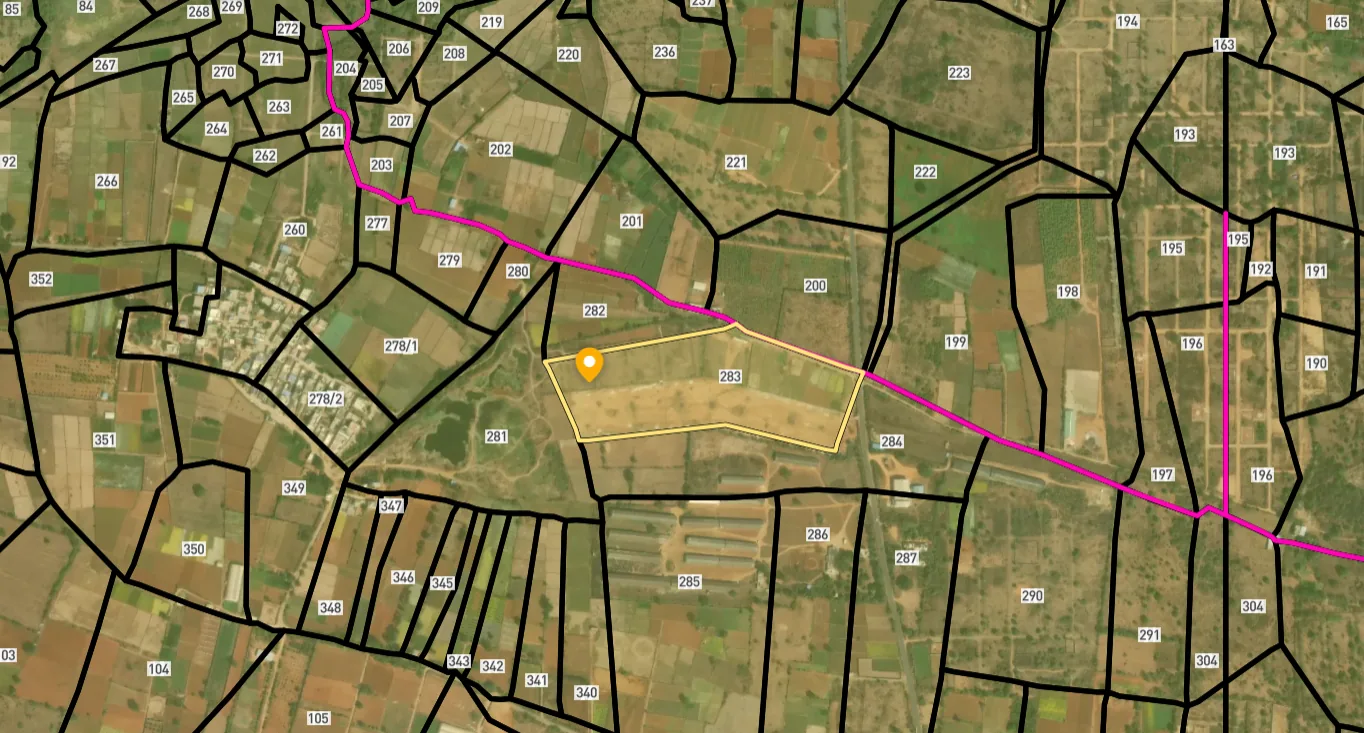
Access Survey NumbersAccess Maharashtra
Survey Numbers
Boundaries and numbers come from published state cadastral records. See all map layers.
Looking to sell your land in Maharashtra?

Browse all verified lands & plots in Maharashtra
More Layers in Maharashtra
See all 60 layers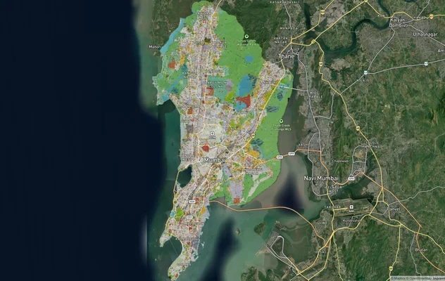
Mumbai Development Plan 2034: Zone Check and Land Use Guide
View Mumbai Masterplan as a live map overlay – check any plot's land use zone for free on 1acre.in. Mumbai masterplan 20...
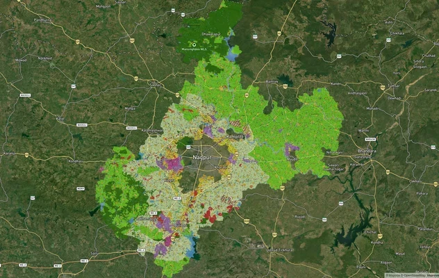
Nagpur Masterplan 2032: Zone Check and Land Use Guide
View Nagpur Masterplan as a live map overlay – check any plot's land use zone for free on 1acre.in. Nagpur Metropolitan ...
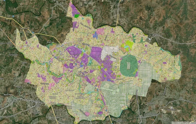
Pimpri Chinchwad PCMC Masterplan: Zone Check and Land Use Guide
View Pimpri Chinchwad Masterplan as a live map overlay – check any plot's land use zone for free on 1acre.in. Pimpri Chi...
More Layers in Maharashtra
Mumbai Development Plan 2034: Zone Check and Land Use Guide
View Mumbai Masterplan as a live map overlay – check any plot's land use zone for free on 1acre.in. Mumbai masterplan 20...
Nagpur Masterplan 2032: Zone Check and Land Use Guide
View Nagpur Masterplan as a live map overlay – check any plot's land use zone for free on 1acre.in. Nagpur Metropolitan ...
Pimpri Chinchwad PCMC Masterplan: Zone Check and Land Use Guide
View Pimpri Chinchwad Masterplan as a live map overlay – check any plot's land use zone for free on 1acre.in. Pimpri Chi...
Frequently Asked Questions
It is an underground twin-tunnel road project connecting the Eastern Freeway at Orange Gate to Marine Drive near Churchgate, designed to cut travel time between the two points to around five minutes.
Yes, reportedly. Following strong objections from Marine Drive residents concerned about heritage building safety and construction disruption, MMRDA considered alternative alignments including routes near the Oval Maidan and outside the NCPA. In April 2026 MMRDA proposed moving the western exit north, near Girgaum Chowpatty, and the Maharashtra Coastal Zone Management Authority cleared the revised design in June 2026.
The alignment runs beneath nearly 700 buildings, including over a hundred heritage structures, at depths ranging from 12 to 52 metres.
MMRDA's target completion date is December 2028, with the southbound tunnel expected to reach Marine Drive by December 2027.
Largely no, since the tunnel runs underground, but the two portal areas at Orange Gate and near Marine Drive/Churchgate involve surface-level construction. The revised Marine Drive exit received coastal clearance in June 2026, and the promenade extension there still needs central approval.
Yes. Residents previously filed a Public Interest Litigation in the Bombay High Court challenging a BMC proposal to double building heights in the precinct, citing heritage preservation and Mumbai's UNESCO nomination bid.
Estimated at approximately Rs 8,056 crore (with some reports citing Rs 7,765 crore or Rs 77.65 billion), the project is being executed by MMRDA with contractors including Larsen & Toubro's Heavy Civil Infrastructure business.
By linking the Eastern Freeway and Atal Setu to the Coastal Road via Marine Drive, the tunnel is expected to provide faster east-west access for commuters travelling toward Navi Mumbai International Airport.
Orange Gate is on P D'Mello Road in South Mumbai, in the Mumbai Port area, where the Eastern Freeway ends. It is often searched as 'Orange Gate, MbPT' after the Mumbai Port Trust. The Orange Gate to Marine Drive tunnel starts here: MMRDA launched its tunnel boring machine at Orange Gate in December 2025.
MMRDA gives the corridor length as 9.96 km, of which about 7 km is underground. The twin tubes each carry two traffic lanes and an emergency lane at depths of 12 to 52 metres. The first tunnel under construction is about 3.45 km long. Reports from 2023 cited 9.23 km and 9.5 km, before the design was revised.
Main tunnelling began on 28 February 2026. By July 2026 about 650 metres had been excavated, and in August 2026 the tunnel boring machine passed beneath seven Central and Harbour Railway tracks while trains kept running. MMRDA's targets are December 2027 for the southbound tunnel to reach Marine Drive and December 2028 for the whole project.
MMRDA has not published a detailed public route map of the revised alignment. Published reports describe the route: from Orange Gate on the Eastern Freeway, beneath the railway corridors and Metro Line 3, to Marine Drive, with the revised exit near Saifee Hospital towards Girgaum Chowpatty. The alignment is shown on the 1acre map layer.
Source
Official government land and infrastructure records
Official Website
mmrda.maharashtra.gov.in
Coordinate Reference System
EPSG:4326 (WGS 84)
Geometry Type
LineString / MultiLineString
Data Format
Vector (GeoJSON) + Raster Tiles
Last Verified
2026
Status
Active
Was this layer helpful?
Anything wrong, outdated, or missing we want to hear it.