
Nashik Ring Road


Nashik Ring Road Preview
Try the Nashik Ring Road on the map
Sign in once and explore the layer for a full day.
- No card details needed
- Find nearby verified lands for sale
Overview
Nashik Ring Road land runs along the 66.15 km parikrama marg that the state is building around Nashik and Trimbakeshwar for the 2027 Simhastha Kumbh Mela. Approved by the Maharashtra Cabinet at roughly ₹8,000 crore and handed to MSIDC to execute, it loops the city to move pilgrim traffic, with land acquisition funded through the Nashik-Trimbakeshwar Kumbh Mela Authority. But near Nashik the traps are tribal-area consent, illegal guntha plotting and a still-shifting alignment, not zoning alone. This page maps the legal red flags, the villages that matter, and the checks to clear before you pay.
Nashik Ring Road Land: The PESA, Gunthewari and Alignment Trap
A ring road lifts the value of everything it touches. It also drags the buyer straight into Nashik's messiest land questions, and those are not about floor space. Parts of this belt sit in Scheduled Areas governed by the PESA Act, where land acquisition and transfer need the gram sabha's prior consent. That is not theory here. At Govardhan village, a PESA gram sabha rejected the no-objection demand for the parikrama route, arguing the acquisition breached tribal safeguards.
The second trap is homegrown. Nashik's fringe is full of gunthewari plots, where farmland is sliced into guntha-sized pieces and sold for homes without NA permission or a sanctioned layout. Buy one and you own an unauthorised plot that needs regularisation before it is legal. Any Nashik Ring Road land purchase has to be read against the NMRDA plan and the 7/12, not a broker's pitch.
This is the checklist that separates a clean buy from a stuck one.
Nashik Ring Road Land: The PESA, Gunthewari and Alignment Trap
Check
What it proves
Walk away if
7/12 extract and NA order
The recorded owner and whether the land is non-agricultural
Only an agricultural 7/12 is offered for a "plot"
Gunthewari status
The layout is sanctioned, not an illegal guntha-piece sale
Land is carved into gunthas without NA or layout
PESA and Scheduled Area check
The land is outside a tribal area needing gram sabha consent
The village falls under PESA or a tribal-restricted khata
Ring road alignment and acquisition list
The plot is not inside the acquired parikrama strip
The survey or group number appears on the acquisition notice
NMRDA zone (DP and Regional Plan)
The land is developable, not green zone or riverbed
Marked green zone, gaothan reservation or Godavari belt
Check
What it proves
Walk away if
7/12 extract and NA order
The recorded owner and whether the land is non-agricultural
Only an agricultural 7/12 is offered for a "plot"
Gunthewari status
The layout is sanctioned, not an illegal guntha-piece sale
Land is carved into gunthas without NA or layout
PESA and Scheduled Area check
The land is outside a tribal area needing gram sabha consent
The village falls under PESA or a tribal-restricted khata
Ring road alignment and acquisition list
The plot is not inside the acquired parikrama strip
The survey or group number appears on the acquisition notice
NMRDA zone (DP and Regional Plan)
The land is developable, not green zone or riverbed
Marked green zone, gaothan reservation or Godavari belt
Do the legal checks before the location seduces you. This project already carries live controversy: at Gaulane village, complainants allege the alignment was changed after the final acquisition list for Group Numbers 11/5 and 11/6 was published, which is exactly the kind of shift that can pull a "safe" plot into the road or leave a "road-touch" plot stranded. The Collector has promised transparent acquisition and rehabilitation for farmers rendered landless, with compensation routed through joint accounts of landholding groups, but that also tells you these parcels are being actively taken. And the Kumbh deadline creates its own hazard, because a 2027 target pushes sellers to offload land fast and buyers to skip diligence. Slow down. If the 7/12, the NA order and the NMRDA zone do not agree, that plot is a problem wearing a good address.
Madsangvi to Govardhan: Where the Parikrama Adds Value
The ring circles Nashik and Trimbakeshwar, so value depends less on the road and more on which side of the loop a plot sits and who holds the title there. The eastern city edge behaves very differently from the tribal western stretch toward Trimbakeshwar.
This is how the corridor's main nodes compare for a land buyer.
Madsangvi to Govardhan: Where the Parikrama Adds Value
Node
Growth driver
Known risk
Madsangvi, east Nashik
On the parikrama, close to the city and the Mumbai-Agra corridor
Active acquisition notices, priciest land, verify NA
Govardhan, Trimbakeshwar side
Ring meets the temple-town pilgrim route
PESA Scheduled Area, gram sabha consent, tribal land curbs
Gaulane
Sits on the alignment
Alignment-change allegations, records in flux
Sinnar and Mumbai-Nagpur side
Ring feeds the Samruddhi Mahamarg interchange
Farther out, speculative, green-zone patches
Node
Growth driver
Known risk
Madsangvi, east Nashik
On the parikrama, close to the city and the Mumbai-Agra corridor
Active acquisition notices, priciest land, verify NA
Govardhan, Trimbakeshwar side
Ring meets the temple-town pilgrim route
PESA Scheduled Area, gram sabha consent, tribal land curbs
Gaulane
Sits on the alignment
Alignment-change allegations, records in flux
Sinnar and Mumbai-Nagpur side
Ring feeds the Samruddhi Mahamarg interchange
Farther out, speculative, green-zone patches
Govardhan is where outsiders get it most wrong. The Trimbakeshwar side looks like a spiritual-tourism goldmine, but much of it is Scheduled Area land where a non-tribal buyer faces heavy transfer restrictions and the gram sabha can simply say no. Madsangvi and the eastern edge are the more conventional bet, close to the city and real infrastructure, yet those are precisely the plots the acquisition machine is eyeing, so timing and title are everything. Gaulane is best left alone until the alignment dispute settles. The Sinnar side rewards patience because it plugs into the Mumbai-Nagpur Expressway, but demand there is still shallow. One rule holds around the whole loop. If a seller cannot show a clean 7/12, an NA order and the plot's position against the current alignment, you are buying a rumour, not a ring-road frontage.
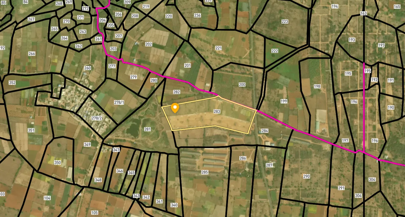
Access Survey NumbersAccess Maharashtra
Survey Numbers
Boundaries and numbers come from published state cadastral records. See all map layers.
Looking to sell your land in Maharashtra?

Browse all verified lands & plots in Maharashtra
More Layers in Maharashtra
See all 60 layers
Mumbai Development Plan 2034: Zone Check and Land Use Guide
View Mumbai Masterplan as a live map overlay – check any plot's land use zone for free on 1acre.in. Mumbai masterplan 20...
Nagpur Masterplan 2032: Zone Check and Land Use Guide
View Nagpur Masterplan as a live map overlay – check any plot's land use zone for free on 1acre.in. Nagpur Metropolitan ...
Pimpri Chinchwad PCMC Masterplan: Zone Check and Land Use Guide
View Pimpri Chinchwad Masterplan as a live map overlay – check any plot's land use zone for free on 1acre.in. Pimpri Chi...
More Layers in Maharashtra
Mumbai Development Plan 2034: Zone Check and Land Use Guide
View Mumbai Masterplan as a live map overlay – check any plot's land use zone for free on 1acre.in. Mumbai masterplan 20...
Nagpur Masterplan 2032: Zone Check and Land Use Guide
View Nagpur Masterplan as a live map overlay – check any plot's land use zone for free on 1acre.in. Nagpur Metropolitan ...
Pimpri Chinchwad PCMC Masterplan: Zone Check and Land Use Guide
View Pimpri Chinchwad Masterplan as a live map overlay – check any plot's land use zone for free on 1acre.in. Pimpri Chi...
Frequently Asked Questions
Yes with clean title, no with hype. The parikrama can lift values, but PESA tribal restrictions, gunthewari plots and a contested alignment mean a verified 7/12 and NA order matter far more than road proximity.
Yes. The Maharashtra Cabinet approved the 66.15 km parikrama marg at about ₹8,000 crore, with MSIDC executing it and acquisition funded through the Kumbh Mela Authority. Land acquisition notices have already begun in some villages.
The loop passes multiple villages around Nashik and Trimbakeshwar. Madsangvi, Govardhan and Gaulane have featured prominently in acquisition meetings and disputes. Always confirm your specific survey number against the current published alignment.
Very cautiously. In Scheduled Areas the gram sabha's consent is mandatory and tribal land transfer to non-tribals is heavily restricted. Govardhan's gram sabha already rejected the project's NOC, so verify PESA status first.
Gunthewari is farmland sold in guntha pieces for housing without NA permission or a sanctioned layout. Such plots are unauthorised until regularised, so a cheap "plot" on agricultural 7/12 can be legally unbuildable.
Yes. Agricultural land needs non-agricultural conversion before construction, and the NMRDA development plan governs what is permitted. Building on unconverted or green-zone land invites penalties and demolition, whatever the seller promises.
Not fully. Complainants allege the alignment was altered at Gaulane after the acquisition list was published. Until the route is locked, verify your plot against the latest official alignment rather than an old map.
It is planned as a parikrama marg for the 2027 Simhastha Kumbh Mela, so the state is pushing for that window. Land acquisition and central funding talks are still underway, so timelines remain tight and fluid.
Source
Official government land and infrastructure records
Coordinate Reference System
EPSG:4326 (WGS 84)
Geometry Type
LineString / MultiLineString
Data Format
Vector (GeoJSON) + Raster Tiles
Last Verified
2026
Status
Active
Was this layer helpful?
Anything wrong, outdated, or missing we want to hear it.