
Kelashi Creek Bridge MSH4


Kelashi Creek Bridge Msh4 Preview
Try the Kelashi Creek Bridge MSH4 on the map
Sign in once and explore the layer for a full day.
- No card details needed
- Find nearby verified lands for sale
Overview
A Kelashi Creek Bridge MSH-4 land purchase depends on knowing where MSRDC's coastal bridge alignment cuts across Ratnagiri district's shoreline in Dapoli taluka. The Kelashi Creek Bridge is one of eight major creek crossings on the 397 km Revas-Reddi Coastal Highway (MSH-4, also called Sagari Mahamarg). MSRDC invited consultancy tenders in November 2023 for Authority Engineer services on EPC mode. Once complete, the bridges eliminate the current four ferry crossings between Revas in Raigad and Reddi in Sindhudurg. This is a state highway upgrade, not the separate greenfield Konkan Expressway (ME-6).
Regulatory Red Flags on Any Kelashi Creek Bridge MSH-4 Land Purchase
MSH-4, the Revas-Reddi Coastal Highway, is a Maharashtra state highway that runs along the entire Konkan coast. It is not access-controlled and it is not greenfield. The Kelashi Creek Bridge is one of eight major bridge projects being added by MSRDC to eliminate ferry crossings and complete the existing corridor.
That distinction matters for buyers. MSH-4 land is not being freshly acquired for a corridor. It is existing state road with existing frontage, and coastal parcels adjacent to it fall under Coastal Regulation Zone (CRZ) rules from the 2019 Notification. Construction within 200 metres of the High Tide Line is restricted. The Maharashtra Coastal Zone Management Authority (MCZMA) issues clearances, not MSRDC.
The table below shows what a Kelashi Creek Bridge MSH-4 land buyer must verify before any advance payment.
Regulatory Red Flags on Any Kelashi Creek Bridge MSH-4 Land Purchase
Check
What to Confirm
Failure Signal
CRZ Zone
Whether the lot sits in CRZ-I, CRZ-II or CRZ-III
Beachfront pitch without MCZMA clearance
Konkan Expressway Overlap
Whether the parcel also falls on the greenfield ME-6 alignment
Double acquisition risk on a single gat
7/12 Extract (Satbara)
Latest owner name, gat number, area, mutation entries
Owner name different from sale deed or Aadhaar
Coastal Setback
Distance from the High Tide Line
Construction intent within 200 metres of HTL
Village Devasthan / Trust Land
Whether the parcel is temple-trust or gaonthan land
Sale attempt on non-transferable trust land
Check
What to Confirm
Failure Signal
CRZ Zone
Whether the lot sits in CRZ-I, CRZ-II or CRZ-III
Beachfront pitch without MCZMA clearance
Konkan Expressway Overlap
Whether the parcel also falls on the greenfield ME-6 alignment
Double acquisition risk on a single gat
7/12 Extract (Satbara)
Latest owner name, gat number, area, mutation entries
Owner name different from sale deed or Aadhaar
Coastal Setback
Distance from the High Tide Line
Construction intent within 200 metres of HTL
Village Devasthan / Trust Land
Whether the parcel is temple-trust or gaonthan land
Sale attempt on non-transferable trust land
The trap here is confusion between two projects. The Revas-Reddi Coastal Highway (MSH-4) is an existing road being upgraded with new creek bridges. The Konkan Expressway (ME-6) is a separate 376 km greenfield access-controlled corridor that MSRDC is planning inland from the coast.
A single Ratnagiri parcel may sit near both. MSH-4 does not trigger fresh 11(1) notifications on adjacent land, but ME-6 does. Cross-check both project alignments on the district collector's website before any advance payment. Maharashtra revenue vocabulary matters: gat number is the aggregated survey number, satbara is the 7/12 extract, ferfar is the mutation register. Ratnagiri's coastal talukas also carry Devasthan and Gaonthan classifications that override standard sale intent, so ask for the village-level classification separately. Some plots sold as freehold in Kelshi or Anjarle may actually be gaonthan land requiring specific gram sabha resolutions before sale. Verify classification before advance.
Growth Corridors Around Dapoli, Kelshi, Anjarle and the MSH-4 Creek Crossings
Dapoli taluka is the Konkan's leading weekend market. Kelshi, Anjarle, Karde, Ladghar and Murud beaches sit within 30 km of each other, and MSH-4 threads them together. The Kelashi Creek Bridge will finally connect Kelshi to Anjarle without requiring the current inland detour. That single change reshapes the land value curve across five villages.
The Konkan buyer profile is well-defined: second-home buyers from Mumbai, Pune and increasingly Bengaluru. Most Ratnagiri coastal land trades on rectangular flat plots facing either creek, coconut grove or beach. Alphonso mango orchards command a separate rate. The eight MSH-4 bridges together eliminate 4 ferry crossings and cut Mumbai-Sindhudurg coastal drive time by 3 to 4 hours.
The table below shows the micro-markets around the Kelashi bridge and their present buyer risk profile.
Growth Corridors Around Dapoli, Kelshi, Anjarle and the MSH-4 Creek Crossings
Micro-Market / Village
What Drives Value
Buyer Risk
Kelshi (Dapoli taluka)
Bridge approach, temple footfall
CRZ overlap, Devasthan land classification
Anjarle
Bridge terminus, secluded beach
Ferry-era pricing versus post-bridge value
Ladghar, Karde, Murud beaches
Established weekend-home market
Old satbara mismatch, gaonthan boundary
Dapoli town
Market centre, connectivity anchor
Agricultural to non-agricultural conversion
Guhagar-Dabhol corridor
Second major creek bridge (2.9 km)
Konkan Expressway alignment overlap
Micro-Market / Village
What Drives Value
Buyer Risk
Kelshi (Dapoli taluka)
Bridge approach, temple footfall
CRZ overlap, Devasthan land classification
Anjarle
Bridge terminus, secluded beach
Ferry-era pricing versus post-bridge value
Ladghar, Karde, Murud beaches
Established weekend-home market
Old satbara mismatch, gaonthan boundary
Dapoli town
Market centre, connectivity anchor
Agricultural to non-agricultural conversion
Guhagar-Dabhol corridor
Second major creek bridge (2.9 km)
Konkan Expressway alignment overlap
The most misread market is Kelshi and Anjarle themselves. Both villages currently sit on either side of the creek with no direct road connection, so land pricing reflects ferry-era isolation. Once the bridge is commissioned, values across both villages will realign, and speculative buying is already visible. Ask for the 7/12 gat number, verify whether the parcel is inside CRZ-I (no construction), CRZ-II (restricted), or CRZ-III (limited), and confirm the Konkan Expressway (ME-6) alignment does not touch the same gat. In Dapoli town, the agricultural-to-non-agricultural conversion order from the District Collector is the operative permission for any commercial or residential build. A Kelashi Creek Bridge MSH-4 land purchase without a fresh satbara, an MCZMA CRZ certificate, and an ME-6 cross-check is guesswork.
Was this layer helpful?
Anything wrong, outdated, or missing we want to hear it.

Access Survey NumbersAccess Maharashtra
Survey Numbers
Boundaries and numbers come from published state cadastral records. See all map layers.
Looking to sell your land in Maharashtra?

Browse all verified lands & plots in Maharashtra
More Layers in Maharashtra
See all 61 layers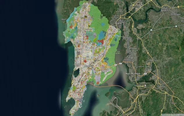
Mumbai Development Plan 2034: Zone Check and Land Use Guide
View Mumbai Masterplan as a live map overlay – check any plot's land use zone for free on 1acre.in. Mumbai masterplan 20...
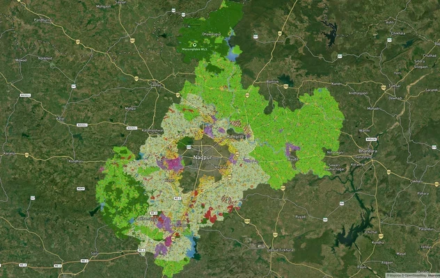
Nagpur Masterplan 2032: Zone Check and Land Use Guide
View Nagpur Masterplan as a live map overlay – check any plot's land use zone for free on 1acre.in. Nagpur Metropolitan ...
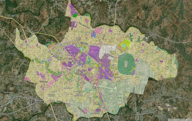
Pimpri Chinchwad PCMC Masterplan: Zone Check and Land Use Guide
View Pimpri Chinchwad Masterplan as a live map overlay – check any plot's land use zone for free on 1acre.in. Pimpri Chi...
More Layers in Maharashtra
Mumbai Development Plan 2034: Zone Check and Land Use Guide
View Mumbai Masterplan as a live map overlay – check any plot's land use zone for free on 1acre.in. Mumbai masterplan 20...
Nagpur Masterplan 2032: Zone Check and Land Use Guide
View Nagpur Masterplan as a live map overlay – check any plot's land use zone for free on 1acre.in. Nagpur Metropolitan ...
Pimpri Chinchwad PCMC Masterplan: Zone Check and Land Use Guide
View Pimpri Chinchwad Masterplan as a live map overlay – check any plot's land use zone for free on 1acre.in. Pimpri Chi...