
Goregaon–Mulund Link Road
Overview
The Goregaon-Mulund Link Road land records question comes with a genuinely unusual engineering story attached, one worth understanding before looking at anything else. A large stretch of this 12.2-kilometre corridor runs through twin tunnels bored beneath Sanjay Gandhi National Park and Aarey Colony, rather than along the surface the way most road projects in this series do. Built by the Brihanmumbai Municipal Corporation at an estimated cost of 14,000 crore rupees, with its foundation stone laid by the Prime Minister in July 2024, the project is designed to connect the Western Express Highway at Goregaon directly to the Eastern Express Highway at Mulund, cutting a commute that currently runs 75 to 90 minutes down to roughly 25 once the whole corridor is finally open. Land near this corridor sits inside Mumbai's city survey system, checked through Property Cards rather than the rural-style 7/12 extract used across most of the rest of Maharashtra, and a meaningful stretch of this project's own construction has needed formal forest clearance simply to proceed at all, which tells you something important about the ground it passes through. This guide covers both the record system that actually applies here and what the project's repeatedly shifting timeline genuinely means for anyone considering land nearby, rather than repeating the more optimistic version of the story that gets told in press releases.
Regulatory Red Flags Around the Goregaon-Mulund Link Road
Start with the document that actually applies in this part of Mumbai, since it differs meaningfully from the record most of Maharashtra relies on. Urban properties inside the city's surveyed areas are tracked through a Property Card, tied to a CTS number rather than the rural survey or Gat number found on a 7/12 extract. This is available through Mahabhulekh the same way a rural 7/12 is, but a buyer near Goregaon, Mulund, or anywhere along this corridor should specifically ask for the Property Card rather than assume the more commonly discussed 7/12 extract applies here, since asking for the wrong document at a registrar's office wastes real time. Ownership alone, though, is only the first check, and arguably not even the most important one. In Mumbai, a plot's Development Plan reservation matters just as much as who legally owns it, because the city's Development Plan can mark a parcel for a road, a garden, a no-development zone, or forest use, entirely independent of what the ownership record itself shows. A Property Card confirming clean title says nothing about whether that same plot carries a reservation making private construction impossible, and this gap is exactly what separates a genuinely buildable plot from one that sits in permanent limbo, waiting years, or indefinitely, for compensation under a reservation that never actually gets released.
This distinction matters more here than in almost any other corridor covered in this series, because the project itself has just gone through exactly this kind of clearance process in full public view. The Union Ministry of Environment, Forest and Climate Change granted final approval under Section 2 of the Forest Conservation Act, 1980, for the diversion of 19.43 hectares of forest land, specifically so the BMC could build the twin tunnels beneath the national park and Aarey Colony. That approval only came through after a formal, multi-year clearance process, and it arrived with a required compensatory afforestation commitment of 19.5 hectares in Chandrapur, hundreds of kilometres away. If a government-backed municipal project of this scale genuinely needed a formal forest diversion order just to build tunnels running deep underground, tunnels officials insist will not disturb surface land or trees at all, any private parcel sitting much closer to the actual surface near Aarey Colony or the national park boundary deserves exactly the same level of scrutiny, if not more. A buyer should confirm a plot's forest classification and its Development Plan reservation independently, rather than assuming that because the GMLR tunnels themselves run deep underground, ordinary land nearby is somehow automatically free of similar restrictions.
The project's own construction record is the third thing worth checking closely, because it has already shifted more than once in a fairly short span of time. An early 2022 report from the BMC targeted the entire corridor opening to traffic by December 2026, a confident date that made its way into plenty of early marketing material for nearby developments. By late 2025 and into 2026, reporting instead described only the first flyover section, running from Dindoshi Court to the park boundary, as targeted for May 2026, with the twin tunnels themselves pushed all the way to October 2028 and the full project to December 2028. Then, in March 2026, further reporting described the completion date slipping again, to 2028 for the corridor on its own and to July 2029 for a combined timeline that also folds in the connecting Versova-Dahisar Coastal Road. As of that same report, the flyover work stood at roughly 48 percent complete while tunnel excavation had reached only about 18 percent, a meaningful gap between the two components. This pattern of repeated schedule revisions is not a minor footnote to skip past. It means anyone buying land near this corridor today, on the assumption that a specific completion year is somehow fixed, is relying on a timeline that has already moved backward at least twice within a few years of each other.
Regulatory Red Flags Around the Goregaon-Mulund Link Road
Land Record Term
What It Proves
Needs Separate Approval?
Blocks Registration or Construction Without It?
Commonly Misused?
Property Card (CTS number)
Current owner and urban plot details
No
Yes
Sometimes confused with the rural-style 7/12 extract
Development Plan reservation
Whether a plot is marked for a road, garden, forest, or no-development use
No, but release requires a formal DP process
Yes, absolute where reserved
A clean Property Card does not confirm the land is free of a reservation
Forest Conservation Act clearance
Confirms whether forest land diversion has been formally approved
Yes, Ministry of Environment, Forest and Climate Change
Yes, for any diversion of classified forest land
Assumed unnecessary for land that looks ordinary on the surface
IGR Maharashtra encumbrance record
Registered sale deeds and mortgage history
No
Yes
A Property Card alone does not reveal this history
Land Record Term
What It Proves
Needs Separate Approval?
Blocks Registration or Construction Without It?
Commonly Misused?
Property Card (CTS number)
Current owner and urban plot details
No
Yes
Sometimes confused with the rural-style 7/12 extract
Development Plan reservation
Whether a plot is marked for a road, garden, forest, or no-development use
No, but release requires a formal DP process
Yes, absolute where reserved
A clean Property Card does not confirm the land is free of a reservation
Forest Conservation Act clearance
Confirms whether forest land diversion has been formally approved
Yes, Ministry of Environment, Forest and Climate Change
Yes, for any diversion of classified forest land
Assumed unnecessary for land that looks ordinary on the surface
IGR Maharashtra encumbrance record
Registered sale deeds and mortgage history
No
Yes
A Property Card alone does not reveal this history
Given how many times this exact project's own schedule has shifted, and how recently the last slip actually happened, the safest approach for land nearby is to separate three questions clearly and answer each one on its own: who owns the plot today, what the Development Plan actually reserves it for regardless of that ownership, and how far the GMLR itself has genuinely progressed on the ground, rather than how far a headline from a year or two ago once claimed it would be by now.
Growth Corridors Around the Goregaon-Mulund Link Road
The project's real progress, read phase by phase rather than as one single headline figure, gives a much steadier picture than any single completion date ever could. The Dindoshi Court to Sanjay Gandhi National Park flyover, the project's first phase, includes a six-lane elevated structure with an elevated rotary, and by early 2026 the bulk of its supporting pillars had already been erected and were visible from the surrounding roads. The twin tunnels, the project's genuine engineering centrepiece, stretch 4.7 kilometres each beneath the park and Aarey Colony, reaching depths between 20 and 160 metres below the surface, with cross-passages built every 300 metres for safety, and roughly 6,548 crore rupees of the total budget earmarked for this single underground component alone. On the Mulund side, a separate 1.89-kilometre flyover package includes a 120-metre cable-stayed structure at Dr. Hedgewar Chowk, originally scheduled for June 2027. Once genuinely finished, the corridor is also meant to integrate with the Metro 2A network and eventually link to the proposed Versova-Dahisar Coastal Road, which would extend Mumbai's west-side connectivity considerably further north and south of this one project on its own.
For land nearby, this phased structure means demand is likely to build unevenly across the corridor rather than lifting everywhere at once. Goregaon's eastern side, sitting closest to the Dindoshi flyover, is nearest to the most visibly advanced piece of construction right now, giving it the clearest short-term connectivity story of any stretch along the route. The Mulund end benefits from its own separate flyover package and from the corridor's direct link into the Eastern Express Highway, though that particular stretch remains tied to a 2027 target that, given this project's documented history, deserves exactly the same healthy scepticism as any other date attached to the GMLR. Land closest to the tunnel portals near Film City and the national park boundary sits in the most ecologically sensitive part of the entire corridor, exactly where the Development Plan and forest-classification checks described above matter the most and should never be skipped.
Growth Corridors Around the Goregaon-Mulund Link Road
Location
Growth Driver
Known Consideration
Goregaon East (Dindoshi flyover approach)
Most visibly advanced construction phase
Confirm actual distance to the completed flyover, not just general proximity to Goregaon
Film City and Aarey Colony boundary
Site of tunnel portals and forest land diversion
Development Plan reservation and forest classification both need independent checking here
Mulund (Dr. Hedgewar Chowk flyover)
Separate cable-stayed flyover package, targeted 2027
Tied to a corridor with a documented history of schedule slippage
Wider east-west corridor (Metro 2A, Coastal Road links)
Long-term integration with Mumbai's broader transit network
Full network effect depends on multiple other projects finishing on their own timelines
Location
Growth Driver
Known Consideration
Goregaon East (Dindoshi flyover approach)
Most visibly advanced construction phase
Confirm actual distance to the completed flyover, not just general proximity to Goregaon
Film City and Aarey Colony boundary
Site of tunnel portals and forest land diversion
Development Plan reservation and forest classification both need independent checking here
Mulund (Dr. Hedgewar Chowk flyover)
Separate cable-stayed flyover package, targeted 2027
Tied to a corridor with a documented history of schedule slippage
Wider east-west corridor (Metro 2A, Coastal Road links)
Long-term integration with Mumbai's broader transit network
Full network effect depends on multiple other projects finishing on their own timelines
The clearest way to read this corridor is to treat construction progress on the ground, not announced dates on a press release, as the real signal worth paying attention to. A flyover at roughly half complete and a tunnel excavation only around a fifth done, as of the most recent detailed reporting available, describes a project genuinely moving forward, but still years away from full operation regardless of what any earlier timeline once promised. Land value near any single phase should track that specific phase's actual physical progress on site, and a buyer weighing a plot near Aarey Colony or the park boundary should treat the forest and Development Plan checks as just as essential as the ordinary Property Card and encumbrance search, not as an optional extra step reserved for the unusually cautious.
Was this layer helpful?
Anything wrong, outdated, or missing we want to hear it.

Access Survey NumbersAccess Maharashtra
Survey Numbers
Boundaries and numbers come from published state cadastral records. See all map layers.
Looking to sell your land in Maharashtra?

Browse all verified lands & plots in Maharashtra
More Layers in Maharashtra
See all 60 layers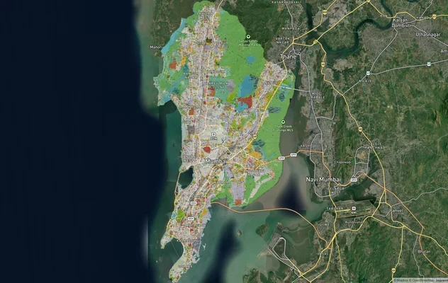
Mumbai Development Plan 2034: Zone Check and Land Use Guide
View Mumbai Masterplan as a live map overlay – check any plot's land use zone for free on 1acre.in. Mumbai masterplan 20...
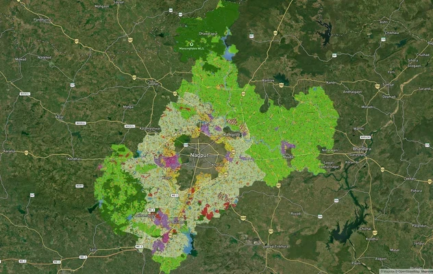
Nagpur Masterplan 2032: Zone Check and Land Use Guide
View Nagpur Masterplan as a live map overlay – check any plot's land use zone for free on 1acre.in. Nagpur Metropolitan ...
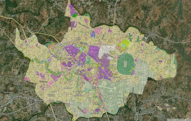
Pimpri Chinchwad PCMC Masterplan: Zone Check and Land Use Guide
View Pimpri Chinchwad Masterplan as a live map overlay – check any plot's land use zone for free on 1acre.in. Pimpri Chi...
More Layers in Maharashtra
Mumbai Development Plan 2034: Zone Check and Land Use Guide
View Mumbai Masterplan as a live map overlay – check any plot's land use zone for free on 1acre.in. Mumbai masterplan 20...
Nagpur Masterplan 2032: Zone Check and Land Use Guide
View Nagpur Masterplan as a live map overlay – check any plot's land use zone for free on 1acre.in. Nagpur Metropolitan ...
Pimpri Chinchwad PCMC Masterplan: Zone Check and Land Use Guide
View Pimpri Chinchwad Masterplan as a live map overlay – check any plot's land use zone for free on 1acre.in. Pimpri Chi...